The best road cycling routes around Chemin
4.5
(31)
430
riders
64
rides
Road cycling routes around Chemin are primarily located in the flat to gently rolling agricultural landscapes of the Burgundy-Franche-Comté region of France, characterized by river valleys and canals. The terrain offers minimal elevation changes, making it suitable for various skill levels. The area features extensive networks of quiet country roads and paths alongside waterways like the Saône River and the Rhine-Rhône Canal. This region provides a mix of open fields, small villages, and riverside scenery for road cyclists.
Best road…
Last updated: July 6, 2026
44
riders
Hard road ride. Very good fitness required. Some segments of this route may be unpaved and difficult to ride.
4.4
(8)
36
riders
58.9km
02:18
180m
180m
Moderate road ride. Good fitness required. Mostly well-paved surfaces and easy to ride.

Sign up for free
4.0
(2)
15
riders
72.5km
02:57
250m
250m
Moderate road ride. Good fitness required. Mostly well-paved surfaces and easy to ride.
4.5
(4)
15
riders
39.9km
01:31
70m
70m
Easy road ride. Great for any fitness level. Mostly well-paved surfaces and easy to ride.
5.0
(2)
13
riders
Easy road ride. Great for any fitness level. Mostly well-paved surfaces and easy to ride.
Get access to more routes and recommendations from other explorers.
Sign up for free
Already have an account?
Our route recommendations are based on thousands of hikes, rides, and runs completed by other people on komoot.
Start today with a free account
Your next adventure awaits.
Login or Signup


Tips from the Community

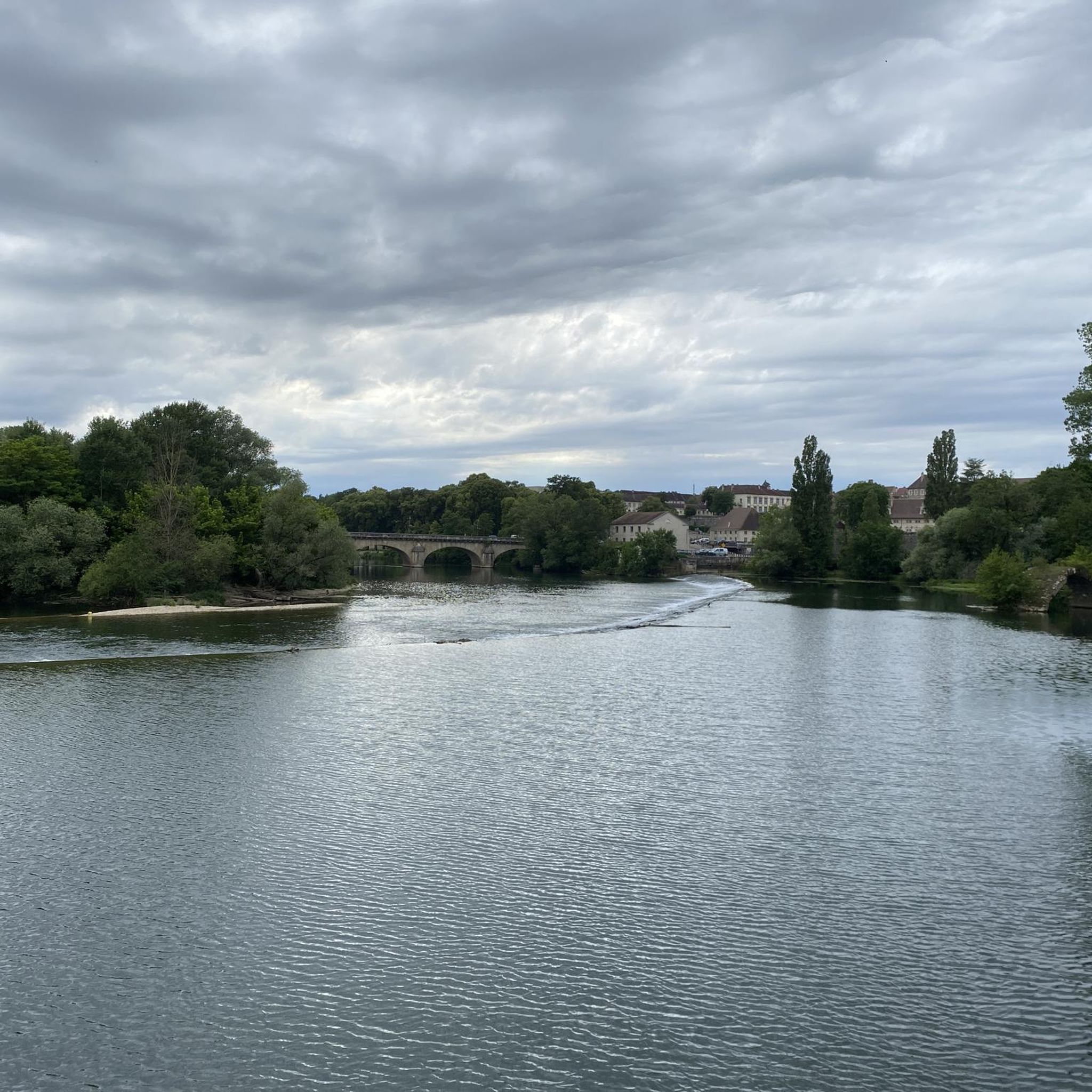
Beautiful place where you can no longer swim.
0
0

Beautiful resting place with charging facilities for e-bikes
0
0

A small, nice place. Before the bridge, there is a bakery.
0
0

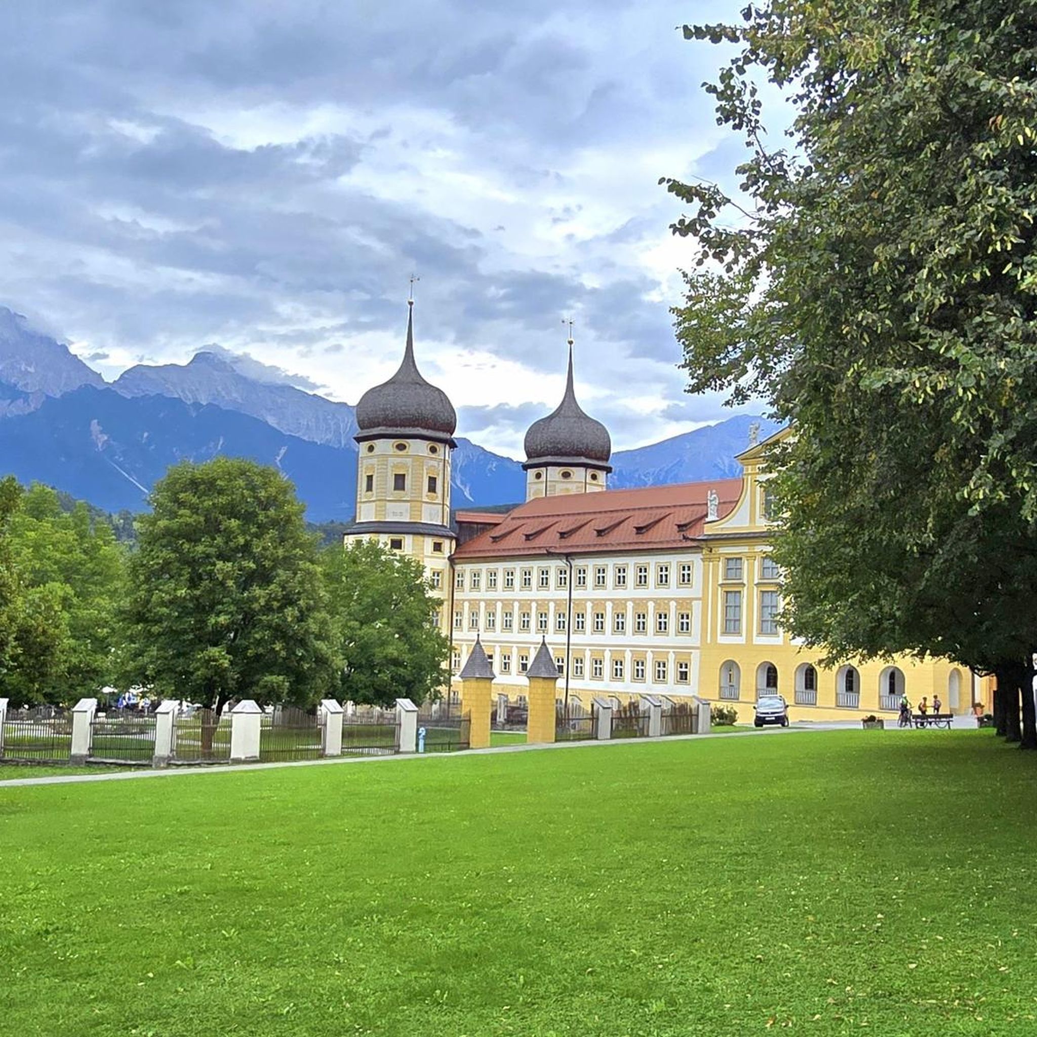
A very beautiful church, an eye-catcher from afar
0
0


Dole was the capital of the Free County of Burgundy under Habsburg rule during the Middle Ages. For centuries, the city served as the seat of parliament and was home to a university. Over the centuries, the city was besieged several times and fought over in conflicts between France and Burgundy, experiencing periods of occupation. The city's inhabitants consistently offered considerable resistance, forcing France to either withdraw or return possession of the city to the Burgundians by treaty. A stroll through the old town reveals numerous picturesque Renaissance buildings.
1
0

The trail is pleasant and well shaded. The view is very beautiful.
0
0

Originally, the Saint-Jean-de-Losne bridge was made of wood and crossed the river diagonally by road no. 27 linking Dijon to Losne. It started on the right bank, a little downstream from the current bridge, and then joined the old Seurre road. The structure was destroyed many times by floods and ice break-ups, but was always rebuilt in the same place until 1830. It was rebuilt in stone from 1833, then rebuilt again after being cut down during the war of 1870… The bridge suffered damage from the war twice more. On June 16, 1940, French engineers blew up an arch, and on September 7, 1944, the retreating Germans dynamited the rest. It was then replaced by a temporary wooden footbridge. After the liberation, the reconstruction work was put out to tender. After all these twists and turns, the bridge was finally rebuilt in the same place in 1950.
0
0
Frequently Asked Questions
What kind of terrain can I expect when road cycling around Chemin?
The road cycling routes around Chemin are primarily located in the flat to gently rolling agricultural landscapes of the Burgundy-Franche-Comté region of France. You can expect extensive networks of quiet country roads and paths alongside waterways like the Saône River and the Rhine-Rhône Canal, with minimal elevation changes.
How many road cycling routes are available in the Chemin area?
Komoot offers over 65 road cycling routes around Chemin. These routes cater to various skill levels, from easy loops to more challenging long-distance rides.
Are there easy road cycling routes suitable for beginners or families?
Yes, there are many easy routes. For instance, the Dole – Charles Quint Lock loop from Champdivers is an easy 27.1-mile (43.6 km) trail that follows flat plains and the Rhine-Rhône Canal, often completed in about 1 hour 44 minutes. Another easy option is the La Saône loop from Saint-Loup, which is 39.8 km long.
Can I find longer, more challenging road cycling routes in the Chemin area?
Yes, for those seeking a challenge, the Port of Saint-Jean-de-Losne – Pont St-Jean-de-Losne loop from Pourlans is a difficult 76.9-mile (123.7 km) route. It features long stretches through rural landscapes and along the Saône River, typically taking over 5 hours to complete.
Are there circular road cycling routes available around Chemin?
Many of the routes around Chemin are designed as loops, offering circular journeys. Examples include the Dole – Charles Quint Lock loop from Champdivers and the Étang Fort Clos – Étang Février loop from Pourlans, providing varied scenery without retracing your path.
What are some scenic highlights or viewpoints along the road cycling routes?
The routes often offer picturesque views of the Saône River and the Rhine-Rhône Canal. You can also find specific viewpoints like the View of the Doubs, providing beautiful vistas of the local waterways and surrounding countryside.
What do other cyclists say about road cycling in Chemin?
The road cycling routes around Chemin are highly rated by the komoot community, with an average score of 4.4 stars from over 20 reviews. Cyclists often praise the quiet country roads, the flat to gently rolling terrain, and the scenic paths alongside rivers and canals.
What is the best season for road cycling around Chemin?
Given the region's agricultural landscapes and river valleys, spring and autumn generally offer the most pleasant conditions for road cycling around Chemin, with mild temperatures and beautiful scenery. Summer can also be enjoyable, though it may be warmer.
Are there routes that follow waterways or canals?
Yes, many routes in Chemin are characterized by their proximity to water. You'll find extensive paths alongside the Saône River and the Rhine-Rhône Canal, offering flat and scenic rides. The Dole – Rhine-Rhône Canal loop from Saint-Aubin is a great example of a route that follows a major waterway.
Are there facilities like rest areas or bike charging stations along the routes?
Yes, some routes pass by useful facilities. For example, you might encounter a Rest Area With Bike Charging Station and Water Pump at Abergement-la-Ronce, which can be convenient for longer rides.
Are there any interesting landmarks or cultural points of interest to explore while cycling?
While the region is primarily known for its natural and agricultural landscapes, the routes often pass through small villages. You can explore historical elements like the Charles Quint Lock near Dole, which is part of the historic canal system.
Are there any moderate difficulty road cycling routes available?
Absolutely. The Étang Fort Clos – Étang Février loop from Pourlans is a popular moderate 36.3-mile (58.4 km) path that traverses a mix of open countryside and passes by several small lakes, offering varied scenery.
Most popular attractions around Chemin

Get inspired with the komoot mobile app


Explore more
Browse the best Road cycling routes in other regions.
