The best walks and hikes around La Chapelle-Aux-Lys
4.6
(45)
219
hikers
29
hikes
Hiking around La Chapelle-Aux-Lys offers a network of trails through a landscape characterized by gentle hills, agricultural fields, and serene bodies of water such as Lac de l'Etruyère and Étang de la Jarousselière. The region features a mix of open paths and wooded sections, providing varied scenery for outdoor activities. Elevation changes are generally modest, making many routes accessible for different fitness levels. These trails often connect small hamlets and natural areas, showcasing the local rural environment.
Best hiking trails…
Last updated: July 2, 2026
5.0
(3)
10
hikers
14.9km
04:03
220m
220m
Moderate hike. Good fitness required. Easily-accessible paths. Suitable for all skill levels.
4.0
(2)
9
hikers
9.72km
02:37
120m
120m
Moderate hike. Good fitness required. Easily-accessible paths. Suitable for all skill levels.

Sign up for free
4.0
(2)
6
hikers
13.5km
03:37
150m
150m
Moderate hike. Good fitness required. Easily-accessible paths. Suitable for all skill levels.
5.0
(2)
5
hikers
15.3km
04:04
150m
150m
Moderate hike. Good fitness required. Easily-accessible paths. Suitable for all skill levels.
5.0
(4)
6
hikers
15.1km
04:07
220m
220m
Moderate hike. Good fitness required. Easily-accessible paths. Suitable for all skill levels.
Get access to more routes and recommendations from other explorers.
Sign up for free
Already have an account?
Our route recommendations are based on thousands of hikes, rides, and runs completed by other people on komoot.
Start today with a free account
Your next adventure awaits.
Login or Signup


Tips from the Community


This old quartzite quarry was active until 1953. Beautiful rock walls dominate the quarries, now redeveloped into a bucolic body of water.
0
0
The stream of the same name flows into this pretty little body of water. A very pleasant path runs along part of it while the Étruyère campsite is located on the banks opposite.
0
0

The Jardin des Abiès, which is a kind of conifer, is home to more than 70 varieties of this family of trees. Very nice walk, on well-maintained grounds.
1
0

Around 1562, Charles de la Forest de Vaudoré, a Protestant lord of Brossardière, erected a sort of barn so that his co-religionists could have a place of worship. It is in this same temple that, on August 13, 1595, during the sermon, a massacre took place. While the French religious wars had just ended, a troop of 45 men-at-arms burst into the midst of the faithful and left behind 31 dead and 33 wounded. In 1791, the entire site was sold as national property to a certain Baudet de la Tardière. The wars of Vendée and the infernal columns did not spare the sanctuary in 1793, since in Jean Huet's pamphlet on Brossardière we can read this: "the chapel was completely uncovered, everything was burned there and the calcined walls fell in ruins". Despite the persecutions, the faithful continued to come there in secret, to venerate a small earthenware statuette. In 1824, by notarial deed, Etienne-Marie Giraud, owner at the time, gave what remained of the chapel to the town of La Tardière. The Parish Factory Council will then be responsible for carrying out the restorations. From 1836, Abbé Girond, who had just been appointed parish priest of La Tardière, endeavored to establish the customs of novenas. During the nine days following August 15 and September 8, crowds flock to the humble sanctuary. On some days, nearly 3,000 people flocked to the Brossardière pilgrimage.
0
0
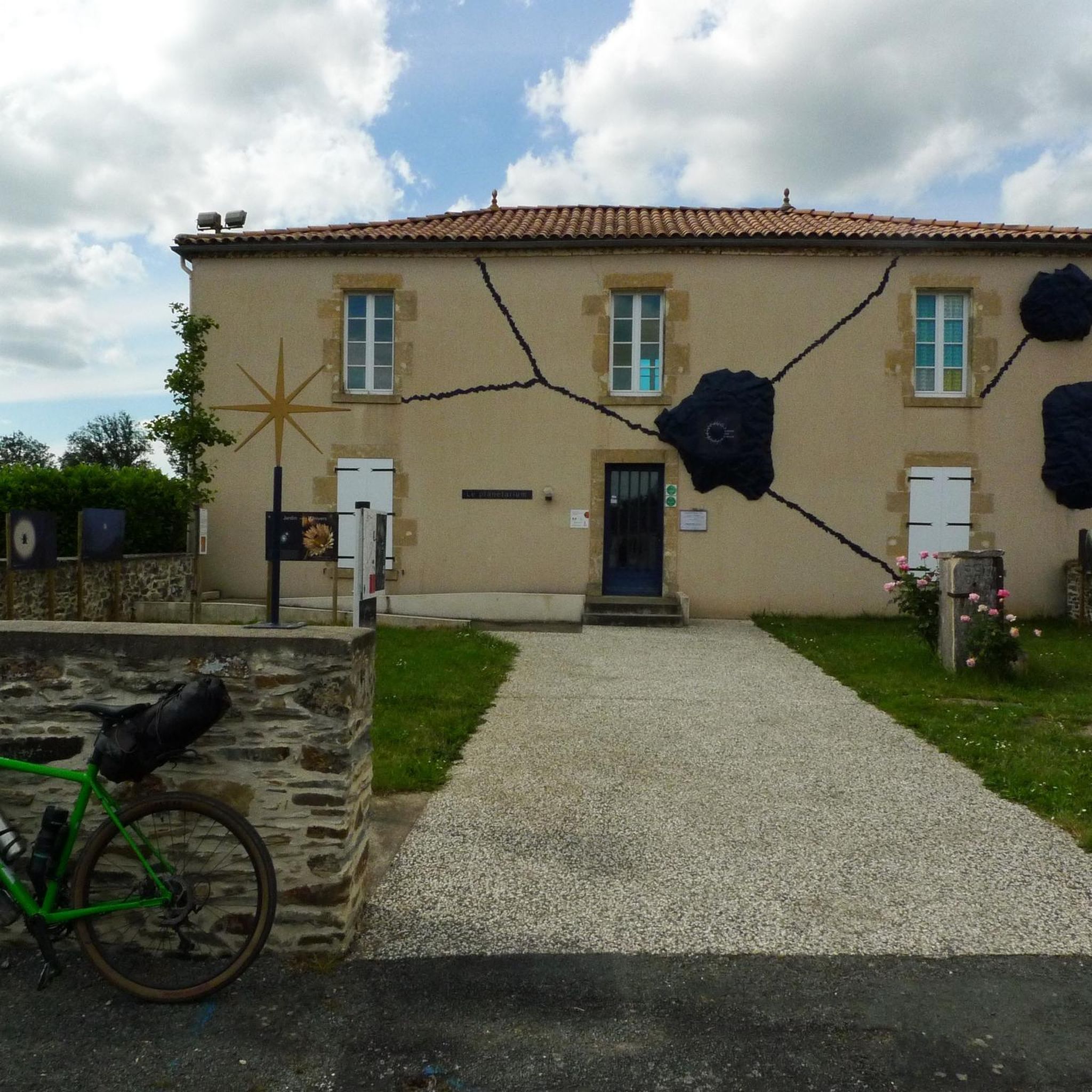
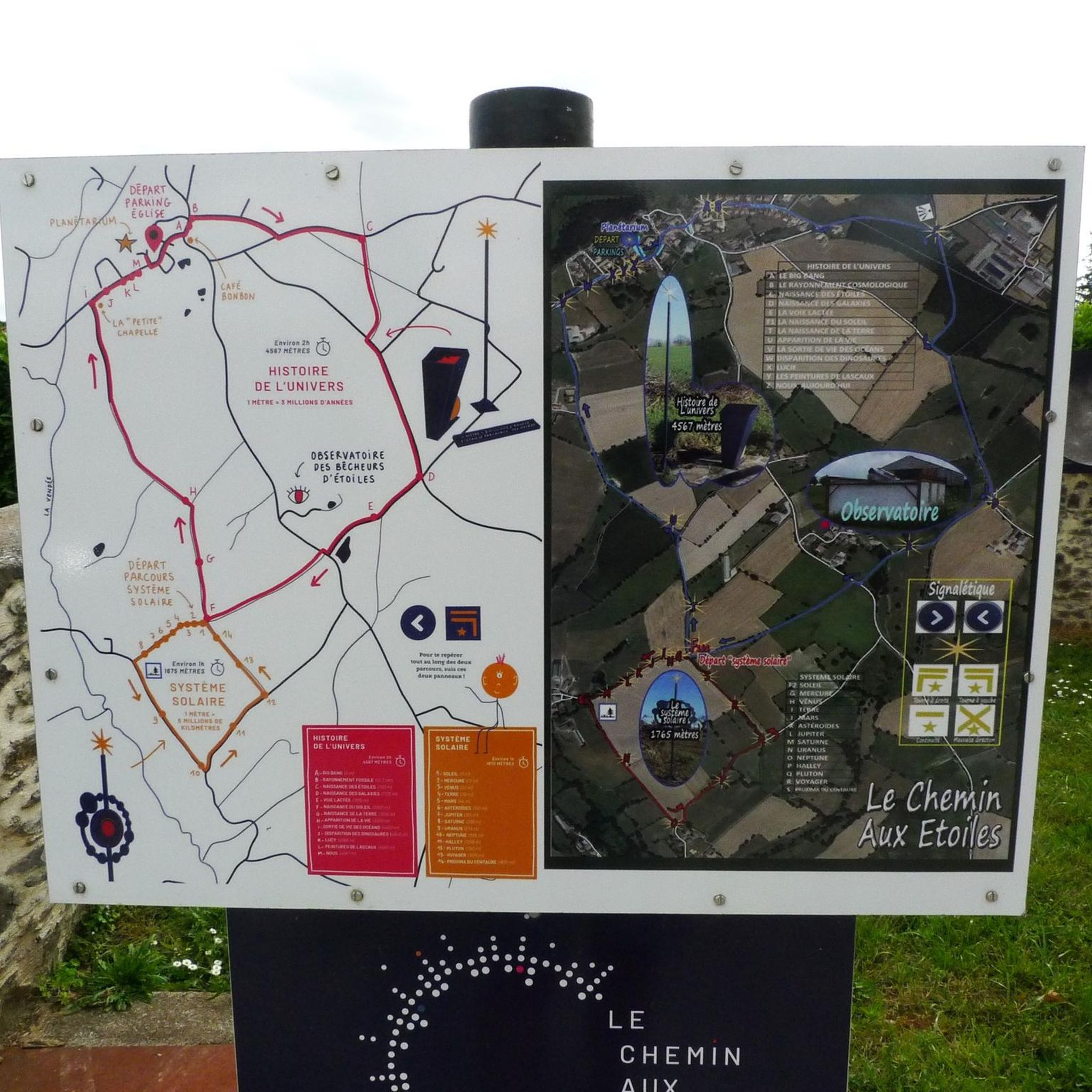
A portion of the circuit is dotted with explanatory and fun panels on the planets and stars of our solar system.
0
0
Frequently Asked Questions
How many hiking trails are available in La Chapelle-Aux-Lys?
There are over 25 hiking trails around La Chapelle-Aux-Lys, offering a variety of options for different preferences and fitness levels.
Are there easy hikes suitable for beginners or families in La Chapelle-Aux-Lys?
Yes, La Chapelle-Aux-Lys offers 12 easy routes. A good option is the Lac de l'Etruyère – Le Petit Puits loop from Terval, which is 3.4 miles (5.5 km) and takes about 1 hour 27 minutes, featuring lakeside paths and rural landscapes.
What are some longer hiking options in the area?
For a more extended exploration, consider the Jardin des Abiès – Le jardin des chirons loop from L'Absie, a moderate 10.3 miles (16.5 km) route. Another choice is The Path to the Stars loop from La Chapelle-aux-Lys, which is 9.4 miles (15.1 km).
Are there circular hiking routes in La Chapelle-Aux-Lys?
Many of the trails in La Chapelle-Aux-Lys are circular, providing convenient starting and ending points. For example, the Étang de la Jarousselière – Lac de l'Etruyère loop from Terval is a moderate 8.4 miles (13.5 km) loop that offers an extended exploration of the lake areas.
What kind of scenery can I expect on the trails around La Chapelle-Aux-Lys?
The region is characterized by gentle hills, agricultural fields, and serene bodies of water like Lac de l'Etruyère and Étang de la Jarousselière. Trails often feature a mix of open paths and wooded sections, showcasing the local rural environment.
Are the hiking trails in La Chapelle-Aux-Lys dog-friendly?
Generally, the rural paths and natural areas around La Chapelle-Aux-Lys are suitable for dogs. However, it's always recommended to keep your dog on a leash, especially near agricultural fields or livestock, and to respect local regulations.
What is the best time of year to go hiking in La Chapelle-Aux-Lys?
The spring and autumn months typically offer the most pleasant hiking conditions with mild temperatures and beautiful natural colors. Summer can also be enjoyable, particularly for shaded routes or early morning/late afternoon hikes, while winter offers a quieter, often crisp experience.
Are there any interesting landmarks or attractions to see near the hiking trails?
Yes, the area offers several points of interest. You might consider visiting Foussais-Payré, a small town of character, or the historic Medieval Village of Vouvant. These can be explored as part of a longer day out.
What do other hikers enjoy most about hiking in La Chapelle-Aux-Lys?
The area is highly rated by the komoot community, with an average score of 4.6 stars from over 30 reviews. Hikers often praise the tranquil lake loops, gentle rural paths, and the varied scenery of open fields and wooded sections.
What should I wear for hiking in La Chapelle-Aux-Lys?
Given the varied terrain of open paths and wooded sections, comfortable walking shoes or hiking boots are recommended. Layered clothing is advisable to adapt to changing weather conditions, and bringing water is always a good idea, especially on longer routes.
Is parking available at the trailheads in La Chapelle-Aux-Lys?
While specific parking information for every trailhead isn't always available, most rural areas in France, including La Chapelle-Aux-Lys, typically offer roadside parking or small designated parking areas near popular starting points for trails. It's advisable to check local signage.
Most popular routes around La Chapelle-Aux-Lys
Most popular attractions around La Chapelle-Aux-Lys

Get inspired with the komoot mobile app


Explore more
Browse the best Hikes in other regions.
