The best walks and hikes around Bellegarde-Poussieu
4.5
(94)
569
hikers
120
hikes
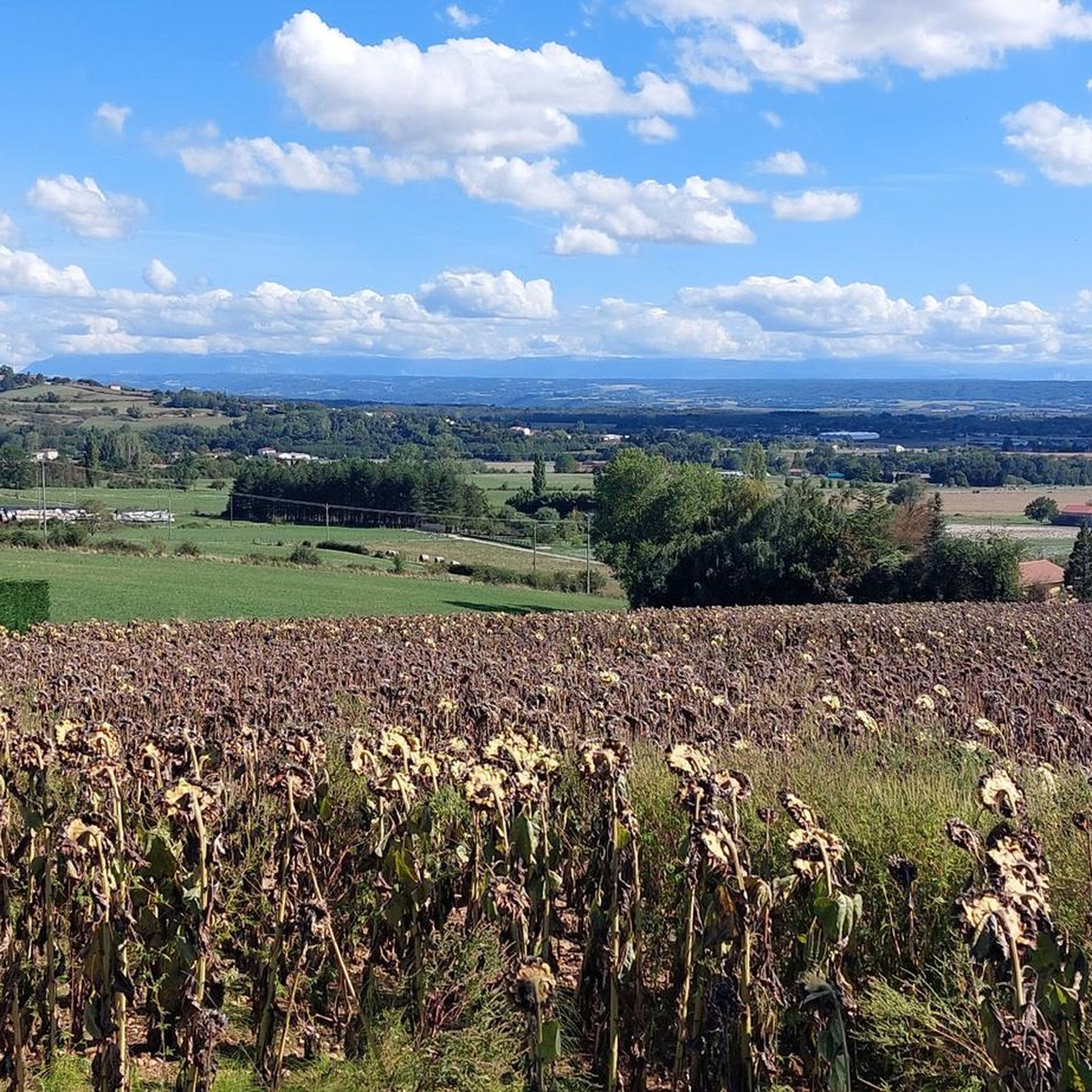
Hiking around Bellegarde-Poussieu offers diverse landscapes, including forests, plateaus, and valleys. The region features varied topography, with trails traversing wooded areas like Bois d'Arche and Grand Bois, alongside open country. Panoramic views are available from higher elevations, extending towards the Pilat massif, Vercors, and sometimes the Alps. Small rivers such as the Sanne carve through the terrain, contributing to the varied hiking experiences.
Best hiking trails around Bellegarde-Poussieu
- The most popular hiking route is Les Grands Chênes loop from Vernioz…
Last updated: July 1, 2026
5.0
(1)
9
hikers
8.60km
02:27
190m
190m
Moderate hike. Good fitness required. Easily-accessible paths. Suitable for all skill levels.
4
hikers
Easy hike. Great for any fitness level. Easily-accessible paths. Suitable for all skill levels.

Sign up for free
4
hikers
Easy hike. Great for any fitness level. Easily-accessible paths. Suitable for all skill levels.
4.0
(1)
5
hikers
9.66km
02:40
170m
170m
Moderate hike. Good fitness required. Easily-accessible paths. Suitable for all skill levels.
1
hikers
18.7km
05:08
310m
310m
Hard hike. Very good fitness required. Easily-accessible paths. Suitable for all skill levels.
Get access to more routes and recommendations from other explorers.
Sign up for free
Already have an account?
Our route recommendations are based on thousands of hikes, rides, and runs completed by other people on komoot.
Start today with a free account
Your next adventure awaits.
Login or Signup

Tips from the Community

The chapel is open daily from 7 a.m. to 10 p.m. All prayer times and the Eucharist are open to you.
4
0
The two springs of Saint Lazarus Spring are not controlled. Fruit trees have been planted at the first, so pilgrims are allowed to pick the fruit.
2
0
In front of the chapel are well-preserved old graves, and the crosses of others are beautifully placed on the walls. It's worth taking a break here to admire the view and the old cemetery. Unfortunately, the chapel isn't always open.
6
0


there is an old chapel, as well as a spring just below. you have to take the path below the bridge
0
0

The original Marian shrine "La Salette", which is referred to here, is located in the French Alps (Arrondissement of Grenoble) and is an important Marian shrine, even if it has nowhere near the level of fame of other places of pilgrimage in honor of the Mother of God - such as Lourdes in the French Pyrenees or Fatima in Portugal. The hiking highlight “La Salette” can be found on komoot under the following link: https://www.komoot.de/highlight/1861054
3
0

This part in the forest is superb. It is not very technical and is done very well on a gravel bike.
0
0
The chapel of La Salette dates from the 11th century. Located in a valley, bordering meadows and orchards, it is the starting point for many hikes. Here, you meet the pilgrims of Santiago de Compostela.
1
0
Frequently Asked Questions
How many hiking trails are there around Bellegarde-Poussieu?
Bellegarde-Poussieu offers a wide selection of hiking opportunities, with over 100 trails available. These range from easy strolls to more challenging excursions, catering to various fitness levels.
Are there easy hiking trails suitable for families in Bellegarde-Poussieu?
Yes, there are 36 easy hiking trails in the area, many of which are suitable for families. For instance, the Bellefontaine Viewing Platform – La Salette Chapel loop from Bellegarde-Poussieu is an easy 3.8-mile path that leads to the historic La Salette Chapel. The 'Circuit des Petites Poulettes' is also known as an easy walk with minimal elevation changes, offering beautiful views on clear days.
What kind of views can I expect on hikes in Bellegarde-Poussieu?
The region is renowned for its stunning panoramic views. From higher elevations, especially along crest paths, you can enjoy expansive outlooks stretching from the Pilat massif to the Savoy Alps, encompassing the Vercors and the Rhône valley. On clear days, even Mont Blanc and the Chartreuse mountains are visible. Many trails, like those on the Feytaux plateau, offer alternating views of woods and open country with distant mountains.
Are there any circular walks in Bellegarde-Poussieu?
Yes, many of the trails in Bellegarde-Poussieu are circular, allowing you to start and end at the same point. A popular option is the Les Grands Chênes loop from Vernioz, a moderate 5.3-mile trail that combines wooded sections with open plateaus. Another is the La Salette Chapel – Bellefontaine Viewing Platform loop from Bellegarde-Poussieu, an easy 3.8-mile route.
What are some interesting landmarks or attractions to see while hiking?
Several trails pass by notable landmarks. The historic La Salette Chapel, built on a rocky outcrop within a classified 'Espace Naturel Sensible,' is a frequent point of interest. You might also encounter the Medieval Round Tower of the Carmel de Surieu Monastery or the Saint-Pierre Church of Assieu. The old village of Pinet, with its castles and Pinet tower, also offers exploration opportunities.
Are there any challenging or difficult hikes in the region?
For experienced hikers seeking a challenge, Bellegarde-Poussieu offers 6 difficult trails. An example is the Ancien Bassin – Saint Lazarus Spring loop from Bellegarde-Poussieu, a substantial 15.6-mile route with over 400 meters of elevation gain, typically taking over 6 hours to complete.
What is the best time of year for hiking in Bellegarde-Poussieu?
The diverse terrain of Bellegarde-Poussieu makes it suitable for hiking across multiple seasons. Spring and autumn offer pleasant temperatures and vibrant natural colors. While many trails traverse dense woods, which can be muddy after rain, these wooded paths also provide shade during warmer months. Winter hiking is possible, but some sections might require appropriate footwear due to mud or occasional snow.
Is Bellegarde-Poussieu a dog-friendly hiking destination?
Many trails in Bellegarde-Poussieu are suitable for hiking with dogs, especially those traversing wooded areas and open country. It's always recommended to keep dogs on a leash, especially in protected natural areas like the 'Espace Naturel Sensible de la Salette,' to protect local flora and fauna.
What do other hikers enjoy most about hiking in Bellegarde-Poussieu?
The area is highly rated by the komoot community, with an average score of 4.6 stars from over 70 reviews. Hikers often praise the diverse landscapes, which include dense woodlands, expansive plateaus, and stunning panoramic viewpoints. The variety of trails, from easy strolls to more challenging excursions, is also frequently highlighted.
Are there options for public transport to reach hiking trailheads?
While specific public transport routes directly to every trailhead in Bellegarde-Poussieu might be limited, the broader Isère department has a public transport network. For detailed information on bus routes and schedules that might connect to the vicinity of trailheads, it's advisable to check local transport authority websites or apps for the Isère region.
Where can I find parking near the hiking trails?
Many popular trailheads in Bellegarde-Poussieu and surrounding villages offer designated parking areas. For specific routes, it's often possible to find parking in the starting village or at key points along the trail. For example, routes starting from Bellegarde-Poussieu itself or nearby Vernioz typically have accessible parking options.
What should I bring for a hike in Bellegarde-Poussieu?
Given the varied terrain, it's recommended to wear sturdy hiking shoes, especially as some wooded sections can be muddy after rain. Bringing water, snacks, and appropriate layers for changing weather conditions is always wise. A map or GPS device is also helpful, as detailed maps and GPX tracks are available for many routes. Don't forget a camera for the panoramic views!
Most popular routes around Bellegarde-Poussieu
Most popular attractions around Bellegarde-Poussieu

Get inspired with the komoot mobile app


Explore more
Browse the best Hikes in other regions.
