The best walks and hikes around Saint-Cyr-Des-Gâts
4.6
(428)
1,859
hikers
137
hikes
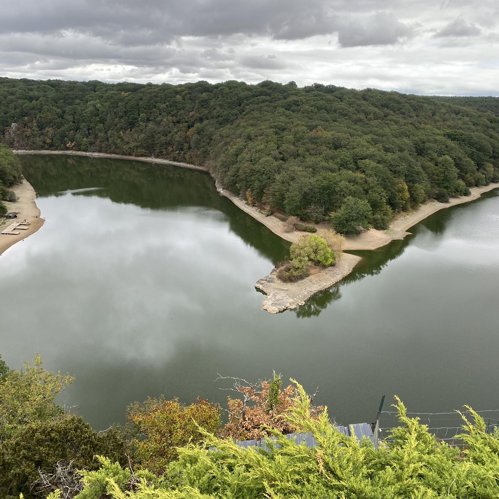
Hiking around Saint-Cyr-Des-Gâts offers routes through the Vendée region, characterized by its bocage landscape, river valleys, and reservoir areas. The terrain features a mosaic of meadows, hedgerows, and wooded sections, interspersed with dells and hills. Several rivers, including the Grand Lay, Petit Lay, Vendée, and Mère, traverse the area, providing diverse natural features. The nearby Mervent-Vouvant State Forest also offers extensive opportunities for exploring nature.
Best hiking trails around Saint-Cyr-Des-Gâts
- The most popular hiking route is View of La Mère…
Last updated: July 5, 2026
4.7
(55)
251
hikers
13.6km
03:48
240m
240m
Moderate hike. Good fitness required. Mostly accessible paths. Sure-footedness required.
4.8
(13)
43
hikers
10.3km
02:43
90m
100m
Moderate hike. Good fitness required. Easily-accessible paths. Suitable for all skill levels.

Sign up for free
4.5
(2)
16
hikers
3.14km
00:51
50m
40m
Easy hike. Great for any fitness level. Easily-accessible paths. Suitable for all skill levels.
8
hikers
9.23km
02:37
160m
160m
Moderate hike. Good fitness required. Mostly accessible paths. Sure-footedness required.
4.5
(2)
3
hikers
6.86km
01:50
70m
80m
Easy hike. Great for any fitness level. Easily-accessible paths. Suitable for all skill levels.
Get access to more routes and recommendations from other explorers.
Sign up for free
Already have an account?
Our route recommendations are based on thousands of hikes, rides, and runs completed by other people on komoot.
Start today with a free account
Your next adventure awaits.
Login or Signup




Tips from the Community

a very interesting story about the fairy Mélusine.
0
0

Path a little narrow and on the edge of a void, not suitable for everyone
0
0

The facade of the front wall of the northern transept arm and the main portal are the real main treasure and attraction of the church.
0
0
In the center of the village lies a gem of Poitou-Charentes architecture: the Romanesque church and its richly decorated northern facade. Vouvant is classified as one of the Most Beautiful Villages of France.
0
0


The Mere Trail winds through a picturesque landscape, offering a glimpse of the local flora and fauna. You will experience the serenity of the Mere River as you stop to enjoy the peace and quiet.
2
0

Among the trees and by the river you will find this magical bridge that makes you feel like you are in another world.
2
0
Frequently Asked Questions
How many hiking trails are available around Saint-Cyr-Des-Gâts?
There are over 130 hiking routes available in the Saint-Cyr-Des-Gâts area. These range from easy strolls to more challenging long-distance treks, offering a variety of options for all skill levels.
What kind of terrain can I expect on hikes in Saint-Cyr-Des-Gâts?
The terrain around Saint-Cyr-Des-Gâts is diverse, featuring river valleys, reservoir areas, and historic villages. You'll find a mix of open countryside and wooded sections, with trails often following waterways and leading to points of interest like medieval towers and dams.
Are there easy hiking trails suitable for beginners or families in Saint-Cyr-Des-Gâts?
Yes, Saint-Cyr-Des-Gâts offers over 40 easy hiking routes. A great option for families or beginners is the Mélusine Tower – Vouvant loop from Vouvant, which is 1.9 miles (3.1 km) long and takes about 51 minutes to complete, exploring the historic village.
Are there challenging or long-distance hikes in Saint-Cyr-Des-Gâts?
For those seeking a challenge, there are 12 difficult routes in the area. A notable long-distance option is the Vendée Loop – View of La Mère loop from Barrage de Pierre Brune, which spans 13 miles (20.9 km) and involves significant elevation changes.
Are there any circular hiking routes in Saint-Cyr-Des-Gâts?
Many of the trails in Saint-Cyr-Des-Gâts are circular, offering convenient starting and ending points. An example is the View of La Mère – Déluge Bridge loop from Barrage de Pierre Brune, a moderate 8.4-mile (13.6 km) route that explores the area around the Barrage de Pierre Brune.
Can I bring my dog on the hiking trails in Saint-Cyr-Des-Gâts?
Generally, dogs are welcome on most hiking trails in the Saint-Cyr-Des-Gâts area, especially in natural open spaces. However, it's always recommended to keep them on a leash, especially near livestock or in protected areas, and to check for any specific local regulations on individual routes.
Are there hiking trails with good viewpoints in Saint-Cyr-Des-Gâts?
Yes, several trails offer scenic viewpoints. The area around the Barrage de Pierre Brune provides elevated perspectives, and the View of La Mère is a specific highlight known for its picturesque river views.
What interesting places or landmarks can I see while hiking in Saint-Cyr-Des-Gâts?
While hiking, you can explore several notable landmarks. These include the historic village of Vouvant and its Mélusine Tower, the Mervent-Vouvant State Forest, and the Bazoges-en-Pareds Keep.
Is there public transport access to hiking trailheads in Saint-Cyr-Des-Gâts?
Public transport options directly to remote trailheads in Saint-Cyr-Des-Gâts can be limited. It is often advisable to use a car to reach the starting points of many hikes, especially those outside the main villages. Some routes may be accessible from larger towns with bus services, but planning ahead is recommended.
Where can I find parking for hiking trails in Saint-Cyr-Des-Gâts?
Parking is generally available at or near the starting points of many popular trails, particularly in villages like Vouvant or near significant landmarks such as the Barrage de Pierre Brune. Look for designated parking areas in these locations.
What do other hikers enjoy the most about hiking in Saint-Cyr-Des-Gâts?
The area is highly rated by the komoot community, with an average score of 4.5 stars from over 300 reviews. Hikers often praise the diverse landscape, the mix of open countryside and wooded sections, and the charm of the historic villages and river valleys encountered along the routes.
What is the best time of year to go hiking in Saint-Cyr-Des-Gâts?
The best time for hiking in Saint-Cyr-Des-Gâts is typically from spring to autumn (April to October). During these months, the weather is generally mild and pleasant, making it ideal for exploring the varied landscapes and enjoying the natural beauty of the Vendée region.
Most popular routes around Saint-Cyr-Des-Gâts
Most popular attractions around Saint-Cyr-Des-Gâts

Get inspired with the komoot mobile app


Explore more
Browse the best Hikes in other regions.
