The best road cycling routes around Isola
4.4
(97)
5,666
riders
11
rides
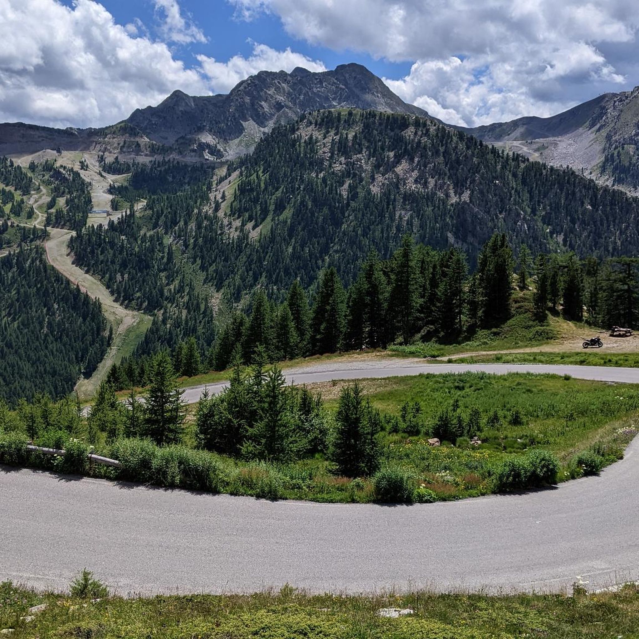
Road cycling routes around Isola offer challenging ascents through the French Alps, characterized by high mountain passes and alpine scenery. The region features diverse terrain, from demanding climbs to winding roads through valleys, with significant elevation gains. Cyclists can explore routes that traverse both French and Italian territories, providing panoramic views of the Mercantour massif.
Best road cycling routes around Isola
- The most popular road cycling route is Isola at the Col de la Lombarde and the Italian border, a difficult 25.2 miles (40.5 km) trail that takes 2 hours 53 minutes to complete. This route features sustained average slopes and connects France and Italy.
- Another top favourite among local road cyclists is Col de la Lombarde loop from Col de la Lombarde / Colle della Lombarda, a difficult 29.9 miles (48.1 km) path. This loop offers panoramic views of the surrounding peaks and valleys.
- Local road cyclists also love the Isola Village loop from Col de la Lombarde / Colle della Lombarda, a 23.5 miles (37.8 km) trail leading through alpine landscapes, often completed in about 2 hours 40 minutes.
- Road cycling around Isola is defined by high mountain passes, alpine scenery, and diverse terrain. The network offers options for different ability levels, from moderate rides to hard climbs.
- The routes in Isola are highly rated by the komoot community with an average score of 4.6 stars from over 70 reviews. More than 4000 road cyclists have used komoot to explore Isola's varied terrain.
Last updated: August 23, 2026
4.3
(3)
276
riders
40.5km
02:54
1,510m
1,510m
Hard road ride. Very good fitness required. Mostly well-paved surfaces and easy to ride.
5.0
(15)
634
riders
55.5km
03:51
1,930m
1,930m
Hard road ride. Very good fitness required. Mostly well-paved surfaces and easy to ride.

Sign up for free
40
riders
Moderate road ride. Good fitness required. Mostly well-paved surfaces and easy to ride.
5.0
(1)
23
riders
155km
09:55
4,440m
4,440m
Hard road ride. Very good fitness required. Some segments of this route may be unpaved and difficult to ride.
29
riders
18.3km
01:13
590m
590m
Moderate road ride. Good fitness required. Mostly well-paved surfaces and easy to ride.
Get access to more routes and recommendations from other explorers.
Sign up for free
Already have an account?
Our route recommendations are based on thousands of hikes, rides, and runs completed by other people on komoot.
Start today with a free account
Your next adventure awaits.
Login or Signup

Other adventures around Isola

Tips from the Community

Quiet road the D29. Nice climb.
0
0

The Forte Albertino of Vinadio was built in the 19th century to block potential French invasions - but it was never used for that. The imposing structures, which have given the town its identity, remain.
0
0

The Col de Sainte-Anne is a pass at an altitude of 425 meters in the French department of Bouches-du-Rhône.
0
1
The Col de la Couillole is a mountain pass in the Massif du Mercantour-Argentera of the French Alps, situated at an altitude of 1,678 m (5,505 ft) in the Alpes-Maritimes department, France. The road connection is open for six to seven months of the year, allowing travel between the Cians gorges in the west and the Tinée valley in the east.
0
0
The Col de la Couillole is a mountain pass in the Massif du Mercantour-Argentera of the French Alps, situated at an altitude of 1,678 m (5,505 ft) in the Alpes-Maritimes department, France. The road connection is open for six to seven months of the year, allowing travel between the Cians gorges in the west and the Tinée valley in the east.
0
0

Fantastic view a few kilometers from the Col de La Lombarde
0
0

https://youtu.be/hC4eceIyyMw?si=515BXh8fRIHsMTkt At the top, there's a wooden stall with snacks and drinks; that's it, a road pass.
0
0

A climb that leads to the Sanctuary of Sant’Anna. A place that I love, beautiful views.
1
0
Frequently Asked Questions
How many road cycling routes are available around Isola?
Isola offers a diverse network of 16 road cycling routes, catering to various skill levels. These routes traverse challenging mountain passes and scenic valleys, providing extensive exploration opportunities.
What is the best time of year for road cycling in Isola?
The best time for road cycling in Isola, especially for high mountain passes like Col de la Lombarde and Cime de la Bonette, is typically from late spring to early autumn (June to September). During these months, the weather is generally more stable, and the passes are clear of snow, offering optimal conditions for challenging climbs and breathtaking views.
Are there any easy or family-friendly road cycling routes in Isola?
While Isola is known for its challenging mountain passes, there are a few routes suitable for easier rides. The region offers 2 easy and 5 moderate routes, which can be a good starting point for families or those seeking less strenuous options. These routes often feature gentler gradients through valleys or lower elevations.
What kind of scenery can I expect along the road cycling routes in Isola?
Road cycling routes in Isola offer spectacular alpine scenery, including panoramic views of the Mercantour massif. You'll encounter diverse terrain, from demanding ascents and fluid descents to rolling sections through pine forests and charming villages. Notable natural features include high mountain passes like Col de la Lombarde, and picturesque lakes such as Lago delle Portette and Lago Sottano della Sella.
Are there any circular road cycling routes in the Isola area?
Yes, Isola features several circular road cycling routes. A popular option is the Col de la Lombarde loop from Col de la Lombarde / Colle della Lombarda, a difficult 29.9-mile (48.1 km) path offering panoramic views. Another is the Isola Village loop from Col de la Lombarde / Colle della Lombarda, a 23.5-mile (37.8 km) trail through alpine landscapes.
Where can I find parking for road cycling routes in Isola?
Parking is generally available in Isola Village and at Isola 2000, which serve as common starting points for many routes. Specific parking areas may vary depending on your chosen route, but these hubs are well-equipped for visitors. It's advisable to check local signage upon arrival for designated cyclist parking.
Can I use public transport to reach road cycling trailheads in Isola with my bike?
Public transport options to Isola and Isola 2000 from cities like Nice exist, but carrying bikes can be challenging. While some regional buses might accommodate bikes if space allows, it's not always guaranteed, especially during peak seasons. It's recommended to check with the specific transport provider in advance regarding their bike policies and availability.
Are there any cafes or accommodations friendly to cyclists in Isola?
Both Isola Village and Isola 2000 offer a selection of cafes, pubs, and accommodations that cater to cyclists. You'll find places to refuel with local cuisine and comfortable stays after a day on the road. Many establishments are accustomed to welcoming outdoor enthusiasts and may offer amenities like secure bike storage.
What are the regulations for cycling in Mercantour National Park?
Isola is located near the entrance of the Mercantour National Park. While road cycling is generally permitted on paved roads within the park's peripheral zone, specific regulations may apply to certain areas or trails, especially regarding off-road cycling. It's always best to consult the official Mercantour National Park website for the most current rules and any required permits, particularly if you plan to venture beyond main roads.
What do other road cyclists enjoy most about road cycling in Isola?
The road cycling experience in Isola is highly rated by the komoot community, with an average score of 4.6 stars from over 70 reviews. Cyclists often praise the challenging ascents, the breathtaking panoramic views from high mountain passes like Col de la Lombarde, and the diverse terrain that offers a true alpine cycling adventure. The opportunity to explore both French and Italian territories is also a significant draw.
Are there any challenging road cycling routes near Isola?
Isola is renowned for its challenging routes, featuring iconic high-altitude passes. The ascent to Col de la Lombarde, for instance, covers over 21 kilometers with significant elevation gain and sustained average slopes. Other formidable climbs in the region include the Cime de la Bonette, the highest paved road in Europe, and Col de Vars, both offering significant challenges for experienced cyclists.
Can I bring my dog on road cycling routes in Isola?
While dogs are generally welcome in many outdoor areas, specific rules may apply to road cycling routes, especially those within or bordering Mercantour National Park. On paved roads, dogs on a leash are usually permitted. However, for their safety and the safety of wildlife, it's crucial to keep them under control. Always check local regulations and park guidelines before heading out with your dog.
Most popular attractions around Isola

Get inspired with the komoot mobile app


Explore more
Browse the best Road cycling routes in other regions.
