The best walks and hikes around Trans-Sur-Erdre
4.4
(107)
652
hikers
62
hikes
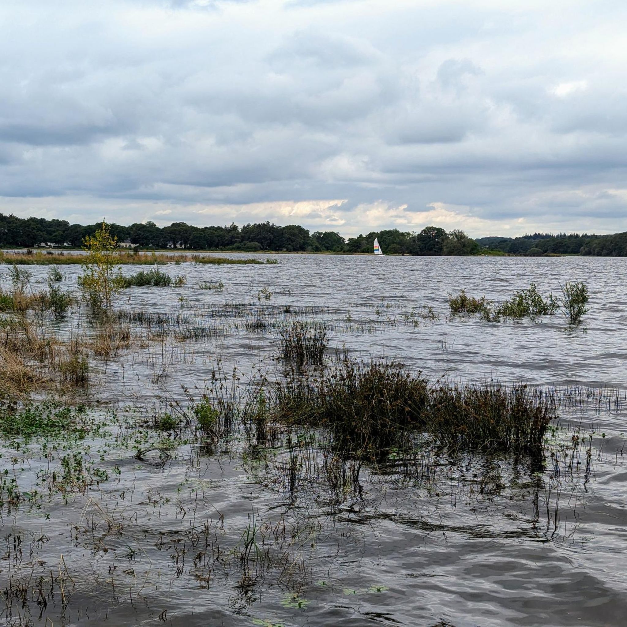
Hiking around Trans-Sur-Erdre offers a network of trails primarily characterized by gentle terrain and proximity to water features. The landscape includes lakes, small rivers like the Erdre, and natural areas, with minimal elevation changes. The region provides accessible paths suitable for various outdoor activities.
Best hiking trails around Trans-Sur-Erdre
- The most popular hiking route is Lake Vioreau Loop, a 6.6 miles (10.6 km) trail that takes 2 hours 41 minutes to complete. This moderate route offers views of Lake…
Last updated: July 4, 2026
4.8
(28)
161
hikers
10.6km
02:41
30m
30m
Moderate hike. Good fitness required. Easily-accessible paths. Suitable for all skill levels.
5.0
(1)
11
hikers
7.23km
01:52
40m
40m
Easy hike. Great for any fitness level. Easily-accessible paths. Suitable for all skill levels.

Sign up for free
4.3
(3)
13
hikers
7.88km
02:08
110m
100m
Moderate hike. Good fitness required. Easily-accessible paths. Suitable for all skill levels.
12
hikers
7.87km
02:02
40m
40m
Moderate hike. Good fitness required. Easily-accessible paths. Suitable for all skill levels.
5.0
(1)
14
hikers
11.8km
03:03
70m
70m
Moderate hike. Good fitness required. Easily-accessible paths. Suitable for all skill levels.
Get access to more routes and recommendations from other explorers.
Sign up for free
Already have an account?
Our route recommendations are based on thousands of hikes, rides, and runs completed by other people on komoot.
Start today with a free account
Your next adventure awaits.
Login or Signup



Tips from the Community

The Étang des Troches, the green lung of Pannecé, is the ideal place for an outdoor excursion. The body of water closest to the car park is a leisure and walking area. It features a walking trail, a pond open for fishing, large family picnic tables, a children's playground including a table tennis table, a fitness area, restrooms, and a shelter in case of rainy weather. https://www.intramuros.org/pannece/decouvrir/11178
0
0

Beautiful 19th-century washhouse located on the Erdre River. A footbridge provides a beautiful view of the washhouse and the river. Picnic tables are available.
1
0

Guinguette open from June to September. Lots of space and very friendly.
0
0
The Ajeaux channel connects the Riaillé bodies of water (La Provostière and Poitevinière) to the large Vioreau Reservoir. The water thus transported allows the supply of the canal from Nantes to Brest.
0
0
The Vioreau forest, located between the municipalities of Joué-sur-Erdre and Meilleraye-de-Bretagne, extends over 750 ha, 70 of which belong to the Department of Loire-Atlantique and are classified Sensitive Natural Areas (ENS). It adjoins to the north the large Vioreau reservoir, also departmental property, which is part of the Nantes-Brest canal supply system.
0
0
The wash house is located on the banks of the Erdre, at the exit of the town of Riaillé towards Ancenis. This beautiful building was abandoned for a long time before being restored in 1990-1991. This stone building would have been built around 1850, it measures 20 meters long and 6 meters wide. Today, the site of the wash house is a pleasant place, equipped for picnics as well as a footbridge spanning the Erdre to lead to the Riante Vallée room. https://www.riaille.fr/decouvre/sites-remarquables-et-sentiers-de-randonnee/sites-remarquables-de-la-commune
1
0
This pond is a water reservoir on the Donneau River. Le Donneau which changes its name (???) from Couffé to be called Le Hâvre. A well-known haven for Loire à Vélo cyclists since it is the river which flows at the foot of the Oudon castle before flowing into the Loire a little further on. Nice pond with trees but I found that it lacked benches and picnic tables near the water. If the town hall reads me...
1
0
Frequently Asked Questions
How many hiking trails are available in Trans-Sur-Erdre?
Trans-Sur-Erdre offers a diverse network of over 50 hiking trails. These routes cater to various skill levels, with 22 easy trails, 28 moderate options, and a couple of more challenging paths for experienced hikers.
Are there easy hiking trails suitable for beginners or families in Trans-Sur-Erdre?
Yes, Trans-Sur-Erdre is well-suited for beginners and families, with 22 easy trails available. A great option is the Rigole des Ajeaux loop from Aire naturelle "Le Temps de Vivre", an easy 4.5-mile (7.2 km) path that follows a waterway through a pleasant natural setting.
What kind of terrain can I expect on hikes around Trans-Sur-Erdre?
The terrain around Trans-Sur-Erdre is generally gentle, characterized by minimal elevation changes. You'll find paths alongside lakes, small rivers like the Erdre, and through natural areas, offering accessible and pleasant walking conditions.
Are there any circular hiking routes in Trans-Sur-Erdre?
Many of the trails in Trans-Sur-Erdre are circular, allowing you to start and end at the same point. For example, the popular Lake Vioreau Loop is a 6.6-mile (10.6 km) circular route offering scenic views of the lake.
Can I bring my dog on the hiking trails in Trans-Sur-Erdre?
Most trails in Trans-Sur-Erdre are dog-friendly, but it's always recommended to keep your dog on a leash, especially near livestock or in protected natural areas. Please ensure you clean up after your pet to maintain the natural beauty of the paths.
Are there any trails suitable for wheelchairs or strollers?
Given the region's generally gentle terrain and accessible paths, some routes may be suitable for wheelchairs or strollers. We recommend checking individual route details on komoot for specific accessibility information, as conditions can vary.
What are some interesting places to see along the hiking trails in Trans-Sur-Erdre?
The region offers several points of interest. You can explore the West bridge at Lac de Vioreau or the impressive Vioreau Reservoir Dam. Another notable spot is the Arcades of the Gué de la Roche, a historic bridge structure.
Where can I find parking for hiking in Trans-Sur-Erdre?
Parking is generally available at the start points of many trails, especially near popular lakes or villages. For instance, the Footbridge over the Erdre – The Washhouse of Riaillé loop from Riaillé typically has parking options in Riaillé. Always check the route description for specific parking recommendations.
What is the best time of year to go hiking in Trans-Sur-Erdre?
The best time for hiking in Trans-Sur-Erdre is typically from spring to autumn (April to October), when the weather is mild and the natural landscapes are at their most vibrant. Summer offers longer daylight hours, while spring and autumn provide comfortable temperatures and beautiful foliage.
What do other hikers say about the trails in Trans-Sur-Erdre?
The hiking routes in Trans-Sur-Erdre are highly regarded by the komoot community, holding an average rating of 4.5 stars from over 90 reviews. Hikers often praise the peaceful lakeside paths, the gentle river routes, and the overall accessibility of the trails.
Are there any opportunities for wild swimming near the hiking routes?
Given the numerous lakes and rivers in the Trans-Sur-Erdre region, there are several spots where wild swimming might be possible. Lake Vioreau and the Étang de la Provostière are popular water bodies. Always check local regulations and safety conditions before entering the water.
How long do hikes typically take in Trans-Sur-Erdre?
Hike durations in Trans-Sur-Erdre vary depending on the route length and your pace. Many popular trails, like the Mount Juillet loop from Les Touches (7.9 km), can be completed in around 2 to 2.5 hours, offering a good balance for a half-day outing.
What should I wear for hiking in Trans-Sur-Erdre?
For hiking in Trans-Sur-Erdre, comfortable walking shoes are essential, as paths can be uneven. Layered clothing is advisable to adapt to changing weather, and a waterproof jacket is recommended, especially outside of peak summer. Don't forget water and sun protection.
Are there any less-known or 'hidden gem' trails in the area?
While the region's main attractions are well-loved, exploring some of the less-trafficked routes can reveal hidden gems. Consider the Provostière Pond – Stele of the Aviators loop from La Provostière for a quieter experience, offering serene pond views and historical interest away from the busiest spots.
Most popular routes around Trans-Sur-Erdre
Most popular attractions around Trans-Sur-Erdre

Get inspired with the komoot mobile app


Explore more
Browse the best Hikes in other regions.
