The best road cycling routes around Châteauvieux
4.6
(254)
6,748
riders
131
rides
Road cycling routes around Châteauvieux are set within the Southern French Alps, offering diverse terrain for cyclists. The region is characterized by varied elevations, from valley floors to significant climbs, providing a dynamic environment for road biking. Cyclists can expect routes with views of the Durance River and Serre-Ponçon Lake, alongside the backdrop of Alpine scenery. The area features a mix of open landscapes and routes passing by historical landmarks like castles.
Best road cycling routes around Châteauvieux
- The most…
Last updated: October 30, 2026
4.5
(2)
65
riders
73.5km
03:32
1,020m
1,020m
Hard road ride. Very good fitness required. Mostly well-paved surfaces and easy to ride.
5.0
(1)
47
riders
Hard road ride. Very good fitness required. Mostly well-paved surfaces and easy to ride.

37
riders
38.3km
01:36
270m
270m
Easy road ride. Mostly well-paved surfaces and easy to ride.
4.0
(3)
24
riders
40.5km
02:02
650m
650m
Moderate road ride. Good fitness required. Mostly well-paved surfaces and easy to ride.
5.0
(3)
33
riders
23.9km
01:05
200m
200m
Easy road ride. Mostly well-paved surfaces and easy to ride.
Get access to more routes and recommendations from other explorers.
Already have an account?
Our route recommendations are based on thousands of hikes, rides, and runs completed by other people on komoot.
Start today with a free account
Your next adventure awaits.
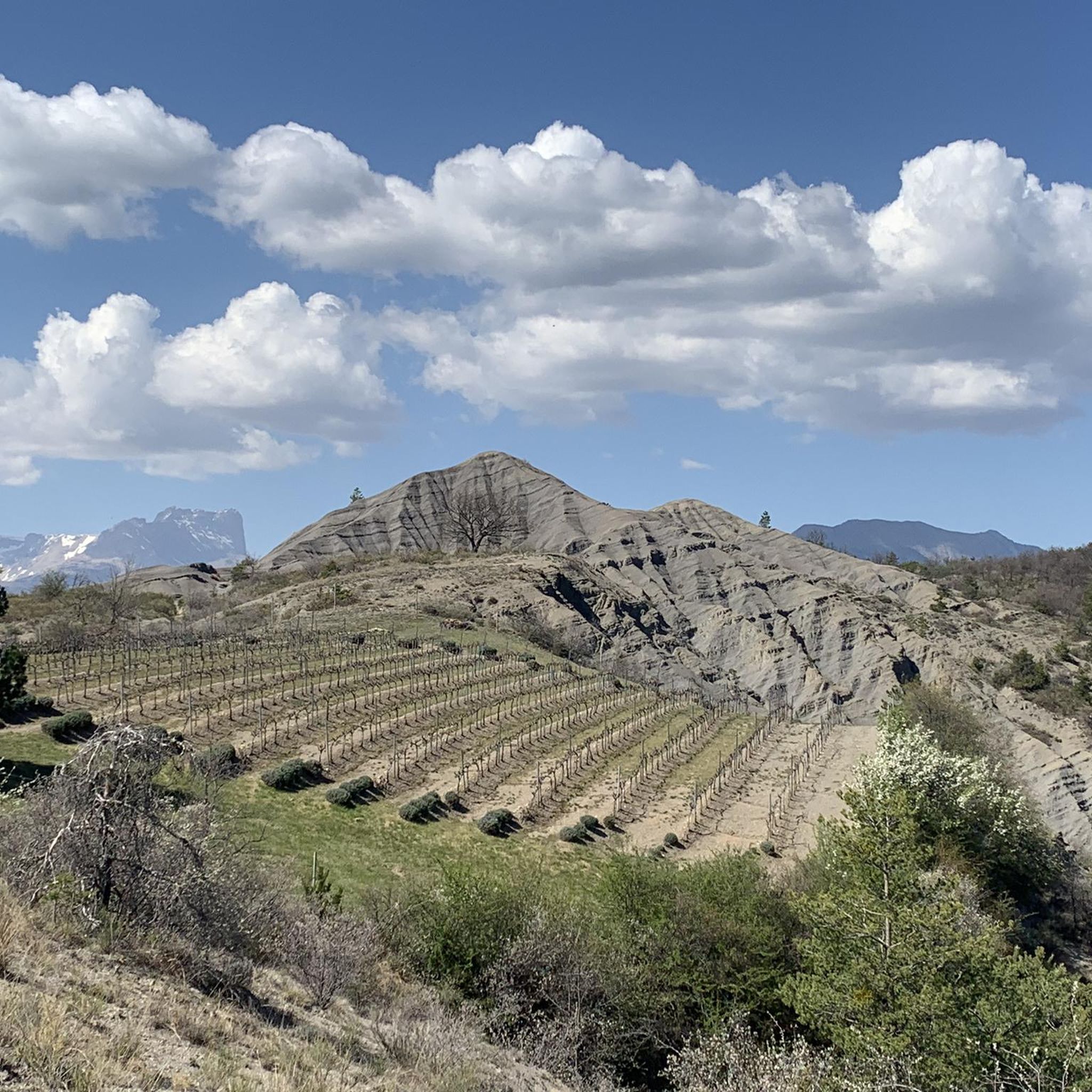
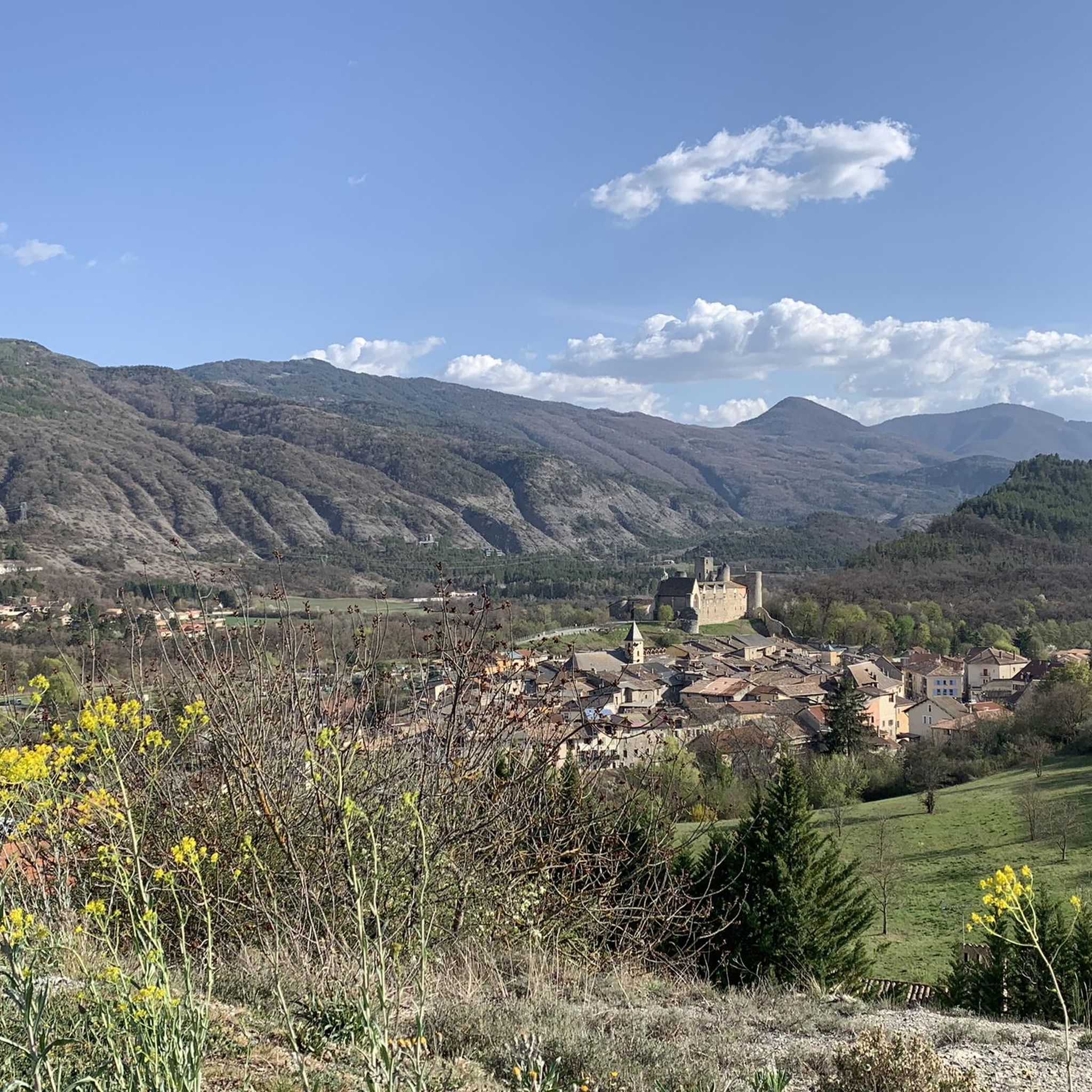
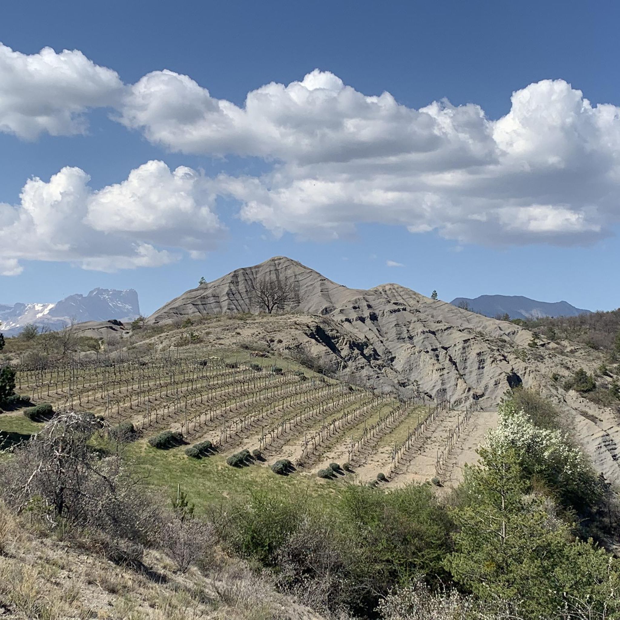
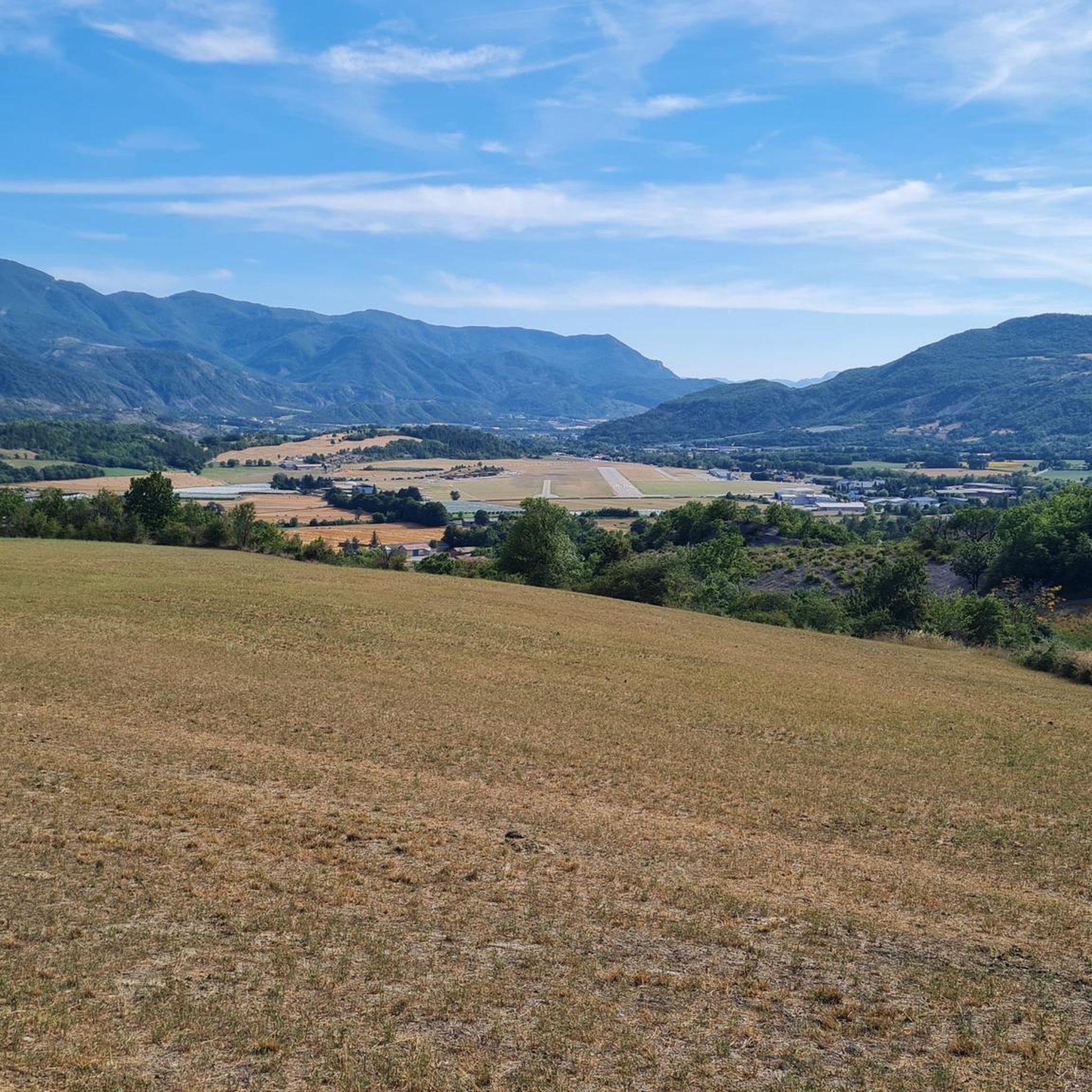

Tips from the Community

Route with a good amount of positive elevation gain that is both rideable and sheltered from heavy traffic.
0
0

The Castle of Tallard is one of the most important medieval monuments in the French Hautes-Alpes. It stands in the village of Tallard, about 20 km from Gap, in a dominant position over the Durance valley.
15
0
The Castle of Tallard is one of the most important medieval monuments in the French Hautes-Alpes. It stands in the village of Tallard, about 20 km from Gap, in a dominant position over the Durance valley.
16
0
Great way to stay out of traffic.
16
0
Old wooden cart adorned with flowers.
10
0
La Route de Tallard (D942) is one of the main roads in the Tallard area, in the Hautes-Alpes, and connects Tallard with the Buëch valley and towns like La Saulce and Gap. For cyclists, it is a much-used road as a link to numerous alpine itineraries.
9
0

Frequently Asked Questions
How many road cycling routes are available around Châteauvieux?
The Châteauvieux area offers a wide selection of road cycling routes, with over 150 tours available. These routes cater to various skill levels, ranging from moderate loops to challenging climbs through the Southern French Alps.
What kind of terrain can I expect on road cycling routes near Châteauvieux?
Road cycling routes around Châteauvieux are characterized by the diverse terrain of the Southern French Alps. You can expect varied elevations, from valley floors to significant climbs, offering a dynamic environment. The landscape features Alpine scenery, views of the Durance River and Serre-Ponçon Lake, and routes passing through open areas and forests.
What is the best time of year for road cycling in Châteauvieux?
The mild climate of the Southern French Alps makes Châteauvieux suitable for road cycling for much of the year. Spring and autumn generally offer pleasant temperatures and beautiful scenery. Summer provides longer daylight hours, though some higher elevation routes might be more challenging due to heat.
Are there road cycling routes suitable for beginners or less experienced cyclists?
Yes, Châteauvieux offers routes for all abilities. While there are many challenging options, you can find several moderate routes. For example, the Pelleautier Lake – Lake Pelleautier loop from Tallard is a moderate 30-mile (48.3 km) trail offering scenic views without extreme difficulty.
What natural features or landmarks can I see while road cycling around Châteauvieux?
Road cycling routes in Châteauvieux often provide stunning views of the Durance River valley and Serre-Ponçon Lake, set against the backdrop of the Alpine scenery. You might also encounter the Sapet Forest or catch glimpses of the Écrins National Natural Park. For specific natural highlights, consider exploring areas near Ceuze pike or La Petite Céüse.
Are there any historical sites or cultural attractions along the road cycling routes?
Yes, the region around Châteauvieux is rich in history. Many routes pass by historical landmarks such as castles, churches, and old houses. A notable example is the View of Château de Tallard – Col de Grele loop from Châteauvieux, which offers views of Tallard Castle. The cultural richness of the Provence-Alpes-Côte d'Azur region also means you might find local markets and gastronomy to explore.
Are there challenging road cycling routes for experienced riders?
Absolutely. For experienced cyclists seeking a challenge, Châteauvieux provides numerous difficult routes with substantial elevation gains. An example is the Tallard Castle – Tallard Castle loop from Communauté d'agglomération Gap-Tallard-Durance, which features significant climbing over its 44.1-mile (71 km) distance.
Can I find circular road cycling routes in the Châteauvieux area?
Yes, many of the road cycling routes around Châteauvieux are designed as loops, allowing you to start and finish at the same point. For instance, the Serre-Ponçon Dam – Rousset Dam loop from Châteauvieux is a popular circular route covering 33.6 miles (54.1 km) with varied terrain.
What do other cyclists say about the road cycling routes in Châteauvieux?
The road cycling routes in Châteauvieux are highly regarded by the komoot community, holding an average rating of 4.6 stars from over 200 reviews. Cyclists often praise the diverse terrain, the stunning Alpine scenery, and the well-maintained paths that make for an enjoyable riding experience.
Is parking available for road cyclists in Châteauvieux?
While specific parking areas for each route are not detailed, Châteauvieux and surrounding towns like Tallard, which serve as common starting points for routes, typically offer public parking facilities. It's advisable to check local signage upon arrival.
Are the road cycling routes around Châteauvieux suitable for families?
While the region is known for its varied elevations, some routes may be suitable for families depending on their experience level. Look for routes described as 'easy' or 'moderate' and consider shorter distances with less elevation gain. Always check the route details for specific difficulty and terrain before setting out with family.
Are there options for food and drink along the road cycling routes?
The region's cultural richness means you'll often find opportunities for refreshments. Routes frequently pass through charming villages and towns where you can discover local markets, cafes, and restaurants to refuel and experience the local gastronomy.
Most popular routes around Châteauvieux
Most popular attractions around Châteauvieux

Get inspired with the komoot mobile app


Explore more
Browse the best Road cycling routes in other regions.
