The best walks and hikes around Saulgond
4.3
(198)
843
hikers
72
hikes
Hiking around Saulgond reveals a landscape characterized by verdant river valleys, extensive meadows, and scattered forests. The region, situated in the Charente department of France, features gentle topography with numerous waterways like the Glane, Issoire, Vienne, and Goire rivers. This rural setting provides varied terrain for exploration on foot, often incorporating historical towns and structures. The trails generally feature mild elevation changes, making them accessible for a range of abilities.
Best hiking trails around Saulgond
- The most popular hiking route…
Last updated: July 2, 2026
4.8
(15)
84
hikers
5.06km
01:17
10m
10m
Easy hike. Great for any fitness level. Easily-accessible paths. Suitable for all skill levels.
4.8
(6)
40
hikers
4.13km
01:03
10m
10m
Easy hike. Great for any fitness level. Easily-accessible paths. Suitable for all skill levels.

Sign up for free
5.0
(3)
9
hikers
13.3km
03:35
160m
160m
Moderate hike. Good fitness required. Easily-accessible paths. Suitable for all skill levels.
5.0
(1)
10
hikers
15.3km
04:08
200m
200m
Moderate hike. Good fitness required. Easily-accessible paths. Suitable for all skill levels.
5.0
(2)
5
hikers
11.7km
03:08
140m
140m
Moderate hike. Good fitness required. Easily-accessible paths. Suitable for all skill levels.
Get access to more routes and recommendations from other explorers.
Sign up for free
Already have an account?
Our route recommendations are based on thousands of hikes, rides, and runs completed by other people on komoot.
Start today with a free account
Your next adventure awaits.
Login or Signup


Tips from the Community


Beautiful walk on the island of Chaillac, near St Junien (87). In one end of the island you have this magnificent paddle mill, which is turned and which is on the banks of Vienne.
0
0

The exterior of the castle is impressive. It is built on the basis of a square, each corner of which is protected by a tower. The moat surrounds the whole building. In summer, the castle can be visited by reservation. Information on the local tourist office website: https://www.tourisme-charentelimousine.fr/fiche-sit/chateau-de-rochebrune-5656147/#truncate
0
0
This old fortified city owes its long existence to its strategic position on the heights of a hill. Thus, the existence of Brigueuil is attested from Antiquity. As you explore the streets of the town, you will discover the remains of the surrounding walls, the entrance gates to the town and the castle which has been altered many times. The local shops are an opportunity to stock up on food and stop to refresh yourself at the café.
0
0


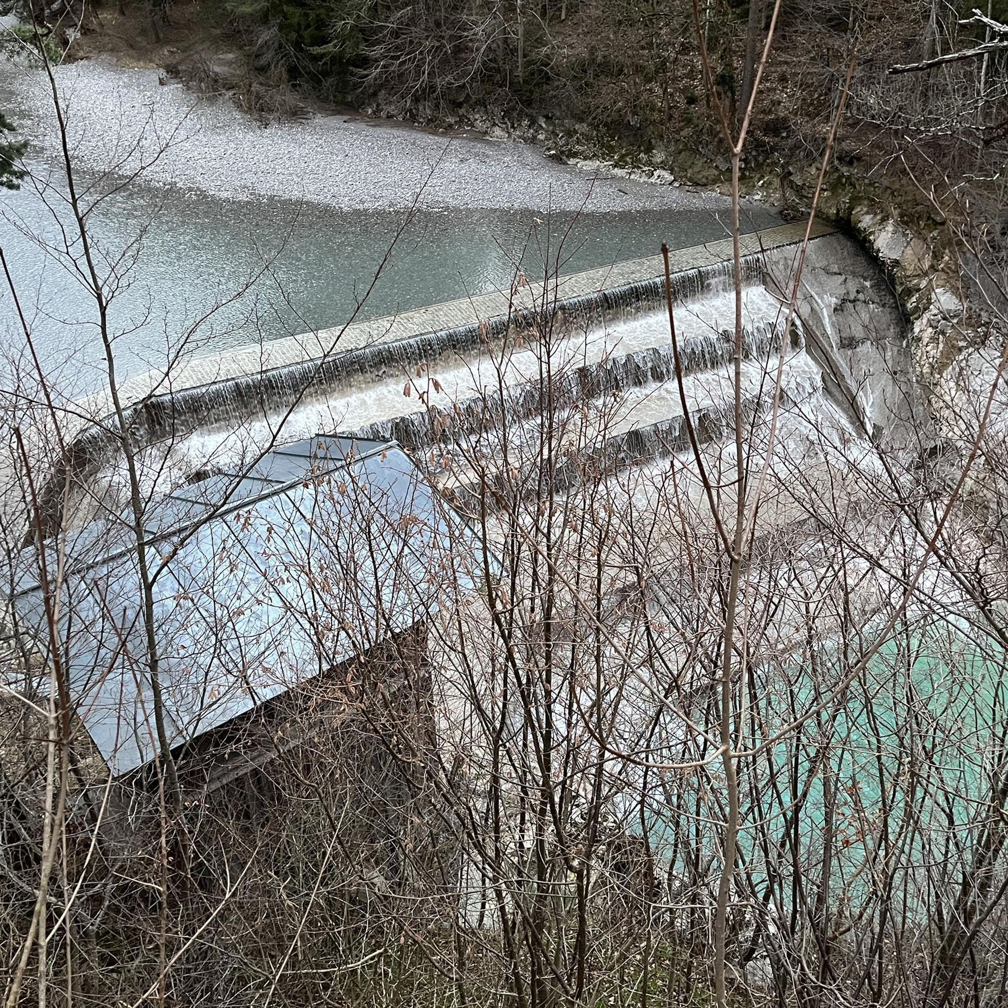
This old mill wheel is still in place and can be seen up close.
2
0
Frequently Asked Questions
How many hiking trails are available around Saulgond?
There are over 70 hiking trails around Saulgond, offering a variety of options for different preferences and fitness levels. The network includes 28 easy routes, 44 moderate routes, and 1 more challenging trail.
What kind of terrain can I expect on hikes near Saulgond?
Hikes near Saulgond feature a diverse landscape characterized by verdant river valleys, extensive meadows, and scattered forests. You'll encounter gentle topography with numerous waterways like the Glane, Issoire, Vienne, and Goire rivers. The trails generally have mild elevation changes, making them accessible for a range of abilities.
What do other hikers say about the trails in Saulgond?
The hiking routes in Saulgond are highly rated by the komoot community, with an average score of 4.4 stars from over 170 reviews. More than 780 hikers have used komoot to explore the varied terrain, often praising the scenic river landscapes and the peaceful rural setting.
Are there easy hiking trails suitable for beginners or casual walkers?
Yes, Saulgond offers many easy hiking trails perfect for beginners or casual walkers. For example, the The Island of Navière in Saint-Junien - loop is an easy 3.1-mile (5.1 km) route exploring a scenic island setting. Another gentle option is the Kingfisher Spot by the River loop from Chaillac-sur-Vienne, which is 2.5 miles (4.1 km) long.
Are there any circular hiking routes around Saulgond?
Many of the trails around Saulgond are circular, allowing you to start and end at the same point. Popular options include the moderate Moulin du Pommier Glamping loop from Saulgond, which is 7.2 miles (11.7 km), or the longer Rochebrune Castle loop from Étagnac, an 8.3-mile (13.3 km) trail.
What natural features can I see while hiking in the Saulgond area?
The Saulgond area is rich in natural beauty. You can explore verdant river landscapes, such as the picturesque Issoire Valley with its unique ford crossing, or the scenic Site Corot on the Glane river. The confluence of the Vienne and Goire rivers near Confolens also offers beautiful water features. Beyond the rivers, you'll find extensive meadows and mixed forests.
Are there historical landmarks or interesting towns to explore on a hike?
Yes, hiking around Saulgond can easily be combined with exploring historical sites and charming towns. You can visit Saint-Junien, known for its Romanesque collegiate church and the unusual Saint-Junien Three-Arched Bridge. The medieval city of Confolens, with its half-timbered houses and historic bridges, is also a highlight. Some routes, like the Rochebrune Castle loop from Étagnac, pass directly by historic castles.
Can I hike with my dog in Saulgond?
Generally, dogs are welcome on hiking trails in rural France, including around Saulgond. It's always advisable to keep your dog on a leash, especially in areas with livestock or near roads, and to clean up after them. There are no specific restrictions mentioned for the trails in this region.
Are there family-friendly hiking options near Saulgond?
Absolutely. Many of the easy and moderate trails around Saulgond are suitable for families. The gentle topography and scenic river walks provide pleasant experiences for all ages. Routes like The Island of Navière in Saint-Junien - loop are particularly good for families looking for an accessible and enjoyable outing.
When is the best time of year to go hiking in Saulgond?
The best time to hike in Saulgond is typically during spring (April to June) and autumn (September to October). During these seasons, the weather is generally mild and pleasant, and the landscapes are particularly beautiful with spring blossoms or autumn colors. Summer can also be enjoyable, but it's best to hike in the mornings or late afternoons to avoid the midday heat.
Is parking available at the trailheads?
While specific parking details for every trailhead are not always listed, most rural hiking areas in France, including around Saulgond, typically offer designated parking spots or roadside parking near popular starting points in villages or close to natural attractions. It's recommended to check local signage upon arrival.
How can I reach the hiking trails around Saulgond using public transport?
Public transport options directly to every trailhead in a rural area like Saulgond can be limited. While major towns like Saint-Junien or Confolens may have bus services, reaching specific, more remote trailheads might require a car. It's advisable to check regional bus schedules for connections to the nearest towns and plan accordingly.
Most popular attractions around Saulgond

Get inspired with the komoot mobile app


Explore more
Browse the best Hikes in other regions.
