The best road cycling routes around Bouillante
5.0
(120)
208
riders
4
rides
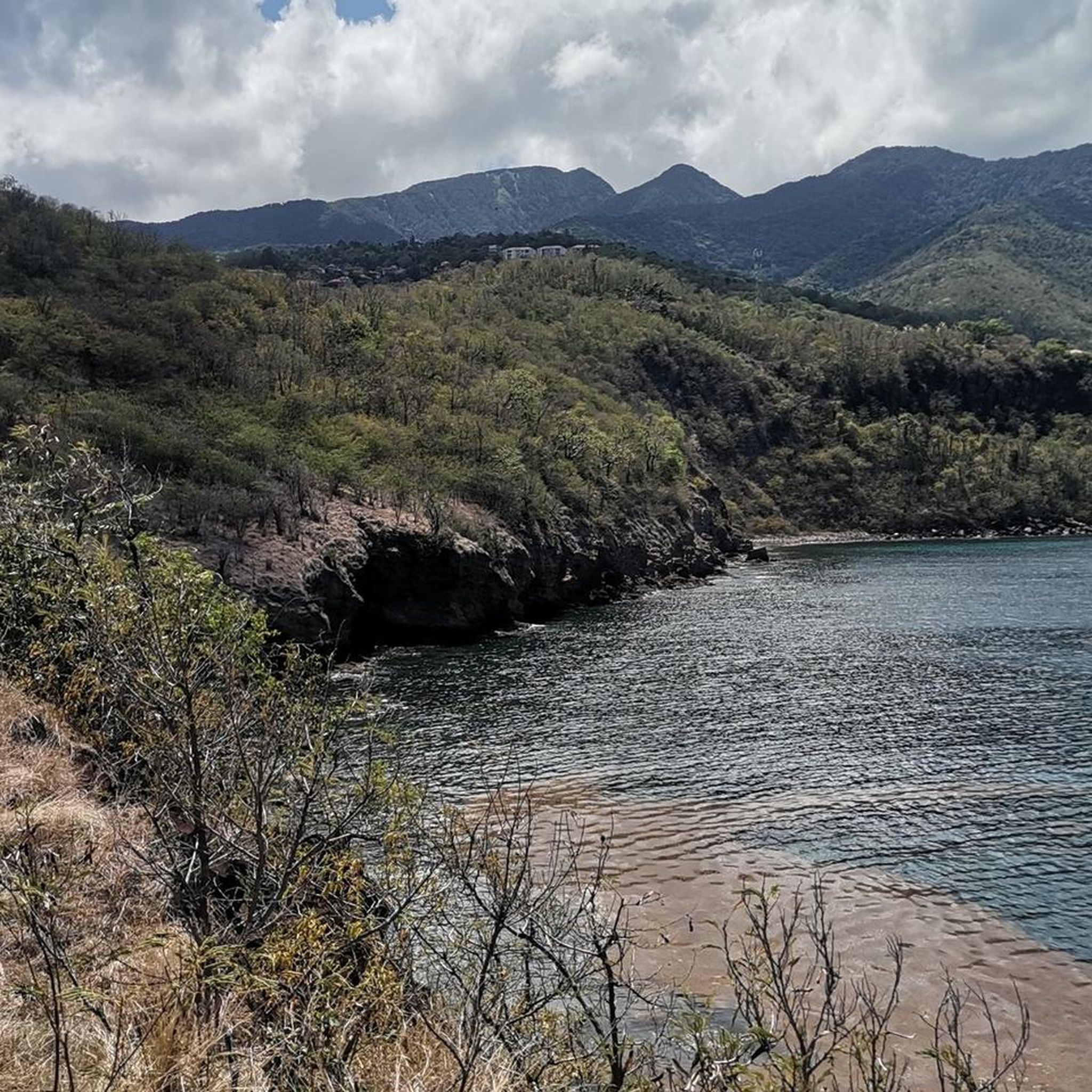
Road cycling routes Bouillante are situated on the west coast of Basse-Terre, Guadeloupe, characterized by a dramatic volcanic landscape. The region features challenging climbs through mountainous terrain and offers scenic coastal roads with views of the Caribbean Sea. Cyclists can expect to ride through lush tropical vegetation, often bordering the protected areas of the Guadeloupe National Park. This diverse environment provides varied terrain with significant elevation changes.
Best road cycling routes around Bouillante
- The most popular road cycling route is Col des Mamelles – Cascade des Écrevisses loop from La Lézarde, a 54.6 miles (87.8 km) trail that takes 4 hours 48 minutes to complete. This difficult route features significant elevation gain through volcanic terrain.
- Another top favourite among local road cyclists is Col des Mamelles – Cascade des Écrevisses loop from Plage de Grande Anse, a difficult 46.8 miles (75.3 km) path. This route offers challenging climbs and descents with views of the surrounding tropical landscape.
- Local road cyclists also love the Cascade des Écrevisses – Col des Mamelles loop from Baie-Mahault, a 27.8 miles (44.8 km) trail leading through volcanic mountains and lush vegetation, often completed in about 2 hours 20 minutes.
- Road cycling around Bouillante is defined by volcanic mountains, scenic coastal roads, and lush tropical vegetation. The network offers options for different ability levels, from moderate to difficult.
- The routes in Bouillante are highly rated by the komoot community with an average score of 5.0 stars from over 120 reviews. More than 200 road cyclists have used komoot to explore Bouillante's varied terrain.
Last updated: July 1, 2026
5.0
(56)
88
riders
88.0km
04:48
1,760m
1,760m
Hard road ride. Very good fitness required. Some segments of this route may be unpaved and difficult to ride.
5.0
(55)
68
riders
79.6km
04:26
1,720m
1,710m
Hard road ride. Very good fitness required. Some segments of this route may be unpaved and difficult to ride.

Sign up for free
5.0
(1)
31
riders
44.8km
02:20
810m
810m
Moderate road ride. Good fitness required. Mostly well-paved surfaces and easy to ride.
5.0
(8)
21
riders
75.0km
04:12
1,640m
1,640m
Hard road ride. Very good fitness required. Some segments of this route may be unpaved and difficult to ride.
Our route recommendations are based on thousands of hikes, rides, and runs completed by other people on komoot.
Start today with a free account
Your next adventure awaits.
Login or Signup
Popular around Bouillante

Tips from the Community

Definitely go to the waterfall during off-peak hours! Then there is street parking and you pretty much have the pool to yourself. The pool itself is small but beautiful. You can also wade through the river a bit, but that's it.
0
0

Nice to look at, but is relatively small and only looks so posing in the pictures.
1
0

Small but beautiful waterfall. The way there is a bit slippery now and then.
1
0
To the left and right of the path, the vegetation of the jungle is unique and diverse. The waterfall is wonderful. The best thing is to come by in the morning, then there will be fewer people. On the last visit, two buses from a cruise ship were on the way ......
2
2

Small waterfall in front of which you can take a bath in a natural pool. Walking time from the car park is only 5 minutes, so a bit crowded. From a wooden platform you can watch the waterfall and the tourists. The way there is unfortunately a dead end.
2
1
Frequently Asked Questions
What kind of terrain can I expect when road cycling around Bouillante?
Bouillante, situated on the west coast of Basse-Terre, Guadeloupe, offers a dynamic road cycling experience characterized by its dramatic volcanic landscape. You'll encounter challenging climbs through mountainous terrain, scenic coastal roads with breathtaking views of the Caribbean Sea, and lush tropical vegetation. The region's volcanic origins mean significant elevation changes, providing varied and engaging rides.
Are there challenging road cycling routes in Bouillante for experienced riders?
Yes, Bouillante is well-suited for experienced road cyclists seeking a challenge. The volcanic terrain of Basse-Terre features routes with significant elevation gains. For instance, the Col des Mamelles – Cascade des Écrevisses loop from La Lézarde is a difficult 87.8 km route with over 1700 meters of elevation gain, offering a strenuous and rewarding ride.
What are the options for moderate road cycling routes in the Bouillante area?
While many routes in Bouillante are challenging, there are options for moderate difficulty. The Cascade des Écrevisses – Col des Mamelles loop from Baie-Mahault is a moderate 44.8 km trail that takes about 2 hours 20 minutes to complete, leading through volcanic mountains and lush vegetation with over 800 meters of elevation gain.
What do other road cyclists say about the routes in Bouillante?
The road cycling routes around Bouillante are highly regarded by the komoot community, holding an average score of 5.0 stars from over 120 reviews. Cyclists often praise the challenging climbs, the stunning coastal views, and the immersive experience of riding through lush tropical vegetation within the protected areas of the Guadeloupe National Park.
Are there any notable natural features or landmarks to see along the road cycling routes?
Yes, the Bouillante area is rich in natural beauty. Many routes pass by or offer access to stunning features such as the Cascade des Écrevisses, a beautiful waterfall. You might also encounter other waterfalls like Ravine Tambour Waterfall or Paradis Waterfall. The routes often provide views of the Pigeon Islets, part of the famous Cousteau Reserve, and wind through areas of the Guadeloupe National Park, showcasing diverse flora and fauna.
Can I find circular road cycling routes around Bouillante?
Yes, several road cycling routes in Bouillante are designed as loops, allowing you to start and finish in the same location. Examples include the Col des Mamelles – Cascade des Écrevisses loop from Plage de Grande Anse, which offers challenging climbs and descents through tropical landscapes, and the Col des Mamelles – Cascade des Écrevisses loop from Rivière Lostau.
What is the best time of year for road cycling in Bouillante?
Bouillante, like much of Guadeloupe, experiences a tropical climate. The dry season, typically from December to May, generally offers more stable weather conditions with less rainfall and comfortable temperatures, making it an ideal time for road cycling. The wet season, from June to November, can bring more humidity and rain, though showers are often brief.
Are there any hot springs near the cycling routes for relaxation?
Bouillante is renowned for its natural hot springs, a direct result of its volcanic activity. After a challenging ride, you can find therapeutic waters at locations like Anse à Sable beach and Bains de Thomas, offering a unique way to relax and recover.
Are there opportunities to combine road cycling with other outdoor activities in Bouillante?
Absolutely. Bouillante's location on Basse-Terre provides easy access to the Guadeloupe National Park, offering extensive hiking trails. You can also visit beautiful beaches like Malendure Beach, known for its black volcanic sand, or explore the marine life at the Cousteau Reserve (Pigeon Islets). The region's diverse natural attractions make it perfect for combining cycling with other outdoor adventures.
Where can I find more information about hiking trails in the Bouillante area?
For those interested in exploring the region on foot, Bouillante offers a network of hiking trails. You can find more detailed information and inspiration for walking and hiking in the area by visiting guadeloupe-tourisme.com.
How many road cycling routes are available in the Bouillante region?
There are several dedicated road cycling routes around Bouillante, with four distinct routes detailed in this guide. These routes vary in difficulty, offering options for both moderate and challenging rides through the region's unique volcanic and coastal landscapes.
Most popular routes around Bouillante
Most popular attractions around Bouillante

Get inspired with the komoot mobile app


Explore more
Browse the best Road cycling routes in other regions.
