The best running trails around La Romagne
4.3
(109)
5,350
runners
14
runs
Jogging around La Romagne offers a variety of routes through the region's rural landscape. The terrain features gentle hills and open countryside, with some routes passing by local landmarks and water features. The area provides a network of paths suitable for longer runs, with elevation gains typically under 150 meters.
Best jogging routes around La Romagne
- The most popular jogging route is Moulin du Bouchot loop from La Romagne, a 7.8 miles (12.6 km) trail that takes 1 hour…
Last updated: May 25, 2026
4.0
(1)
51
runners
16.2km
01:50
160m
160m
Hard run. Very good fitness required. Mostly paved surfaces. Suitable for all skill levels.
5.0
(1)
5
runners
20.5km
02:08
140m
140m
Hard run. Very good fitness required. Mostly paved surfaces. Suitable for all skill levels.

Sign up for free
3
runners
11.7km
01:15
60m
60m
Moderate run. Good fitness required. Mostly paved surfaces. Suitable for all skill levels.
4
runners
16.7km
01:46
80m
80m
Hard run. Very good fitness required. Mostly paved surfaces. Suitable for all skill levels.
3
runners
9.97km
01:03
60m
60m
Moderate run. Good fitness required. Mostly paved surfaces. Suitable for all skill levels.
Get access to more routes and recommendations from other explorers.
Sign up for free
Already have an account?
Our route recommendations are based on thousands of hikes, rides, and runs completed by other people on komoot.
Start today with a free account
Your next adventure awaits.
Login or Signup




Tips from the Community

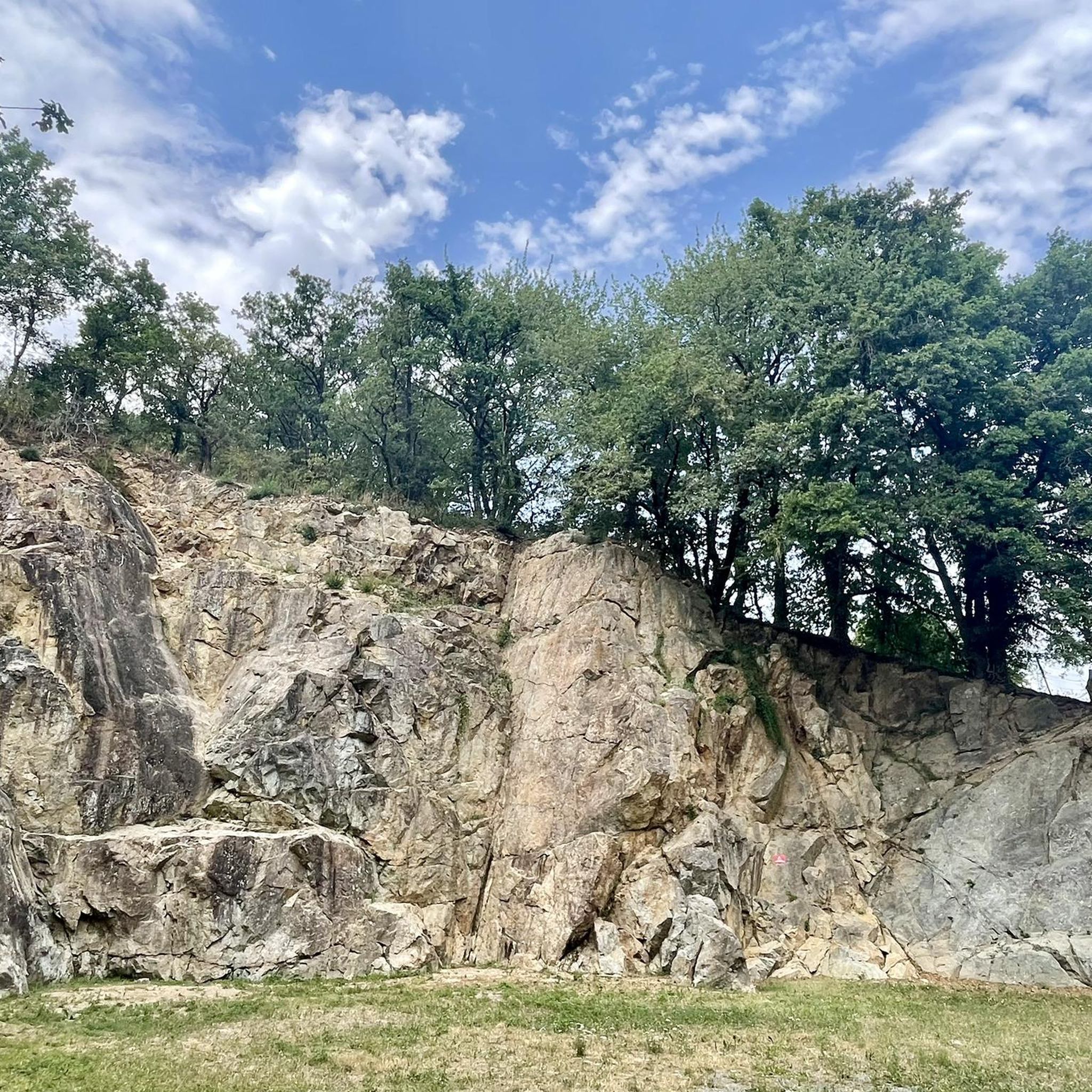
Former mill, once operated by several generations of potters, with a now private footbridge that served as a link between La Séguinière and La Romagne, and now a natural area on the banks of the Moine popular for several sporting activities. First of all, hiking, it is in particular the favorite place for the "Randonnée du Bouchot" organized each year for the Séguinière blood sausage festival (!!!). It is also a popular place for climbing with the presence of a cliff offering a small site of about fifteen routes with a height ranging from 10 to 20 m and a level of difficulty of 4 to 6b. For cyclists, the place gives the opportunity of a beautiful hill going up from the river towards the Séguinière. The passage of the ford can sometimes be blocked in the event of flooding of the river, but that passes largely in the beautiful days.
0
0
From 1820, during the Restoration, everywhere, we saw monuments erected in memory of the Vendée leaders. The Marquis de la Bretesche, General Councilor of Maine-et-Loire, wanted to perpetuate the memory of the so-called Battle of Torfou of September 19, 1793, one of the Vendée victories in which the multiple assaults of the Republican troops, reinforced by the troops of Kléber, came to an end. from Mainz. In 1826 he erected at his own expense this granite column 8m65 high and 1m33 in diameter, "duration being the most important thing in these constructions" in his own words. In 1975, the Association du Souvenir Vendéen had two new plaques sealed, one of which bears the names of the Vendée generals who took part in the battle of "Elbée, Bonchamps, Charrette, Lescure, Royrand".
0
0
Frequently Asked Questions
What kind of terrain can I expect on running routes around La Romagne?
The running routes around La Romagne primarily feature a rural landscape with gentle hills and open countryside. You'll find a network of paths suitable for various distances, with elevation gains typically staying under 150 meters, offering a comfortable challenge for most runners.
Are there any longer running routes for experienced runners in La Romagne?
Yes, for those seeking a longer challenge, routes like the Torfou Column loop from La Romagne offer a difficult 20.5 km (12.7 miles) path through the local landscape. Another option is the Étang du Pavillon loop from La Romagne, which is 16.7 km (10.4 miles) and also rated difficult.
What do other runners say about the trails in La Romagne?
The running routes in La Romagne are highly regarded by the komoot community, holding an average rating of 4.3 stars from over 130 reviews. Runners often praise the varied countryside paths and the pleasant, gentle hills that define the area's running experience.
Are there any circular running routes available in La Romagne?
Many of the running routes in La Romagne are designed as loops, offering convenient circular options. For example, the popular Moulin du Bouchot loop from La Romagne is a 12.6 km (7.8 miles) moderate trail, and the Running loop from La Romagne covers 11.7 km (7.3 miles) through varied countryside.
What points of interest can I see while running in La Romagne?
Several routes pass by local landmarks and water features. You might encounter historical sites like the Valley of the Three Provinces or the impressive Tiffauges Castle. The Moulin du Bouchot loop, for instance, takes you past the historic Moulin du Bouchot.
How many running routes are there in total around La Romagne?
There are 13 distinct running routes available around La Romagne, offering a good variety of distances and difficulties to suit different preferences and fitness levels.
Are there any moderate difficulty running trails for intermediate runners?
Yes, the majority of routes in La Romagne are rated as moderate. A good option is the Running loop from La Romagne, which is a 9.97 km (6.2 miles) trail with moderate elevation changes, perfect for an intermediate run.
What are the typical elevation gains on running routes in La Romagne?
The elevation gains on running routes in La Romagne are generally quite manageable, typically staying under 150 meters. This makes the area suitable for runners who prefer less strenuous climbs while still enjoying varied terrain.
Can I find routes that pass by water features in La Romagne?
Yes, some running routes in La Romagne incorporate water features into their paths. The region's rural landscape often includes streams, rivers, or small ponds, providing scenic elements during your run.
What is the overall character of the running environment in La Romagne?
The running environment in La Romagne is characterized by peaceful countryside paths, gentle rolling hills, and occasional glimpses of local landmarks or water features. It offers a blend of moderate and more challenging experiences, ideal for those looking to explore rural France on foot.
Are there any specific historical monuments along the running trails?
Yes, for example, the Torfou Column loop from La Romagne passes by a significant historical monument, the Torfou Column, offering a cultural element to your run.
Most popular routes around La Romagne
Most popular attractions around La Romagne

Get inspired with the komoot mobile app


Explore more
Browse the best Running Trails & Routes in other regions.
