The best walks and hikes around Saint-Hilaire
4.7
(137)
720
hikers
104
hikes
Hiking around Saint-Hilaire offers a diverse landscape characterized by rolling countryside, historical landmarks, and rural paths. The region features gentle elevation changes, with routes often passing through agricultural areas and small hamlets. Hikers can expect a mix of open fields and wooded sections, providing varied scenery throughout the trails.
Best hiking trails around Saint-Hilaire
- The most popular hiking route is Church of Chalo-Saint-Mars loop from Chalo-Saint-Mars, a 6.7 miles (10.8 km) trail that takes about 3 hours to complete,…
Last updated: August 26, 2026
4.3
(3)
12
hikers
10.8km
03:01
220m
220m
Moderate hike. Good fitness required. Easily-accessible paths. Suitable for all skill levels.
3.5
(4)
19
hikers
Moderate hike. Good fitness required. Easily-accessible paths. Suitable for all skill levels.

Sign up for free
5.0
(1)
6
hikers
7.30km
02:00
110m
110m
Easy hike. Great for any fitness level. Easily-accessible paths. Suitable for all skill levels.
5.0
(1)
5
hikers
6.92km
01:54
110m
110m
Easy hike. Great for any fitness level. Easily-accessible paths. Suitable for all skill levels.
5.0
(1)
2
hikers
5.41km
01:27
60m
60m
Easy hike. Great for any fitness level. Easily-accessible paths. Suitable for all skill levels.
Get access to more routes and recommendations from other explorers.
Sign up for free
Already have an account?
Our route recommendations are based on thousands of hikes, rides, and runs completed by other people on komoot.
Start today with a free account
Your next adventure awaits.
Login or Signup


Tips from the Community

also called the leaning tower
0
0

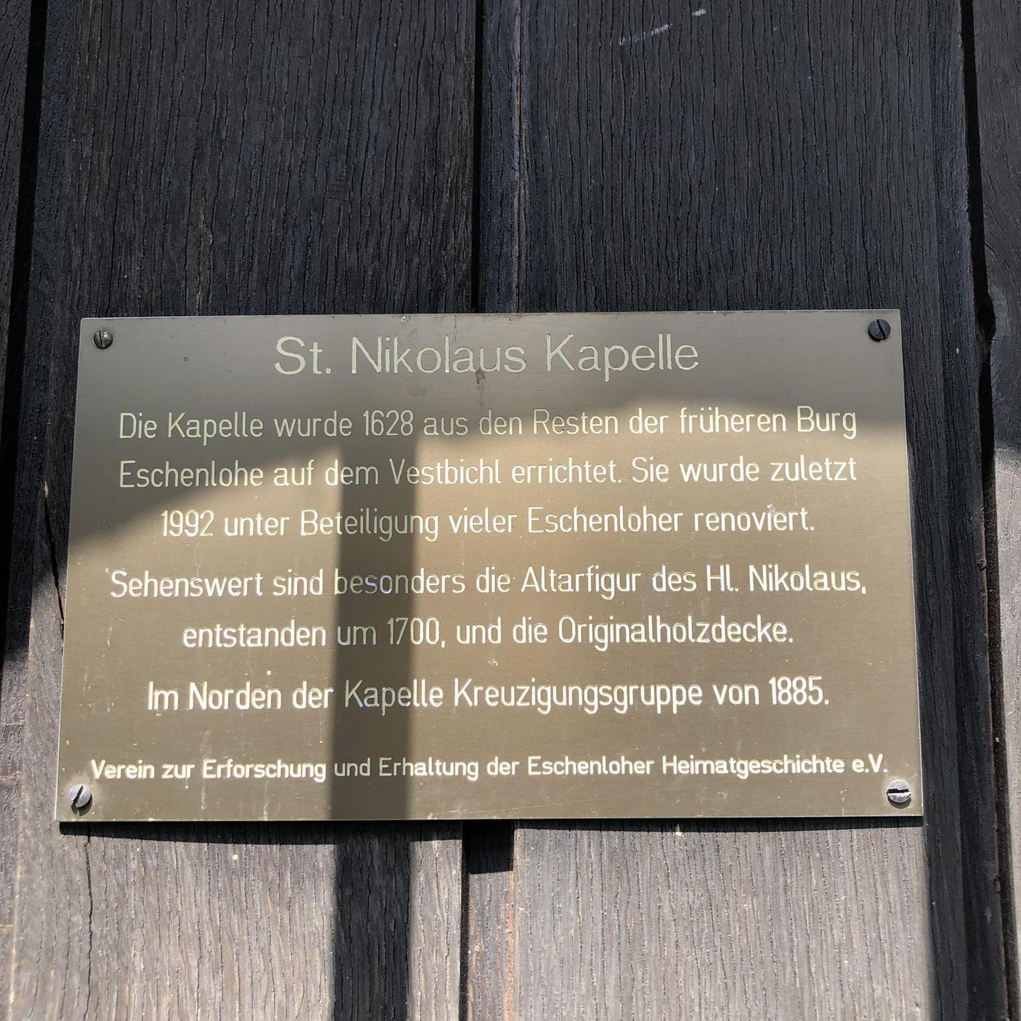
Building dating back to the 12th century, famous for its "leaning tower", its 14th century bell tower.
0
0
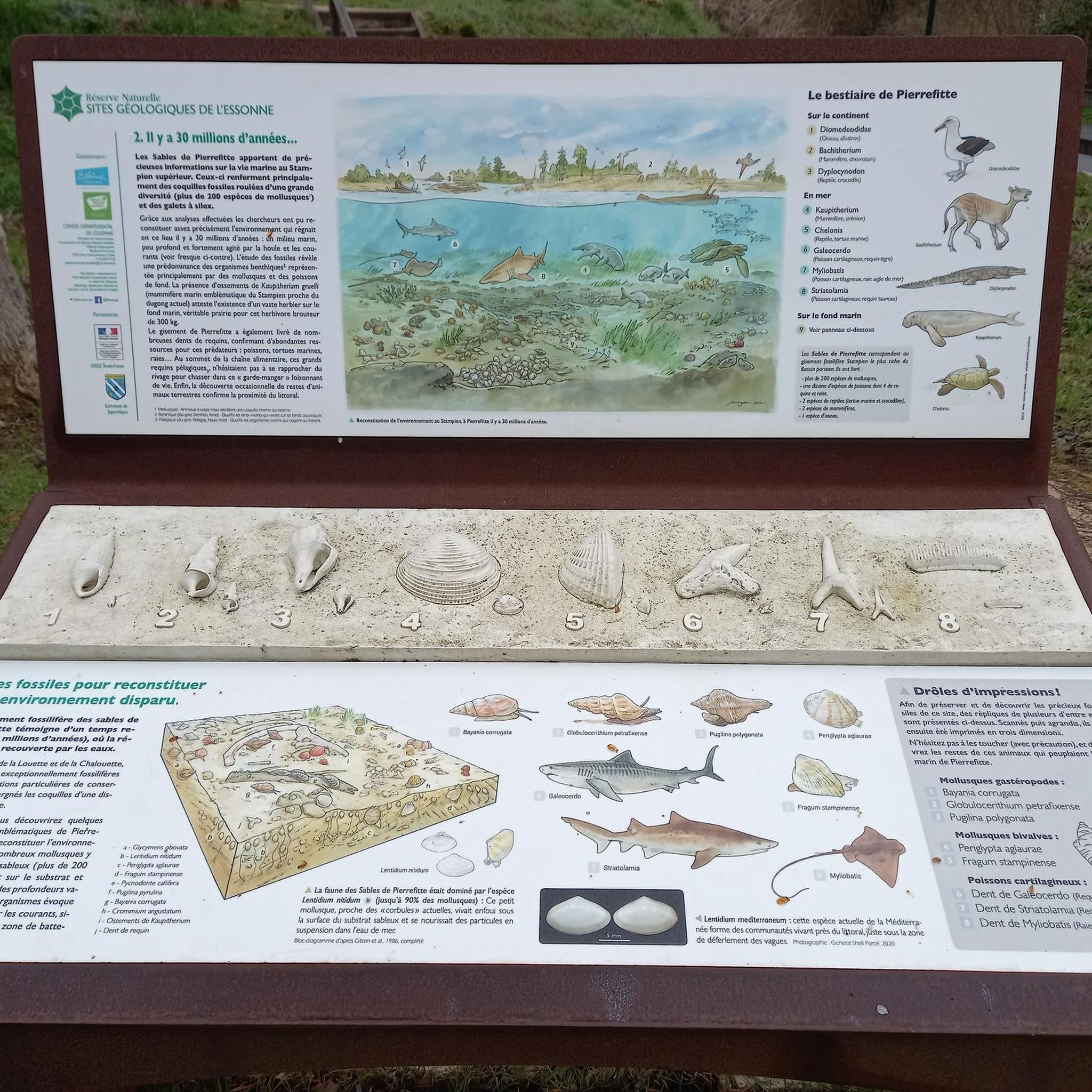
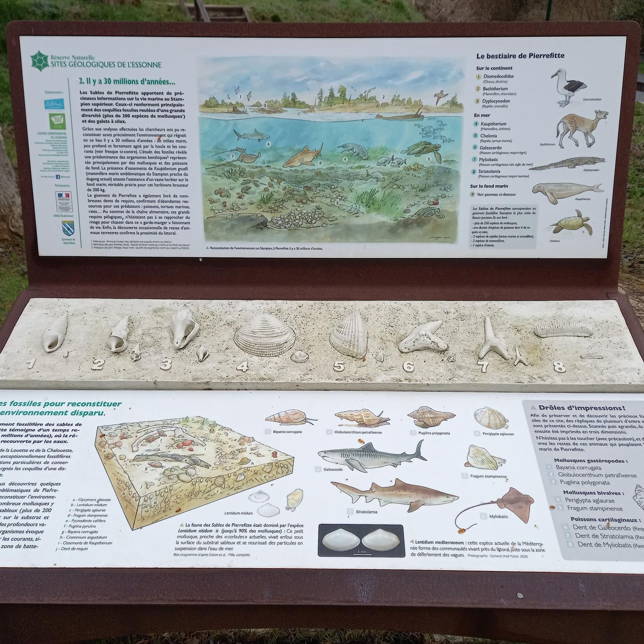
Small village located at the junction of the Louette and Chalouette valleys
1
0
Building from the beginning of the 17th century having belonged to the family of the poet Alfred de Vigny.
1
0
Located on private property.
0
0

Not the prettiest, but starting to compete with Pisa.
0
0
Frequently Asked Questions
How many hiking trails are available around Saint-Hilaire?
There are nearly 100 hiking trails around Saint-Hilaire, offering a diverse range of experiences. The komoot community has recorded 99 routes in total, catering to various preferences and fitness levels.
Are there easy hiking routes suitable for beginners in Saint-Hilaire?
Yes, Saint-Hilaire offers a good selection of easy routes perfect for beginners or those seeking a relaxed walk. You'll find 36 easy trails, such as the Church of Chalo-Saint-Mars – Tronchet Manor loop from Chalo-Saint-Mars, which is 7.3 km long and takes about 2 hours to complete.
What kind of terrain can I expect on hikes in Saint-Hilaire?
Hikes in Saint-Hilaire typically feature rolling countryside, agricultural areas, and wooded sections. The elevation changes are generally gentle, making for pleasant walks through varied rural scenery and past historical landmarks.
Are there any challenging hikes for experienced trekkers?
While the region is known for its gentle terrain, there are 6 more challenging routes for those looking for a greater workout. These routes often cover longer distances or feature slightly more varied elevation, though still within the region's characteristic rolling hills.
Are there circular hiking routes available in Saint-Hilaire?
Yes, many of the trails around Saint-Hilaire are circular, allowing you to start and end at the same point. A popular option is the Menhir de Pierrefitte loop from Saint-Hilaire, an 8.1 km moderate route that takes you past the ancient Menhir de Pierrefitte.
What are some notable landmarks or attractions to see while hiking?
The region is rich in historical sites. Along your hikes, you might encounter ancient structures like the Menhir de Pierrefitte. Nearby attractions include the impressive Château de Dourdan and the historic Saint-Germain-d'Auxerre Church of Dourdan.
Is Saint-Hilaire a good destination for family-friendly hikes?
Absolutely. The gentle elevation changes and well-maintained paths make many routes around Saint-Hilaire suitable for families with children. Look for the 'easy' rated trails for the most family-friendly options.
What is the best time of year to go hiking in Saint-Hilaire?
The best time to hike in Saint-Hilaire is generally from spring to autumn, when the weather is mild and the countryside is in full bloom or displaying vibrant fall colors. Summer offers longer daylight hours, while spring and autumn provide comfortable temperatures for longer excursions.
Are dogs allowed on the hiking trails in Saint-Hilaire?
Most trails in rural France, including those around Saint-Hilaire, are generally dog-friendly, especially if your dog is well-behaved and kept on a leash. However, always be mindful of agricultural areas and local regulations, particularly near livestock.
Are there any hikes that pass by cafes or places for refreshments?
Many routes in Saint-Hilaire pass through or near small hamlets and villages where you might find local cafes or bakeries. Planning your route to include a stop in a village like Chalo-Saint-Mars can offer a pleasant break and a chance to experience local hospitality.
What do other hikers enjoy most about the trails in Saint-Hilaire?
The komoot community highly rates the trails in Saint-Hilaire, with an average score of 4.7 stars from over 100 reviews. Hikers often praise the tranquil rural paths, the blend of open fields and wooded sections, and the historical sites like the Menhir de Pierrefitte.
Is public transport available to reach hiking trailheads in Saint-Hilaire?
Public transport options to specific trailheads can vary. While some villages might be accessible by local bus services, for maximum flexibility, especially for starting points outside of main towns, traveling by car is often recommended. Always check local transport schedules in advance.
Where can I find parking for hiking trails in Saint-Hilaire?
Parking is typically available in the villages and towns that serve as starting points for many routes, such as Saint-Hilaire or Chalo-Saint-Mars. Look for designated public parking areas, often near churches or village centers. Always park responsibly and respect local residents.
Most popular routes around Saint-Hilaire
Most popular attractions around Saint-Hilaire

Get inspired with the komoot mobile app


Explore more
Browse the best Hikes in other regions.
