The best walks and hikes around Varennes-Sur-Usson
4.6
(168)
1,214
hikers
110
hikes
Hiking around Varennes-Sur-Usson offers diverse natural landscapes shaped by a volcanic past in the Auvergne-Rhône-Alpes region of France. The area features varied terrain, including rounded peaks, expansive plains, and cool forests. Hikers can explore sites within the Auvergne Volcanoes Regional Nature Park, such as the Chaîne des Puys, which showcases unique geological formations. Trails often follow rivers, providing refreshing environments and views of the surrounding natural heritage.
Best hiking trails around Varennes-Sur-Usson
- The most popular hiking route is The Usson…
Last updated: June 29, 2026
4.8
(15)
84
hikers
Moderate hike. Good fitness required. Easily-accessible paths. Suitable for all skill levels.
4.6
(11)
22
hikers
10.5km
02:46
90m
90m
Moderate hike. Good fitness required. Easily-accessible paths. Suitable for all skill levels.

Sign up for free
4.5
(2)
15
hikers
16.1km
04:29
300m
300m
Moderate hike. Good fitness required. Easily-accessible paths. Suitable for all skill levels.
5.0
(1)
9
hikers
9.74km
02:52
280m
280m
Moderate hike. Good fitness required. Easily-accessible paths. Suitable for all skill levels.
4.0
(3)
6
hikers
8.18km
02:21
200m
200m
Moderate hike. Good fitness required. Easily-accessible paths. Suitable for all skill levels.
Get access to more routes and recommendations from other explorers.
Sign up for free
Already have an account?
Our route recommendations are based on thousands of hikes, rides, and runs completed by other people on komoot.
Start today with a free account
Your next adventure awaits.
Login or Signup


Tips from the Community

Former ramparts converted into a green space overlooking the surrounding area
0
0

You can stop at the village bakery
0
0

Wear sturdy footwear and bring plenty of water and food. There are no restaurants or cafes nearby.
0
0
Come and see the little Versailles Auvergne with its magnificent library and its park
1
0

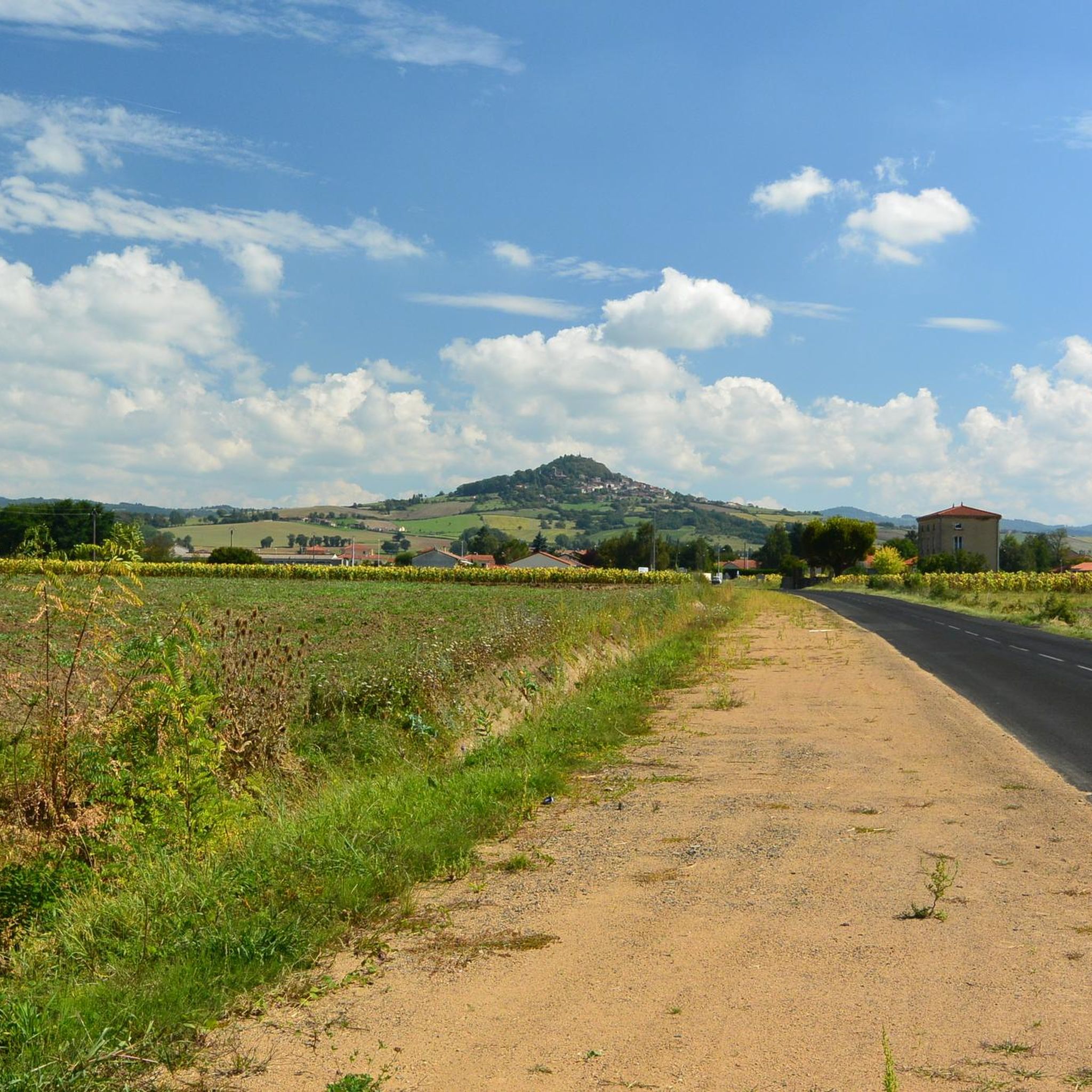
Usson is a beautiful village perched on a volcanic peak facing the Chaîne des Puys, the Monts Dore, and the Cézallier Plateau. It was once the site of a castle where Queen Margot was exiled for 19 years. If you're looking for a sightseeing and historical stop, Usson offers breathtaking views of the surrounding landscape, and you can visit the Saint-Maurice church, the remains of the ramparts, and the statue of the Virgin Mary overlooking the village.
2
0

Perched on a volcanic peak, the place of exile of Queen Margot for 19 years, the village of Usson is one of the Most Beautiful Villages in France.
0
0
You may have a photo book in English for during the tour.
0
0

The climb to the Pic d'Usson is 2.2 km long with a total drop of about 170 m. The average gradient is 7-8% with steeper sections of 12%.
1
0
Frequently Asked Questions
How many hiking trails are available around Varennes-sur-Usson?
Varennes-sur-Usson offers a wide variety of hiking opportunities, with over 110 trails recorded on komoot. These routes cater to all levels, from leisurely strolls to more challenging treks, allowing you to explore the diverse landscapes of the Auvergne-Rhône-Alpes region.
What kind of landscapes can I expect to see while hiking near Varennes-sur-Usson?
The region around Varennes-sur-Usson is characterized by its unique volcanic past, offering a dramatic and varied landscape. You'll encounter rounded volcanic peaks, expansive green plains, and cool, dense forests. Many trails provide views of the Chaîne des Puys and wind along rivers, showcasing the rich geological heritage of the Auvergne.
Are there easy hiking trails suitable for beginners or families in Varennes-sur-Usson?
Yes, Varennes-sur-Usson has plenty of options for easier hikes, with 35 routes classified as easy. These trails are often suitable for families and those looking for a more relaxed outdoor experience. While specific family-friendly routes aren't detailed here, many of the easy trails offer accessible terrain.
Are there any circular hiking routes around Varennes-sur-Usson?
Yes, many of the trails in the area are circular, allowing you to start and end at the same point. For example, the The Usson peak - loop starting from Saint-Remy-de-Chargnat - Livradois-Forez Regional Natural Park is a popular moderate loop, and the Château de Parentignat loop from Parentignat also offers a scenic circular walk.
What interesting landmarks or attractions can I see along the hiking trails?
Several trails pass by notable points of interest. You might encounter historic sites like the Château de Parentignat or the Saint-Maurice Church. The charming Village of Usson is also a highlight in the area, offering a glimpse into local heritage.
Are there trails with panoramic views in the Varennes-sur-Usson area?
Absolutely. The region's volcanic formations and elevated points naturally lend themselves to stunning vistas. Many trails offer breathtaking panoramic views of the surrounding plains, forests, and the distinctive rounded peaks of the Auvergne, including glimpses of the Chaîne des Puys.
What do other hikers enjoy most about the trails in Varennes-sur-Usson?
The hiking trails around Varennes-sur-Usson are highly regarded by the komoot community, with an average rating of 4.7 stars from over 150 reviews. Hikers often praise the diverse terrain, the peaceful ambiance of the forests, and the unique geological features shaped by the region's volcanic history.
Are dogs allowed on the hiking trails around Varennes-sur-Usson?
Generally, dogs are welcome on most hiking trails in the Varennes-sur-Usson area, especially if kept on a leash. However, it's always advisable to check specific regulations for any protected natural areas or regional parks you plan to visit, as rules can vary.
Is there parking available at the trailheads?
While specific parking details for every trailhead are not listed, many popular hiking routes in the region, especially those starting from villages like Parentignat or Saint-Remy-de-Chargnat, typically have designated parking areas nearby. It's recommended to check the route details on komoot for specific starting points.
What is the best time of year to go hiking in Varennes-sur-Usson?
The Auvergne-Rhône-Alpes region is beautiful throughout much of the year. Spring and autumn offer pleasant temperatures and vibrant natural colors, making them ideal for hiking. Summer is also popular, though some trails might be warmer. Winter hiking is possible, but conditions can be more challenging, especially at higher elevations.
Are there any challenging routes for experienced hikers in Varennes-sur-Usson?
Yes, for those seeking a more strenuous adventure, there are 9 routes classified as difficult in the Varennes-sur-Usson area. These trails often feature greater elevation changes and longer distances, providing a good challenge for experienced hikers. An example of a longer moderate route is the Northern ramparts – Château de Parentignat loop from Parentignat, which covers over 16 km.
Can I access hiking trails using public transport in Varennes-sur-Usson?
While Varennes-sur-Usson is a rural area, some larger towns nearby may offer public transport connections. However, direct public transport access to specific trailheads can be limited. It's often more convenient to reach many starting points by car. For detailed information, it's best to check local transport schedules for the specific village closest to your chosen trail.
Most popular routes around Varennes-Sur-Usson
Most popular attractions around Varennes-Sur-Usson

Get inspired with the komoot mobile app


Explore more
Browse the best Hikes in other regions.
