The best running trails around Saint-Apollinaire
4.4
(126)
5,999
runners
194
runs
Jogging around Saint-Apollinaire offers diverse terrain within the Hautes-Alpes department of France. The region features a preserved glacial lake, Lake Saint-Apollinaire, situated at 1452 meters, providing flat paths and gentle inclines. Mountain and forest trails wind through larch and fir forests and mountain pastures, offering varied surfaces. The village itself is perched on a rocky peak, providing panoramic views of Lake Serre-Ponçon and the Durance Valley.
Best jogging routes around Saint-Apollinaire
- The most popular jogging route is Lac de Saint-Apollinaire…
Last updated: July 13, 2026
4.8
(4)
64
runners
Hard run. Good fitness required. Sure-footedness, sturdy shoes and alpine experience required.
4.8
(5)
65
runners
Hard run. Good fitness required. Sure-footedness, sturdy shoes and alpine experience required.

Sign up for free
66
runners
68.6km
09:55
3,110m
3,110m
Hard run. Very good fitness required. Sure-footedness, sturdy shoes and alpine experience required.
58
runners
8.92km
01:47
690m
690m
Hard run. Very good fitness required. Sure-footedness, sturdy shoes and alpine experience required.
36
runners
Hard run. Very good fitness required. Mostly accessible paths. Some sure footedness required.
Get access to more routes and recommendations from other explorers.
Sign up for free
Already have an account?
Our route recommendations are based on thousands of hikes, rides, and runs completed by other people on komoot.
Start today with a free account
Your next adventure awaits.
Login or Signup

Tips from the Community


Perfect for a lunch break with a breathtaking view. Car access possible.
0
0


Beautiful and useful fountain with fresh water
1
1

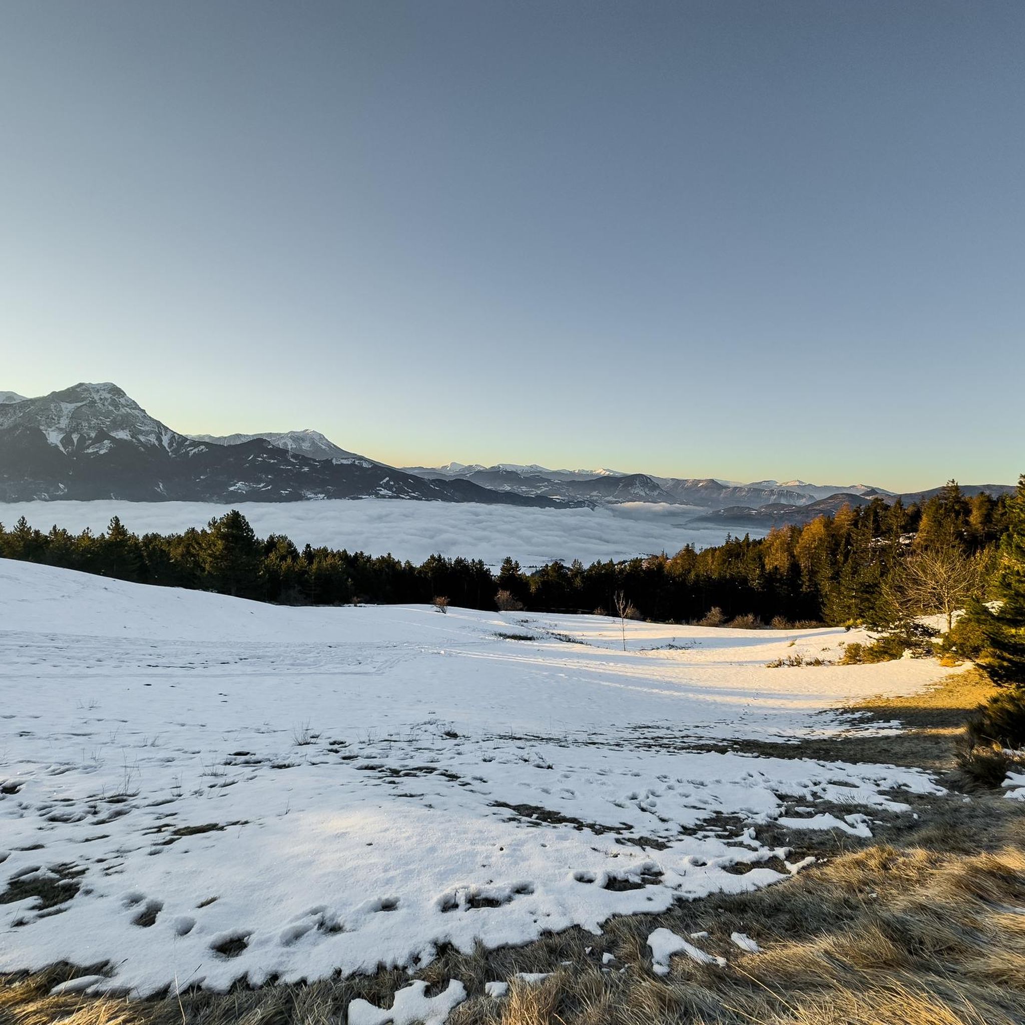
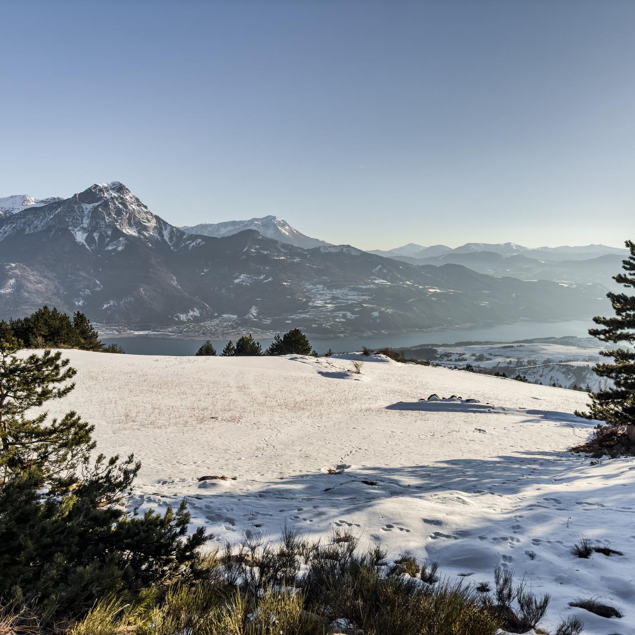
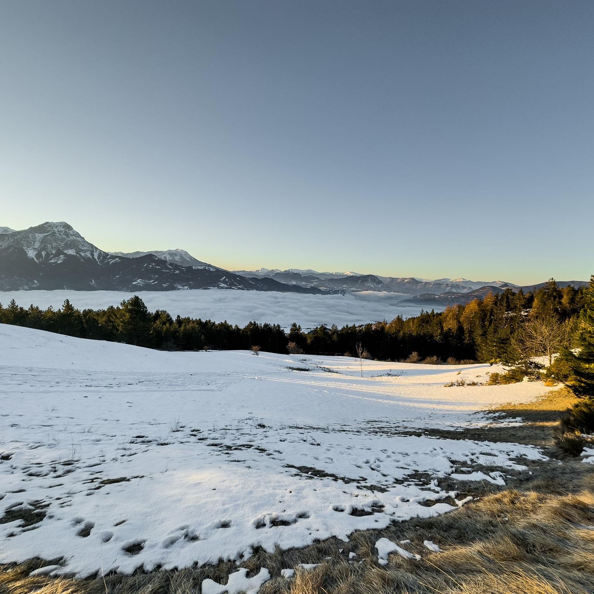
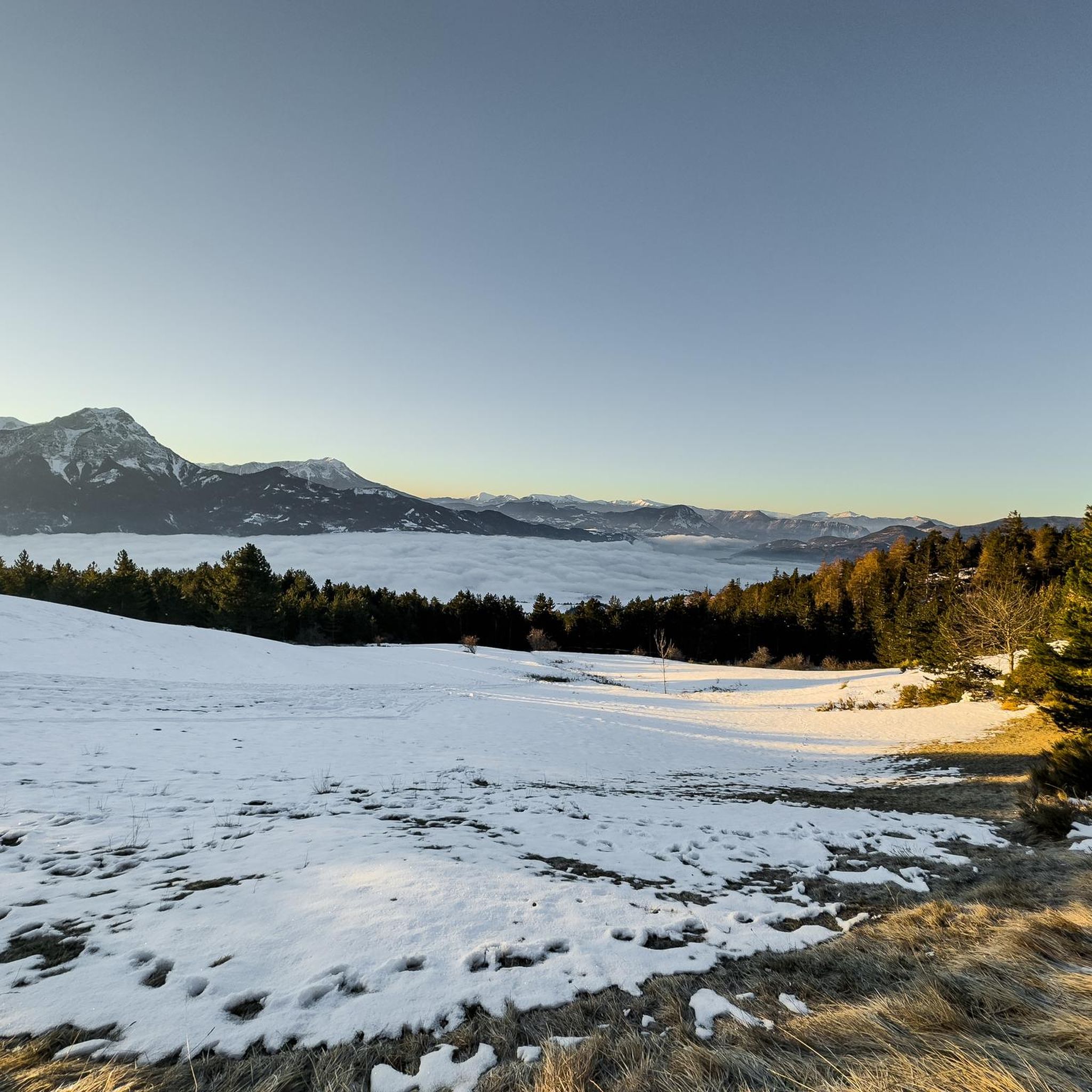
Magnificent view of Lake Serre-Ponçon and its mountains from a superb path in the shade of the Aiguilles de Chabrières.
0
0

This superb path below the Aiguilles de Chabrières offers magnificent views of Lake Serre-Ponçon. It is easily accessible from Saint-Apollinaire.
0
0
Frequently Asked Questions
How many running routes are available around Saint-Apollinaire?
Saint-Apollinaire offers a wide variety of running experiences, with over 150 routes documented on komoot. These range from gentle lakeside paths to more challenging mountain trails, ensuring options for every runner.
What kind of scenery can I expect on the jogging trails in Saint-Apollinaire?
The region boasts stunning natural beauty. You can expect crystal-clear glacial lakes like Lac de Saint-Apollinaire, serene larch and fir forests, and expansive mountain pastures. Many routes also provide breathtaking panoramic views of Lake Serre-Ponçon and the surrounding peaks, including the dramatic Chabrières Needles.
Are there any easy or beginner-friendly running paths in Saint-Apollinaire?
Yes, while many routes are challenging, there are 8 easy routes perfect for beginners or those seeking a relaxed run. The paths around Lake Saint-Apollinaire, for instance, offer flat sections and gentle inclines amidst beautiful scenery.
Can I find circular running routes in the area?
Absolutely! Many of the running routes around Saint-Apollinaire are circular, allowing you to start and finish at the same point. A popular option is the Lac de Saint-Apollinaire – View of Lake Serre-Ponçon loop from Saint-Apollinaire, which is 5.3 miles (8.5 km) long and offers fantastic views.
What do other runners enjoy most about the trails in Saint-Apollinaire?
The running routes in Saint-Apollinaire are highly rated by the komoot community, with an average score of 4.4 stars from over 100 reviews. Runners frequently praise the diverse terrain, the stunning views of Lake Serre-Ponçon, and the peaceful atmosphere around the glacial lake.
Are there any family-friendly jogging options around Saint-Apollinaire?
Yes, the area around Lake Saint-Apollinaire offers paths with gentle inclines and flat sections, which are suitable for families. These routes provide a safe and scenic environment for a family jog, often with picnic areas nearby to relax after your run.
Are dogs allowed on the running routes in Saint-Apollinaire?
Saint-Apollinaire is generally dog-friendly, with many trails suitable for running with your canine companion. However, it's always recommended to keep dogs on a leash, especially in areas with livestock or within the proximity of the Écrins National Park, to protect wildlife and ensure everyone's safety.
What are some notable landmarks or points of interest I might see while running?
Beyond the stunning natural landscapes, you might encounter several points of interest. The village itself, perched on a rocky peak, offers panoramic views. You can also spot the Morgon peak and the dramatic Chabrières Needles. The Lac de Saint-Apollinaire is a highlight in itself, and you might even catch glimpses of the Savines Bridge on Lake Serre-Ponçon on longer routes.
Are there any longer running routes for endurance training?
For those looking for a significant challenge, Saint-Apollinaire offers extensive routes. For example, the Lac Saint-Apollinaire – Lake Serre-Ponçon loop from Les Chênes is a substantial 43.2 miles (69.5 km) trail that leads through diverse mountain landscapes and along Lake Serre-Ponçon, typically taking over 10 hours to complete.
What is the best time of year to go running in Saint-Apollinaire?
The region is beautiful year-round, but the best time for running is generally from spring through autumn. During these seasons, the weather is pleasant, and the trails are most accessible. Summer offers abundant sunshine, while autumn brings stunning colors to the larch forests. Winter running is possible but may require specialized gear due to snow and ice, especially at higher altitudes.
Is parking available near the running trailheads?
Yes, many popular trailheads, especially those around Lake Saint-Apollinaire and near villages like Saint-Apollinaire itself or Station de Ski de Réallon, offer designated parking areas. It's advisable to check specific route details for parking information before you go.
What are the typical elevation changes on running routes in this region?
The elevation changes vary significantly depending on the route's difficulty. While lakeside paths might have minimal elevation gain, mountain trails can be quite demanding. For instance, the Lac de Saint-Apollinaire – View of Lake Serre-Ponçon loop from Station de Ski de Réallon, a difficult 5.6-mile route, involves over 280 meters of ascent and descent.
Most popular routes around Saint-Apollinaire
Most popular attractions around Saint-Apollinaire

Get inspired with the komoot mobile app


Explore more
Browse the best Running Trails & Routes in other regions.
