The best walks and hikes around Baldy Peak
4.6
(21)
150
hikers
11
hikes
Hiking around Baldy Peak, also known as Mount San Antonio, offers diverse landscapes within the San Gabriel Mountains. The region features elevations reaching over 10,000 feet (3,000 meters), transitioning from chaparral and oak woodlands at lower levels to yellow pine forests and an unforested alpine zone. Hikers encounter varied terrain, including narrow ridges and direct ascents, providing a range of experiences.
Best hiking trails in Baldy Peak
- The most popular hiking route is Mount Baldy Trail loop — Mount Baldy…
Last updated: October 10, 2026
3.94km
01:09
180m
0m
The South Fork Trail #97 offers a fascinating journey through contrasting landscapes, starting with a lush, shaded path alongside the South Fork of the Little Colorado River. You'll quickly transition…
669m
00:14
70m
0m
The Amberian Loop offers a quick and easy hiking experience, perfect for a short outing in the Apache-Sitgreaves National Forest. As you follow the route, you will gain 223 feet…

1.39km
00:23
40m
10m
Step onto the Fir Loop for an easy hike through a vibrant evergreen forest. As you follow the path, you will encounter towering Douglas firs and wander through old-growth sections,…
759m
00:14
60m
0m
West Fork Trail #94 offers an easy hiking experience through a varied landscape of forest and meadows. You will cover 0.5 miles (0.8 km) and gain 183 feet (56 metres)…
5.0
(1)
9
hikers
25.6km
07:34
750m
750m
Embark on the Mount Baldy Trail loop, a difficult 15.9-mile (25.6 km) hike that promises a rewarding experience for seasoned adventurers. You will ascend 2445 feet (745 metres) over an…
11
hikers
8.24km
02:25
240m
240m
Embark on the East Baldy Trail #95, a moderate hiking route that guides you through varied terrain and scenic landscapes. As you hike, you will discover lush forests filled with…
8
hikers
25.9km
07:38
720m
720m
Embark on the West Baldy Trail, a difficult hiking route that spans 16.1 miles (25.9 km) and climbs 2371 feet (723 metres) over an estimated 7 hours and 37 minutes.…
4.0
(1)
5
hikers
17.1km
05:04
500m
500m
East Baldy Trail #95 offers a challenging hike through varied landscapes, starting in pleasant grassy meadows before climbing into dense spruce-fir forests and areas with quaking aspen. This difficult route…
1
hikers
8.18km
02:27
260m
260m
Embark on the Robinson Hollow Trail loop for a refreshing journey through the diverse landscapes of Apache-Sitgreaves National Forest. This moderate 5.1-mile (8.2 km) hike takes you through impressive ponderosa…
6.45km
01:59
230m
230m
The Flat Top Summit Trail offers a pleasant and accessible hike to a high point, making it a great option for a quick escape into nature. This easy 4.0-mile (6.4…
Our route recommendations are based on thousands of hikes, rides, and runs completed by other people on komoot.
Tips from the Community

You'll get a great view of the White Mountain Apache Reservation, Big Lake, Crescent Lake, a chunk of the Black River Valley, Escudilla Mountain, the Blue Range, and on into the Gila National Forest in New Mexico for achieving this milestone.
0
0
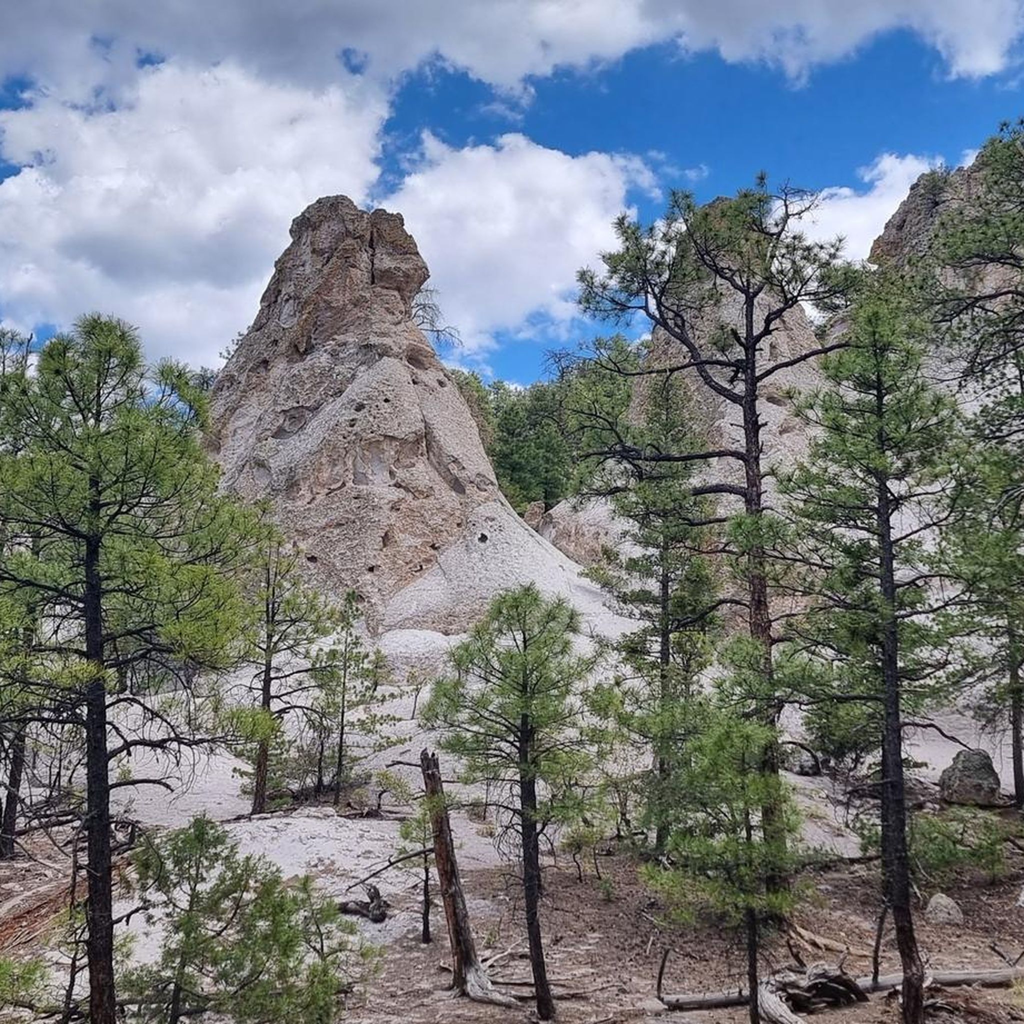
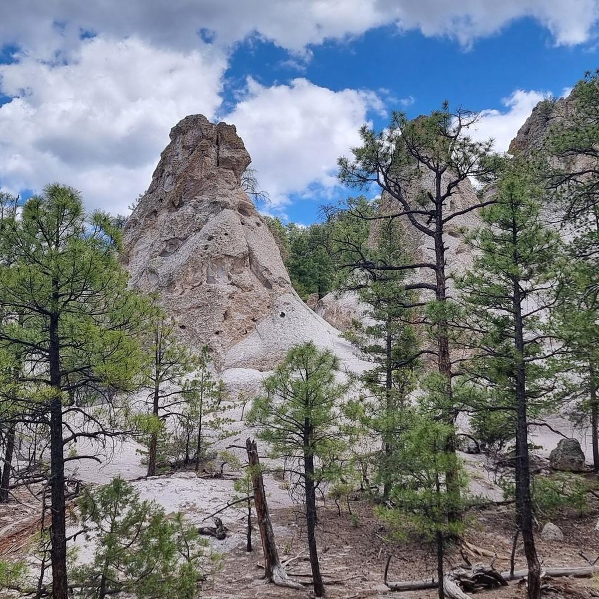
As you enjoy your trek, you will encounter granite formations that are fascinating, and offer broad views toward Big Lake and the Blue Range. These formations happen when viscous (thick/sticky) magma slowly cools and crystallizes, way before it is able to reach the Earth’s surface. Then, with erosion, you are left with these curious features.
0
0
Frequently Asked Questions
What kind of hiking trails can I expect around Baldy Peak?
Baldy Peak, also known as Mount San Antonio, offers a diverse range of hiking experiences. You'll find everything from strenuous ascents to more moderate paths, with terrain transitioning from chaparral and oak woodlands at lower elevations to yellow pine forests and an unforested alpine zone at higher altitudes. The trails feature varied landscapes, including narrow, rugged ridges and direct climbs.
Are there any easy hiking options for beginners or families in the Baldy Peak area?
Yes, there are several easier trails suitable for beginners or families. For instance, the Escudilla Trail to Toolbox Draw Meadow — Escudilla Wilderness is an easy 2.4-mile path. Overall, the region offers 5 easy routes among its 16 total hiking trails.
What are some notable natural features or landmarks to look out for while hiking around Baldy Peak?
Hikers can enjoy several natural features. The prominent San Antonio Falls, an 80-foot cascade, is a beautiful stop early on the trail from Manker Flats. From the summit, you'll be rewarded with expansive, unobstructed panoramic views of the San Gabriel Mountains, the Angeles National Forest, and the Los Angeles metropolitan area. The East Baldy Trail to Granite Formations — Mount Baldy Wilderness specifically leads towards distinct granite formations.
Can I find any loop trails for hiking in Baldy Peak?
Yes, loop trails are available for those who prefer not to retrace their steps. A notable option is the Mount Baldy Trail loop — Mount Baldy Wilderness, a challenging 15.9-mile route offering extensive views across the wilderness area.
What is the best time of year to hike Baldy Peak?
Baldy Peak is popular for hiking during summer and fall. However, it offers year-round appeal. In winter, it transforms into a wonderland for skiing and snowboarding, but hiking during colder months requires special snow gear and mountaineering skills due to snow and ice conditions.
Are there any amenities or places to eat near the hiking trails?
Yes, Mount Baldy Notch, a significant hub between Mount Baldy and Mount Harwood, hosts a ski resort and offers dining options at the Top of the Notch Restaurant. This can be a convenient stop for hikers.
How difficult are the trails in Baldy Peak generally?
The trails around Baldy Peak range from moderate to difficult. The region is known for challenging ascents and varied terrain. Out of 16 total routes, there are 5 easy, 8 moderate, and 3 difficult trails, ensuring options for different ability levels.
What do other hikers say about the trails in Baldy Peak?
The hiking routes in Baldy Peak are highly rated by the komoot community, with an average score of 4.5 stars from over 10 reviews. Hikers often praise the challenging ascents, diverse forest ecosystems, and the panoramic vistas from its high points.
Is there public transport or parking available for accessing the trails?
While specific public transport details are not provided, parking is generally available at trailheads like Manker Flats. For some routes, a ski lift can take hikers to Baldy Notch, shortening the overall hike and providing an alternative access point.
Are there any trails that offer a unique or thrilling experience?
The Devil's Backbone Trail, accessible from Baldy Notch, is famous for traversing a narrow, rugged ridge. It provides exhilarating views and can be a thrilling experience for those comfortable with heights, especially when clear of snow.
What kind of wildlife might I encounter on the trails?
The diverse ecosystems of Baldy Peak support various wildlife. At lower elevations, you might see animals adapted to chaparral and oak woodlands, while higher up in the yellow pine forests and alpine zones, you could encounter deer, black bears, and squirrels.
Are there any long-distance hiking options in the area?
Yes, for those seeking longer adventures, Baldy Peak offers several extensive routes. For example, the West Baldy Trail — Mount Baldy Wilderness is a challenging 16.1-mile trail that typically takes around 7 hours and 37 minutes to complete.
Most popular routes around Baldy Peak

Get inspired with the komoot mobile app


Explore more
Browse the best Hikes in other regions.
