The best running trails around Saint-Côme-Et-Maruéjols
4.2
(291)
5,954
runners
451
runs
Jogging around Saint-Côme-Et-Maruéjols offers a variety of routes through a landscape characterized by rolling hills and open plains, typical of the Vaunage region. The terrain includes gentle ascents and descents, providing varied challenges for runners. Paths often traverse agricultural areas and offer views of the surrounding countryside. This region provides a mix of moderate and difficult running trails suitable for different fitness levels.
Best jogging routes around Saint-Côme-Et-Maruéjols
- The most popular jogging route is View of the Vaunage loop from…
Last updated: July 8, 2026
128
runners
27.5km
03:25
530m
530m
Hard run. Very good fitness required. Mostly paved surfaces. Suitable for all skill levels.
17
runners
9.00km
01:05
260m
260m
Moderate run. Good fitness required. Mostly paved surfaces. Suitable for all skill levels.

Sign up for free
5.0
(2)
12
runners
7.53km
00:54
150m
150m
Moderate run. Good fitness required. Mostly paved surfaces. Suitable for all skill levels.
11
runners
11.3km
01:15
130m
130m
Moderate run. Good fitness required. Mostly paved surfaces. Suitable for all skill levels.
3.0
(1)
6
runners
8.32km
01:01
160m
160m
Moderate run. Good fitness required. Mostly paved surfaces. Suitable for all skill levels.
Get access to more routes and recommendations from other explorers.
Sign up for free
Already have an account?
Our route recommendations are based on thousands of hikes, rides, and runs completed by other people on komoot.
Start today with a free account
Your next adventure awaits.
Login or Signup

Tips from the Community

Unfortunately, there are a lot of tarmacked passages but a lovely walk nonetheless.
1
0


Nice little station abandoned in 1987. The cycle path was built on the site of the line in the early 2000s. Since then, the old station has been transformed into a library.
1
0

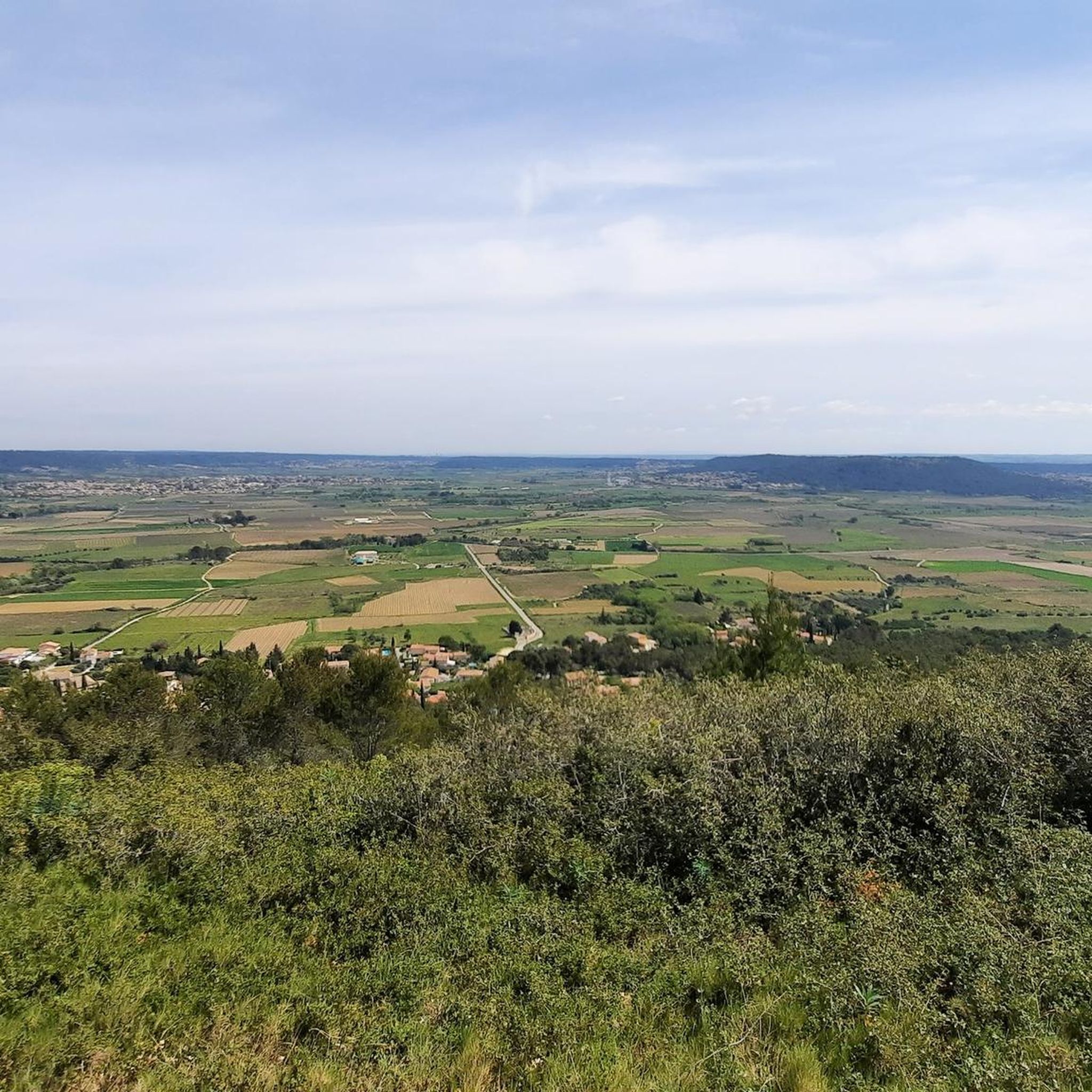
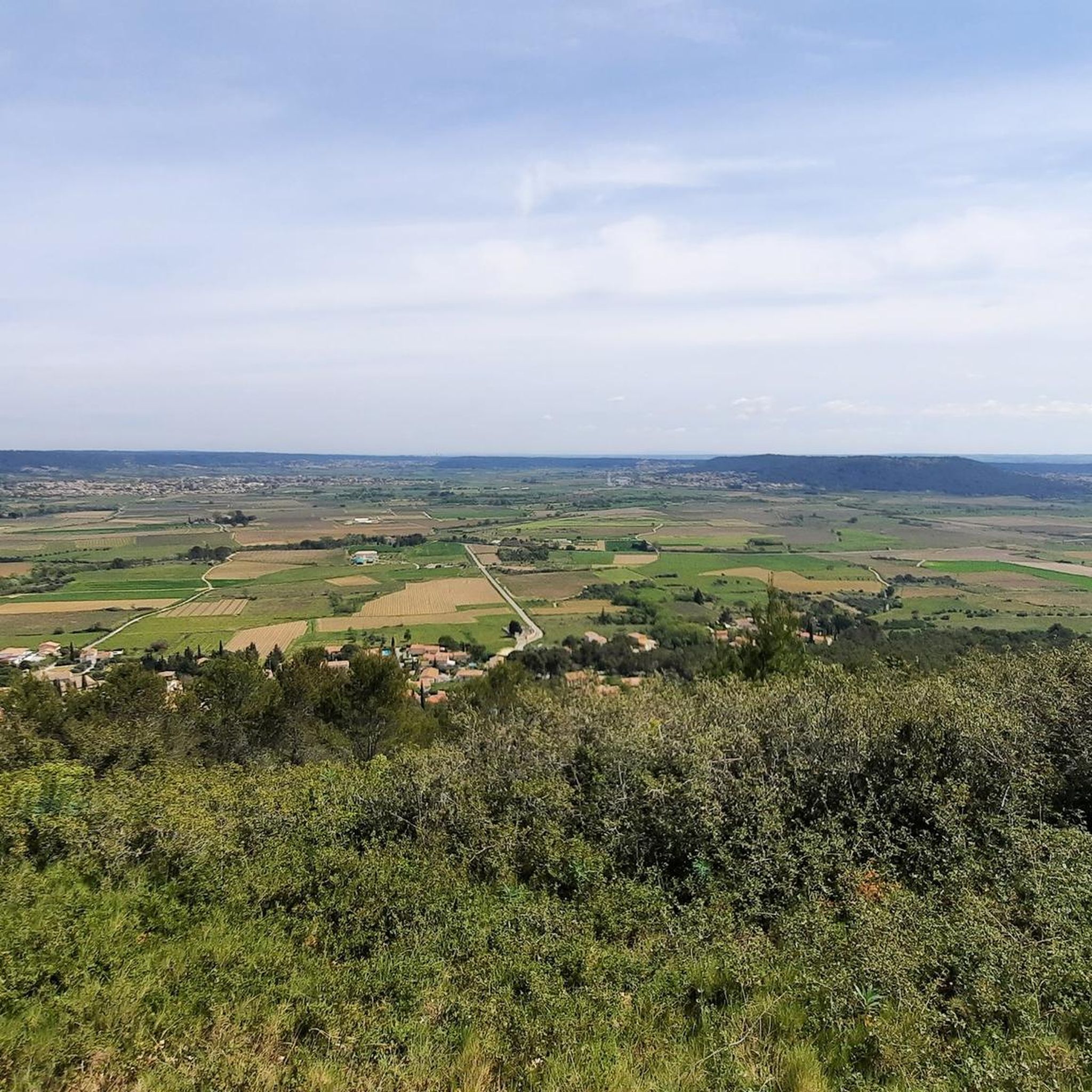
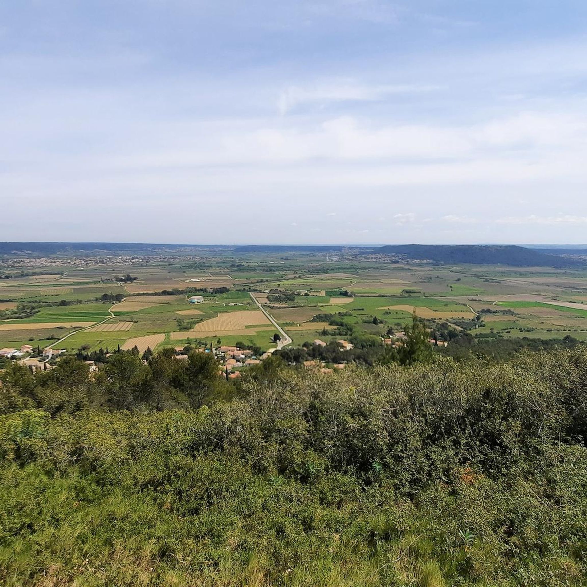
The heights of Saint-Côme offer a privileged playground for mountain biking. There are many trails and the terrain offers an interesting succession of climbs and descents. Indeed, the Vaunage, the plain located between Nîmes and Sommières, ends here to give way to the hills. The spot is perfect for admiring the landscape.
0
0

Many beautiful views of the Vaunages plain
0
0

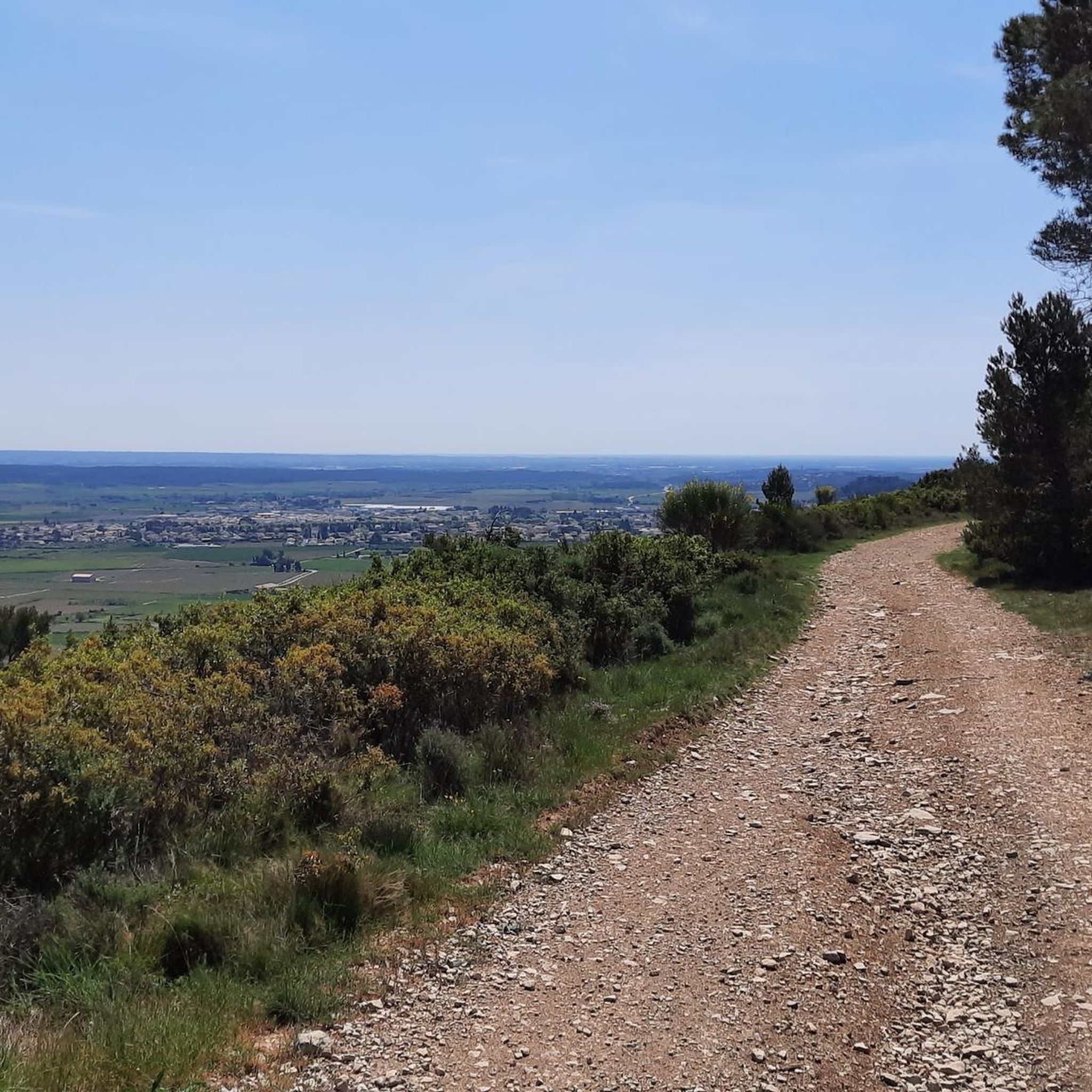
Path passing by the Capitelle triple (dry stone shelter intended for cultivation at a time when the scrubland was still cultivated land) and offering magnificent viewpoints.
0
0
The plateau on which the windmill of Langlade is located offers magnificent panoramas.
3
0

Frequently Asked Questions
How many running routes are available in Saint-Côme-Et-Maruéjols?
There are over 430 running routes around Saint-Côme-Et-Maruéjols, offering a wide variety of options for different fitness levels and preferences. This includes 27 easy routes, 363 moderate routes, and 46 difficult trails.
Are there any long-distance running paths in the Saint-Côme-Et-Maruéjols area?
Yes, for those seeking a challenge, the region offers several long-distance running paths. A notable option is the difficult View of the Vaunage loop from Saint-Côme-et-Maruéjols, which spans 17.1 miles (27.5 km) with significant elevation changes across the Vaunage landscape.
What are some good running routes for beginners or those looking for an easy jog?
While the guide highlights moderate and difficult routes, Saint-Côme-Et-Maruéjols does offer 27 easy running routes. These typically feature gentler terrain and shorter distances, perfect for a relaxed jog or for those new to running in the area. Look for routes with minimal elevation gain for the most comfortable experience.
Are there any circular running routes in Saint-Côme-Et-Maruéjols?
Many of the running routes in Saint-Côme-Et-Maruéjols are designed as circular loops, allowing you to start and finish at the same point. Examples include the moderate Triple Capitelle - Panorama loop from Sinsans and the Running loop from Clarensac, both offering varied scenery.
What kind of scenery can I expect on the running trails around Saint-Côme-Et-Maruéjols?
The running trails in Saint-Côme-Et-Maruéjols traverse a landscape of rolling hills and open plains, characteristic of the Vaunage region. You'll often find yourself running through agricultural areas, with views of the surrounding countryside. Some routes, like the Triple Capitelle - Panorama loop from Sinsans, also offer panoramic vistas and pass by historical stone structures known as Capitelles.
Are there any family-friendly running paths in the region?
For families, it's best to look for the easier, shorter routes with less elevation gain. While specific 'family-friendly' designations aren't always available, the 27 easy routes in the area are generally suitable for a more relaxed pace, which can be ideal for families jogging together. Consider routes that avoid steep climbs.
What are some interesting landmarks or attractions I might see while running?
The region offers several points of interest. You might encounter historical sites like the Ancient Roman Quarry or the Roman Fountain of Ranquet. For scenic views, look for routes near the Roc de Gachone – 4 Windmills. Some paths also pass by unique natural monuments like the Carrières de Junas.
What do other runners say about the trails in Saint-Côme-Et-Maruéjols?
The running routes in Saint-Côme-Et-Maruéjols are highly regarded by the komoot community, holding an average rating of 4.1 stars from over 200 reviews. Runners frequently praise the varied terrain, the scenic views of the Vaunage landscape, and the well-maintained paths that cater to different ability levels.
Are there any advanced running trails for experienced runners?
Yes, experienced runners will find challenging options in Saint-Côme-Et-Maruéjols. There are 46 difficult routes available, characterized by longer distances and significant elevation changes. The View of the Vaunage loop from Saint-Côme-et-Maruéjols is a prime example, offering a demanding 17.1-mile run with substantial climbs.
Is it possible to find less crowded running paths in the area?
While popular routes can see more activity, with over 430 routes available, it's certainly possible to find quieter paths. Exploring some of the less-trafficked moderate or easy routes, especially during off-peak hours or weekdays, can lead to a more solitary running experience through the peaceful agricultural landscapes and rolling hills.
What is the best time of year for running in Saint-Côme-Et-Maruéjols?
The spring and autumn months are generally ideal for running in Saint-Côme-Et-Maruéjols. The weather is typically mild and pleasant, with comfortable temperatures for outdoor activity. Summers can be quite warm, so early morning or late evening runs are recommended during this season. Winters are usually mild, making year-round running possible, though some paths might be muddy after rain.
Are there running routes accessible by public transport?
While specific public transport links to individual trailheads are not detailed in the route descriptions, Saint-Côme-Et-Maruéjols is a commune in the Gard department. It's advisable to check local bus services or regional transport options that connect to the villages where many routes begin, such as Clarensac or Sinsans, to plan your access.
Most popular routes around Saint-Côme-Et-Maruéjols
Most popular attractions around Saint-Côme-Et-Maruéjols

Get inspired with the komoot mobile app


Explore more
Browse the best Running Trails & Routes in other regions.
