The best running trails around Gacé
4.3
(5)
105
runners
22
runs
Jogging around Gacé offers a diverse landscape for runners, situated in the Touques Valley at the southern gateway to the Pays d'Auge. The region features "Augeron landscapes" and a mix of historical sites, providing varied backdrops for running. Paths often cross valleys and climb back up, or run along the Touques valley, indicating a mix of flat and inclined routes. The local topography includes elevation changes, with altitudes ranging from 179m to 316m.
Best jogging routes around Gacé
- The most…
Last updated: August 18, 2026
6
runners
5.54km
00:35
40m
40m
Moderate run. Good fitness required. Mostly paved surfaces. Suitable for all skill levels.
4
runners
6.62km
00:46
120m
120m
Moderate run. Good fitness required. Mostly paved surfaces. Suitable for all skill levels.

Sign up for free
4
runners
9.82km
01:03
140m
140m
Moderate run. Good fitness required. Mostly paved surfaces. Suitable for all skill levels.
5.0
(2)
3
runners
7.52km
00:47
60m
60m
Moderate run. Good fitness required. Mostly paved surfaces. Suitable for all skill levels.
3
runners
8.57km
00:55
120m
120m
Moderate run. Good fitness required. Mostly paved surfaces. Suitable for all skill levels.
Get access to more routes and recommendations from other explorers.
Sign up for free
Already have an account?
Our route recommendations are based on thousands of hikes, rides, and runs completed by other people on komoot.
Start today with a free account
Your next adventure awaits.
Login or Signup



Tips from the Community

The village is very pretty. The effort to access it too.
0
0

Pretty village perched on its promontory. Some beautiful coasts to get there, and a beautiful panorama as a reward!
0
0
Pretty village of character at the top of its hill where it is good to walk. Nice view of Le Pin stud farm and the Pays d'Argentan. Many hiking trails from the village.
0
0
Frequently Asked Questions
How many running routes are available around Gacé?
There are over 15 dedicated jogging routes around Gacé, offering a variety of distances and challenges. The komoot community has explored these trails more than 70 times, highlighting the area's popularity among runners.
What kind of terrain can I expect on the jogging trails in Gacé?
The terrain around Gacé is quite varied, reflecting its position in the Touques Valley and at the gateway to the Pays d'Auge. You'll find paths that cross valleys and climb back up, as well as routes that run along the Touques valley. This means a mix of flat sections and inclines, with altitudes ranging from 179m to 316m, providing interesting elevation changes for your run.
Are there any challenging running routes for experienced joggers?
Yes, Gacé offers routes with significant elevation changes for a more demanding run. For example, the Running loop from Lignères is a moderate 6.1-mile (9.8 km) path featuring substantial ascents and descents, providing a good workout through scenic countryside.
Can I find family-friendly jogging routes in the Gacé area?
While specific 'easy' routes are not highlighted, many of the moderate trails around Gacé, especially those with less extreme elevation changes, can be suitable for families looking for a pleasant jog. The picturesque Augeron landscapes and historical surroundings make for an enjoyable outing.
Are there any historical landmarks or points of interest along the running trails?
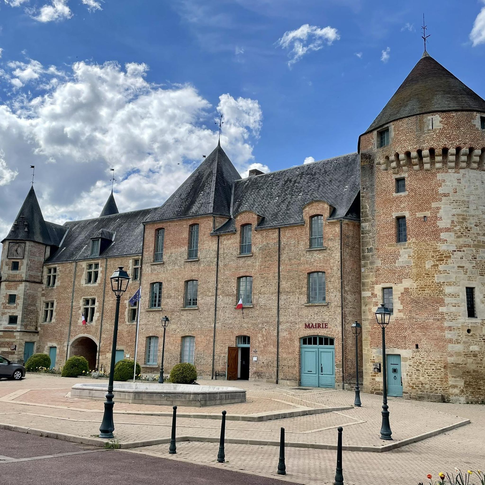
Absolutely! The region around Gacé is rich in history and natural beauty. While jogging, you might encounter historical sites like the ruins of Saint-Evroult Abbey, which offers a historical setting with views of a pond and forest. The town of Gacé itself features the Château de Gacé, and nearby, Château de Villebadin boasts a large park ideal for tranquil runs.
What do other runners say about the trails in Gacé?
The running routes in Gacé are highly rated by the komoot community, holding an average score of 4.3 out of 5 stars from multiple reviews. Runners often praise the varied terrain, the picturesque Augeron landscapes, and the mix of historical and natural backdrops that make each run unique.
Are the jogging routes in Gacé typically circular?
Yes, many of the popular running routes around Gacé are designed as loops, allowing you to start and finish at the same point. Examples include the Running loop from Le Merlerault and the Running loop from Échauffour, which are both well-regarded circular paths.
What is the best time of year to go running in Gacé?
Gacé's diverse landscapes are enjoyable throughout much of the year. Spring and autumn offer pleasant temperatures and vibrant scenery, with lush greenery or colorful foliage. Summer can also be ideal, especially during cooler mornings or evenings. While specific seasonal conditions aren't detailed, the mix of valley and elevated paths suggests good options for different weather.
Are there options for longer running excursions near Gacé?
For those looking for longer trail running experiences, while slightly further afield (about 33 km), the Forêt d'Écouves and Signal d'Écouves are notable sites of natural beauty that could offer more extensive and challenging routes for a dedicated excursion.
Can I bring my dog on the running trails around Gacé?
The natural and varied landscapes of Gacé, including paths along the Touques Valley and through historical surroundings, generally offer a welcoming environment for dog owners. It's always advisable to keep dogs on a leash and respect local regulations, especially when passing through villages or near private properties.
What kind of views can I expect while running in Gacé?
Jogging in Gacé offers a variety of scenic views. You'll experience the characteristic 'Augeron landscapes,' which are known for their picturesque charm. Routes often provide vistas of the Touques Valley, and from elevated points, such as near the village of Exmes, you can enjoy expansive views of the Le Pin stud farm and the wider Pays d'Argentan.
Are there any running routes that start directly from Gacé town?
Yes, you can find routes that start conveniently from Gacé itself. The Château de Gacé loop from Gacé is a moderate 7.9 km (4.9 miles) route that allows you to explore the surroundings directly from the town, incorporating the historical château into your run.
Most popular attractions around Gacé

Get inspired with the komoot mobile app


Explore more
Browse the best Running Trails & Routes in other regions.
