The best walks and hikes around Fossès-Et-Baleyssac
4.5
(33)
140
hikers
30
hikes
Hiking around Fossès-Et-Baleyssac offers access to the varied landscapes of the Gironde department in Nouvelle-Aquitaine, France. The region features extensive pine forests, such as those found in the Landes de Gascogne Regional Nature Park, providing shaded woodland paths. Hikers can also explore picturesque vineyards and tranquil rural countryside, alongside riverbanks along the Garonne and Dordogne rivers. This diverse terrain provides a range of experiences for outdoor enthusiasts.
Best hiking trails around Fossès-Et-Baleyssac
- The most popular hiking route is Bastide of…
Last updated: June 30, 2026
20
hikers
3.63km
01:00
60m
50m
Easy hike. Great for any fitness level. Easily-accessible paths. Suitable for all skill levels.
2.0
(2)
6
hikers
9.46km
02:36
150m
150m
Moderate hike. Good fitness required. Easily-accessible paths. Suitable for all skill levels.

Sign up for free
4.7
(3)
7
hikers
29.3km
07:45
280m
280m
Hard hike. Very good fitness required. Easily-accessible paths. Suitable for all skill levels.
4.0
(1)
7
hikers
25.8km
06:38
120m
120m
Hard hike. Very good fitness required. Easily-accessible paths. Suitable for all skill levels.
10
hikers
Moderate hike. Good fitness required. Easily-accessible paths. Suitable for all skill levels.
Get access to more routes and recommendations from other explorers.
Sign up for free
Already have an account?
Our route recommendations are based on thousands of hikes, rides, and runs completed by other people on komoot.
Start today with a free account
Your next adventure awaits.
Login or Signup

Tips from the Community


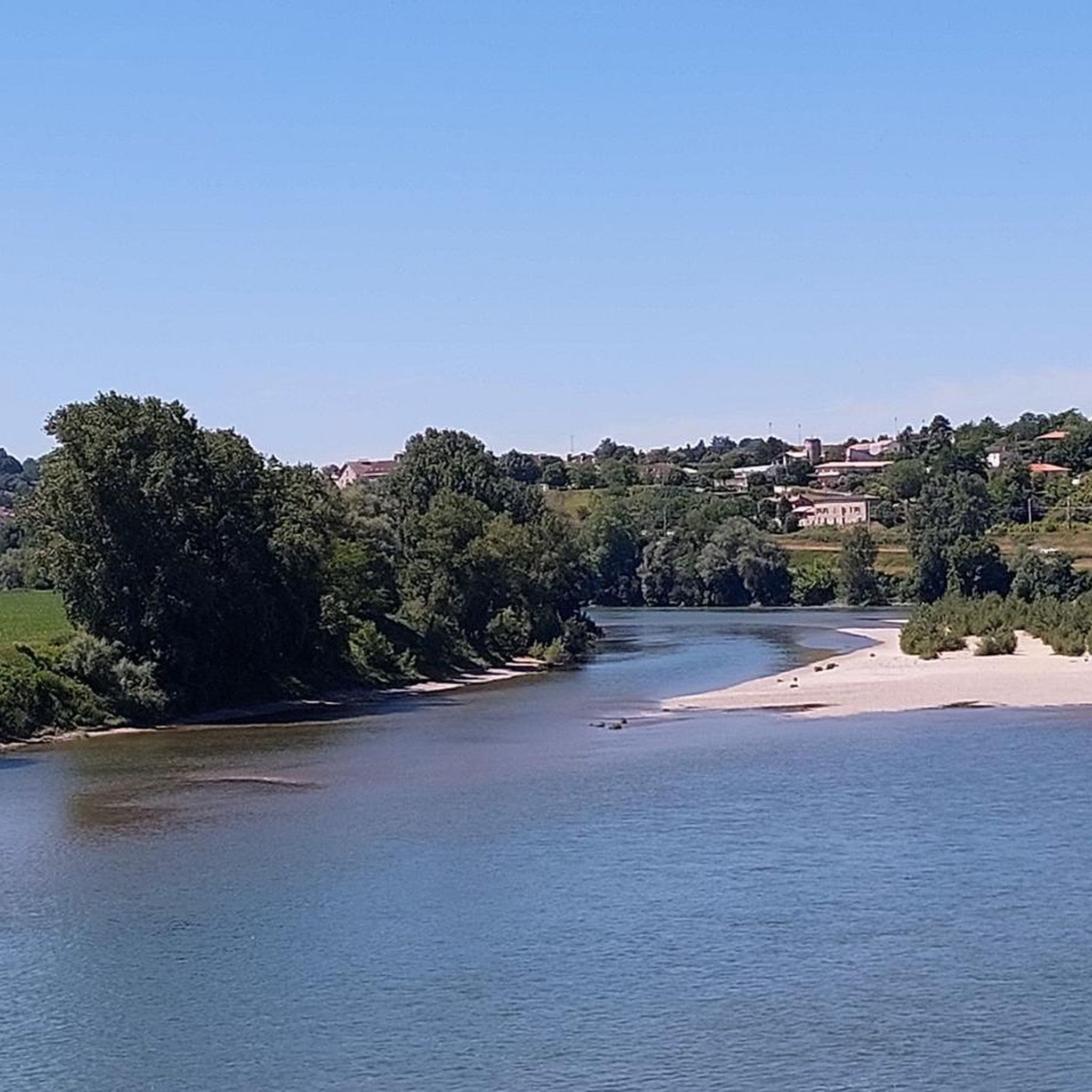
I hope a bit of advertising is allowed. There is a marvellous B&B / gîte - Haras de la Tour - just 2.5 km off all of these routes at Lamothe-Landerron. Many cyclists have stayed here. Have a look at http://www.harastour.com/ It is 5 km from the start point at Sainte-Bazeille. If you get lost I can come and cycle back with you.
0
0

La Réole is a commune in the south-west of France, located in the department of Gironde, in the Nouvelle-Aquitaine region. It benefits from the national label City of Art and History
0
0

A few kilometers from Cadours, the Château de Laréole, a jewel of the Renaissance in its green setting, opens to the public every spring in the spring. The building has been heritage of the Department Council since 1984 and has been recovered from obscurity and beautifully restored.
3
1

Lake of nine fountains of Neuffons, all round! Large pontoon and picnic tables.
2
0
Monségur is an old medieval Bastide perched on a hill and surrounded by ramparts from which you can see the Drot Valley spread out. To see: the square square with its cast iron and glass halls, the church, the Governor's Tower and the small streets of undeniable charm.
1
0
This suspension bridge, 168 meters long and 9 meters wide, had two sidewalks
3
0
The bridge has been closed to car traffic since August 13, 2021 . It remains open to pedestrians and cyclists
3
0
Frequently Asked Questions
How many hiking trails are available around Fossès-Et-Baleyssac?
There are over 25 hiking trails around Fossès-Et-Baleyssac, offering a diverse range of experiences. These routes cater to various skill levels, from easy strolls through vineyards to more challenging paths along riverbanks and through forests.
What types of landscapes can I expect to see while hiking in this region?
The region around Fossès-Et-Baleyssac, within the Gironde department, offers a rich mosaic of landscapes. You can expect to hike through extensive pine forests, picturesque vineyards, tranquil rural countryside, and along scenic riverbanks, particularly near the Garonne and Dordogne rivers. Some areas also feature coastal landscapes and estuaries.
Are there any easy hiking trails suitable for beginners or families?
Yes, there are 10 easy hiking trails in the area, perfect for beginners or families. A great option is the Bastide of Monségur loop from Monségur, which is a 2.3-mile (3.6 km) trail that takes about 1 hour to complete, exploring the historic bastide town.
What are the difficulty levels of the hiking trails around Fossès-Et-Baleyssac?
The trails around Fossès-Et-Baleyssac are categorized into three main difficulty levels: 10 easy routes, 12 moderate routes, and 3 difficult routes. This variety ensures there's a suitable path for every hiker, from leisurely walks to more strenuous excursions.
Are there any circular walks available?
Many of the trails in the region are designed as circular routes, allowing you to start and end at the same point. For example, the Château de La Réole loop from La Réole is a moderate 5.9-mile (9.5 km) circular path offering views of the château and river landscape.
What interesting landmarks or natural features can I see along the trails?
While hiking, you can encounter several interesting features. Many routes follow the Garonne Lateral Canal, offering unique views of this historic waterway. You might also pass by sites like Le Moulin de Loubens or the charming Couthures-sur-Garonne Riverside Village, adding cultural and historical context to your outdoor adventure.
What do other hikers enjoy most about hiking in Fossès-Et-Baleyssac?
The area is highly rated by the komoot community, with an average score of 4.6 stars from over 20 reviews. Hikers often praise the diverse terrain, from quiet woodlands to scenic river paths, and the well-maintained network of trails that cater to various abilities.
Are there any longer, more challenging hikes for experienced trekkers?
Yes, for more experienced trekkers, there are 3 difficult routes available. A notable option is the Rouergue Bridge – The Canal Latéral à la Garonne loop from Gare de La Réole, a 16.1-mile (25.8 km) trail that leads through varied countryside and along the canal, typically taking around 6 hours 40 minutes to complete.
Can I find trails that follow canals or rivers?
Absolutely. The region is well-known for its river and canal paths. The The Canal Latéral à la Garonne – Canal de Garonne at Meilhan loop from Fontet is a moderate 8.2-mile (13.2 km) route that offers a pleasant walk alongside the canal, showcasing the tranquil waterways of the area.
What is the best time of year to go hiking in Fossès-Et-Baleyssac?
The Gironde department generally offers pleasant hiking conditions for much of the year. Spring and autumn provide mild temperatures and beautiful scenery, with blooming wildflowers or vibrant fall foliage. Summer can be warm, but many forest trails offer welcome shade. Winter hikes are also possible, especially on clear, crisp days.
Are there opportunities to see vineyards on the hiking trails?
Yes, the region is famous for its vineyards. Many hiking routes will take you through picturesque vineyard landscapes, particularly in areas like Saint-Emilion, allowing you to immerse yourself in the tranquility of the wine-growing countryside.
Are there any hikes that feature aqueducts or other interesting engineering structures?
Indeed. The Aqueduct in Meilhan-sur-Garonne – Ship birth on the canal loop from Meilhan-sur-Garonne is a moderate 6.9-mile (11.1 km) trail that highlights the impressive aqueduct and other canal-related structures, offering a unique blend of nature and engineering marvels.
Most popular routes around Fossès-Et-Baleyssac
Most popular attractions around Fossès-Et-Baleyssac

Get inspired with the komoot mobile app


Explore more
Browse the best Hikes in other regions.
