The best walks and hikes around Fère-Champenoise
4.4
(8)
48
hikers
4
hikes
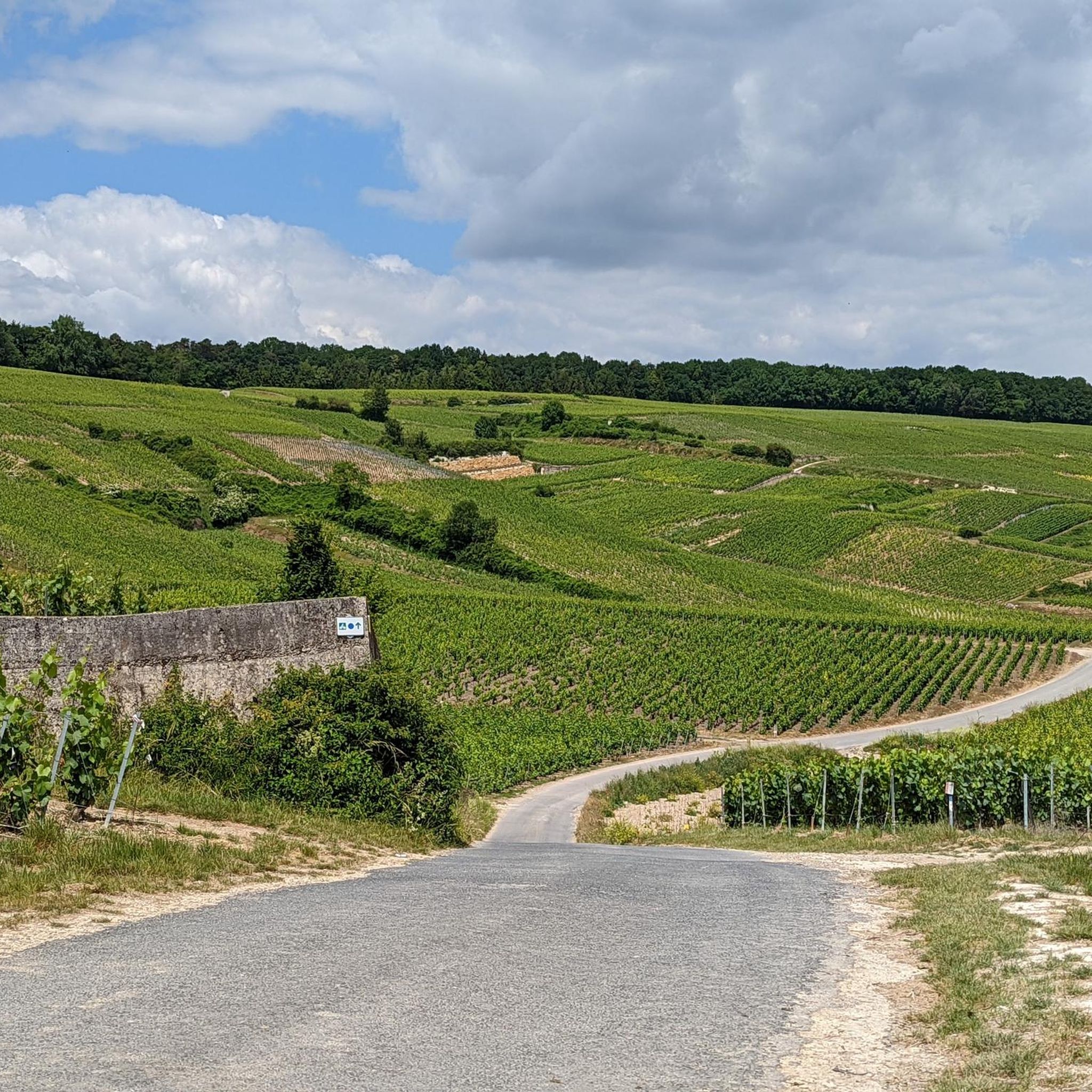
Hiking around Fère-Champenoise offers diverse landscapes within the Champagne region of France. The area features a blend of flatlands, green valleys, and rolling hills, including the Mont Aimé Viewpoint, which provides panoramic views of the Côte des Blancs vineyards. The region is characterized by extensive vineyards, forests, and agricultural plains, alongside significant wetland areas like the Marais de Reuves and Marais de Saint-Gond. Rivers such as the Vaure and Somme further enhance the natural setting, providing varied terrain for outdoor…
Last updated: June 25, 2026
5
hikers
4.64km
01:11
10m
10m
Easy hike. Great for any fitness level. Easily-accessible paths. Suitable for all skill levels.
2
hikers
21.6km
05:44
210m
210m
Hard hike. Very good fitness required. Easily-accessible paths. Suitable for all skill levels.

Sign up for free
7
hikers
6.04km
01:41
110m
110m
Easy hike. Great for any fitness level. Easily-accessible paths. Suitable for all skill levels.
5.0
(4)
11
hikers
8.37km
02:16
120m
120m
Moderate hike. Good fitness required. Easily-accessible paths. Suitable for all skill levels.
5.0
(1)
4
hikers
5.56km
01:33
100m
100m
Easy hike. Great for any fitness level. Easily-accessible paths. Suitable for all skill levels.
Our route recommendations are based on thousands of hikes, rides, and runs completed by other people on komoot.
Start today with a free account
Your next adventure awaits.
Login or Signup
Popular around Fère-Champenoise

Tips from the Community

Beautiful view of Champagne, some passages at 13/14°.
0
0

A hill with an altitude of 240 meters. It offers beautiful panoramic views of the Côte des Blancs vineyards, the surrounding villages and the fields.
0
0
It is a Gothic church in the Romanesque style, it has been classified as a Historic Monument since July 30, 1934. The beginning of the construction dates from the 12th century.
1
0
These marshes are renowned for their ecological richness. They cover the territory of 1700 ha. Sturdy shoes and waterproof spray recommended, although you don't have to walk through the swamp, there is a trail. Avoid on particularly rainy days.
1
0
Menhir is a monument formed by a standing stone. This menhir is isolated and dates from the Neolithic period. It is classified as a historical monument and seems to indicate an ossuary located nearby (according to the anthropological society of Paris).
0
0
Frequently Asked Questions
How many hiking trails are available in Fère-Champenoise?
The Fère-Champenoise area offers a selection of hiking routes, with 4 distinct trails detailed in this guide. More broadly, the region boasts around 29 marked trails covering over 250 kilometers, providing diverse options for exploration.
Are there easy hiking options suitable for beginners or families?
Yes, Fère-Champenoise has several easy hiking options. For instance, the Reuves Marsh Loop is an easy 4.6 km trail that takes about 1 hour 10 minutes, perfect for a relaxed walk. Another easy option is the Mont Aimé Viewpoint – Mont-Aimé loop from Bergères-lès-Vertus, which is 6 km long and offers great views.
Can I find circular hiking routes in the area?
Yes, many of the trails in Fère-Champenoise are circular. Examples include the Reuves Marsh Loop, which explores unique wetlands, and the Loop around Vert-Toulon — Menhir de l'étang de Chénevry, a longer circular path through vineyards.
What kind of natural landscapes can I expect to see while hiking?
Fère-Champenoise offers a rich tapestry of landscapes. You'll encounter extensive vineyards, vast agricultural plains, and serene forests. A significant feature is the presence of important wetland areas like the Marais de Reuves and Marais de Saint-Gond, known for unique flora such as marsh irises and water lilies. Rivers like the Vaure and Somme also enhance the natural setting.
Are there any historical or cultural points of interest along the trails?
Yes, the region blends natural beauty with historical charm. You can visit the 12th-century Saint-Pierre Church, a Gothic church classified as a Historic Monument. Another unique spot is the Lavoir, an old washhouse. Some routes, like the Loop around Vert-Toulon, pass by the historic Menhir de l'étang de Chénevry.
Is Fère-Champenoise suitable for hiking with dogs?
While specific dog-friendly regulations for individual trails are not detailed, generally, the natural landscapes of Fère-Champenoise, including forests and open plains, are welcoming for walks with dogs. It's always advisable to keep dogs on a leash, especially near agricultural areas or wildlife habitats, and to respect local signage.
What is the best time of year to go hiking in Fère-Champenoise?
The Champagne region, including Fère-Champenoise, is beautiful throughout much of the year. Spring and autumn offer pleasant temperatures and stunning scenery, with vineyards in bloom or displaying vibrant fall colors. Summer is also popular, though it can be warmer. Winter hikes are possible, especially in the forests, but some trails might be muddy.
How can I reach the hiking trails using public transport?
Fère-Champenoise is a commune in the Marne department. While local bus services might connect surrounding villages, direct public transport links specifically to trailheads can be limited. It's recommended to check regional transport schedules for buses connecting to Fère-Champenoise or nearby towns, and then plan your hike from there. Many trails are accessible by car.
Are there specific parking facilities for hikers?
Parking is generally available in Fère-Champenoise and the surrounding villages, often near town centers or designated public parking areas. For specific trailheads, parking information might be available on local signage or detailed route descriptions. Many routes start from easily accessible points where parking is convenient.
What do other hikers say about the trails in Fère-Champenoise?
The trails in Fère-Champenoise are highly rated by the komoot community, with an average score of 4.8 stars from over 5 reviews. Hikers often praise the varied terrain, from wetlands to vineyards, and the expansive views, particularly from the Mont Aimé Viewpoint. Over 30 hikers have used komoot to explore the area's diverse paths.
Can I find routes that offer panoramic views?
Absolutely. The Mont Aimé Viewpoint is a highlight, standing at 240 meters and offering expansive panoramic views of the Côte des Blancs vineyards and the surrounding agricultural fields. The Mont Aimé Viewpoint – Mont-Aimé loop from Bergères-lès-Vertus is a great route to experience these vistas.
Are there any longer, more challenging hikes for experienced hikers?
Yes, for those seeking a challenge, the Loop around Vert-Toulon — Menhir de l'étang de Chénevry is a difficult 21.6 km path. This trail winds through vineyards and agricultural fields, requiring a good level of fitness and taking approximately 5 hours 44 minutes to complete.
Where can I find a place to picnic or rest during my hike?
The Fère-Champenoise area is equipped with amenities for visitors. There are designated picnic areas available for you to rest and enjoy the peaceful surroundings. Many trails also pass through villages where you might find local cafes or shops.
Most popular routes around Fère-Champenoise
Most popular attractions around Fère-Champenoise

Get inspired with the komoot mobile app


Explore more
Browse the best Hikes in other regions.
