The best road cycling routes around Dournon
4.4
(37)
731
riders
67
rides
Road cycling routes around Dournon traverse the varied terrain of the Jura mountains, offering undulating landscapes, dense forests, and scenic valleys. The region is characterized by elevation changes suitable for road cyclists, with routes passing by numerous lakes and gorges. This area provides a diverse backdrop for cycling, from challenging ascents to more gentle rides through the French countryside.
Best road cycling routes around Dournon
- The most popular road cycling route is Col de Chalamont loop from Crouzet-Migette, a…
Last updated: October 9, 2026
5.0
(1)
8
riders
24.0km
01:17
460m
460m
Moderate road ride. Good fitness required. Mostly well-paved surfaces and easy to ride.
4.7
(3)
10
riders
40.8km
02:06
710m
710m
Moderate road ride. Good fitness required. Mostly well-paved surfaces and easy to ride.

10
riders
Moderate road ride. Good fitness required. Mostly well-paved surfaces and easy to ride.
4.0
(1)
12
riders
Moderate road ride. Good fitness required. Mostly well-paved surfaces and easy to ride.
5.0
(2)
4
riders
73.4km
03:44
1,200m
1,200m
Hard road ride. Very good fitness required. Mostly well-paved surfaces and easy to ride.
Get access to more routes and recommendations from other explorers.
Already have an account?
Our route recommendations are based on thousands of hikes, rides, and runs completed by other people on komoot.
Start today with a free account
Your next adventure awaits.

Tips from the Community

Cascade also affected by drought, to admire it best, favor the periods April-May and October-November.
0
0

Not suitable for children. Very dangerous, but beautiful. Recommended for adults who are not afraid of heights.
0
0

The village of Nans-sous-Sainte-Anne is remarkable for the scale of its landscapes, the rhythm of the mountains and depressions. It knows how to combine in a restricted space the charm of the foliage and the fir trees with the austerity of the rock walls, the impetuosity of the waterfalls with the intimacy of the undergrowth, the mystery of the caves with the picturesqueness of the belvederes.
1
0

The Cascade de Syratu is an impressive waterfall that cascades over the rocky cliffs of the Baume above Mouthier-Haute-Pierre in the Doubs department. With a total height difference of 230 metres, it is the largest waterfall in the department. The waterfall consists of several levels: The upper part begins with an almost vertical drop of 50 metres from the edge of the plateau at a height of 600 metres. This is followed by a second vertical drop of 32 metres, which brings the water to the level of the road. The lower part of the waterfall extends over a wooded slope and ends at the Loue river, where there are several waterfalls covered with tufa. To get a general view of the waterfall, you should climb up the left bank after crossing the old bridge over the Loue. The middle part of the waterfall is visible from the road that goes up to the gorges. The lower part, with its wild tuff massifs, can be reached on foot via paths that start on either side of the small bridge over the Syratu stream.
8
0

The valley is beautiful, the rock walls down to the road and... the Lison flows very quietly, without any fuss like the last few kilometers.
1
0

Beautiful path to the waterfall. Suitable footwear is recommended when it is wet.
0
0
Finally there is an alternative in an otherwise almost gastronomic landscape. There is now a gastronomic commitment again here: https://aubergedupontdudiable.com
0
0

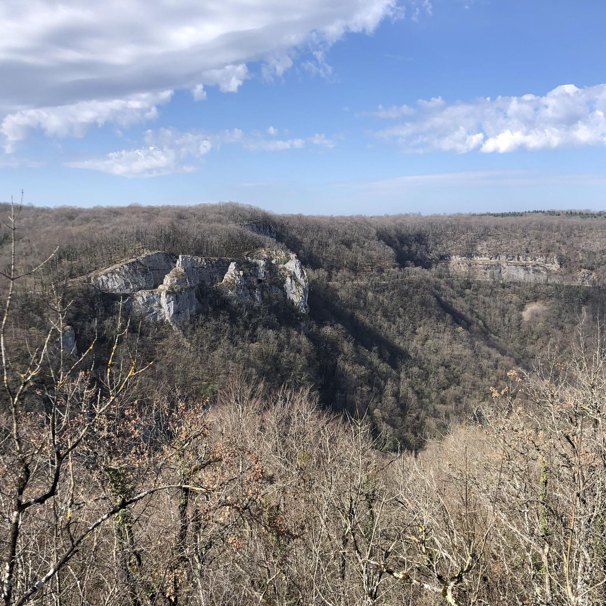
This section of road which ventures into the Nouailles gorges, gradually transforms as it descends into a gigantic canyon overlooking the Loue valley. The cliffs are impressive in places. It is a marvel to explore which gives a little air of adventure and a lot of pleasure.
1
0
Frequently Asked Questions
How many road cycling routes are available around Dournon?
There are over 60 road cycling routes around Dournon, offering a wide range of options for different skill levels. You'll find routes varying from easy to difficult, with the majority being moderately challenging.
What kind of terrain can I expect when road cycling near Dournon?
Road cycling near Dournon offers a diverse terrain, characterized by the undulating landscapes of the Jura mountains. You can expect routes through dense forests, scenic valleys, and past numerous lakes and gorges. The topography includes both challenging ascents and more gentle rides through the French countryside.
Are there routes suitable for advanced road cyclists?
Yes, Dournon offers challenging routes for advanced road cyclists. For instance, the Great views over the Loue – Village of Lods loop from Nans-sous-Sainte-Anne is a difficult 45.7-mile (73.5 km) path with significant elevation gain and panoramic views over the Loue valley.
Are there easy road cycling routes for beginners or those looking for a more relaxed ride?
Absolutely. There are several easy and moderate routes perfect for beginners or those seeking a more relaxed experience. For example, the View of the Jura Countryside loop from Dournon is a moderate 11.0-mile (17.7 km) trail that leads through the picturesque Jura countryside.
What scenic viewpoints or landmarks can I discover on road cycling routes?
Many routes offer stunning views and pass by notable landmarks. You can cycle past natural wonders like the Lison Spring and the Verneau Spring. The region also features historic sites such as the Royal Saltworks of Arc-et-Senans and the Besançon Citadelle, which can be incorporated into longer tours.
Are there routes that pass by waterfalls or gorges?
Yes, the Dournon area is rich in water features. You can find routes that take you near the Lison Waterfalls, the Creux Billard — Karst Basin and Waterfall, and the Gorges de la Lemme, offering dramatic geological formations and scenic views.
Are there circular road cycling routes around Dournon?
Many of the road cycling routes around Dournon are designed as loops, allowing you to start and finish in the same location. Examples include the Col de Chalamont loop from Crouzet-Migette and the Roadbike loop from Nans-sous-Sainte-Anne.
What is the typical length and duration of road cycling routes in the Dournon area?
Route lengths vary significantly. You can find shorter rides, like the View of the Jura Countryside loop from Dournon at 11.0 miles (17.7 km) taking about an hour. Longer, more challenging routes, such as the Great views over the Loue – Village of Lods loop from Nans-sous-Sainte-Anne, can be over 45 miles (73.5 km) and take several hours to complete.
When is the best time of year for road cycling in Dournon?
The Jura region, including Dournon, is generally best for road cycling from spring through autumn. During these seasons, the weather is typically mild, and the natural landscapes are at their most vibrant. Summer offers warmer temperatures, while spring and autumn provide cooler rides and beautiful foliage.
What do other road cyclists enjoy the most about road cycling in Dournon?
The road cycling routes in Dournon are highly rated by the komoot community, with an average score of 4.4 stars from over 20 reviews. Cyclists often praise the varied terrain, the stunning natural beauty of the Jura mountains, and the opportunities to explore dense forests and scenic valleys.
Are there any routes that pass through towns with local markets?
Yes, some routes can be planned to pass near charming towns like Salins-les-Bains or Arbois, which are known for their local markets. This offers a great opportunity to experience local culture and cuisine during your ride. The Salins-les-Bains loop from Nans-sous-Sainte-Anne is one such route.
Most popular attractions around Dournon

Get inspired with the komoot mobile app


Explore more
Browse the best Road cycling routes in other regions.
