The best walks and hikes around Montgardin
4.5
(1831)
12,140
hikers
257
hikes
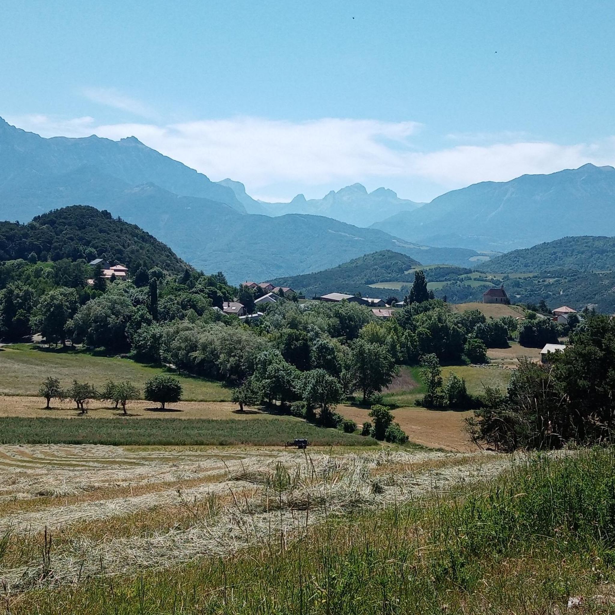
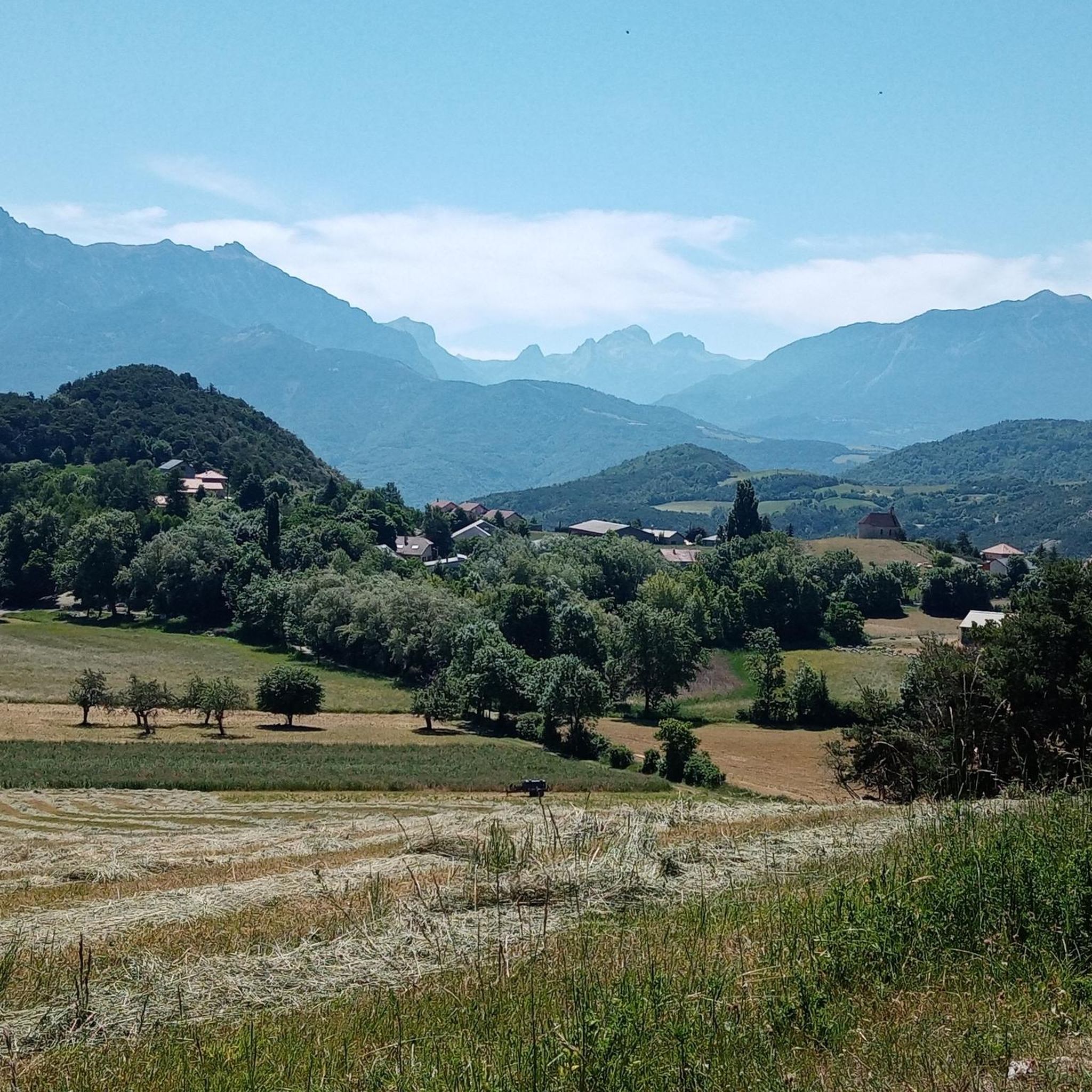
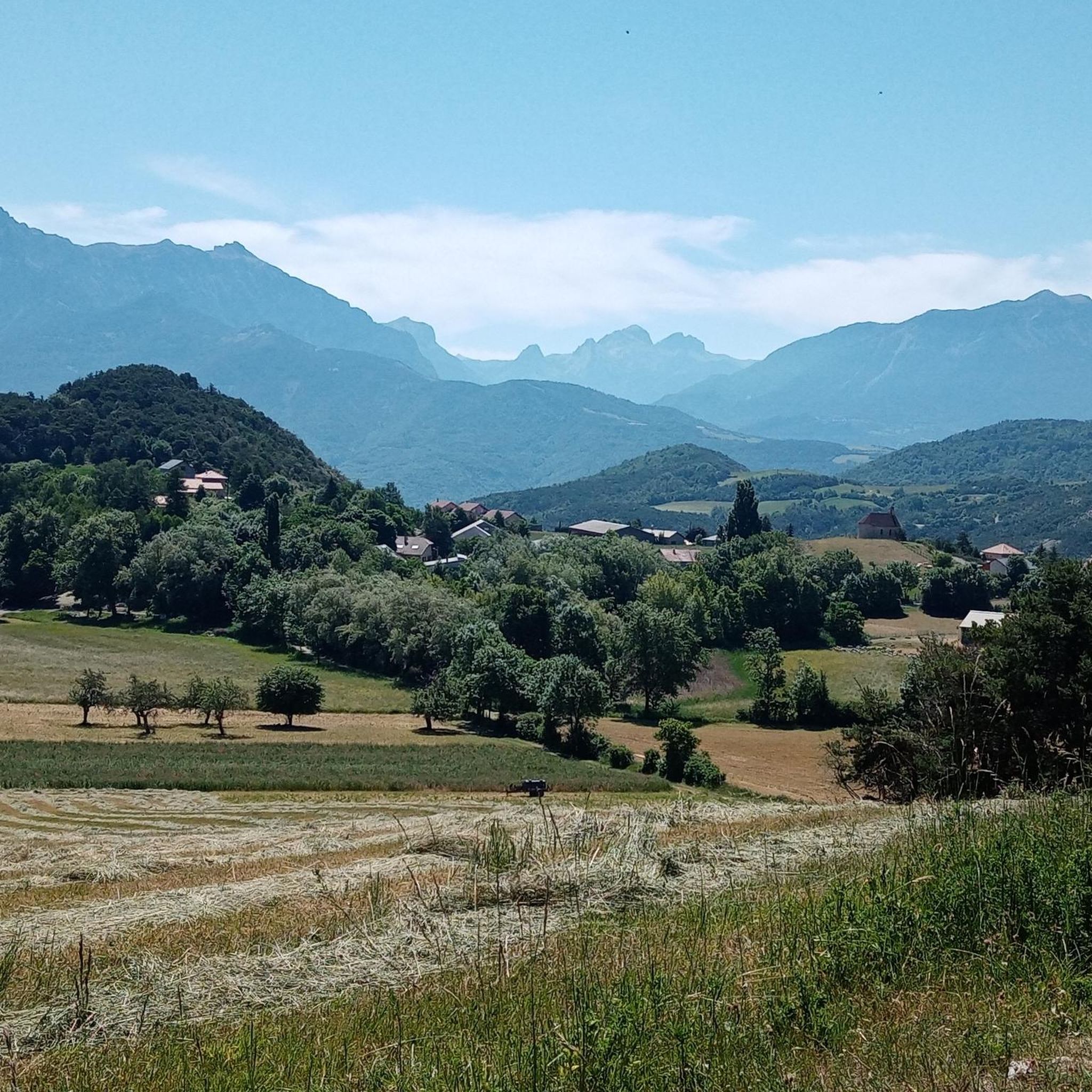
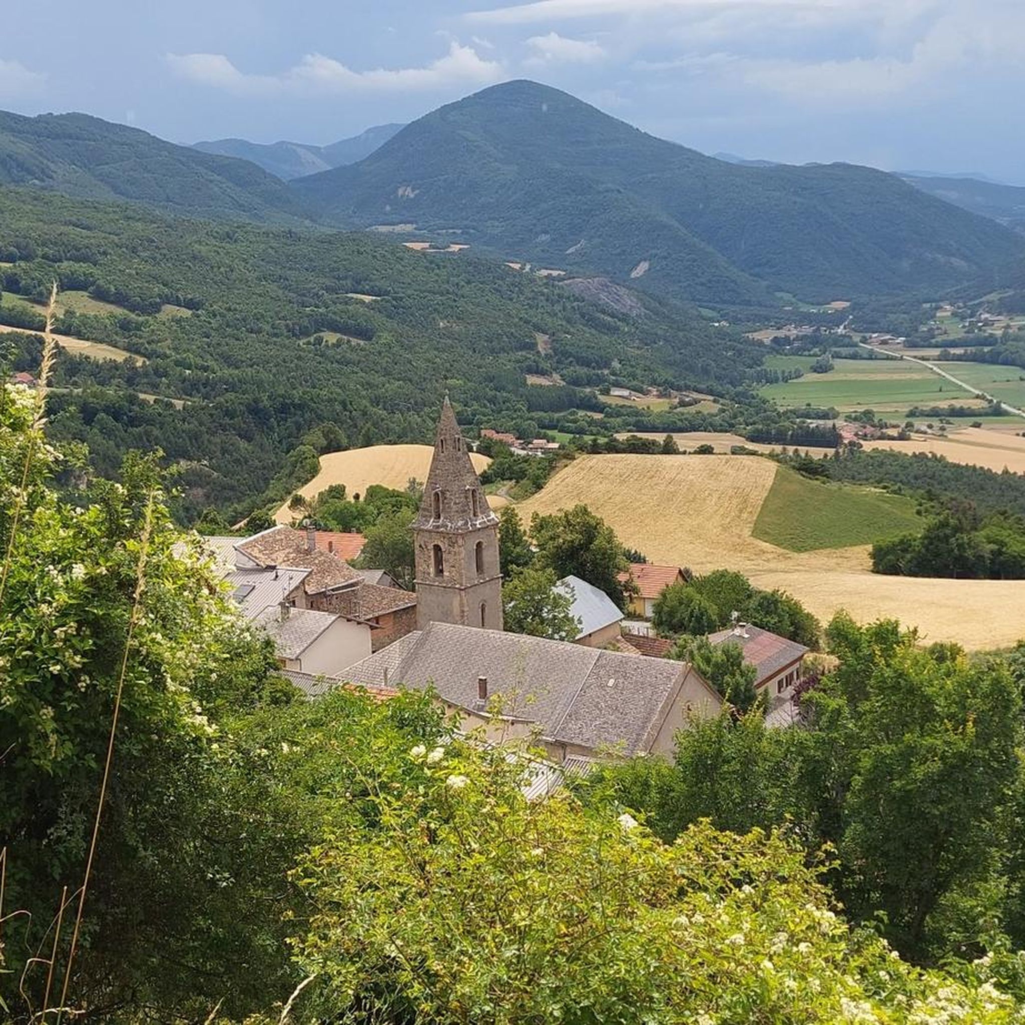
Hiking trails around Montgardin offer a diverse landscape characterized by rolling hills, valleys, and forested areas. The region provides a variety of terrain suitable for different hiking preferences, from gentle paths to more challenging ascents. Hikers can explore routes that feature panoramic views and natural landmarks.
Best hiking trails around Montgardin
- The most popular hiking route is Magnificent view of the lake – Chanteloube Viaduct loop from Chorges, a 11.1 miles (17.8 km) trail that takes 4 hours 58…
Last updated: June 25, 2026
5.0
(8)
29
hikers
18.0km
05:01
350m
350m
Hard hike. Very good fitness required. Easily-accessible paths. Suitable for all skill levels.
4.4
(5)
27
hikers
21.1km
07:32
1,270m
1,270m
Hard hike. Very good fitness required. Mostly accessible paths. Sure-footedness required.

Sign up for free
5.0
(3)
16
hikers
25.1km
10:05
1,580m
1,580m
Hard hike. Very good fitness required. Sure-footedness, sturdy shoes and alpine experience required.
3.0
(1)
13
hikers
13.6km
03:51
290m
290m
Moderate hike. Good fitness required. Easily-accessible paths. Suitable for all skill levels.
4.7
(13)
9
hikers
14.9km
04:11
280m
280m
Moderate hike. Good fitness required. Easily-accessible paths. Suitable for all skill levels.
Get access to more routes and recommendations from other explorers.
Sign up for free
Already have an account?
Our route recommendations are based on thousands of hikes, rides, and runs completed by other people on komoot.
Start today with a free account
Your next adventure awaits.
Login or Signup

Tips from the Community


This is where you will have a breathtaking view of the Serre Ponçon lake. By going to this viewpoint, you will be able to admire the turquoise waters of the lake, surrounded by the rugged peaks of the French Alps. The area offers peaceful hiking trails and is a great place to take a break and admire the natural beauty of this large artificial lake, which reflects the surrounding mountains.
0
1

Beautiful and colorful sign at the entrance of Chorges
0
0

The Chanteloube viaduct, located on the Serre-Ponçon lake, is an unusual place. Built for a railway line that was never completed, this partially submerged viaduct offers a fascinating spectacle, with its arches reflected in the turquoise waters of the lake.
1
0

Old railway viaduct. Was never equipped with a rail, then submerged by the dam.
0
0

Frequently Asked Questions
How many hiking trails are available around Montgardin?
There are over 250 hiking trails around Montgardin, offering a diverse range of experiences. These include 80 easy routes, 143 moderate trails, and 29 more challenging excursions.
Are there easy hiking trails suitable for beginners or families in Montgardin?
Yes, Montgardin offers 80 easy hiking trails, many of which are suitable for beginners or families. These routes typically feature gentler paths and shorter distances. For a moderate option that's still accessible, consider the Montgardin – Panorama loop from Montgardin, which is 8.2 km long and offers scenic views.
What are some challenging hikes for experienced trekkers in Montgardin?
For experienced trekkers seeking a challenge, Montgardin has 29 difficult routes. A notable option is the Gardette Pass loop from Chorges, a 21.0 km path with significant elevation gain. Another demanding trail is the Col de Chorges – Le Piolit loop from Chorges, which spans 24.8 km and leads through mountain passes.
Are there any circular walks or loop trails near Montgardin?
Yes, many trails around Montgardin are designed as loops, allowing you to start and end at the same point. Examples include the popular Magnificent view of the lake – Chanteloube Viaduct loop from Chorges and the Views of Chorges – Magnificent view of the lake loop from Chorges, both offering stunning lake vistas.
What natural landmarks or attractions can I see along the hiking trails?
The Montgardin area is rich in natural beauty. Hikers can discover various natural monuments and lakes. Highlights include the impressive Chabrières Needles, the serene Lac de Saint-Apollinaire, and the dramatic Gorges de la Blanche. You might also encounter unique geological formations like the Demoiselles Coiffées.
Are there any man-made landmarks or points of interest near the hiking routes?
Yes, several man-made landmarks are integrated into the landscape. The impressive Serre-Ponçon Dam is a significant structure in the region, and the historic Chanteloube Viaduct is a notable feature along some lake-view trails.
What do other hikers enjoy most about hiking in Montgardin?
The hiking trails around Montgardin are highly rated by the komoot community, with an average score of 4.5 stars from over 1,800 reviews. Hikers frequently praise the diverse terrain, the panoramic views, and the presence of mountain passes. Many appreciate the variety of options available for different ability levels.
Is Montgardin suitable for winter hiking?
While the region offers diverse terrain, winter conditions can vary significantly, especially at higher elevations and mountain passes. Some trails may become challenging or inaccessible due to snow and ice. It's advisable to check local weather conditions and trail reports before planning a winter hike and to be equipped with appropriate gear.
What kind of gear should I bring for hiking in Montgardin?
Given the varied terrain, including rolling hills, valleys, and mountain passes, sturdy hiking boots with good ankle support are recommended. Depending on the season and trail difficulty, layers of clothing, rain gear, sufficient water, snacks, a map or GPS device, and sun protection are essential. For more challenging routes, trekking poles can be beneficial.
Are there options for parking near the trailheads in Montgardin?
Many popular trailheads and starting points for hikes around Montgardin, especially those originating from nearby towns like Chorges, typically offer designated parking areas. It's common for routes to begin near villages or accessible points where parking facilities are available, though availability can vary. Always check specific route details for recommended parking.
Can I reach hiking trails in Montgardin using public transport?
While Montgardin itself is a smaller commune, some hiking trails may be accessible from larger nearby towns like Chorges, which might have better public transport connections. However, direct public transport to all trailheads might be limited. Planning your route in advance and checking local bus or train schedules for connections to starting points is recommended.
Most popular routes around Montgardin
Most popular attractions around Montgardin

Get inspired with the komoot mobile app


Explore more
Browse the best Hikes in other regions.
