The best MTB trails around Noiron
4.4
(24)
71
riders
20
rides
Noiron mountain bike trails are situated within the Haute-Saône department of Bourgogne-Franche-Comté, France, offering diverse terrain for mountain biking. The region features deep forests, flower-filled valleys, and plateaus, providing varied landscapes for riders. The Ognon and Saône rivers contribute to a green environment, while areas like the Plateau des 1000 Étangs present unique natural features. This geographical setting provides a range of routes from gentle paths to more challenging tracks.
Best mountain bike trails around Noiron
- The most popular mountain…
Last updated: May 25, 2026
4.2
(11)
11
riders
51.8km
02:44
160m
160m
Moderate mountain bike ride. Good fitness required. Suitable for all skill levels.
10
riders
18.0km
00:57
50m
50m
Easy mountain bike ride. Great for any fitness level. Suitable for all skill levels.

Sign up for free
4.7
(7)
7
riders
27.0km
01:38
90m
90m
Easy mountain bike ride. Great for any fitness level. Suitable for all skill levels.
5.0
(1)
9
riders
39.0km
02:43
310m
310m
Moderate mountain bike ride. Good fitness required. Suitable for all skill levels.
4.0
(1)
5
riders
34.9km
01:58
230m
230m
Easy mountain bike ride. Great for any fitness level. Suitable for all skill levels.
Get access to more routes and recommendations from other explorers.
Sign up for free
Already have an account?
Our route recommendations are based on thousands of hikes, rides, and runs completed by other people on komoot.
Start today with a free account
Your next adventure awaits.
Login or Signup


Tips from the Community

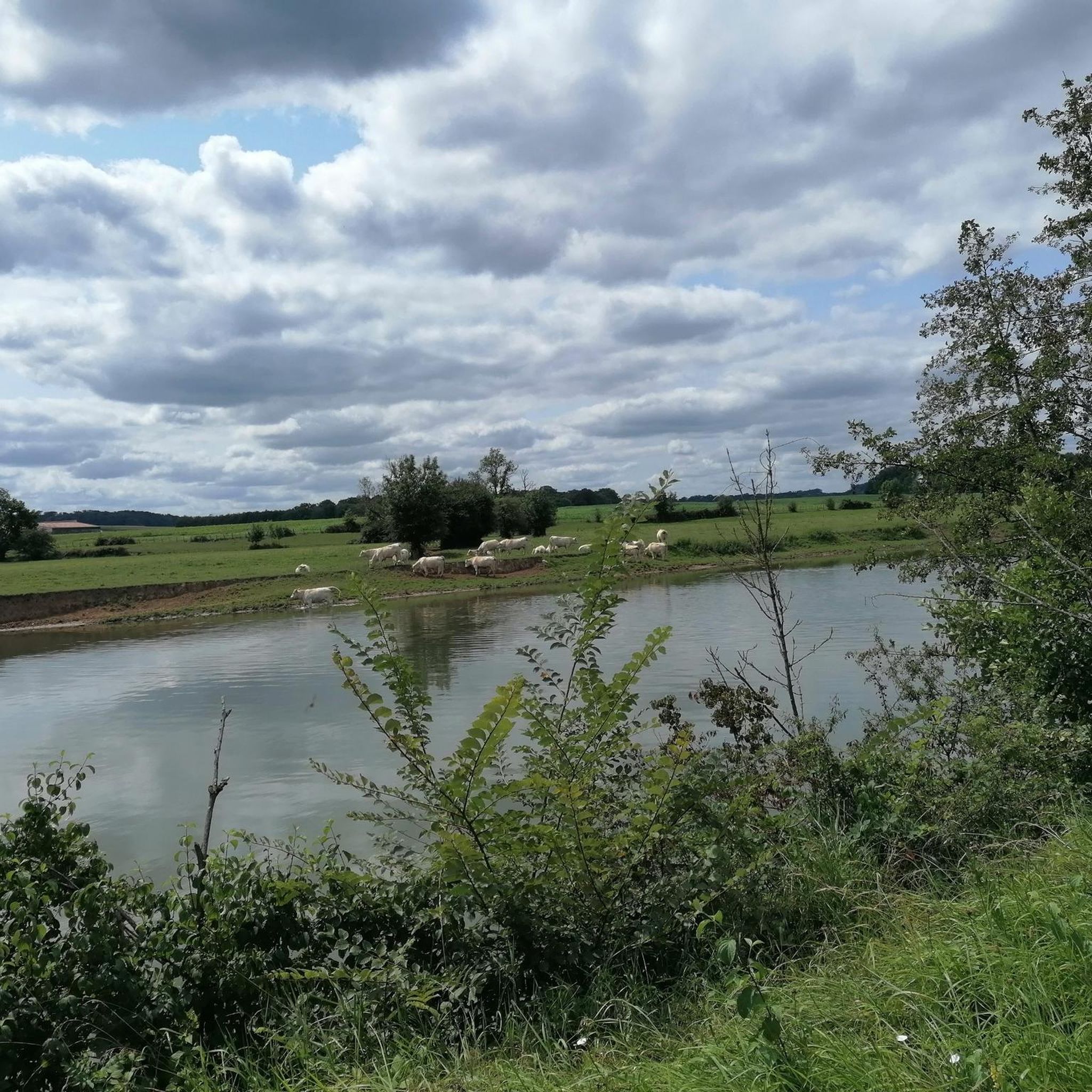
The Saône is a river that flows through Burgundy and Franche-Comté. It is a major tributary of the Rhône and a popular spot for water sports, fishing and boat trips
10
4
The highlight here is taken from the resting point above the exit. There is also a table here.
11
4


The Savoyeux tunnel was built during the July Monarchy, in 1837. It facilitates navigation on the Saône. The dimensions of the work are impressive: 642.5 meters long, and only 6.55 meters wide. It passes under the hill and makes it possible to cut a meander in the river, and to avoid a dam located a little higher up.
0
0
The Tunnel de Savoyeux is an underground canal that diverts the Saône between two of its meanders near Savoyeux, in Haute-Saône, in France. It was completed in 1843 and made it possible to sail the small Saône to the Saône. It is 642.5 meters long and 6.55 meters wide. It has no path for pulling the boats, so the skippers had to pull the boats with chains attached to the walls of the tunnel. It also has a lock at the end of the tunnel
10
4
The Tunnel de Savoyeux is an underground canal that diverts the Saône between two of its meanders near Savoyeux, in Haute-Saône, France. It was completed in 1843 and made it possible to sail the small Saône to the Saône. It is 642.5 meters long and 6.55 meters wide. It has no path for pulling the boats, so the skippers had to pull the boats with chains attached to the walls of the tunnel. It also has a lock at the end of the tunnel
12
4

Locked diversion of the Saône built in two stages, in 1840 and 1880. This reach is one of the areas developed to make the Saône navigable.
0
0

This dam has a fixed part and a mobile part each measuring about fifty meters long. This structure was completely overhauled in 2014 after six years of work. Thus, the original dam dating from the 1840s was equipped with a fish pass and a footbridge on which pedestrians and cyclists can circulate to cross the watercourse.
1
0
Frequently Asked Questions
How many mountain bike trails are there around Noiron?
There are over 20 mountain bike trails around Noiron, offering a variety of experiences. The region, part of the Haute-Saône department, is known for its diverse terrain including deep forests, flower-filled valleys, and plateaus.
What are the difficulty levels of mountain bike trails around Noiron?
The trails around Noiron cater to various skill levels. You'll find a good mix with 9 easy routes and 11 moderate routes. Currently, there are no difficult routes listed directly in Noiron, but the broader Haute-Saône region offers more challenging options, particularly in areas like the Monts de Gy Mountain Bike Base.
Are there any circular mountain bike trails in the Noiron area?
Yes, many of the trails around Noiron are designed as loops, allowing you to start and finish at the same point. For example, you could try the Savoyeux Tunnel – Savoyeux Tunnel loop from Gray, which is a moderate 32.2-mile ride, or the easier Apremont Dam loop from Germigney.
What do other mountain bikers enjoy most about mountain biking in Noiron?
The mountain bike trails around Noiron are highly rated by the komoot community, with an average score of 4.4 stars from more than 20 reviews. Riders often praise the varied terrain, which includes river paths, forest tracks, and scenic views, especially around natural features like the Apremont Dam.
Are there family-friendly mountain bike trails in Noiron?
Yes, the area offers several family-friendly options, particularly among the 9 easy routes available. These trails often feature gentler paths through the countryside, such as the Apremont Dam loop from Germigney, which provides scenic views suitable for a relaxed ride.
What can I see along the mountain bike trails around Noiron?
Many routes offer views of the region's natural beauty, including the Ognon and Saône rivers. You can also encounter interesting landmarks like the Pont de Pierre of Gray or the Apremont Dam. The broader Haute-Saône region is also home to the unique Plateau des 1000 Étangs, known for its numerous small lakes.
Is there parking available for mountain biking in Noiron?
While specific parking areas for mountain biking in Noiron are not detailed, routes often start from towns like Gray or Germigney, where public parking facilities are generally available. It's advisable to check local parking options for your chosen starting point.
Can I access mountain bike trails around Noiron by public transport?
Public transport options directly to trailheads in smaller villages like Noiron might be limited. However, larger towns in the vicinity, such as Gray, may offer better public transport connections, from which you can then access routes like the Pont de Pierre of Gray – Gray loop.
What is the best time of year for mountain biking in Noiron?
The region's diverse landscapes, with forests and valleys, are enjoyable throughout the warmer months. Spring and autumn offer pleasant temperatures and beautiful scenery, with spring bringing flower-filled valleys and autumn showcasing vibrant foliage. Summer is also suitable, but it's always wise to check local weather conditions.
Are there options for longer mountain bike routes near Noiron?
Yes, if you're looking for longer rides, there are several options. The Savoyeux Tunnel – Savoyeux Tunnel loop from Gray covers over 32 miles (51 km). The broader Haute-Saône department also features extensive networks, including the 'Grand tour des Monts de Gy' which can be up to 45 km.
Are there cafes or accommodation options near the mountain bike trails?
While Noiron itself is a smaller community, nearby towns like Gray, which serve as starting points for several routes, offer a range of amenities including cafes, restaurants, and accommodation. The Haute-Saône region generally provides options for visitors, from charming villages to larger towns.
Where can I find more information about mountain biking in the Haute-Saône region?
For more detailed information about mountain biking and other outdoor activities in the Haute-Saône department, you can visit the official tourism website. They provide insights into various routes and bases, such as the Monts de Gy Mountain Bike Base. You can find more details at hautesaonetourisme.com.
Most popular attractions around Noiron

Get inspired with the komoot mobile app


Explore more
Browse the best MTB trails in other regions.
