The best running trails around Saint-Régis-Du-Coin
4.5
(75)
3,301
runners
22
runs
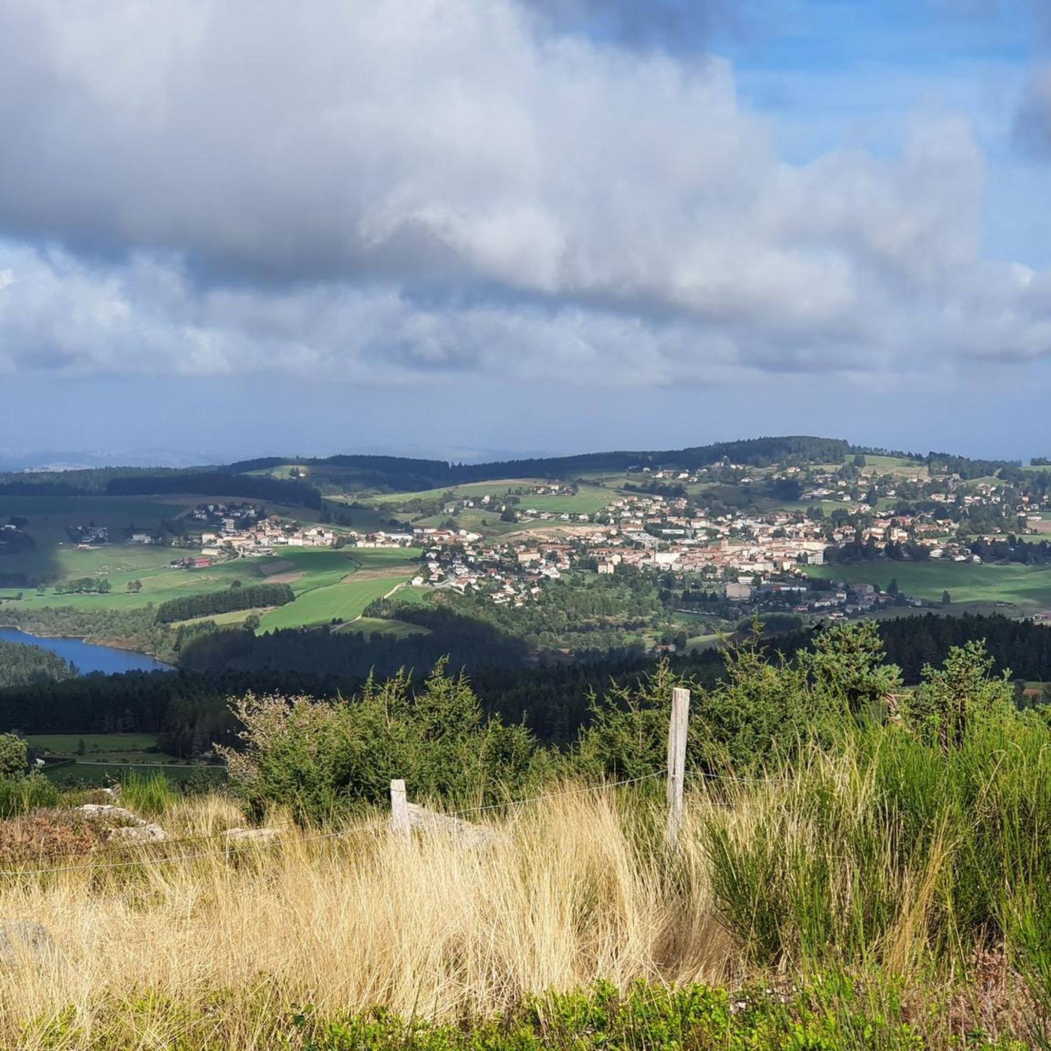
Jogging around Saint-Régis-Du-Coin offers access to varied mid-mountain terrain within the Pilat Regional Natural Park. The area, situated at an altitude of approximately 1071 meters, features a dedicated trail pole with marked routes. Joggers can explore diverse landscapes including forests, agricultural areas, and significant natural features like the Tourbière de Gimel and Étangs de Prélager. This region provides a natural setting for running, with trails that offer both technical and rolling sections.
Best jogging routes around Saint-Régis-Du-Coin
- The most popular…
Last updated: July 13, 2026
5.0
(3)
118
runners
15.8km
02:01
400m
400m
Hard run. Very good fitness required. Mostly paved surfaces. Suitable for all skill levels.
55
runners
19.5km
02:27
470m
470m
Hard run. Very good fitness required. Mostly paved surfaces. Suitable for all skill levels.

Sign up for free
43
runners
Hard run. Very good fitness required. Mostly paved surfaces. Suitable for all skill levels.
35
runners
13.8km
01:46
350m
350m
Hard run. Very good fitness required. Mostly paved surfaces. Suitable for all skill levels.
35
runners
Hard run. Very good fitness required. Mostly paved surfaces. Suitable for all skill levels.
Get access to more routes and recommendations from other explorers.
Sign up for free
Already have an account?
Our route recommendations are based on thousands of hikes, rides, and runs completed by other people on komoot.
Start today with a free account
Your next adventure awaits.
Login or Signup

Other adventures around Saint-Régis-Du-Coin

Tips from the Community

Interview with the Alps at the level of the megalithic remains.
0
0

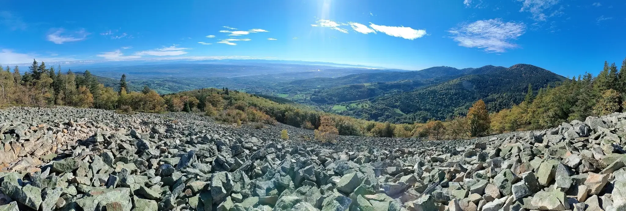
This megalithic site is known as Gnaorou. This name does not appear on IGN maps. It is a word from the local dialect, meaning “in the clouds”. The place offers a magnificent panorama of the Alps.
0
0
The Gimel peat bog is located at an altitude of 1,200 meters. It is one of the sources of the Dunerette. The marsh forms a bulge and contains a mosaic of plant groups. It has the particularity of having never been exploited for its peat.
0
0
Crêt de Chaussître is located at the southern end of Pilat. It offers a beautiful panorama of the Monts du Velay, Mont Mezenc, the Yssingeaux juices and the high plateaus of Forez.
0
0

By mountain bike, the northern accesses are difficult, large stones, very technical. Access by chemin du Teil easier but steep and partly paved. My favorite access is through the east in the woods from Prélager (before arriving at the picnic area, take the small grassy path on the left which descends slightly)
0
0
Path laid out in wood, accessible to strollers.
1
0

A primitive lake transformed into a bog over the years, colonized by mosses and vegetation. The best known and surely the most beautiful of the Pilat Regional Natural Park.
1
0
Frequently Asked Questions
How many running routes are available around Saint-Régis-Du-Coin?
There are over 15 dedicated running routes in the Saint-Régis-Du-Coin area, catering to various fitness levels. The region is part of the Pilat Regional Natural Park and features a dedicated trail pole with marked routes for trail running, Nordic walking, and canicross.
Are there any easy or moderate running trails suitable for beginners or families?
While many routes in Saint-Régis-Du-Coin are rated as difficult due to the mid-mountain terrain, there are also moderate options. For example, the Running loop from Saint-Régis-du-Coin is a moderate 9.7 km trail that offers a good introduction to the area's landscapes without extreme elevation gains. The dedicated trail pole also offers routes like 'La Glacière', a 6.8 km loop with 100m elevation, suitable for a gentler pace.
What kind of landscapes and views can I expect on the jogging routes?
Jogging routes in Saint-Régis-Du-Coin offer diverse landscapes, including forests, agricultural areas, and significant natural features. You can enjoy exceptional panoramic views from high points like the Crêt de Chaussître, offering vistas over Yssingelais, Le Forez, and the Haute Loire. The Crêt de Chaussître – Chaussitre Cross loop from Saint-Régis-du-Coin is a great option for scenic views.
Are there any dog-friendly running routes in Saint-Régis-Du-Coin?
Yes, Saint-Régis-Du-Coin is known for its outdoor activities, including canicross, which is running with dogs. The dedicated trail pole offers specific routes suitable for this, such as 'La Glacière', a 6.8 km loop. Many of the natural trails within the Pilat Regional Natural Park are generally welcoming to dogs, but always ensure they are kept on a leash and that you respect local regulations and wildlife.
What are some notable natural attractions or landmarks to see while running?
You can encounter several remarkable natural features and landmarks. The Tourbière de Gimel, a protected Natura 2000 site, offers a unique wetland environment with a wooden boardwalk. The Étangs de Prélager are also significant wetlands that can be integrated into routes. For panoramic views, head towards the Crêt de Chaussître or the Table d'orientation de Panère, the commune's highest point.
Are there circular running routes available?
Yes, many of the running routes in Saint-Régis-Du-Coin are designed as circular loops, allowing you to start and finish in the same location. Examples include the Chaussitre Cross loop from Saint-Régis-du-Coin and the Croix des Confins – Le Gnaorou loop from Réserve biologique dirigée de Chaussitre et Gimel, which are popular choices among local runners.
What is the best time of year to go running in Saint-Régis-Du-Coin?
The mid-mountain terrain of Saint-Régis-Du-Coin makes spring, summer, and autumn ideal for running. During these seasons, you can fully enjoy the diverse landscapes and panoramic views. While winter running is possible, be prepared for colder temperatures and potentially snowy or icy conditions, especially at higher altitudes. The dedicated trail pole provides an inviting reception area with changing rooms and showers, which can be useful year-round.
Are there facilities like parking or changing rooms for runners?
Yes, Saint-Régis-Du-Coin, as a 'Village Sport Nature', offers dedicated facilities for outdoor enthusiasts. The trail pole provides an inviting reception area with changing rooms and showers, enhancing the running experience. Parking is generally available near the starting points of the marked routes.
What do other runners say about the trails in Saint-Régis-Du-Coin?
The running routes in Saint-Régis-Du-Coin are highly rated by the komoot community, with an average score of 4.5 stars from over 80 reviews. Runners often praise the varied terrain, the immediate immersion in nature, and the exceptional panoramic views from points like the Crêt de Chaussitre. The presence of both technical and rolling sections is also frequently highlighted as a great training ground.
Can I find routes that offer a good challenge for experienced trail runners?
Absolutely. Saint-Régis-Du-Coin's mid-mountain terrain and dedicated trail networks provide excellent challenges for experienced trail runners. Many routes are rated as difficult, featuring significant elevation gains and diverse surfaces. The Croix des Confins – Le Gnaorou loop from Réserve biologique dirigée de Chaussitre et Gimel, for instance, is a challenging 27.6 km trail with nearly 1000m of elevation gain, offering a substantial workout.
Are there any specific routes that offer views of the Alps or Vercors?
Yes, for breathtaking panoramic views, you should aim for the higher points in the area. The Table d'orientation de Panère, the commune's highest point at 1301 meters, offers exceptional views of the Southern Pilat, the Alps, and the Vercors. While not a specific route, integrating this viewpoint into your run will reward you with stunning vistas.
What is the typical duration for a running route in this region?
The duration of running routes in Saint-Régis-Du-Coin varies significantly depending on the distance and difficulty. For example, a moderate 9.7 km route like the Running loop from Saint-Régis-du-Coin might take around 1 hour 10 minutes. More challenging routes, such as the 19.5 km Chaussitre Cross loop from Saint-Régis-du-Coin, typically require around 2 hours 30 minutes, while longer, difficult trails can take over 3 hours 40 minutes.
Most popular routes around Saint-Régis-Du-Coin
Most popular attractions around Saint-Régis-Du-Coin

Get inspired with the komoot mobile app


Explore more
Browse the best Running Trails & Routes in other regions.
