Saint-Jacques-En-Valgodemard
Saint-Jacques-En-Valgodemard
The best road cycling routes around Saint-Jacques-En-Valgodemard
4.6
(70)
1,800
riders
38
rides
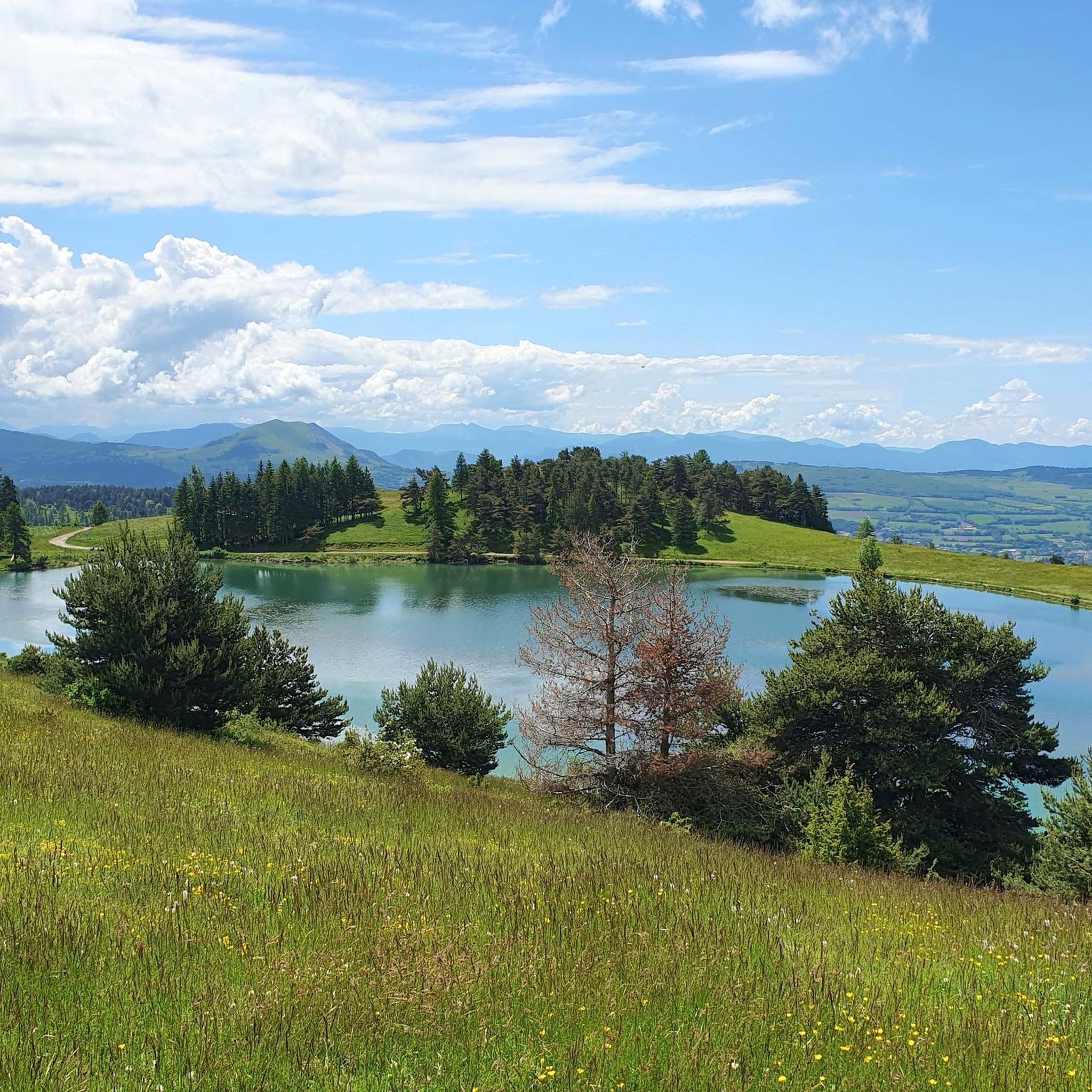
Road cycling routes around Saint-Jacques-En-Valgodemard are set within the dramatic mountainous landscapes of the Hautes-Alpes, characterized by significant elevation changes and deep valleys. The region, often referred to as "the Himalaya of the Alps," features grand mountains with peaks exceeding 3,000 meters and is carved by the Séveraisse river. Cyclists navigate roads winding through these alpine environments, offering challenging climbs and rewarding descents, with access to the diverse terrain of the Écrins National Park.
Best road cycling routes in Saint-Jacques-En-Valgodemard
- The most popular road cycling route is Gioberney Climb, a 31.6 miles (50.8 km) trail that takes 2 hours 35 minutes to complete. This route features substantial elevation gain through alpine scenery.
- Another top favourite among local road cyclists is Champoleon valley – View of the Écrins Mountains loop from La Motte-en-Champsaur, a difficult 35.2 miles (56.7 km) path. This route offers expansive views of the Écrins Mountains.
- Local road cyclists also love the Corps – Sanctuary of La Salette loop from Saint-Firmin, a 31.0 miles (49.9 km) trail leading through varied mountain terrain, often completed in about 3 hours 15 minutes.
- Road cycling around Saint-Jacques-En-Valgodemard is defined by deep glacial valleys, high alpine peaks, and the rugged terrain of the Écrins National Park. The network offers options for various ability levels, from moderate climbs to difficult, sustained ascents.
- The routes in Saint-Jacques-En-Valgodemard are highly rated by the komoot community with an average score of 4.4 stars from over 60 reviews. More than 1800 road cyclists have used komoot to explore Saint-Jacques-En-Valgodemard's varied terrain.
Last updated: July 1, 2026
4.7
(3)
59
riders
50.8km
02:35
860m
860m
Moderate road ride. Good fitness required. Mostly well-paved surfaces and easy to ride.
4.5
(2)
61
riders
45.2km
02:18
660m
650m
Moderate road ride. Good fitness required. Some segments of this route may be unpaved and difficult to ride.

Sign up for free
4.5
(2)
132
riders
74.2km
03:45
1,050m
1,050m
Hard road ride. Very good fitness required. Some segments of this route may be unpaved and difficult to ride.
4.7
(3)
74
riders
49.9km
03:08
1,420m
1,420m
Hard road ride. Very good fitness required. Mostly well-paved surfaces and easy to ride.
4.5
(4)
42
riders
60.9km
03:09
1,070m
1,070m
Hard road ride. Very good fitness required. Mostly well-paved surfaces and easy to ride.
Get access to more routes and recommendations from other explorers.
Sign up for free
Already have an account?
Our route recommendations are based on thousands of hikes, rides, and runs completed by other people on komoot.
Start today with a free account
Your next adventure awaits.
Login or Signup
Other adventures around Saint-Jacques-En-Valgodemard

Tips from the Community

coffee, tea, pastries, cakes, ice cream, toilets, water and a warm welcome
0
0


Very popular sanctuary in summer, accommodation available
0
0

By bike it's a beautiful climb without too many people (worth seeing in summer anyway) with superb open landscapes
0
0

Very nice and well known climb with beautiful scenery.
0
0

A valley with very little traffic surrounded by pine forests.
26
0
Village Isere, on the Route Napoleon, Corps takes place in the heart of the Dauphiné, eighty kilometers from Grenoble. This ancient medieval town is located on the border of the Hautes-Alpes, in the southern Alps, about 40 km from Gap and close to Saint-Firmin, Aspres-lès-Corps and Ambel.
28
0
The river is formed by the confluence of the Drac Noir and Drac Blanc streams which originate in the western part of the Massif des Écrins.
30
0
Frequently Asked Questions
How many road cycling routes are available around Saint-Jacques-En-Valgodemard?
There are over 40 road cycling routes available in the Saint-Jacques-En-Valgodemard area. These routes vary significantly in difficulty, offering options for different skill levels.
What are the typical difficulty levels for road cycling in this region?
The road cycling routes around Saint-Jacques-En-Valgodemard are predominantly moderate to difficult, reflecting the region's mountainous terrain. You'll find 2 easy routes, 21 moderate routes, and 17 difficult routes, characterized by significant elevation changes and challenging climbs.
When is the best time of year for road cycling in the Valgaudemar valley?
The best time for road cycling in the Valgaudemar valley is generally from late spring through early autumn. During these months, the weather is more stable, and mountain passes are typically clear of snow, allowing access to the full range of routes and breathtaking alpine scenery.
Are there challenging road cycling routes for experienced cyclists?
Yes, the region is known for its challenging terrain, often referred to as 'the Himalaya of the Alps.' Routes like the Champoleon valley – View of the Écrins Mountains loop from La Motte-en-Champsaur and the Corps – Sanctuary of La Salette loop from Saint-Firmin offer substantial elevation gains and demanding ascents, perfect for experienced riders seeking a test of endurance.
What natural features or landmarks can I see along the road cycling routes?
The routes offer stunning views of the Valgaudemar Valley, the Écrins National Park, and majestic peaks over 3,000 meters. You can also encounter beautiful natural sites such as the Lacs de Pétarel and various mountain passes like the famous Col du Noyer (1664 m), which provides panoramic vistas.
Are there any routes that pass by waterfalls?
While specific routes are not highlighted for waterfalls, the Valgaudemar valley is known for its numerous waterfalls and mountain streams. Notable examples include the impressive 'Voile de la Mariée' (Bride's Veil) waterfall near the Gioberney chalet, and others like Casset and Combefroide, which are often accessible from the main valley roads.
What do other road cyclists enjoy most about road cycling in Saint-Jacques-En-Valgodemard?
The area is highly rated by the komoot community, with an average score of 4.4 stars from over 60 reviews. Cyclists frequently praise the dramatic alpine scenery, the challenging climbs, and the sense of accomplishment from navigating the deep glacial valleys and high mountain passes.
Are there any easy or beginner-friendly road cycling routes?
While the region is generally challenging, there are a couple of easier routes available. These typically feature less extreme elevation changes, offering a gentler introduction to road cycling in the Valgaudemar valley. For example, the Gioberney Climb is rated moderate, but its initial sections are more accessible.
Can I find circular road cycling routes in the area?
Yes, many of the routes are designed as loops, allowing you to start and finish in the same location. Examples include the Saint-Bonnet-en-Champsaur – Chaillol 1600 loop from La Motte-en-Champsaur and the Villar-Loubière – The Chapel of Valgaudemar loop from Aspres-lès-Corps, which offer varied terrain and scenic returns.
What are the options for parking or public transport access for road cycling routes?
Specific parking areas are often available in villages and near trailheads throughout the Valgaudemar valley. Public transport options are more limited in this mountainous region, so planning your route with a starting point accessible by car is generally recommended. Always check local information for current parking regulations and availability.
Are there any historic or cultural points of interest along the routes?
Beyond the natural beauty, you can explore picturesque villages and hamlets like Villar-Loubière with its traditional architecture. The historic Canal des Herbeys, completed in 1773, also offers pleasant paths along its route, featuring bridges and aqueducts, providing a glimpse into the region's past.
Most popular routes around Saint-Jacques-En-Valgodemard
Most popular attractions around Saint-Jacques-En-Valgodemard

Get inspired with the komoot mobile app


Explore more
Browse the best Road cycling routes in other regions.
