The best cycling routes around Erlenbach
4.4
(1251)
10,064
riders
289
rides
Touring cycling around Erlenbach offers a diverse landscape with varied terrain suitable for different skill levels. The region features a mix of rolling hills, valleys, and more challenging ascents, providing a range of experiences for cyclists. Elevation changes are common, with some routes featuring significant climbs, while others offer gentler gradients.
Best touring cycling routes around Erlenbach
- The most popular touring cycling route is Bike loop from Villé, a 15.0 miles (24.1 km) trail that takes 1 hour 36…
Last updated: July 5, 2026
4.5
(8)
85
riders
Moderate bike ride. Good fitness required. Mostly paved surfaces. Suitable for all skill levels.
4.8
(23)
73
riders
29.3km
01:56
200m
200m
Moderate bike ride. Good fitness required. Mostly paved surfaces. Suitable for all skill levels.

Sign up for free
4.5
(4)
88
riders
62.2km
04:50
1,690m
1,690m
Hard bike ride. Very good fitness required. Mostly paved surfaces. Suitable for all skill levels.
5.0
(5)
19
riders
46.9km
03:33
1,080m
1,080m
Hard bike ride. Very good fitness required. Mostly paved surfaces. Suitable for all skill levels.
16
riders
40.4km
03:47
1,020m
1,020m
Hard bike ride. Very good fitness required. Mostly paved surfaces. Suitable for all skill levels.
Get access to more routes and recommendations from other explorers.
Sign up for free
Already have an account?
Our route recommendations are based on thousands of hikes, rides, and runs completed by other people on komoot.
Start today with a free account
Your next adventure awaits.
Login or Signup

Tips from the Community

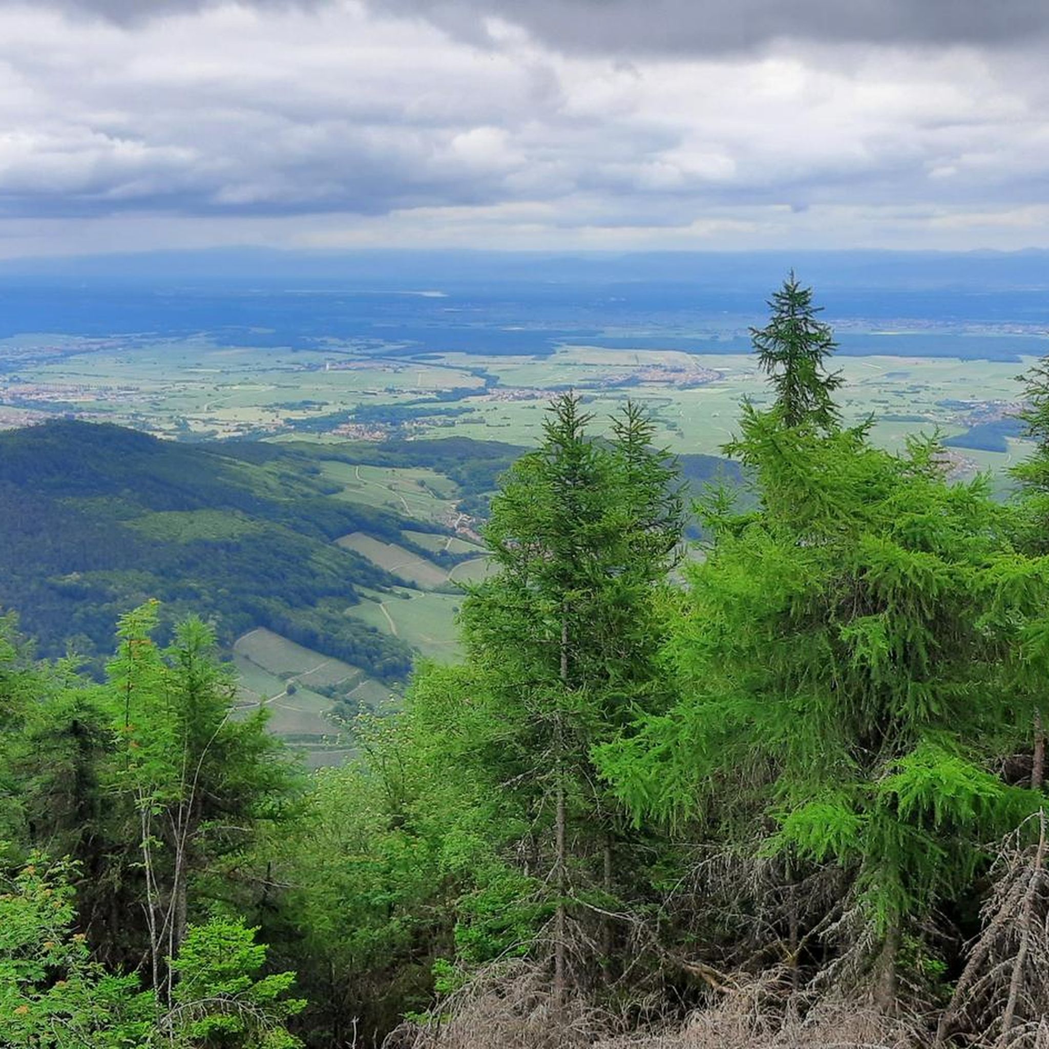
The Champ du Feu, at 1099 meters, is the highest mountain in the Bas-Rhin department in the Vosges in Alsace. It is located between the towns of Belmont and Le Hohwald and consists of a vast plateau with forests, meadows, and moorlands. The area is a popular nature and recreational area. In summer, it is mainly used for hiking, mountain biking, and nature observation. In winter, there is a small ski area with cross-country trails and simple slopes for winter sports. From the Champ du Feu, the La Serva stream originates, which later forms the Cascade de la Serva. In clear weather, the summit offers wide views over the Vosges, the Rhine plain, and even the Black Forest. The area is particularly known for its quiet nature, high moors, sunrises and starry skies, as well as well-marked hiking trails.
0
0

Beautiful little village on the way to Santiago de Compostela coming from Germany.
0
0


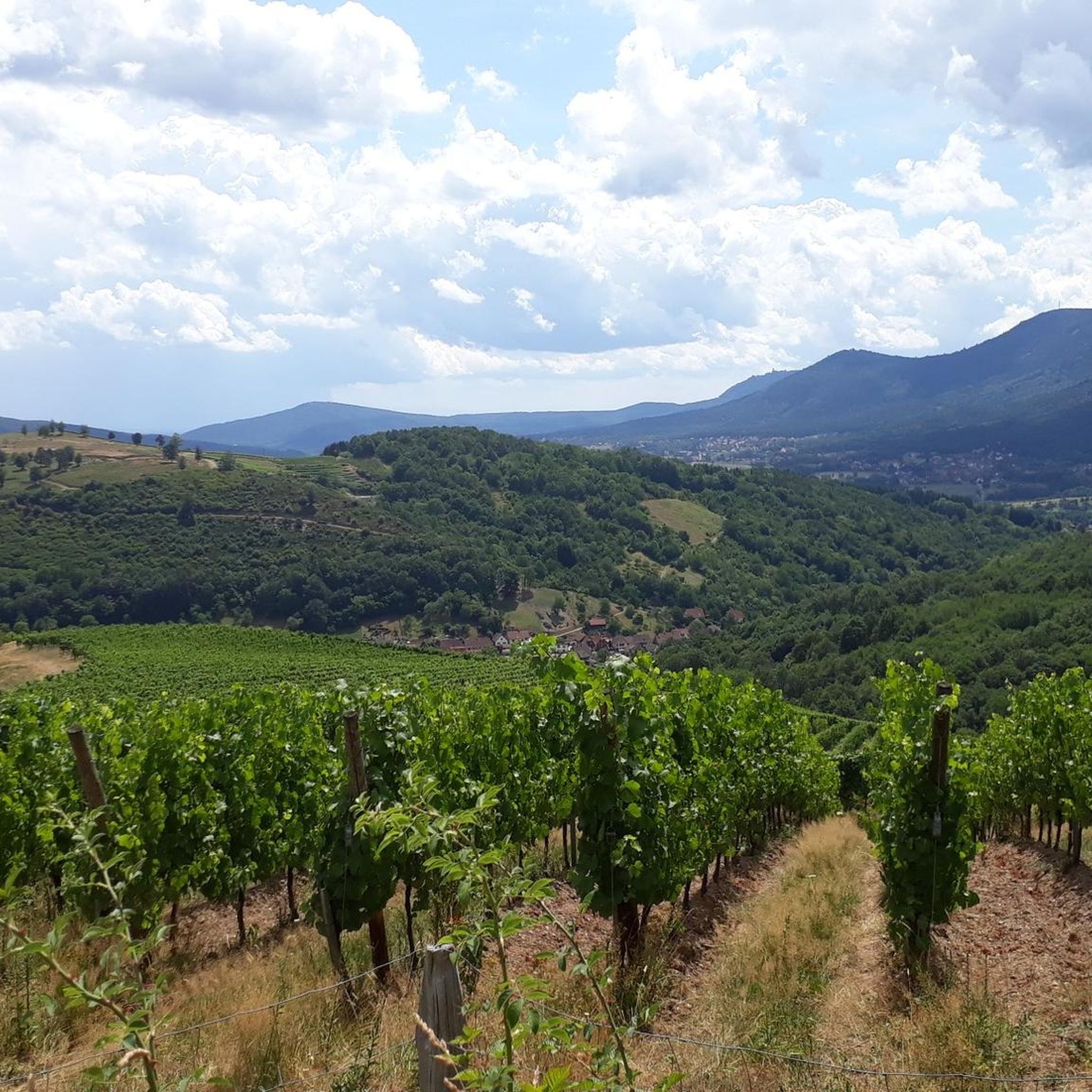
Taennelkreuz Chapel is located in the middle of the vineyards at an elevation of 208 meters. This chapel was built in 1905 and dedicated to the Holy Cross on September 23, 1906. With a cruciform floor plan and a neo-Gothic style, it is located in the middle of the vineyard at the foot of the Rittersberg.
6
0

Magnificent pass to climb from different slopes (Breitenbach, Steige, Vallée de la Bruche, Andlau). It is also a crossing point towards the Champ du feu, the Hohwald, the Mont Ste Odile.
0
0

The route is completely paved and essentially car-free, as signs prohibit it. Nevertheless, someone occasionally drives along here. The route is very pleasant and beautiful, tucked away in the forest.
0
0
A short spiritual break on the climb to the Ortenbourg and Ramstein castles from Scherwiller 67.
0
0
Frequently Asked Questions
How many touring cycling routes are available around Erlenbach?
There are over 280 touring cycling routes in the Erlenbach region, catering to a wide range of skill levels and preferences. You'll find everything from easy loops to challenging mountain passes.
Are there easy touring cycling routes suitable for beginners or families?
Yes, Erlenbach offers a good selection of easy routes. There are 58 routes classified as easy. A great option for a gentle ride is the Bike loop from Villé, which is 15.0 miles (24.1 km) long with minimal elevation gain.
What are some challenging touring cycling routes in the Erlenbach area?
For experienced cyclists seeking a challenge, the region features 134 difficult routes with significant climbs. Consider the Charbonnière Pass – Champ du Feu loop from Saint-Martin, a demanding 32.7 miles (52.6 km) trail with over 1000 meters of elevation gain, or the Climont – Urbeis Pass loop from Saint-Martin, which is similarly challenging.
Are there circular touring cycling routes available?
Many of the touring cycling routes around Erlenbach are designed as loops, allowing you to start and end at the same point. Examples include the easy Bike loop from Villé and the more moderate Col de Steige – View of Steige loop from Saint-Martin.
When is the best season to go touring cycling in Erlenbach?
The best time for touring cycling in Erlenbach is typically from spring through autumn (April to October). During these months, the weather is generally mild, and the landscapes are vibrant. Summer offers the warmest temperatures, while spring and autumn provide pleasant conditions with fewer crowds and beautiful foliage.
What kind of terrain can I expect on touring cycling routes in Erlenbach?
The Erlenbach region offers highly varied terrain. You'll encounter rolling hills, scenic valleys, and challenging mountain passes. Some routes feature gentle gradients, while others include significant ascents and descents, providing diverse experiences for all skill levels.
How do other touring cyclists rate the routes in Erlenbach?
The touring cycling routes in Erlenbach are highly regarded by the komoot community, holding an average rating of 4.3 stars from over 1000 reviews. Cyclists often praise the diverse landscapes, well-maintained paths, and the variety of options for different fitness levels.
Are there routes with scenic viewpoints?
Yes, many routes in the Erlenbach region offer stunning scenic viewpoints, especially those that traverse higher elevations or mountain passes. The Col de Steige – View of Steige loop from Saint-Martin is known for its scenic vistas.
Can I find less crowded touring cycling routes in Erlenbach?
While popular routes can see more traffic, Erlenbach's extensive network of over 280 routes means it's possible to find quieter paths. Exploring some of the moderate or difficult routes, or cycling during off-peak hours and seasons, can lead to a more serene experience.
Are there touring cycling routes that are easily accessible by public transport?
Many towns and villages in the Erlenbach region, including starting points for some routes, are connected by local public transport. It's advisable to check local bus or train schedules for specific route access points to plan your journey effectively.
Where can I find parking for touring cycling routes in Erlenbach?
Parking is generally available in the towns and villages that serve as common starting points for routes, such as Villé or Saint-Martin. Look for designated public parking areas, often near town centers or trailheads. Some smaller villages might have limited options, so planning ahead is recommended.
Most popular routes around Erlenbach
Most popular attractions around Erlenbach

Get inspired with the komoot mobile app


Explore more
Browse the best Cycling routes in other regions.
