The best cycling routes around Meisengott
4.4
(214)
2,177
riders
160
rides
Touring cycling around Meisengott features routes that navigate through a landscape characterized by significant elevation changes, dense forests, and mountain passes. The region's terrain includes both challenging climbs and scenic descents, offering varied experiences for cyclists. Many routes traverse forested areas and connect various passes, indicating a hilly to mountainous environment. This makes Meisengott suitable for touring cyclists seeking routes with notable ascents and descents.
Best touring cycling routes around Meisengott
- The most popular touring cycling route is Bike route…
Last updated: July 5, 2026
16
riders
40.4km
03:47
1,020m
1,020m
Hard bike ride. Very good fitness required. Mostly paved surfaces. Suitable for all skill levels.
5.0
(2)
12
riders
21.6km
01:25
230m
230m
Moderate bike ride. Good fitness required. Mostly paved surfaces. Suitable for all skill levels.

Sign up for free
5.0
(3)
9
riders
65.2km
03:56
350m
350m
Moderate bike ride. Good fitness required. Mostly paved surfaces. Suitable for all skill levels.
5.0
(1)
14
riders
22.6km
02:07
290m
290m
Hard bike ride. Good fitness required. You may need to push your bike for some segments of this route.
5.0
(1)
12
riders
33.4km
02:06
370m
370m
Moderate bike ride. Good fitness required. Mostly paved surfaces. Suitable for all skill levels.
Get access to more routes and recommendations from other explorers.
Sign up for free
Already have an account?
Our route recommendations are based on thousands of hikes, rides, and runs completed by other people on komoot.
Start today with a free account
Your next adventure awaits.
Login or Signup

Tips from the Community

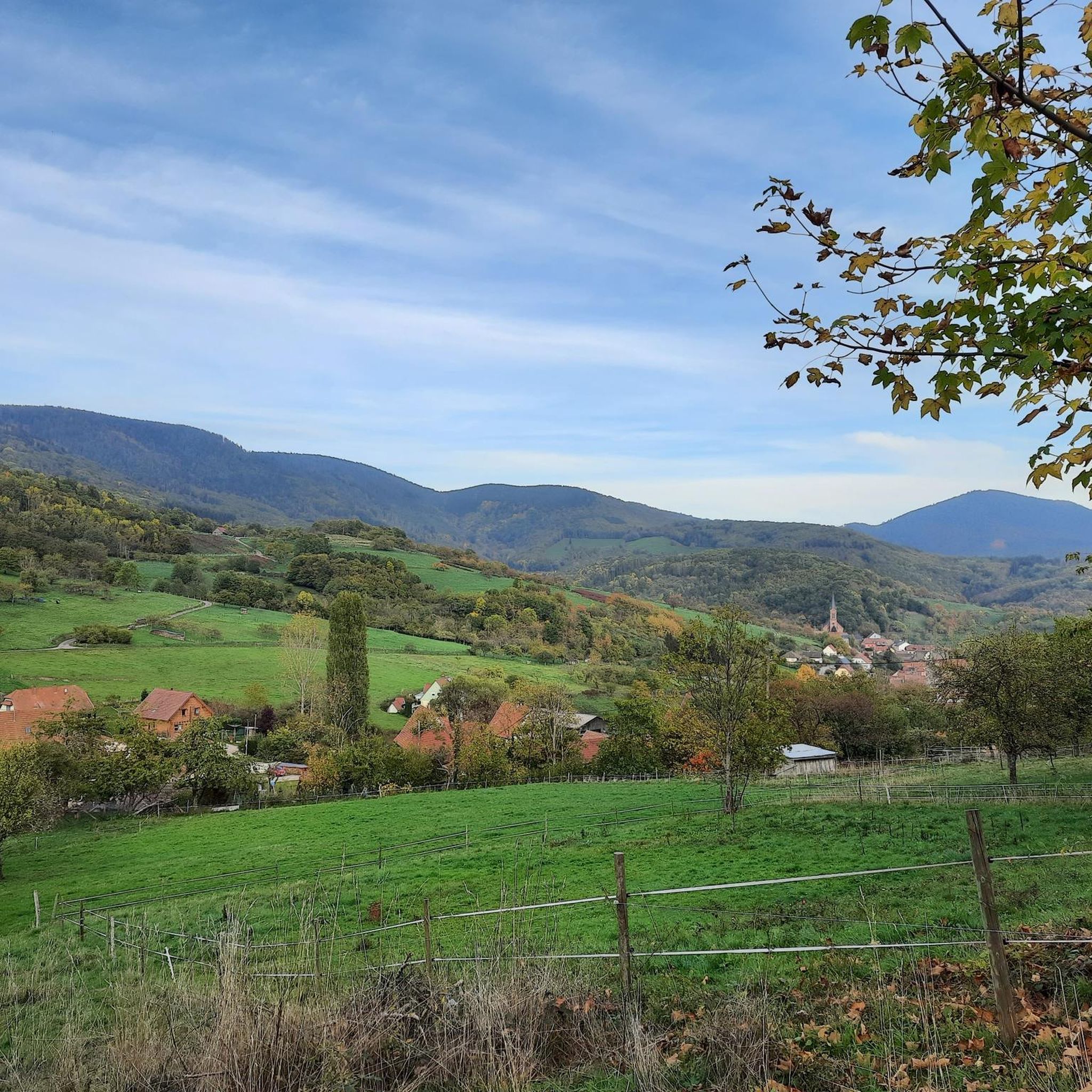
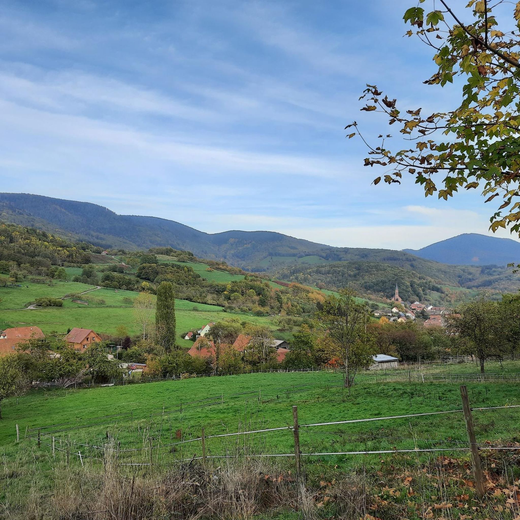
Very nice town center
0
0

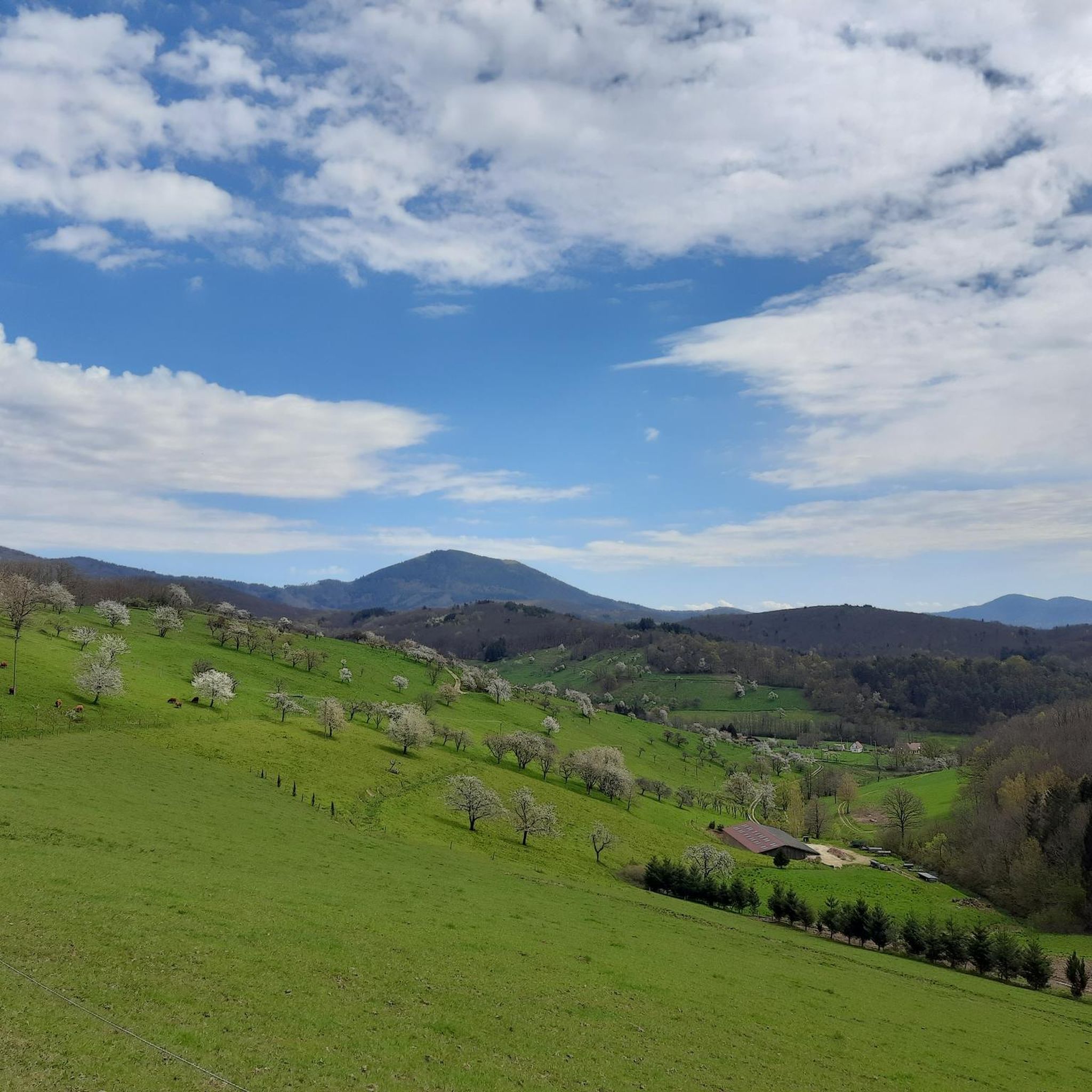
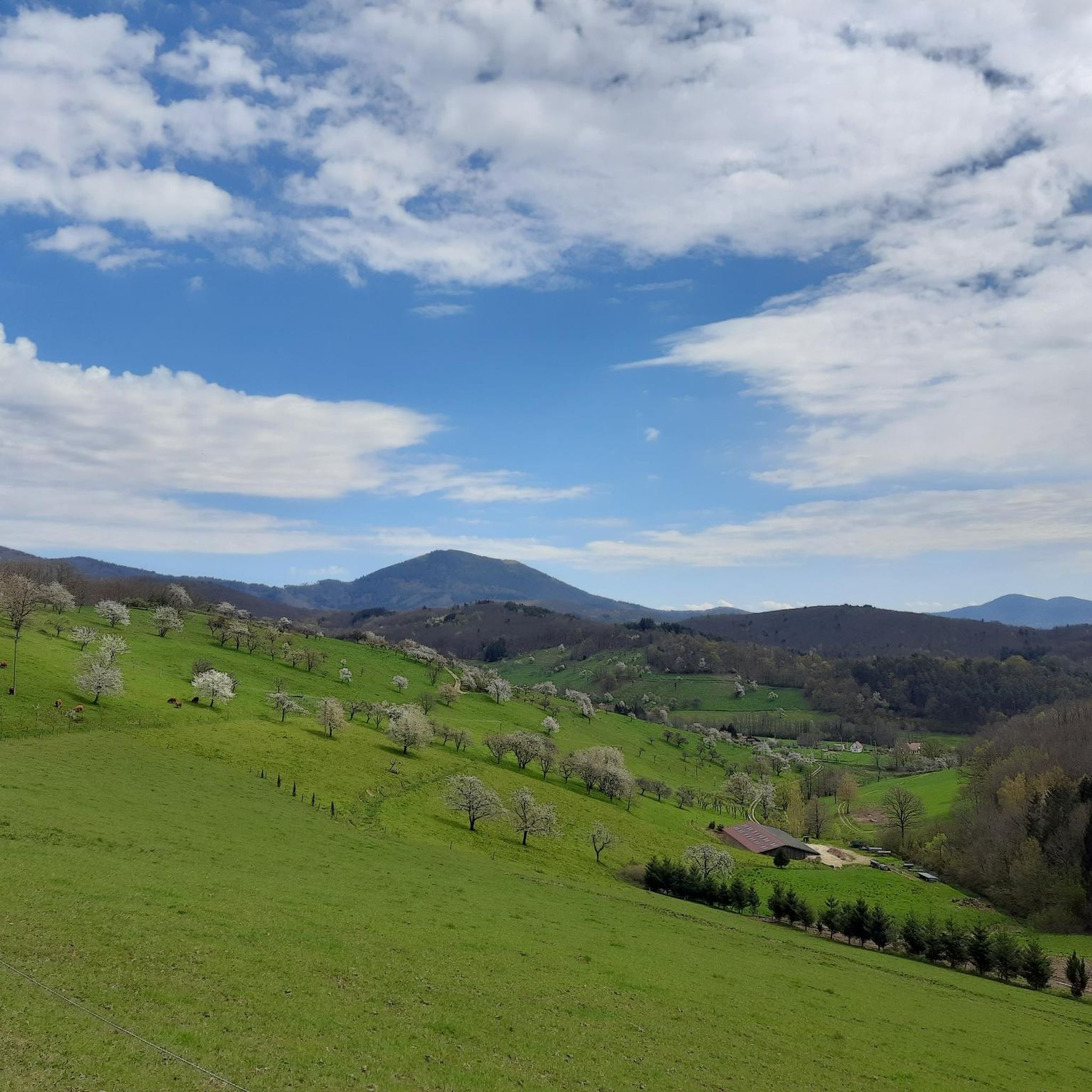
Champ du Feu, at 1099 meters, is the highest mountain in the Bas-Rhin department of the Vosges in Alsace. It is located between the villages of Belmont and Le Hohwald and consists of an extensive high plateau with forests, meadows, and moorlands. The area is a popular nature and recreational area. In summer, it is mainly used for hiking, mountain biking, and nature observation. In winter, there is a small ski resort with cross-country trails and simple slopes for winter sports. The stream La Serva originates from Champ du Feu and later forms the Cascade de la Serva. In clear weather, the summit offers wide views over the Vosges, the Rhine plain, and as far as the Black Forest. The area is particularly known for its tranquil nature, high moors, sunrises and starry skies, as well as well-marked hiking trails.
0
0
Champ du Feu, at 1099 meters, is the highest mountain in the Bas-Rhin department of the Vosges in Alsace. It lies between the towns of Belmont and Le Hohwald and consists of an extensive high plateau with forests, meadows, and moorlands. The area is a popular nature and recreational area. In summer, it is mainly used for hiking, mountain biking, and nature observation. In winter, there is a small ski area with cross-country trails and simple slopes for winter sports. The brook La Serva originates from Champ du Feu, later forming the Cascade de la Serva. In clear weather, the summit offers wide views over the Vosges, the Rhine plain, and as far as the Black Forest. The area is particularly known for its tranquil nature, high moors, sunrises and starry skies, as well as well-marked hiking trails.
0
0
The Champ du Feu, at 1099 meters, is the highest mountain in the Bas-Rhin department in the Vosges in Alsace. It is located between the towns of Belmont and Le Hohwald and consists of a vast plateau with forests, meadows, and moorlands. The area is a popular nature and recreational area. In summer, it is mainly used for hiking, mountain biking, and nature observation. In winter, there is a small ski area with cross-country trails and simple slopes for winter sports. From the Champ du Feu, the La Serva stream originates, which later forms the Cascade de la Serva. In clear weather, the summit offers wide views over the Vosges, the Rhine plain, and even the Black Forest. The area is particularly known for its quiet nature, high moors, sunrises and starry skies, as well as well-marked hiking trails.
0
0


Pretty good description on the Alsace bike tour
1
0

Possible origins of the name: Celtic rituals: It is believed that solstice and sacrificial fires were lit here in Celtic times. Charcoal burners' fire: The "fire" could also refer to the fires lit by charcoal burners in the surrounding forests of the Vosges Mountains. Cattle pasture: A popular theory states that the French word "feu" is a corruption of the German word "Vieh," meaning "field of cattle," as it was a sparsely wooded plateau where cattle could graze. Text from the Internet
1
0
Frequently Asked Questions
How many touring cycling routes are available around Meisengott?
There are over 160 touring cycling routes in the Meisengott region, offering a wide range of experiences from moderate to difficult. The area is known for its significant elevation changes, dense forests, and mountain passes.
Are there any easy touring cycling routes for beginners in Meisengott?
While Meisengott is characterized by challenging terrain, there are 16 routes classified as easy. These routes typically feature less extreme elevation changes, making them suitable for those new to touring cycling or looking for a more relaxed ride.
What are the typical lengths of touring cycling routes in Meisengott?
Route lengths vary significantly. For example, the Bike loop from Saint-Martin is around 13.4 miles (21.6 km), while the Charbonnière Pass – Champ du Feu loop from Saint-Martin extends to 32.7 miles (52.6 km), offering options for different endurance levels.
Are there any circular touring cycling routes in the Meisengott area?
Yes, many routes in Meisengott are designed as loops, allowing you to start and end at the same point. Examples include the Bike route in forest – 20% Gradient Warning Sign loop from Lalaye and the Climont – Urbeis Pass loop from Saint-Martin.
What kind of scenery can I expect on touring cycling routes around Meisengott?
Meisengott's routes primarily traverse dense forests, open landscapes, and mountain passes. You can expect scenic descents and panoramic views from higher elevations. The region's natural beauty is a significant draw for cyclists.
What are some scenic viewpoints or attractions along the touring cycling routes?
The region offers several points of interest. You might encounter the Champ du Feu, a prominent summit, or the historic Hering Tower on Ungersberg. For natural beauty, the Hohwald waterfall is a notable highlight.
Are there any historical landmarks or castles to explore near the routes?
Yes, the area is home to historical sites such as Bernstein Castle and Frankenbourg Castle. These offer interesting detours and a glimpse into the region's past.
What do other touring cyclists say about the routes in Meisengott?
The touring cycling routes in Meisengott are highly regarded by the komoot community, with an average rating of 4.4 stars from over 200 reviews. Cyclists often praise the challenging climbs, rewarding descents, and the immersive experience of cycling through dense forests and mountain passes.
Are there any moderate touring cycling routes for intermediate riders?
Yes, Meisengott offers 47 routes classified as moderate. These routes provide a good balance of challenge and accessibility for intermediate riders. An example is the Col de Steige – View of Steige loop from Saint-Martin, which features varied terrain without the extreme demands of the most difficult trails.
What is the best time of year to go touring cycling in Meisengott?
Given the region's mountain passes and forested terrain, late spring through early autumn (May to October) generally offers the most favorable conditions for touring cycling. During these months, the weather is typically milder, and trails are clear of snow and ice, providing optimal riding experiences.
Are there places to eat or rest along the touring cycling routes?
While specific cafes directly on every route are not listed, the region has establishments like the Rothlach Inn and Charbonnière Pass, which can serve as rest stops or places to refuel. Planning your route with potential stops in mind is advisable.
Most popular routes around Meisengott
Most popular attractions around Meisengott

Get inspired with the komoot mobile app


Explore more
Browse the best Cycling routes in other regions.
