The best running trails around Kolrein
4.1
(46)
2,459
runners
180
runs
Jogging routes around Kolrein navigate a landscape characterized by varied terrain, including significant elevation changes. The region offers a mix of moderate and challenging paths, with many routes featuring substantial climbs. This diverse topography provides opportunities for runners seeking different levels of physical engagement.
Best jogging routes around Kolrein
- The most popular jogging route is Running loop from Saint-Blaise-la-Roche, a 8.0 miles (12.9 km) trail that takes 1 hour 34 minutes to complete. This difficult route features an elevation…
Last updated: May 24, 2026
11
runners
12.9km
01:34
350m
350m
Hard run. Very good fitness required. Mostly paved surfaces. Suitable for all skill levels.
4.0
(2)
4
runners
6.56km
00:49
230m
230m
Moderate run. Good fitness required. Mostly paved surfaces. Suitable for all skill levels.

Sign up for free
6
runners
16.0km
01:58
510m
510m
Hard run. Very good fitness required. Mostly paved surfaces. Suitable for all skill levels.
6
runners
10.8km
01:14
240m
240m
Moderate run. Good fitness required. Mostly paved surfaces. Suitable for all skill levels.
4.0
(1)
5
runners
11.3km
01:15
210m
210m
Moderate run. Good fitness required. Mostly paved surfaces. Suitable for all skill levels.
Get access to more routes and recommendations from other explorers.
Sign up for free
Already have an account?
Our route recommendations are based on thousands of hikes, rides, and runs completed by other people on komoot.
Start today with a free account
Your next adventure awaits.
Login or Signup

Tips from the Community

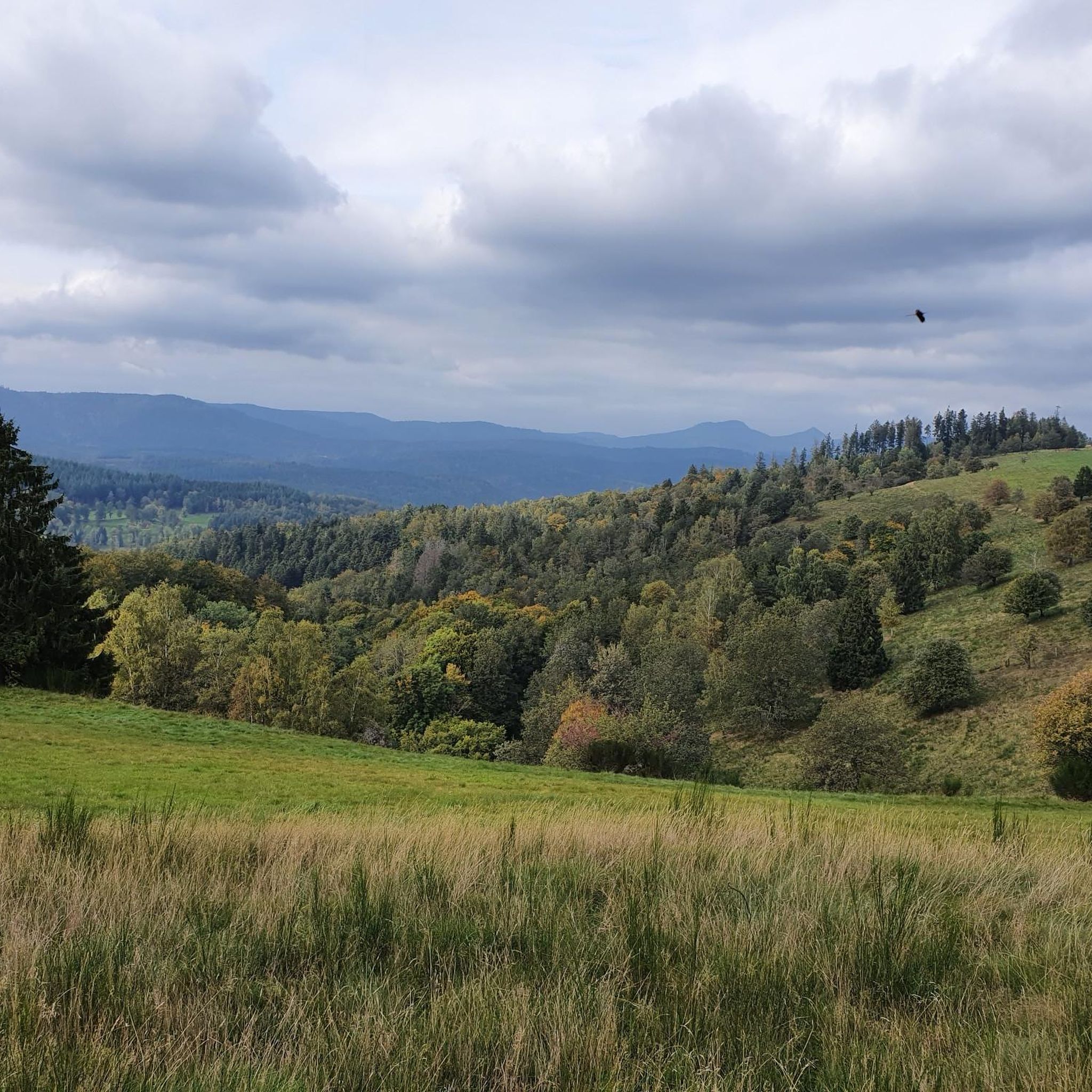
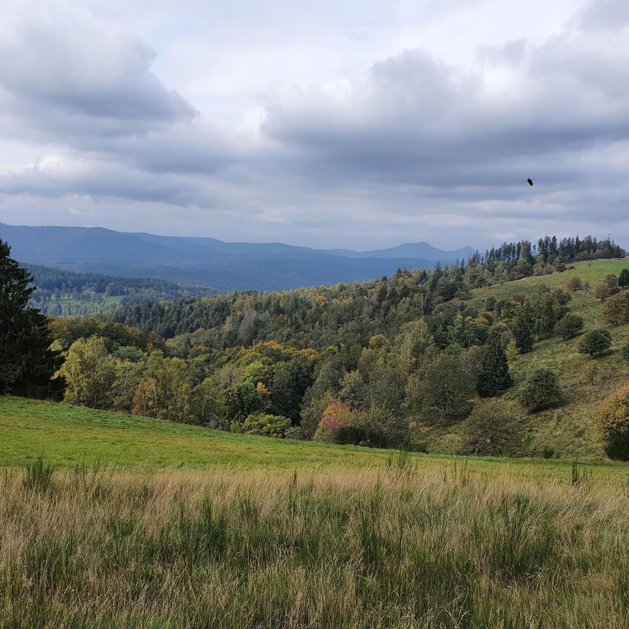
One of my favorite places in the Bruche Valley. Below the Champ du Feu, the vegetation fades to enhance the landscape. You can perfectly observe the Donon and the surrounding peaks in a hilly landscape, especially if you climb Mont Saint-Jean. The place is perfect for a picnic in summer. And for the most gourmet, the Perheux farmhouse inn is only a few meters away.
2
0

Great view of the Bruche valley including the Donon (on the other side of the river); see picture
0
0
Unlike its heavily wooded slope, the western slope of the Champ du Feu massif has magnificent pastures which allow you to appreciate all the beauty of the relief.
0
0

The Col de la Salcée from Bourg-Bruche is 3.3 km long with a total drop of 97 m. The average gradient is 2.9% with maximum gradients of 6.9%.
2
0


One of the most beautiful views of the Bruche valley
1
0

Another small pass that lies between the Col Urbeis and the Col Steige. Depending on which direction you are coming from, you hardly have to climb a lot.
0
0
Frequently Asked Questions
How many running trails are available in Kolrein?
Kolrein offers a wide selection of running routes, with over 170 trails available for you to explore. This includes a diverse range of paths suitable for various fitness levels.
What is the general difficulty level of jogging routes in Kolrein?
Jogging routes in Kolrein are predominantly moderate to difficult. There are 72 moderate trails and 93 difficult trails, making it an ideal destination for runners seeking a challenge. For those looking for a gentler experience, there are also 8 easy routes available.
What do other runners think about the trails in Kolrein?
The running trails in Kolrein are highly regarded by the komoot community, boasting an average rating of 4.3 stars from over 30 reviews. More than 2,400 runners have already used komoot to discover the varied terrain and scenic beauty of the region.
Are there any easy jogging routes in Kolrein?
Yes, Kolrein does offer some easier options for runners. While the region is known for its challenging terrain, there are 8 routes classified as easy, providing a less strenuous experience for beginners or those looking for a relaxed run.
What are some challenging running trails in Kolrein?
For experienced runners seeking a demanding workout, Kolrein has numerous challenging trails. A notable difficult route is the Running loop from Saint-Blaise-la-Roche, which spans 8.0 miles (12.9 km) with over 1,100 feet of elevation gain. Another demanding option is the Col de la Perheux loop from Bellefosse, a 9.9-mile (16.0 km) path featuring over 1,600 feet of ascent.
Are there any circular running routes in Kolrein?
Yes, many of the running routes in Kolrein are circular, offering convenient start and end points. Examples include the Running loop from Saint-Blaise-la-Roche, the Col de la Perheux loop from Bellefosse, and the Running loop from Colroy-la-Roche.
Can I find running routes that pass by waterfalls in Kolrein?
Yes, you can incorporate natural beauty into your run. The Hohwald waterfall is a beautiful natural monument in the region, and you can find routes that pass nearby or offer detours to this scenic spot. Look for trails in the vicinity of Hohwald for this experience.
Are there any scenic viewpoints along the running trails in Kolrein?
Absolutely. Kolrein's hilly terrain means many routes offer stunning vistas. The Champ du Feu, a prominent summit, provides excellent panoramic views and is accessible via several trails. Additionally, mountain passes like Col de la Perheux and Salcée Pass are known for their scenic outlooks.
What kind of natural attractions can I see while running in Kolrein?
Kolrein's running routes are set amidst a rich natural landscape. Besides the Hohwald waterfall and the panoramic views from Champ du Feu, you might encounter other natural monuments like The Big Oak or explore the Protected Natural Area of La Châtaigne Pendue.
Are there any running routes that include mountain passes?
Yes, Kolrein is characterized by its mountainous terrain, and several running routes traverse scenic mountain passes. You can find trails that go over Col de la Perheux, Kreuzweg Pass, Col de Steige, and Salcée Pass, offering both challenging ascents and rewarding views.
What is the terrain like for running in Kolrein?
The terrain in Kolrein is defined by hilly paths and significant elevation changes. You can expect a mix of forest trails, open country, and sometimes rocky sections, providing a varied and engaging running experience. The region is known for its diverse topography, offering both steady runs and challenging ascents.
Are there any moderate running routes for a balanced workout?
Yes, Kolrein offers a good selection of moderate running routes perfect for a balanced workout. The Running loop from Colroy-la-Roche is a popular moderate trail, covering 6.6 miles (10.6 km) and typically completed in about 1 hour 13 minutes. Another option is the Salcée Pass – Ranrupt saulxures loop from Colroy-la-Roche, which is 11.2 km long.
What is a good shorter running route in Kolrein?
For a shorter, yet still engaging run, consider the Running loop from Saulxures. This moderate route is approximately 6.4 km (4.0 miles) long and features over 260 meters of elevation gain, making it a good option for a quicker workout with some challenge.
Most popular attractions around Kolrein

Get inspired with the komoot mobile app


Explore more
Browse the best Running Trails & Routes in other regions.
