The best walks and hikes in Ayre
4.3
(80)
1,264
hikers
12
hikes
Hiking in Ayre, located on the Isle of Man, offers diverse terrain characterized by its mountainous landscape, extensive forest plantations, and river valleys. The region features prominent peaks like Snaefell, providing significant elevation changes and panoramic views. Trails often follow waterways such as the Sulby River, leading through varied woodlands and open fells.
Best hiking trails in Ayre
- The most popular hiking route is Snaefell loop from Bungalow Station, an easy 1.9 miles (3.1 km) trail that takes about…
Last updated: May 15, 2026
4.6
(5)
98
hikers
3.12km
01:08
190m
190m
Easy hike. Great for any fitness level. Easily-accessible paths. Suitable for all skill levels.
5.0
(1)
33
hikers
11.7km
03:52
520m
520m
Moderate hike. Good fitness required. Easily-accessible paths. Suitable for all skill levels.

Sign up for free
4.7
(3)
13
hikers
12.3km
03:29
280m
280m
Moderate hike. Good fitness required. Easily-accessible paths. Suitable for all skill levels.
5.0
(4)
13
hikers
8.63km
02:30
220m
220m
Moderate hike. Good fitness required. Easily-accessible paths. Suitable for all skill levels.
7
hikers
3.57km
01:05
130m
130m
Easy hike. Great for any fitness level. Easily-accessible paths. Suitable for all skill levels.
5.0
(2)
9
hikers
7.46km
02:15
250m
260m
Moderate hike. Good fitness required. Easily-accessible paths. Suitable for all skill levels.
5.0
(1)
1
hikers
13.7km
04:20
530m
530m
Moderate hike. Good fitness required. Easily-accessible paths. Suitable for all skill levels.
5
hikers
21.4km
06:41
780m
780m
Hard hike. Very good fitness required. Easily-accessible paths. Suitable for all skill levels.
7
hikers
5.99km
01:49
200m
190m
Easy hike. Great for any fitness level. Easily-accessible paths. Suitable for all skill levels.
5.0
(1)
3
hikers
11.4km
03:22
340m
350m
Moderate hike. Good fitness required. Easily-accessible paths. Suitable for all skill levels.
Get access to more routes and recommendations from other explorers.
Sign up for free
Already have an account?
Our route recommendations are based on thousands of hikes, rides, and runs completed by other people on komoot.
Start today with a free account
Your next adventure awaits.
Login or Signup
Other adventures in Ayre

Tips from the Community

Don't miss the Miner's Path around the Laxey Wheel. This is a very interesting wheel-based path.
0
0

Homemade pies and a Shepards Pie that will fill you up. They've got logburners, a shop and a cinema too!
0
0

Covered in scaffolding end of March 2022. Typical 😅😅!
1
0
Snaefell 621m, Isle of Man, UK. World Country HP. After a two year absence due to covid and the obvious lack of travel it’s good to good to get out to the Isle of Man to do Snaefell. At 621m it’s not only an isolated 600m peak but listed as a world country high point on Peakbagger. This makes it no 25/256 for me. Not the hardest of hikes and a bit novel having a coffee shop at the top and to see tourists getting off the electric tram. Hey ho but a great hike on a stunning day with beautiful views and other interesting things to see on route. Route Statistics: 14km, 676m of ascent in a carb fuelled 5hrs 45min with two Mochas, a Meringue slice and a cream and jam scone!
1
0


I went for an evening wander here, although it was shut and I couldn't enter I still managed to get some great pictures. My grandad visited the Laxey Wheel 60 years ago and he recommended this place to me.
1
0
What a beautiful town! Lovely beach, cafes and pubs. I headed out for an evening walk to the laxey Wheel which was impressive.
0
0
Frequently Asked Questions
How many hiking trails are there in Ayre?
Ayre, located on the Isle of Man, features around 13 distinct hiking routes. These trails offer diverse terrain, from easy riverside paths to challenging mountain ascents, catering to various skill levels.
Are there easy hiking trails suitable for beginners in Ayre?
Yes, Ayre offers several easy hiking trails perfect for beginners. For instance, the Snaefell loop from Bungalow Station is an easy 1.9-mile (3.1 km) trail with views of the fells. Another accessible option is the Top of the Glen – Sulby Reservoir Water Channel loop from Sulby River, which is 2.2 miles (3.5 km) long.
Can I find circular hiking routes in Ayre?
Many of the hiking routes in Ayre are circular, allowing you to start and end at the same point. Examples include the Snaefell loop from Bungalow Station, the Snaefell – North Barrule loop from Snaefell Summit, and the Sulby Reservoir Water Channel – Ballaugh Plantation loop from Sulby River.
What kind of landscapes or viewpoints can I expect on hikes in Ayre?
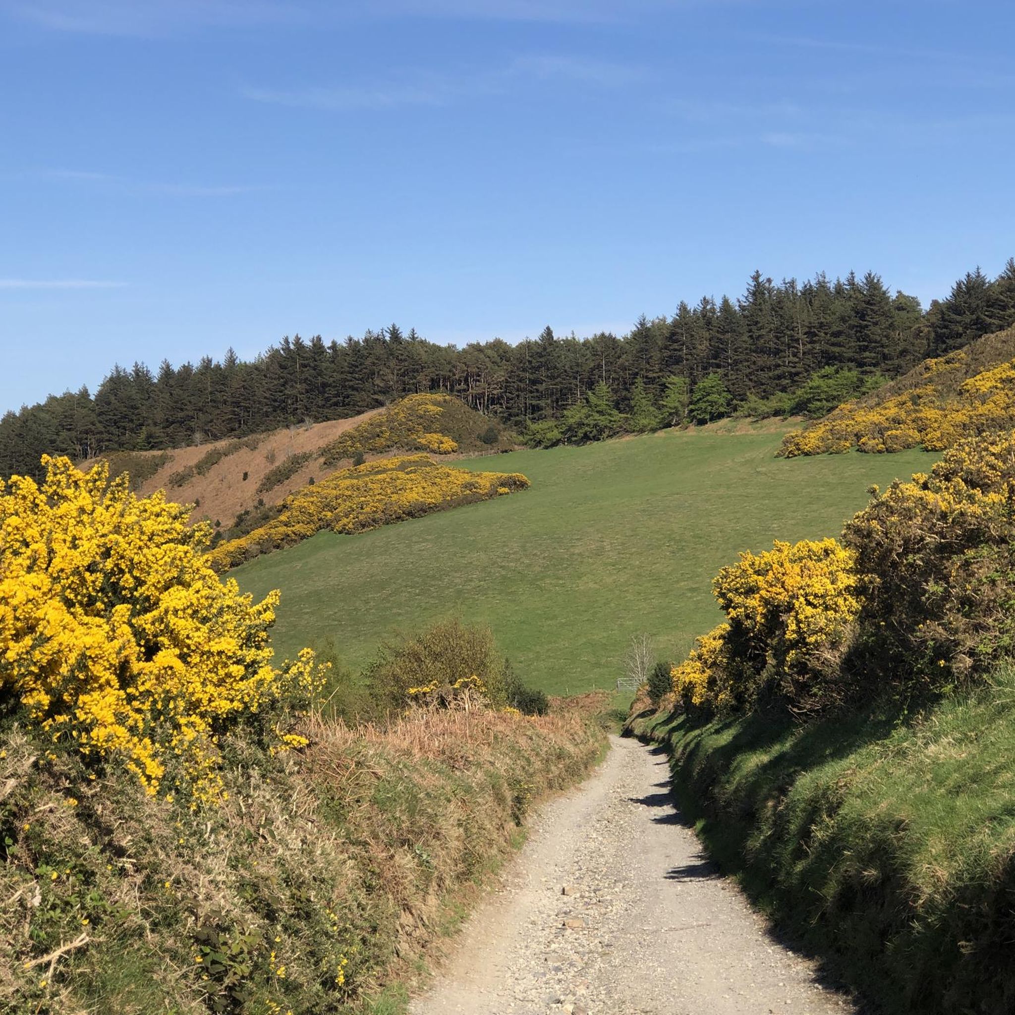
Hiking in Ayre offers diverse landscapes, characterized by its mountainous terrain, extensive forest plantations, and river valleys. You can expect panoramic views from prominent peaks like Snaefell, as well as scenic paths through woodlands and along waterways like the Sulby River.
Are there any family-friendly hiking options in Ayre?
Yes, Ayre has trails suitable for families. The easier routes, such as the Snaefell loop from Bungalow Station, are generally well-suited for families looking for a less strenuous outdoor experience. These paths often feature gentle gradients and scenic surroundings.
What are some notable landmarks or attractions to see near the hiking trails in Ayre?
Along the hiking trails in Ayre, you can encounter several interesting landmarks. The summit of Snaefell offers expansive views. Other points of interest include Point of Ayre Lighthouse and the Bungalow TT Crossing and Joey Dunlop Memorial, which are significant local sites.
What do other hikers say about the trails in Ayre?
The hiking routes in Ayre are highly rated by the komoot community, with an average score of 4.4 stars from over 50 reviews. Hikers often praise the varied terrain, from mountainous fells to tranquil forest plantations, and the well-maintained paths that make exploration enjoyable.
Are there any hikes in Ayre that follow rivers or pass through forest plantations?
Yes, many trails in Ayre incorporate both river sections and forest plantations. For example, the Sulby Reservoir Water Channel – Ballaugh Plantation loop from Sulby River leads through extensive forest plantations and along the Sulby River, offering a blend of woodland and riverside scenery.
Is Ayre suitable for winter hiking?
Ayre's mountainous landscape and fells can be challenging in winter conditions, especially on higher elevations like Snaefell. While lower-level forest and river paths might be accessible, hikers should be prepared for colder temperatures, potential snow or ice, and shorter daylight hours. Always check local weather forecasts before heading out.
How can I get to the trailheads in Ayre using public transport?
Many trailheads in Ayre, particularly those around Snaefell and the Sulby River area, are accessible via public transport routes on the Isle of Man. For specific routes, such as the Snaefell loop from Bungalow Station, the Bungalow TT Crossing is a known public transport stop. It's advisable to check the Isle of Man bus and tram schedules for the most current information on routes and timings to your chosen trailhead.
Where can I park when hiking in Ayre?
Parking is generally available near popular trailheads in Ayre. For routes starting from locations like Bungalow Station or near the Sulby River, designated parking areas are often provided. It's recommended to check specific route details on komoot or local signage for the most convenient parking options.
Are dogs allowed on the hiking trails in Ayre?
While many outdoor areas on the Isle of Man are dog-friendly, it's always best to check specific regulations for each trail, especially those passing through nature reserves or farmland. Generally, dogs should be kept on a lead to protect wildlife and livestock, and owners are expected to clean up after their pets.
Are there any less crowded hiking trails in Ayre?
To find less crowded trails in Ayre, consider exploring some of the moderate routes that venture deeper into the forest plantations or less frequented fells. While popular spots like Snaefell can attract more visitors, trails like the Druidale – Tholt-e-Will Forest Plantation loop from Sulby River might offer a more secluded experience, especially during off-peak times.
Most popular attractions in Ayre

Get inspired with the komoot mobile app


