The best cycling routes around Montjoie-Saint-Martin
4.6
(172)
1,305
riders
58
rides
Touring cycling routes around Montjoie-Saint-Martin traverse the picturesque Norman bocage, characterized by hedgerows and varied agricultural landscapes. The region is drained by the Beuvron and Sélune rivers, offering scenic routes along their valleys. Cyclists can also find greenways built on old railway tracks, providing car-free paths. The area's proximity to Mont-Saint-Michel Bay offers views of the iconic landmark.
Best touring cycling routes around Montjoie-Saint-Martin
- The most popular touring cycling route is Dolmen of La Pierre Courcoulée – Cordon des druides loop from Villamée, a 25.9 miles (41.7 km) trail that takes 3 hours 15 minutes to complete, featuring varied terrain and historical points of interest.
- Another top favourite among local touring cyclists is The Couesnon at Beauvoir – View of Mont Saint-Michel loop from Saint-Georges-de-Reintembault, a difficult 65.9 miles (106.1 km) path. This route offers expansive views of Mont-Saint-Michel and follows the Couesnon River.
- Local touring cyclists also love the View of Mont Saint-Michel – The Couesnon at Beauvoir loop from Saint-Georges-de-Reintembault, a 59.0 miles (94.9 km) trail leading through the Norman bocage and along river valleys, often completed in about 6 hours.
- Touring cycling around Montjoie-Saint-Martin is defined by greenways, the Norman bocage, and views of Mont-Saint-Michel Bay. The network offers options for different ability levels, from easy greenway rides to more challenging routes.
- The routes in Montjoie-Saint-Martin are highly rated by the komoot community with an average score of 4.6 stars from over 200 reviews. More than 4000 touring cyclists have used komoot to explore Montjoie-Saint-Martin's varied terrain.
Last updated: November 5, 2026
4.8
(26)
206
riders
Hard bike ride. Very good fitness required. Mostly paved surfaces.
4.0
(1)
8
riders
69.9km
04:14
370m
370m
Moderate bike ride. Good fitness required. Mostly paved surfaces.

4
riders
51.2km
03:16
440m
440m
Moderate bike ride. Good fitness required. Mostly paved surfaces.
2
riders
21.7km
01:31
350m
350m
Moderate bike ride. Good fitness required. Mostly paved surfaces.
2
riders
23.5km
01:24
170m
170m
Moderate bike ride. Good fitness required. Mostly paved surfaces.
Get access to more routes and recommendations from other explorers.
Already have an account?
Our route recommendations are based on thousands of hikes, rides, and runs completed by other people on komoot.
Start today with a free account
Your next adventure awaits.

Tips from the Community

Absolument sublime !!!
1
0

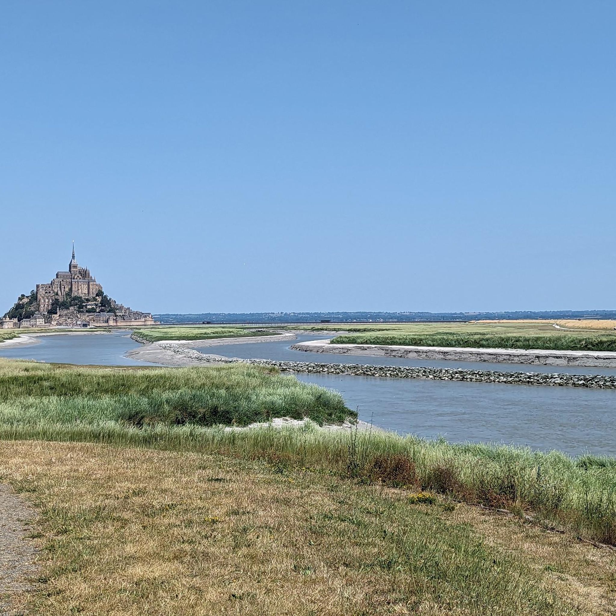
Mont-Saint-Michel is a world-famous rocky island and commune on the border between Normandy and Brittany in France. Crowned by a monumental, medieval Benedictine abbey, this architectural marvel has been a UNESCO World Heritage site since 1979. The bay of the mount is also known for Europe's strongest tides, with a tidal range of up to 14 meters.
2
0

The footpath along the Couesnon to the dam already offers an impressive view of Mont-Saint-Michel. From here, the path with an unobstructed view leads across the salt marshes and the bay, with the landmark of Normandy impressively rising against the wide landscape. Especially in calm weather and with changing light, atmospheric views emerge of Mont-Saint-Michel, the course of the Couesnon river, and the tide-shaped surroundings.
14
0
The Couesnon dam (Barrage du Couesnon) was completed in 2009 and is part of the measures to preserve the bay of Mont-Saint-Michel. The facility regulates the water flow of the Couesnon and supports the natural removal of sediments by the tides. This is intended to counteract the increasing silting up of the bay and preserve the special character of Mont-Saint-Michel as a tidal island. The dam also offers a popular viewpoint with a view of Mont-Saint-Michel and the surrounding salt marshes.
3
0

From there it looks the strongest !!!
2
0

Lovely route, first along the coast on good cycle paths, then after the large car park via all sorts of narrow roads and villages back to the campsite in Ceaux.
0
0

If there's a remarkable site that's worth a detour, it's Mont St Michel!
2
0
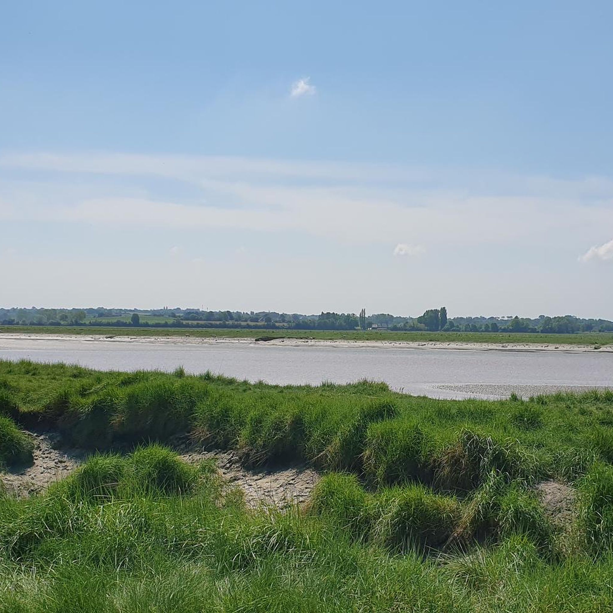
La Roche Torin is a prominent vantage point in the Bay of Mont Saint-Michel. This spot offers a unique view of the bay and is a popular destination for hikers and photographers, especially during strong tides (coefficient over 100). The tidal coefficient is the most important indicator for assessing the dynamics of the bay. A coefficient over 100 indicates spectacular tide conditions and a natural spectacle. Here in the Bay of Mont Saint-Michel, the highest tides in Europe occur, with a tidal range of up to 15 meters between high and low tide. Tidal range Mont Saint-Michel: https://tides4fishing.com/fr/basse-normandie/le-mont-saint-michel#_tidal_coefficient
1
0
Frequently Asked Questions
What types of touring cycling routes can I find around Montjoie-Saint-Martin?
The region offers a diverse network of touring cycling routes. You'll find picturesque paths through the Norman bocage, routes along the scenic Beuvron and Sélune river valleys, and dedicated greenways built on old railway tracks. Many routes also provide stunning views of Mont-Saint-Michel Bay.
Are there any easy touring cycling routes suitable for beginners or families?
Yes, Montjoie-Saint-Martin features several easy routes, particularly along the greenways (Voies Vertes). These car-free paths, often shaded and relatively flat, are ideal for families and those seeking a more relaxed ride. The region has over 15 easy touring cycling routes available.
What are the most scenic viewpoints or natural features to look out for while cycling?
Cyclists can enjoy the charming Norman bocage landscape with its hedgerows and orchards. The valleys of the Beuvron and Sélune rivers offer unspoiled views, with the Sélune being one of France's last salmon rivers. Many routes also provide breathtaking views of Mont-Saint-Michel, especially from vantage points like the Pointe de Roche Torin or along the dedicated cycle path amidst the salt meadows of the bay.
Can I cycle to Mont-Saint-Michel from Montjoie-Saint-Martin?
Absolutely. Montjoie-Saint-Martin is approximately 20 km from Mont-Saint-Michel. You can cycle along dedicated paths, including sections of the Véloscénie and greenways, that lead directly to the iconic abbey. Bicycles are permitted on the walkway bridge to Mont-Saint-Michel 24 hours a day, offering a unique approach to the site.
Are there any circular touring cycling routes in the area?
Yes, many routes around Montjoie-Saint-Martin are designed as loops. For example, the difficult route The Couesnon at Beauvoir – View of Mont Saint-Michel loop from Saint-Georges-de-Reintembault offers expansive views of Mont-Saint-Michel and follows the Couesnon River. Another option is the Old Town of Mellouen – Former Parigné stop loop from Saint-James.
What is the best time of year to go touring cycling in Montjoie-Saint-Martin?
The spring and autumn months generally offer the most pleasant conditions for touring cycling, with milder temperatures and beautiful landscapes. Summer can also be enjoyable, especially on shaded greenways, but be prepared for potentially warmer weather. Always check local forecasts before your ride.
What historical sites or attractions can I visit along the cycling routes?
Beyond Mont-Saint-Michel, you can explore charming villages like Ducey, which features the impressive Montgommery Castle. The Voie verte de la Véloscénie itself is a highlight, offering a scenic journey. You might also encounter local markets in nearby towns like Saint-James or Avranches.
Are there any challenging touring cycling routes for experienced riders?
Yes, the region offers routes with more significant elevation changes and longer distances for experienced touring cyclists. For instance, the route View of Mont Saint-Michel – The Couesnon at Beauvoir loop from Saint-Georges-de-Reintembault is a challenging 59.0-mile (94.9 km) trail leading through the Norman bocage and along river valleys.
What do other touring cyclists say about the routes in Montjoie-Saint-Martin?
The touring cycling routes around Montjoie-Saint-Martin are highly regarded by the komoot community, with an average rating of 4.6 stars from over 200 reviews. Cyclists often praise the varied terrain, the stunning views of Mont-Saint-Michel, and the peaceful greenways.
Is public transport available for cyclists with bikes in Montjoie-Saint-Martin?
While specific public transport options for bikes directly in Montjoie-Saint-Martin might be limited, the broader region of Normandy is increasingly bike-friendly. It's advisable to check with local transport providers or regional tourism offices for the most up-to-date information on train or bus services that accommodate bicycles, especially for longer distances or connecting to major cycling routes like the Véloscénie.
Where can I find parking for my car when starting a touring cycling route?
Many towns and villages that serve as starting points for routes, such as Ducey, Saint-James, or even Montjoie-Saint-Martin itself, typically offer public parking facilities. For routes along greenways, designated parking areas are often available at access points. It's recommended to check specific route details or local municipality websites for precise parking locations.
Are there any routes that pass by cafes or places to stop for refreshments?
Yes, many touring cycling routes in the region are designed to pass through or near charming villages and towns where you can find cafes, bakeries, and local markets. Towns like Ducey, Saint-James, and Avranches are good places to stop for refreshments and experience local life. Planning your route with these stops in mind can enhance your cycling experience.
Most popular routes around Montjoie-Saint-Martin
Most popular attractions around Montjoie-Saint-Martin

Get inspired with the komoot mobile app


Explore more
Browse the best Cycling routes in other regions.
