The best running trails around Haspelschiedt
4.7
(68)
1,980
runners
175
runs
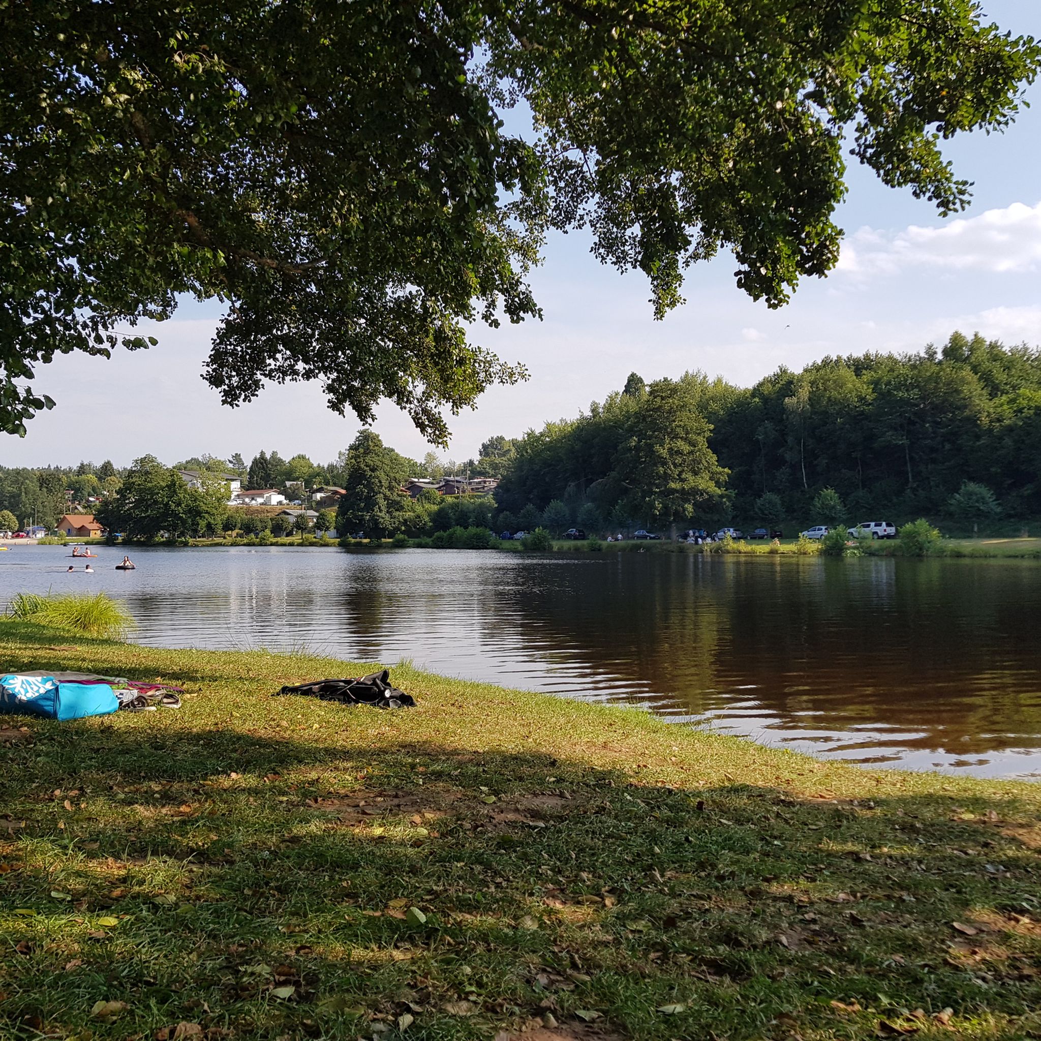
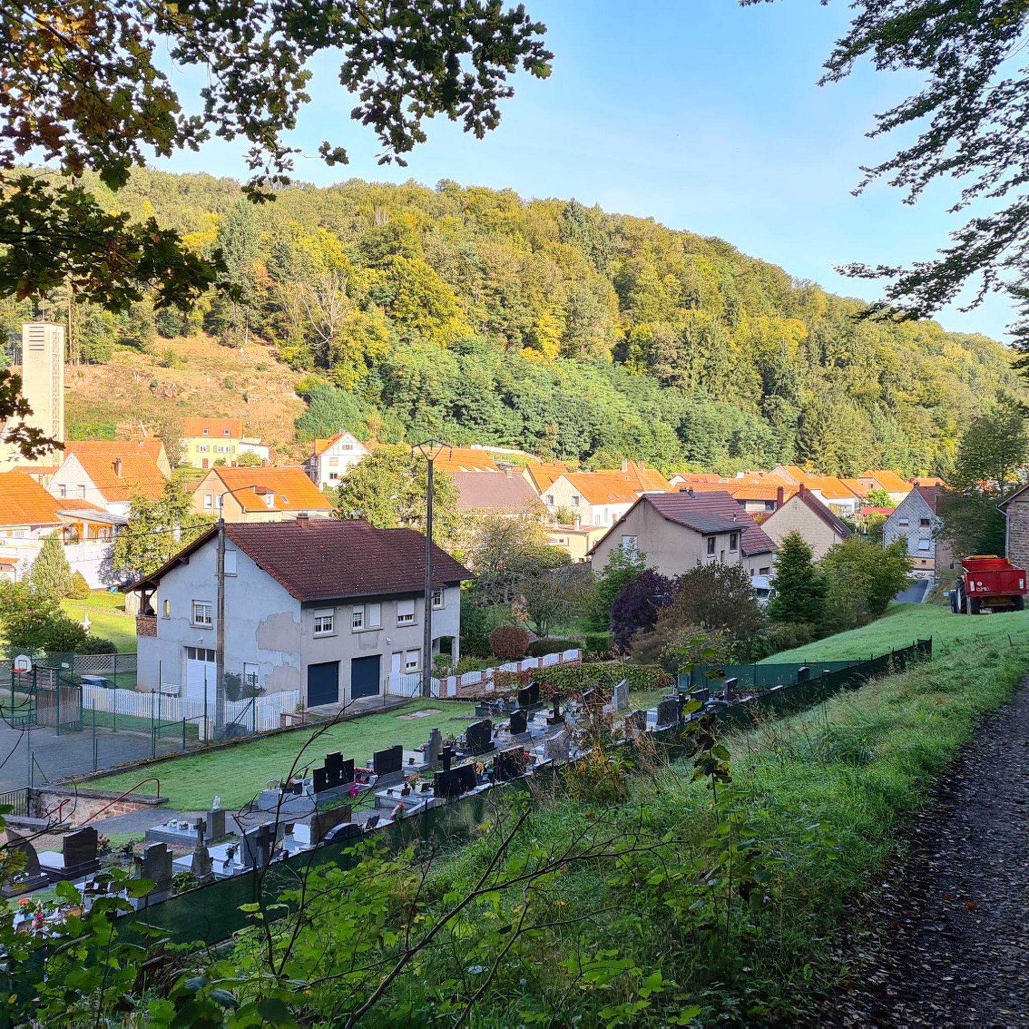
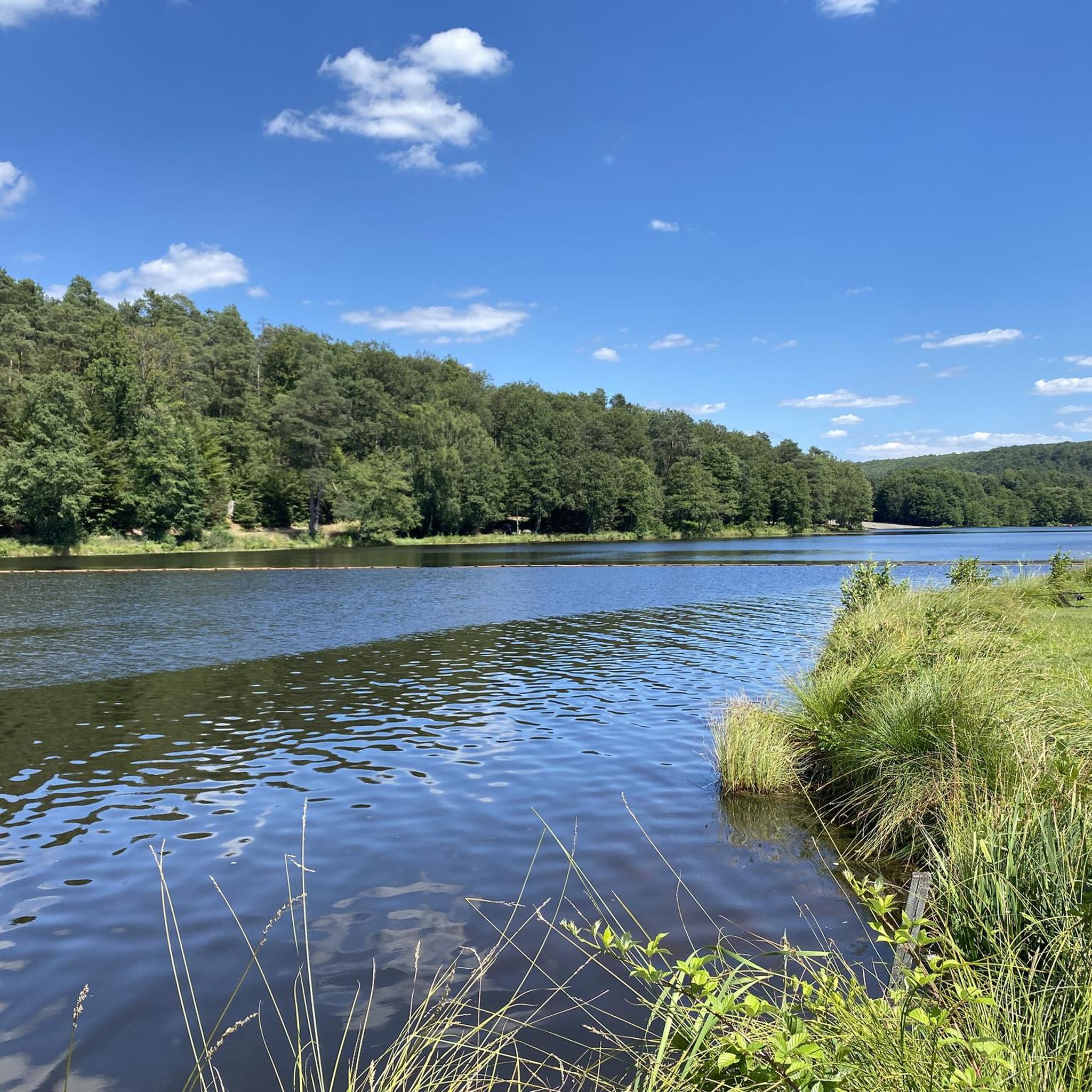
Jogging routes Haspelschiedt offer diverse natural landscapes within the Moselle department of France. The region features extensive forests and varied terrain, with altitudes ranging between 246 and 393 meters, providing options for different fitness levels. Key natural features include the picturesque Haspelschiedt Pond, the dramatic Altschloss Rocks, and the valleys of the Schwarz and Hornbach streams. These elements combine to create a network of trails suitable for running and exploration.
Best jogging routes around Haspelschiedt
- The most popular jogging route…
Last updated: May 25, 2026
67
runners
6.72km
00:46
80m
80m
This moderate 4.2-mile (6.7 km) jogging loop from Roppeviller takes you through the Pfälzerwald-Vosges du Nord Biosphere Reserve to the Alts
5.0
(3)
56
runners
13.6km
01:34
250m
250m
Moderate run. Good fitness required. Mostly paved surfaces. Suitable for all skill levels.

Sign up for free
37
runners
18.1km
02:06
340m
340m
Hard run. Very good fitness required. Mostly accessible paths. Some sure footedness required.
15
runners
9.07km
00:58
100m
100m
Moderate run. Good fitness required. Mostly paved surfaces. Suitable for all skill levels.
22
runners
13.0km
01:30
290m
290m
Moderate run. Good fitness required. Mostly paved surfaces. Suitable for all skill levels.
Get access to more routes and recommendations from other explorers.
Sign up for free
Already have an account?
Our route recommendations are based on thousands of hikes, rides, and runs completed by other people on komoot.
Start today with a free account
Your next adventure awaits.
Login or Signup
Tips from the Community

A play of colors that is second to none. From strong red, depending on the light, orange, between gray and mossy rocks. And again and again the different shapes, caves and passages.
5
0

The garden is currently closed 😞 but will reopen in spring.
0
0

The Altschlossfelsen (also known as Eppenbrunn Castle) are a group of red sandstone rocks designated as a natural monument (ND) ND-7340-205 and a cultural monument (KD) in the municipality of Eppenbrunn in the Palatinate Forest on the border with France, and are the largest rock formation in the Palatinate. They are located on the eastern slope of the Brechenberg (406 m) near Eppenbrunn and Roppeviller at an elevation of approximately 365 m above sea level at the northeast end and 380 m above sea level at the southwest end of the rock band. The Altschlossfelsen are a group of red sandstone rocks approximately one and a half kilometers long and up to 30 meters high. The group consists of sandstone towers and walls. The Altschlossfelsen are crisscrossed by cracks and joints, some of which are wide enough to climb through. They are known primarily for their diverse weathering phenomena and rare lichens. The summit plateau can be reached from the north and south on narrow paths. There, you'll find a sparse forest and moss-covered rocks. A special lighting situation created by the sun, the "rock glow," is best seen around 7:00 p.m. in the first half of April, depending on weather conditions, vegetation, and the position of the sun. In the morning hours, the glow occurs around 8:45 a.m. Finds from the Hallstatt and Roman periods attest to earlier settlement of the rock group. In 1964, for example, shards from the La Tène period (c. 450–50 BC) were found. Traces of a medieval castle from the 11th or 12th century are found on the four main rocks. These include the remains of a stepped structure, post holes, remains of masonry, and notches for beams in the rock. A depression with a diameter of four meters is located on a rock, which may have served as a cistern. Additionally, on the southern and northern slopes around the rock formation, humped blocks, which may have originated from the structure of a former castle, as well as shards from the High Middle Ages were found in a wall groove. A more precise dating of the castle complex is difficult, as the castle was not mentioned before 1297 or later in the 1605 border description between Lorraine and the County of Hanau-Lichtenberg. Source: https://de.wikipedia.org/wiki/Altschlossfelsen
1
0
The Altschlossfelsen (also known as Eppenbrunn Castle) are a group of red sandstone rocks designated as a natural monument (ND) ND-7340-205 and a cultural monument (KD) in the municipality of Eppenbrunn in the Palatinate Forest on the border with France, and are the largest rock formation in the Palatinate. They are located on the eastern slope of the Brechenberg (406 m) near Eppenbrunn and Roppeviller at an elevation of approximately 365 m above sea level at the northeast end and 380 m above sea level at the southwest end of the rock band. The Altschlossfelsen are a group of red sandstone rocks approximately one and a half kilometers long and up to 30 meters high. The group consists of sandstone towers and walls. The Altschlossfelsen are crisscrossed by cracks and joints, some of which are wide enough to climb through. They are known primarily for their diverse weathering phenomena and rare lichens. The summit plateau can be reached from the north and south on narrow paths. There, you'll find a sparse forest and moss-covered rocks. A special lighting situation created by the sun, the "rock glow," is best seen around 7:00 p.m. in the first half of April, depending on weather conditions, vegetation, and the position of the sun. In the morning hours, the glow occurs around 8:45 a.m. Finds from the Hallstatt and Roman periods attest to earlier settlement of the rock group. In 1964, for example, shards from the La Tène period (c. 450–50 BC) were found. Traces of a medieval castle from the 11th or 12th century are found on the four main rocks. These include the remains of a stepped structure, post holes, remains of masonry, and notches for beams in the rock. A depression with a diameter of four meters is located on a rock, which may have served as a cistern. Additionally, on the southern and northern slopes around the rock formation, humped blocks, which may have originated from the structure of a former castle, as well as shards from the High Middle Ages were found in a wall groove. A more precise dating of the castle complex is difficult, as the castle was not mentioned before 1297 or later in the 1605 border description between Lorraine and the County of Hanau-Lichtenberg. Source: https://de.wikipedia.org/wiki/Altschlossfelsen
1
0

Great viewpoint of the surrounding forest.
1
0

A beautiful hiking trail along the historic rock formations near the border
2
0

The largest rock in the Palatinate Forest.
0
0

It's a shame that the goats are no longer there and can roam freely. They were always nice encounters.
1
0
Frequently Asked Questions
How many running routes are available around Haspelschiedt?
There are over 180 running routes around Haspelschiedt, offering a wide variety of options for different fitness levels and preferences. The region's diverse landscapes, from extensive forests to picturesque ponds, provide a rich environment for exploration.
What kind of terrain can I expect on the running trails in Haspelschiedt?
Haspelschiedt offers a mix of terrains, including extensive forested paths, hilly sections with altitudes ranging between 246 and 393 meters, and routes along river valleys. You'll find everything from relatively easy circuits around ponds to more demanding trails through areas like the Altschloss Rocks and the Witches' Gorge.
Are there easy running routes suitable for beginners in Haspelschiedt?
Yes, Haspelschiedt has 13 easy running routes perfect for beginners or those looking for a relaxed jog. These often feature less elevation gain and smoother paths, such as circuits around the Haspelschiedt Pond.
Are there challenging running trails for experienced runners?
Absolutely. For experienced runners seeking a challenge, Haspelschiedt offers 47 difficult routes. These trails often feature significant elevation changes and more rugged terrain, providing a demanding workout amidst the region's natural beauty. An example is the Altschlossfelsen Trail – Altschlossfelsen loop from Roppeviller, which covers over 18 km with substantial elevation.
Can I find running routes that pass by natural landmarks?
Many running routes in Haspelschiedt feature stunning natural landmarks. You can explore the dramatic Altschloss Rocks, discover the unique Witches' Gorge, or enjoy the tranquility of Rössels Pond. The Altschlossfelsen Rock Circuit Trail is a popular option for experiencing these rock formations.
Are there any historical sites or points of interest along the running trails?
Yes, the region around Haspelschiedt blends natural beauty with historical intrigue. You might encounter the ancient Neolithic Polishing Rock, or pass by the historic Saint-Nicolas Church and Saint-Wendelin Chapel. The nearby town of Bitche, just 5 km away, features the impressive Citadel of Bitche, which can be incorporated into longer runs, such as the Citadel of Bitche – Citadel of Bitche loop from Camp Bitche.
Are there running routes that feature water bodies like ponds or rivers?
Haspelschiedt is rich in water features. The two-kilometer long Haspelschiedt Pond is a central point for many scenic runs, offering a picturesque and relatively easy circuit. You can also find tranquil routes around Sägmühl Pond and Rössels Pond, or follow paths along the Schwarz and Hornbach streams.
What do other runners enjoy most about jogging in Haspelschiedt?
The running routes in Haspelschiedt are highly rated by the komoot community, with an average score of 4.6 stars from over 70 reviews. Runners often praise the diverse natural landscapes, the well-maintained trails, and the variety of options suitable for different fitness levels, from easy pond circuits to challenging forest runs.
Are there any waterfalls along the running routes?
While not large cascades, you can find charming water features. The Witches' Gorge (Hexenklamm) is a notable area, and within it, you can discover a Rest Area at the Small Waterfall in Hexenklamm, offering a unique and engaging experience for those seeking a more varied run.
Can I find routes that explore the extensive forests of the region?
Yes, Haspelschiedt is known for its 'covered country' with extensive forests, making it ideal for forest runs. Many routes traverse these wooded areas, offering shade and a peaceful environment. You might even encounter remarkable trees like the nearly 350-year-old Kayser Oak or an avenue of towering Douglas firs along the Gruenholz path.
Are there any circular running routes available?
Yes, many of the running routes in Haspelschiedt are circular, allowing you to start and finish at the same point. For example, the popular Altschlossfelsen loop from Roppeviller offers a moderate 13.6 km circular path through hilly, forested areas.
Most popular routes around Haspelschiedt
Most popular attractions around Haspelschiedt

Get inspired with the komoot mobile app


Explore more
Browse the best Running Trails & Routes in other regions.
