The best road cycling routes around Guémappe
4.4
(326)
4,192
riders
482
rides
Road cycling around Guémappe, a tranquil farming village in Pas-de-Calais, France, is characterized by its gently undulating terrain and expansive agricultural landscapes. The region is situated within the Cojeul valley, offering well-paved surfaces suitable for road cyclists. Elevations range from 52 to 92 meters, indicating a relatively flat to gently rolling landscape. This environment provides open vistas across fields of cereals and beets.
Best road cycling routes around Guémappe
- The most popular road cycling route is The Marshes - Lécluse…
Last updated: July 2, 2026
4.0
(3)
22
riders
35.9km
01:26
170m
170m
Moderate road ride. Great for any fitness level. Some segments of this route may be unpaved and difficult to ride.
5.0
(5)
18
riders
63.1km
02:37
410m
410m
Moderate road ride. Good fitness required. Mostly well-paved surfaces and easy to ride.

Sign up for free
4.3
(3)
11
riders
55.4km
02:22
380m
380m
Moderate road ride. Good fitness required. Mostly well-paved surfaces and easy to ride.
9
riders
23.8km
00:56
110m
110m
Easy road ride. Great for any fitness level. Mostly well-paved surfaces and easy to ride.
9
riders
60.1km
02:23
230m
230m
Moderate road ride. Good fitness required. Mostly well-paved surfaces and easy to ride.
Get access to more routes and recommendations from other explorers.
Sign up for free
Already have an account?
Our route recommendations are based on thousands of hikes, rides, and runs completed by other people on komoot.
Start today with a free account
Your next adventure awaits.
Login or Signup



Tips from the Community

Mont César rises to a height of 138 meters on the left bank of the Thérain River, near the hamlet of Froidmont, in the municipality of Bailleul-sur-Thérain, in the Oise department. The hill, which overlooks the valley and surrounding marshes, has been inhabited since the Bronze Age and was likely a Gallo-Roman oppidum on an ancient, fortified Gallic camp. Archaeological excavations carried out since the 18th century have unearthed numerous objects and remains of fortifications. During excavations conducted in 1878 by Isidore Berton, Gallic coins and various objects from the Roman period were discovered. Want to know more? Click through to the source: https://fr.wikipedia.org/wiki/Mont_C%C3%A9sar
0
0

Small hill over 500 meters through fields and woods, with a positive elevation gain of 26 meters.
0
0


Monument to the dead of Neuville-Saint-Vaast during the two world wars. The village was evacuated at the start of the Great War, destroyed by the fighting of 1915. The village was completely rebuilt after the war, hence its motto Resurgam and its coat of arms with the phoenix. The reconstruction was completed in the 1930s.
0
1
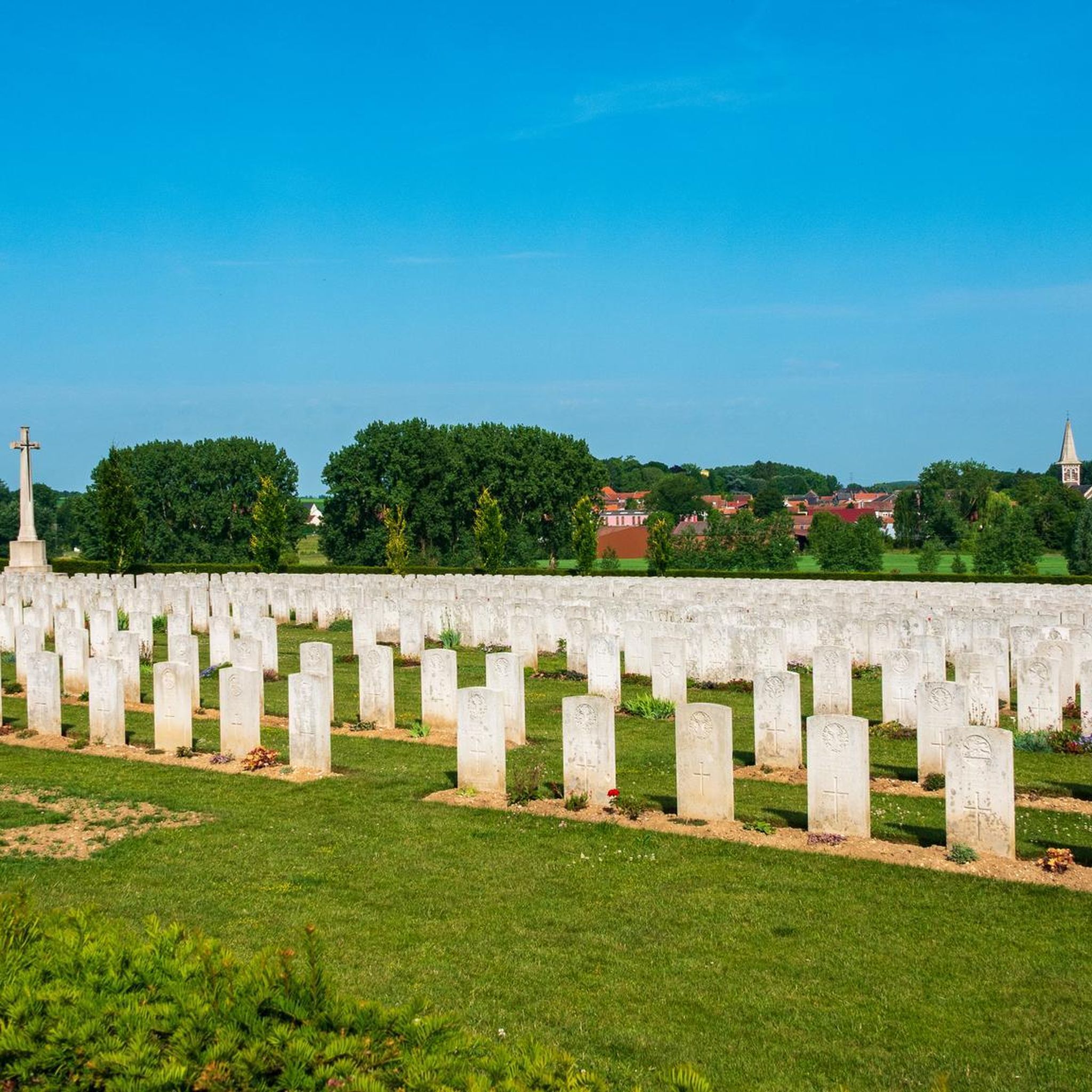
Zivy-Crater was one of two mine craters that were used by the Canadian Corps Burial Officer in 1917 for the burial of bodies found on the Vimy battlefield.
0
0
The Chapel, built in 1624, is located on the edge of the lands of Etrun Abbey, and visible along the old Gallo-Roman road. According to legend, the chapel was built on this location to respect the wishes of two nuns.
1
0

Very rolling greenway, somewhat monotonous but still pleasant
1
0

Entrance to the Biache marshes, on the towpath side
0
1
Frequently Asked Questions
How many road cycling routes are available around Guémappe?
There are over 490 road cycling routes available around Guémappe, catering to various skill levels. This includes more than 120 easy routes, over 350 moderate routes, and 15 difficult routes for experienced cyclists.
What is the typical terrain like for road cycling in Guémappe?
The terrain around Guémappe is generally gently undulating, with elevations ranging from 52 to 92 meters. You'll primarily cycle through expansive agricultural plains, offering well-paved surfaces and open vistas across fields of cereals and beets. The region is situated within the Cojeul valley, contributing to its relatively flat to gently rolling landscape.
Are there routes suitable for beginners or those seeking an easier ride?
Yes, there are over 120 easy road cycling routes around Guémappe. An example of an easier route is the Roadbike loop from Vis-en-Artois, which covers about 23.7 km with manageable elevation changes.
What kind of natural features can I expect to see while cycling?
While cycling around Guémappe, you'll primarily encounter vast agricultural plains with fields of cereals and beets, offering peaceful, open vistas. The region is also part of the Cojeul valley, and you might pass by the Cojeul river or its tributaries. Additionally, the commune is home to ecological interest zones, including the Wancourt-Guémappe marsh, which signifies rich biodiversity.
Are there any historical landmarks or points of interest along the road cycling routes?
Yes, the Guémappe area is rich in history, particularly related to World War I. Routes like the Memory Cycle Route – Farbus Hill loop from Wancourt explore historical sites. The village itself has a restored chapel and the Saint-Léger church. Nearby Arras, just 13 km away, offers significant attractions such as the UNESCO-listed Arras Town Hall and Belfry, the Arras Citadel, and the Carrière Wellington museum, detailing WWI underground tunnels.
Can I find family-friendly road cycling options near Guémappe?
While specific 'family-friendly' routes are not explicitly categorized, the abundance of easy and moderate routes, combined with the gently rolling terrain and well-paved surfaces, makes many paths suitable for families. The peaceful agricultural lanes offer a safe and enjoyable environment for cycling with children, especially on routes with lower difficulty grades.
What is the best time of year for road cycling in the Guémappe area?
The region's climate generally makes spring, summer, and early autumn the most pleasant seasons for road cycling. During these months, you can expect favorable weather conditions for exploring the agricultural plains and historical sites. Winter conditions might include colder temperatures and potentially less predictable weather.
Are there options for parking or public transport access for cyclists?
Guémappe is a small farming village, so direct public transport options might be limited. However, its proximity to Arras (approximately 13 km) means you can likely access the area via public transport to Arras and then cycle to Guémappe. For parking, you'll typically find local parking within the village or at the starting points of various routes, especially those originating from nearby towns like Vis-en-Artois or Wancourt.
Where can cyclists find amenities like cafes or accommodation in Guémappe?
As a tranquil farming village, Guémappe itself has limited amenities. However, its proximity to larger towns like Arras means you can easily find a wider range of cafes, pubs, restaurants, and accommodation options just a short ride away. Many cyclists choose to base themselves in Arras and explore the Guémappe area from there.
What do other cyclists say about road cycling in Guémappe?
The road cycling routes around Guémappe are highly rated by the komoot community, with an average score of 4.3 stars from over 260 reviews. More than 3,800 road cyclists have used komoot to explore the area, often praising the peaceful agricultural landscapes, well-maintained surfaces, and the blend of natural beauty with historical significance.
Are there any longer road cycling routes for experienced riders?
Yes, for experienced riders looking for longer distances, routes like the Memory Cycle Route – Farbus Hill loop from Wancourt offer a substantial ride of over 63 km. Another option is the Angel Memorial – Biache-Saint-Vaast marshes loop from Vis-en-Artois, which is approximately 60 km long.
Can I find circular road cycling routes around Guémappe?
Yes, many of the popular road cycling routes in the area are circular. Examples include The Marshes - Lécluse Pond – Between the lakes loop from Vis-en-Artois and the 1917 — Écoust-Saint-Mein loop from Vis-en-Artois, allowing you to start and end your ride in the same location.
What makes the Guémappe region unique for road cycling?
The Guémappe region offers a unique blend of tranquil rural cycling through extensive agricultural plains and the Cojeul valley, combined with a rich historical context, particularly from World War I. Its gently undulating terrain provides enjoyable rides without overly strenuous climbs, making it accessible for various fitness levels, while its proximity to the cultural and historical attractions of Arras adds significant value to any cycling trip.
Most popular attractions around Guémappe

Get inspired with the komoot mobile app


Explore more
Browse the best Road cycling routes in other regions.
