The best road cycling routes around Omps
4.2
(43)
1,005
riders
163
rides
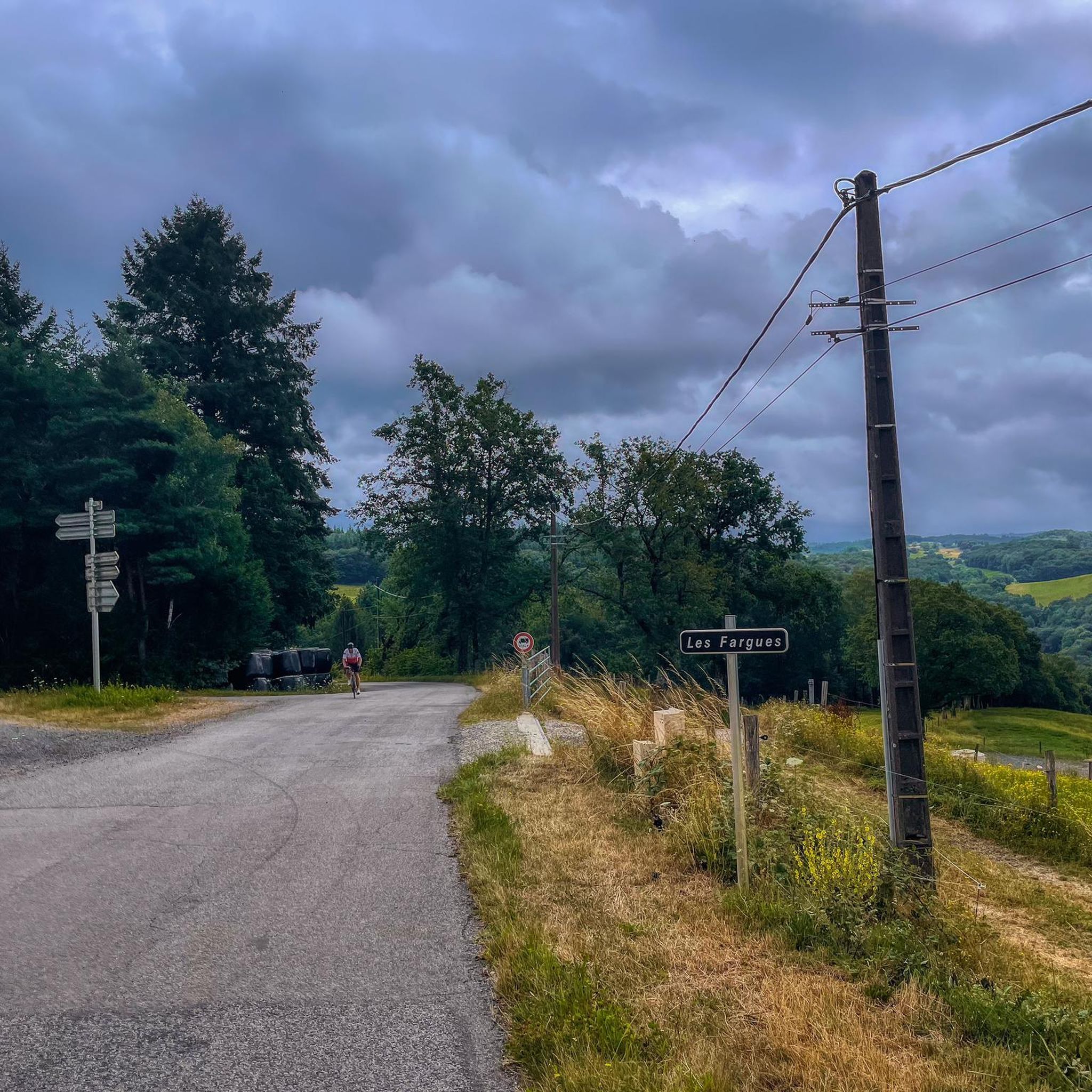
Road cycling routes around Omps traverse a landscape characterized by rolling hills and river valleys. The region features varied terrain, including ascents to viewpoints like Puy Saint Lauent and routes along the Lot valley. Road cyclists can expect a mix of moderate climbs and descents, with elevation gains typical of a hilly environment.
Best road cycling routes around Omps
- The most popular road cycling route is Panorama du Puy Saint Lauent loop from Le Rouget, a 37.8 miles (60.8…
Last updated: May 21, 2026
94
riders
115km
06:05
2,120m
2,120m
Hard road ride. Very good fitness required. Mostly well-paved surfaces and easy to ride.
4.0
(1)
49
riders
40.9km
01:55
470m
470m
Moderate road ride. Good fitness required. Mostly well-paved surfaces and easy to ride.

Sign up for free
3.3
(3)
37
riders
64.3km
03:09
840m
840m
Moderate road ride. Good fitness required. Mostly well-paved surfaces and easy to ride.
32
riders
Moderate road ride. Good fitness required. Mostly well-paved surfaces and easy to ride.
26
riders
94.1km
04:26
1,230m
1,230m
Hard road ride. Very good fitness required. Mostly well-paved surfaces and easy to ride.
Get access to more routes and recommendations from other explorers.
Sign up for free
Already have an account?
Our route recommendations are based on thousands of hikes, rides, and runs completed by other people on komoot.
Start today with a free account
Your next adventure awaits.
Login or Signup



Tips from the Community

Small town with a fantastic panorama. Church, castle, and river.
0
0
One of many beautiful views of the reservoir.
0
0

Just a stone's throw from Puy Mary, the Pas de Peyrol offers superb views of the Cantal mountains. Its ascent is nearly 12 kilometers long and averages 5.6%.
0
0

Did it last week with the cycling friends. Splendor of a Col. 🤩
0
0

Many centuries ago, our ancestors discovered the possibility of harnessing the power of the elements - which on the one hand could be helpful and useful, but on the other hand could also be a threat as untamed forces of nature - for various purposes and thus be able to do without human or animal muscle power. Mills like these are a good example of the human engineering skills of earlier generations: the heavy millstones used to grind grain into corn or press oil, for example, could be powered by the wind or - as here - water.
0
0

From the road to Conques, lovely view of the steep valley of the Lot, which flows below. The river marks the border between Cantal and Aveyron.
0
0
Beautiful asphalt road, in the Rance valley, between Saint-Étienne-de-Maurs and Roannes-Saint-Mary. Numerous signs, intended for cyclists, announcing the difference in altitude have been installed on the shoulders. In the fall, watch out for chestnuts on the road!
0
0

At an altitude of 1,588 meters, the Pas de Peyrol is located between the Puy Mary and the Puy de la Tourte. It is known to be the highest road pass in the Massif Central and is worth it, because the last few kilometers have high percentages. There you can admire Puy Mary which peaks at an altitude of 1,783 metres. It is one of the peaks of the Cantal mountains. It is easily recognizable with its pyramidal silhouette.
1
0
Frequently Asked Questions
How many road cycling routes are available around Omps?
There are over 160 road cycling routes around Omps, offering a wide variety of options for different skill levels and preferences. These include 10 easy routes, 81 moderate routes, and 69 challenging routes.
Are there easy road cycling routes suitable for beginners in Omps?
Yes, Omps offers 10 easy road cycling routes. These routes are generally shorter and feature less elevation gain, making them ideal for beginners or those looking for a relaxed ride through the scenic landscape.
What kind of terrain can I expect on road cycling routes around Omps?
Road cycling routes around Omps are characterized by rolling hills and river valleys. You can expect a mix of moderate climbs and descents, with terrain that includes ascents to viewpoints like Puy Saint Lauent and picturesque stretches along the Lot valley.
Are there challenging road cycling routes for experienced riders?
Absolutely. For experienced riders seeking a challenge, Omps features 69 difficult road cycling routes. One such route is the Côte de l'Enseigne – View of the Lot valley loop from Saint-Mamet-la-Salvetat, which covers approximately 94 kilometers and includes significant elevation changes.
Can I find loop road cycling routes in Omps?
Yes, many road cycling routes in Omps are designed as loops. For example, the Panorama du Puy Saint Lauent loop from Le Rouget is a popular moderate route offering panoramic views, and the Moulin d'Entraygues – Côte de l'Enseigne loop from Le Rouget provides varied terrain with notable climbs.
What are the typical distances and durations for road cycling routes in Omps?
Routes vary significantly. Moderate routes like the Panorama du Puy Saint Lauent loop from Saint-Mamet-la-Salvetat are around 40 kilometers, taking a few hours. More challenging routes, such as the Côte de l'Enseigne – View of the Lot valley loop from Saint-Mamet-la-Salvetat, can extend to over 90 kilometers and require a full day of cycling.
What do other road cyclists say about the routes in Omps?
The road cycling routes in Omps are highly rated by the komoot community, with an average score of 4.4 stars from over 60 reviews. Cyclists often praise the varied terrain, panoramic viewpoints, and the overall scenic beauty of the region.
Are there any scenic viewpoints or attractions along the road cycling routes?
Yes, the region offers several scenic viewpoints and attractions. Many routes feature ascents to elevated positions like Puy Saint Lauent, providing panoramic views. You might also encounter highlights such as the Himalayan suspension bridge at Lake Cantalès, the charming town of Laroquebrou, or the historic Château de Laroquebrou.
What is the best season for road cycling in Omps?
Given the rolling hills and river valleys, spring and autumn generally offer the most pleasant conditions for road cycling in Omps, with milder temperatures and beautiful scenery. Summer can also be excellent, though it's advisable to start earlier in the day to avoid the midday heat.
Are there family-friendly road cycling options in Omps?
While the region is known for its hilly terrain, the 10 easy routes available are generally more suitable for families or those with less cycling experience. These routes typically have less elevation gain and are shorter in distance, providing a more relaxed experience.
Where can I find parking at road bike trailheads in Omps?
Parking availability can vary by starting point. Many routes begin from towns or villages like Le Rouget or Saint-Mamet-la-Salvetat, where public parking is often available. It's recommended to check specific route details on komoot for suggested starting points and parking information.
Are there road cycling routes that pass by places to stop for refreshments?
While specific cafe stops are not detailed for every route, many routes pass through or near villages and towns where you can find local shops, bakeries, or cafes to refuel. Planning your route with komoot allows you to identify potential stops along the way.
Most popular attractions around Omps

Get inspired with the komoot mobile app


Explore more
Browse the best Road cycling routes in other regions.
