The best walks and hikes around Vauconcourt-Nervezain
4.3
(48)
193
hikers
30
hikes
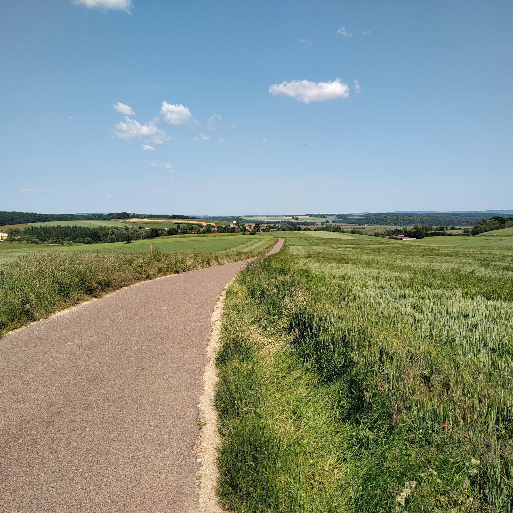
Hiking around Vauconcourt-Nervezain offers varied landscapes, including significant forest areas and riverine environments. The commune is characterized by gently undulating terrain, traversed by the Gourgeonne river, a tributary of the Saône. This area features woodlands like the Bois de la Vendue, which includes the commune's highest point at 273 meters, alongside agricultural land and plateau formations. These diverse physical features provide a range of natural settings for hikes Vauconcourt-Nervezain popular trails routes.
Best hiking trails around Vauconcourt-Nervezain
- The most popular…
Last updated: July 4, 2026
3.7
(3)
16
hikers
7.96km
02:21
230m
230m
Moderate hike. Good fitness required. Easily-accessible paths. Suitable for all skill levels.
4.0
(3)
19
hikers
Moderate hike. Good fitness required. Easily-accessible paths. Suitable for all skill levels.

Sign up for free
4.8
(4)
14
hikers
10.3km
02:45
120m
110m
Moderate hike. Good fitness required. Easily-accessible paths. Suitable for all skill levels.
3.5
(2)
6
hikers
4.98km
01:17
20m
20m
Easy hike. Great for any fitness level. Easily-accessible paths. Suitable for all skill levels.
4.0
(1)
6
hikers
4.63km
01:12
30m
30m
Easy hike. Great for any fitness level. Easily-accessible paths. Suitable for all skill levels.
Get access to more routes and recommendations from other explorers.
Sign up for free
Already have an account?
Our route recommendations are based on thousands of hikes, rides, and runs completed by other people on komoot.
Start today with a free account
Your next adventure awaits.
Login or Signup



Tips from the Community

A curiosity of river navigation
2
0

The washhouse with the oval washbasin was built in 1844.
0
0

The 681-metre canal tunnel was built at the end of the 19th century. It allows barges to avoid a long detour via the Saône.
3
0

You don't see that every day.
2
0


A bombastic portal leads into the Saone tunnel. Worth seeing.
2
1

Church listed as a Historic Monument, known from the 11th century but rebuilt in its current state in the 16th century. It underwent numerous phases of work over the following centuries, relating as much to the building itself as to the furniture and paintings it contains. If you have a moment, don't hesitate to take a look inside and in particular at its altarpieces.
0
0
Frequently Asked Questions
What kind of terrain can I expect on hikes around Vauconcourt-Nervezain?
The region around Vauconcourt-Nervezain offers a diverse landscape. You'll find significant forest areas, such as the Bois de la Vendue, alongside riverine environments along the Gourgeonne and Saône rivers. The terrain is generally gently undulating, with some routes traversing rolling hills that provide scenic vistas. Expect a mix of dense woodlands, open agricultural plateaus, and picturesque riverbanks.
Are there any easy hiking trails suitable for beginners or a relaxed stroll?
Yes, there are several easy options. For a relaxed walk, consider the Dérivation de Charentenay loop from Ray-sur-Saône. This route is just under 5 km with minimal elevation changes, making it ideal for a gentle outing along the Saône.
What are some notable landmarks or natural features to look out for on the trails?
The area is rich in both natural beauty and historical points of interest. Along the Saône River, you can enjoy picturesque views of emerald green banks and observe local fauna. Trails may also lead you past charming villages, historic wash-houses like the Ray-sur-Saône washhouse, and even remnants of ancient vineyards. Don't miss the unique Saint-Albin Canal Tunnel, which is part of some local routes.
Are there any circular hiking routes available?
Yes, many of the trails around Vauconcourt-Nervezain are designed as circular routes, allowing you to start and end in the same location. A popular moderate option is the La Grosse Roche – Butter bread loop from La Roche-Morey, which takes about 2 hours 21 minutes through forested areas.
Can I hike with my dog in this region?
The natural landscapes of Vauconcourt-Nervezain and the surrounding Haute-Saône department are generally very welcoming for dogs. With extensive forests and open fields, many trails offer ample space for your canine companion. However, it's always advisable to keep dogs on a leash, especially near agricultural areas, livestock, or within Natura 2000 sites like the Saône Valley, to protect local wildlife and ensure a pleasant experience for everyone.
What is the best time of year to go hiking in Vauconcourt-Nervezain?
The region is beautiful throughout the year, but spring and autumn offer particularly pleasant conditions for hiking. In spring, the forests burst with new growth, and wildflowers are abundant. Autumn brings vibrant colors to the woodlands. Summer provides pleasant walks in the shade of the extensive forests, while winter can offer serene, crisp conditions, though some paths might be muddy or icy.
Are there any longer, more challenging routes for experienced hikers?
While the area is characterized by gently undulating terrain, there are longer routes that offer a good challenge. The The silence loop from Ray-sur-Saône is a moderate 15.5 km path that explores the wider Saône valley region, typically taking around 4 hours 6 minutes. Another option is The silence loop from Soing, a 14.5 km trail with varied terrain.
What do other hikers enjoy most about hiking in Vauconcourt-Nervezain?
The area is highly rated by the komoot community, with an average score of 4.2 stars from over 39 reviews. Hikers often praise the peacefulness of the dense woodlands, the scenic riverine paths along the Gourgeonne, and the varied terrain that offers options for different ability levels. The well-maintained trails and the opportunity to discover charming villages are also frequently highlighted.
Are there any historical sites or castles I can visit near the hiking trails?
Yes, the region has a rich history. You can find several castles nearby, such as Rupt-sur-Saône Castle, Chateau la Rochelle, and Vellexon Castle. Some hiking routes might pass close to these historical structures, offering a glimpse into the area's past.
Is public transport available to reach the trailheads, or is a car necessary?
While specific public transport options directly to every trailhead in Vauconcourt-Nervezain can be limited due to its rural nature, having a car generally offers the most flexibility to access the various starting points for hikes. Many trails begin in or near villages, where parking is often available. For detailed information on local transport, it's best to consult regional transport services.
Are there any family-friendly hiking options suitable for children?
The region offers several easy trails with gentle gradients that are suitable for families with children. The diverse landscapes, including forests and riverbanks, provide engaging environments for younger hikers. Look for shorter, less strenuous loops, such as the Dérivation de Charentenay loop from Ray-sur-Saône, which offers an enjoyable experience without being too demanding.
Most popular routes around Vauconcourt-Nervezain
Most popular attractions around Vauconcourt-Nervezain

Get inspired with the komoot mobile app


Explore more
Browse the best Hikes in other regions.
