The best walks and hikes around Bosc-Guérard-Saint-Adrien
4.4
(490)
3,354
hikers
206
hikes
Hiking around Bosc-Guérard-Saint-Adrien offers a network of trails through varied terrain. The region is characterized by its gentle rolling hills, dense woodlands, and numerous water features, including lakes and streams. These natural elements provide a diverse landscape for outdoor activities. The area's topography makes it suitable for a range of hiking experiences, from leisurely walks to more extended excursions.
Best hiking trails around Bosc-Guérard-Saint-Adrien
- The most popular hiking route is Montville Lake – As the water flows loop from Bosc-Guérard-Saint-Adrien, a 7.8 miles (12.6 km) trail that takes 3 hours 22 minutes to complete. This route features scenic paths around Montville Lake and along local waterways.
- Another top favourite among local hikers is As the water flows – Clairette Ford Crossing loop from Bosc-Guérard-Saint-Adrien, a moderate 10.0 miles (16.1 km) path. This trail explores the local river network and includes a ford crossing, offering varied natural scenery.
- Local hikers also love the Le Cailly loop from Bosc-Guérard-Saint-Adrien, a 5.1 miles (8.3 km) trail leading through the Cailly valley, often completed in about 2 hours 14 minutes.
- Hiking around Bosc-Guérard-Saint-Adrien is defined by its woodlands, river valleys, and tranquil lake paths. The network offers options for different ability levels, including easy hikes Bosc-Guérard-Saint-Adrien and more moderate routes.
- The routes in Bosc-Guérard-Saint-Adrien are highly rated by the komoot community with an average score of 4.5 stars from over 400 reviews. More than 3000 hikers have used komoot to explore Bosc-Guérard-Saint-Adrien's varied terrain.
Last updated: July 2, 2026
3.9
(12)
42
hikers
12.8km
03:26
150m
150m
Moderate hike. Good fitness required. Easily-accessible paths. Suitable for all skill levels.
4.9
(7)
24
hikers
Moderate hike. Good fitness required. Easily-accessible paths. Suitable for all skill levels.

Sign up for free
4.8
(8)
28
hikers
8.50km
02:18
120m
110m
Moderate hike. Good fitness required. Easily-accessible paths. Suitable for all skill levels.
4.8
(8)
29
hikers
8.29km
02:14
110m
110m
Moderate hike. Good fitness required. Easily-accessible paths. Suitable for all skill levels.
4.0
(1)
9
hikers
6.35km
01:48
120m
120m
Easy hike. Great for any fitness level. Easily-accessible paths. Suitable for all skill levels.
Get access to more routes and recommendations from other explorers.
Sign up for free
Already have an account?
Our route recommendations are based on thousands of hikes, rides, and runs completed by other people on komoot.
Start today with a free account
Your next adventure awaits.
Login or Signup



Tips from the Community

Fief owned in 1553 by François de Montgomery, the first man-at-arms in France. The Château du Bosc Théroulde was rebuilt from 1616 to 1632 in the Napoleon III style. It benefited from significant revivals in the 19th century.
0
0
At Petit Tendos, you will cross (via a bridge!) the Cailly. On the side, however, you access the river. Your potential 4-legged companion will be delighted! The Cailly is a tributary of the Seine into which it flows at Rouen. A river with a regular flow, the Cailly crosses two completely distinct zones; in the upstream part, a lightly urbanized area dominated by agricultural activities, in the downstream part, between Malaunay and its mouth, a totally urbanized area, a real street of urban areas with an industrial vocation.
0
0
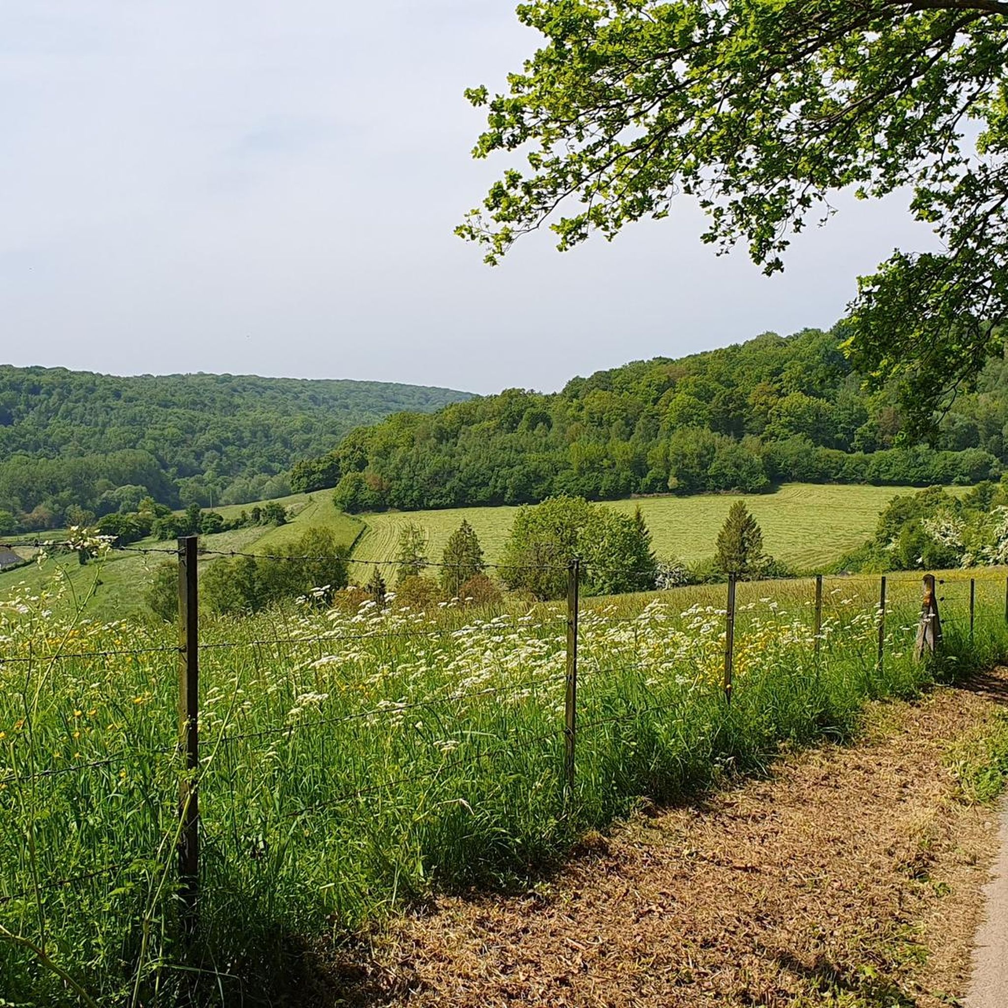
On the descent leading to Grand Tendos, a lovely view of the Cailly valley awaits you.
0
0
The structural work of the church, namely the nave and the bell tower, date from the first half of the 16th century. The choir was rebuilt in the 19th century, first from 1844 to 1846, then following the re-construction of the sacristy in 1866. The church was damaged in 1944 following a bombing.
0
0
After climbing a large clearing to reach the Bosc Théroulde castle, you will enjoy a lovely view of the Cailly valley.
0
0
Beautiful picnic area at the entrance to the Bois de Fécamp.
0
0
Ferme Raimbourg has obtained the “Rural Heritage” label for its double bread oven. This farm has retained its typical 19th century rural architecture and its visit is a sort of return to paradise in a true Normandy region which is located at the transition from the beech groves of the Pays de Caux and the forests of the Pays de Bray, in the middle of Cailly valley.
0
0
The Church has a Latin cross plan with one nave, a nave intersected by a transept, semi-circular bays punctuate the elevations. The bell tower and its polygonal slate spire dominate the double-sloped roofs. The facade is decorated with geometric patterns.
0
0
Frequently Asked Questions
How many hiking trails are there in Bosc-Guérard-Saint-Adrien?
There are over 200 hiking routes available around Bosc-Guérard-Saint-Adrien, catering to various skill levels. This includes 82 easy routes, 115 moderate routes, and a few more challenging options.
What is the best time of year for hiking in Bosc-Guérard-Saint-Adrien?
The region's gentle rolling hills and woodlands make it suitable for hiking throughout much of the year. Spring and autumn offer pleasant temperatures and vibrant scenery, while summer provides longer daylight hours. Winter hiking is also possible, though some paths might be muddy or require appropriate footwear.
Are there options for beginner hikers in Bosc-Guérard-Saint-Adrien?
Yes, Bosc-Guérard-Saint-Adrien offers a good selection of easy hikes perfect for beginners. For example, the As the water flows loop from Mont-Cauvaire is an easy 3.9-mile (6.3 km) trail that takes around 2 hours to complete, offering a gentle introduction to the area's natural beauty.
What kind of terrain can I expect on hikes around Bosc-Guérard-Saint-Adrien?
The terrain around Bosc-Guérard-Saint-Adrien is characterized by gentle rolling hills, dense woodlands, and numerous water features such as lakes and streams. You can expect a mix of forest paths, riverside trails, and open country, providing a diverse landscape for exploration.
Are there any family-friendly hiking trails in Bosc-Guérard-Saint-Adrien?
Many of the easier routes in the region are suitable for families. The trails often pass through woodlands and along water, providing engaging scenery for children. Look for routes marked as 'easy' on komoot for the most family-friendly options.
Can I bring my dog on the hiking trails in Bosc-Guérard-Saint-Adrien?
Generally, dogs are welcome on most hiking trails in the Bosc-Guérard-Saint-Adrien area, provided they are kept under control, especially when passing through agricultural land or near wildlife. Always check local signage for specific restrictions, particularly in nature reserves or protected areas.
Are there circular walking routes available?
Yes, many of the hiking routes in Bosc-Guérard-Saint-Adrien are designed as circular loops, allowing you to start and end at the same point. An example is the Le Cailly loop from Bosc-Guérard-Saint-Adrien, which is a moderate 5.1-mile (8.3 km) trail.
Where can I find parking for hiking trails in Bosc-Guérard-Saint-Adrien?
Parking is typically available near the starting points of many popular trails and in the villages surrounding Bosc-Guérard-Saint-Adrien. Specific parking information is often detailed on individual komoot tour pages, or you can look for public parking areas in towns like Montville or Fontaine-le-Bourg.
Are there any interesting landmarks or attractions to see near the hiking trails?
While hiking in the natural landscapes, you're also close to historical and cultural sites. Notable attractions in the wider region include the impressive Cathédrale Notre-Dame de Rouen, the historic Gros Horloge, and the Saint Joan of Arc Church, all located in the nearby city of Rouen.
What do other hikers say about the trails in Bosc-Guérard-Saint-Adrien?
The trails in Bosc-Guérard-Saint-Adrien are highly rated by the komoot community, with an average score of 4.5 stars from over 400 reviews. Hikers often praise the tranquil woodlands, the scenic paths along lakes and rivers, and the well-maintained routes that offer a peaceful escape into nature.
Are there any trails with good views or natural features like water?
Yes, the region is known for its beautiful water features. The Montville Lake – As the water flows loop from Bosc-Guérard-Saint-Adrien offers scenic paths around Montville Lake and along local waterways, providing lovely views and a refreshing atmosphere.
What should I wear for hiking in this region?
Given the varied terrain and potential for changing weather, it's advisable to wear comfortable, layered clothing. Sturdy hiking shoes are recommended, especially for trails that might be muddy or uneven. Bringing a waterproof jacket is also a good idea, regardless of the season.
Can I hike in Bosc-Guérard-Saint-Adrien during winter?
Winter hiking is possible, but conditions can vary. Some trails might be muddy or slippery, especially after rain or frost. It's best to wear appropriate waterproof footwear and warm layers. Always check local weather conditions before heading out.
Most popular routes around Bosc-Guérard-Saint-Adrien
Most popular attractions around Bosc-Guérard-Saint-Adrien

Get inspired with the komoot mobile app


Explore more
Browse the best Hikes in other regions.
