The best walks and hikes around Friville-Escarbotin
4.5
(1069)
5,781
hikers
147
hikes
Hiking around Friville-Escarbotin offers access to the varied landscapes of the Somme region in northern France. The area is characterized by a mix of coastal paths along the chalk cliffs of the Alabaster Coast, agricultural fields, and pockets of woodland. Elevation changes are generally gentle, making many routes accessible for various fitness levels. The terrain often features well-maintained paths and rural roads.
Best hiking trails around Friville-Escarbotin
- The most popular hiking route is Panoramic view – Cliffs of Ault loop…
Last updated: June 26, 2026
4.7
(22)
105
hikers
13.7km
03:34
100m
90m
Moderate hike. Good fitness required. Easily-accessible paths. Suitable for all skill levels.
4.0
(3)
51
hikers
5.30km
01:27
80m
80m
Easy hike. Great for any fitness level. Easily-accessible paths. Suitable for all skill levels.

Sign up for free
4.7
(3)
23
hikers
12.1km
03:14
130m
130m
Moderate hike. Good fitness required. Easily-accessible paths. Suitable for all skill levels.
5.0
(3)
18
hikers
6.93km
01:52
80m
80m
Easy hike. Great for any fitness level. Easily-accessible paths. Suitable for all skill levels.
4.5
(2)
5
hikers
8.56km
02:14
60m
60m
Moderate hike. Good fitness required. Easily-accessible paths. Suitable for all skill levels.
Get access to more routes and recommendations from other explorers.
Sign up for free
Already have an account?
Our route recommendations are based on thousands of hikes, rides, and runs completed by other people on komoot.
Start today with a free account
Your next adventure awaits.
Login or Signup

Tips from the Community

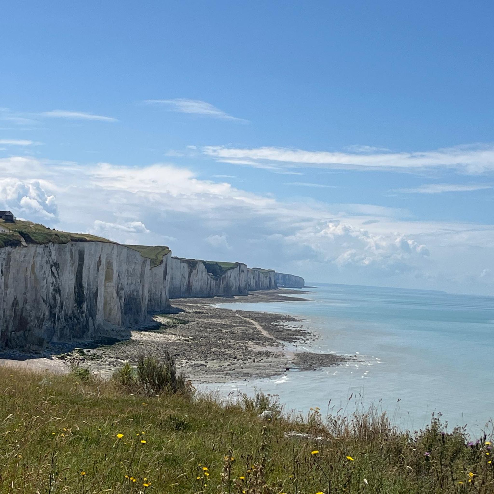
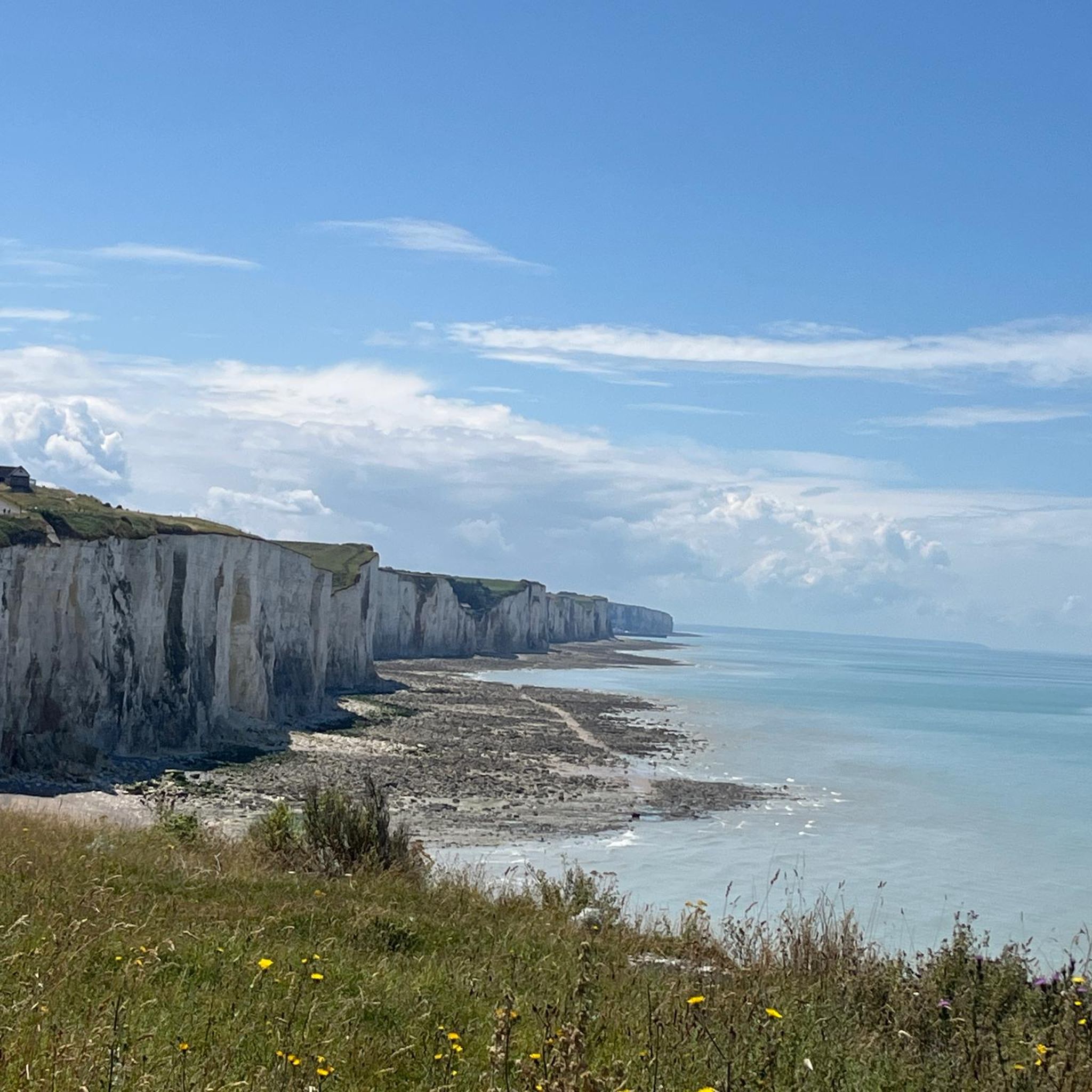
Step through the gate, then climb about 120 steps and enjoy the view.
1
0
The cliffs are made of chalk and are impressive to look at.
3
0
Here in Ault begin the chalk cliffs, which stretch all the way to Normandy and repeatedly appear as enormous cliffs.
4
0

The cliffs around the beach of Ault are composed of chalk from the Upper Cretaceous, more precisely from the Turonian and Coniacian (around 83 million years ago to 90 million years ago). They are strewn with flint nodules which highlight the subhorizontal stratification planes (the formation of flint has already been discussed in Discovery of the geology of the cliffs of Étretat, presentation of an excursion from the beach of Tilleul (Antifer) to the Porte d'Amont (Étretat Nord)). The relative proportion of chalk and flint is around 90-95% chalk to 5-10% flint. Flint horizons are stratigraphic markers. On the cliffs of Ault, the regular flint band called Seven Sisters is recognizable and characterizes the boundary between the Middle Coniacian and the Upper Coniacian (around 87 million years ago). The boundary between the lower and middle Coniacian is marked by the Shoreham 2 marl level, which is more difficult to identify. These lithostratigraphic markings allow in particular the correlation of distant deposits, such as between the Normandy and Picardy coasts, or between the French and English coasts.
3
0
The cliffs surrounding Ault beach are made of Upper Cretaceous chalk, more precisely from the terminal Turonian and Coniacian (approximately 83 Ma to 90 Ma). They are dotted with flint nodules that highlight the sub-horizontal stratification planes (the formation of flint has already been discussed in À la découverte géologique des falaises d'Étretat, presentation of an excursion going from Tilleul beach (Antifer) to Porte d'Amont (Étretat Nord)). The relative proportion between chalk and flint is approximately 90-95% chalk for 5-10% flint. The flint horizons are stratigraphic markers. On the cliffs around Ault, the regular band of flint called Seven Sisters is recognizable and characterizes the limit between the Middle Coniacian and the Upper Coniacian (approximately 87 Ma). The boundary between the Lower and Middle Coniacian is marked by the Shoreham 2 marl level, which is more difficult to identify. These lithostratigraphic markers allow in particular the correlation of distant deposits, such as for example between the Normandy and Picardy coasts, or between the French and English coasts.
3
0
The cliffs around the beach of Ault are composed of chalk from the Upper Cretaceous, more precisely from the Turonian and Coniacian (around 83 million years ago to 90 million years ago). They are strewn with flint nodules which highlight the subhorizontal stratification planes (the formation of flint has already been discussed in Discovery of the geology of the cliffs of Étretat, presentation of an excursion from the beach of Tilleul (Antifer) to the Porte d'Amont (Étretat Nord)). The relative proportion of chalk and flint is around 90-95% chalk to 5-10% flint. Flint horizons are stratigraphic markers. On the cliffs of Ault, the regular flint band called Seven Sisters is recognizable and characterizes the boundary between the Middle Coniacian and the Upper Coniacian (around 87 million years ago). The boundary between the lower and middle Coniacian is marked by the Shoreham 2 marl level, which is more difficult to identify. These lithostratigraphic markings allow in particular the correlation of distant deposits, such as between the Normandy and Picardy coasts, or between the French and English coasts.
2
0

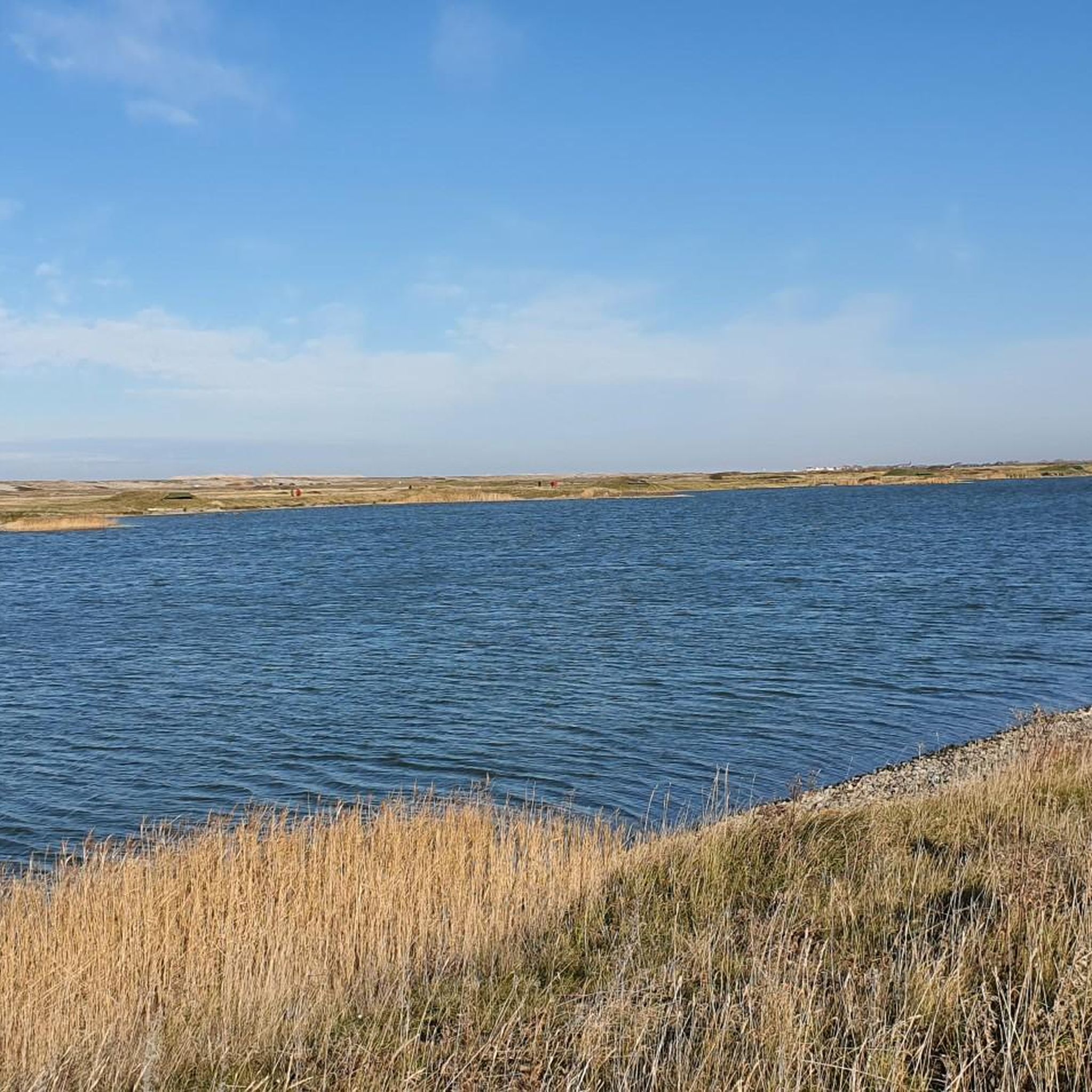
The former gravel pits of Incheville and Bouvaincourt (Les Ballastières de Incheville et Bouvaincourt) in the valley of the Bresle river are now ponds and lakes, recreational and fishing waters. Since 2015, they have also been part of the network of protected areas within the European Union Natura2000. The Vallée de la Bresle long-distance hiking trail runs through part of the area.
0
0
Frequently Asked Questions
How many hiking trails are available around Friville-Escarbotin?
There are over 140 hiking routes around Friville-Escarbotin, offering a diverse range of experiences from coastal paths to rural landscapes. These include 49 easy routes, 84 moderate routes, and 8 more challenging options.
Are there easy hiking trails suitable for beginners or families in Friville-Escarbotin?
Yes, Friville-Escarbotin offers many easy trails perfect for beginners or families. The terrain generally features gentle elevation changes. An excellent option is The Cliffs of Ault – Ault Chalk Cliffs loop from Ault, an easy 3.3-mile (5.3 km) path providing direct access to the distinctive chalk cliffs and coastal scenery.
What kind of scenery can I expect on hikes around Friville-Escarbotin?
Hiking around Friville-Escarbotin offers varied scenery typical of the Somme region. You'll encounter dramatic coastal paths along the chalk cliffs of the Alabaster Coast, expansive agricultural fields, and peaceful pockets of woodland. Many routes provide stunning sea views and opportunities to explore the unique coastal geology.
Are there any circular walks available in the Friville-Escarbotin area?
Yes, many of the hiking routes around Friville-Escarbotin are circular, allowing you to start and end at the same point. For example, the Panoramic view – Cliffs of Ault loop from Woignarue is a popular circular route offering expansive coastal views.
What are some interesting natural attractions or landmarks to see while hiking?
The region is rich in natural beauty. You can explore the impressive Ault Chalk Cliffs or the serene La Cise Cliff. The Marais de Gousseauville also offers a different natural landscape with its marshlands.
Is Friville-Escarbotin suitable for dog-friendly hikes?
Many trails in the Friville-Escarbotin area are suitable for hiking with dogs, especially those traversing rural roads and agricultural paths. However, it's always advisable to keep dogs on a leash, particularly near livestock or on coastal paths where cliffs can be steep. Check specific route details for any restrictions.
What is the best time of year to go hiking in Friville-Escarbotin?
The best time to hike in Friville-Escarbotin is generally from spring through autumn (April to October) when the weather is milder and the days are longer. Summer offers pleasant coastal breezes, while spring and autumn provide beautiful colors and fewer crowds. Winter hiking is possible but can be windier and colder, especially along the coast.
Are there any routes that offer views of the sea or coast?
Absolutely, the region is renowned for its coastal paths. Routes like View of the cliffs – Ault Beach and Cliffs loop from Ault provide direct access to the Alabaster Coast and offer spectacular views of the English Channel and the iconic chalk cliffs.
What do other hikers say about the trails in Friville-Escarbotin?
The trails in Friville-Escarbotin are highly rated by the komoot community, with an average score of 4.4 stars from over 1000 reviews. Hikers often praise the diverse landscapes, well-maintained paths, and the stunning coastal views.
Are there any hikes that pass by lakes or water features?
While the primary focus is coastal, there are routes that explore inland water features. The area around Friville-Escarbotin includes highlights such as the Bouvaincourt-sur-Bresle Ponds and the Les Ballastières d'Incheville et Bouvaincourt, offering a different natural experience away from the coast.
Are there options for longer, more challenging hikes?
While many routes feature gentle elevation, there are options for longer excursions. For example, the Hiking loop from Dargnies is a 7.3-mile (11.8 km) moderate trail that takes about 3 hours to complete, leading through varied rural landscapes.
Is it possible to find parking near the trailheads?
Yes, many trailheads in the Friville-Escarbotin area, especially those starting from villages or popular coastal access points, offer designated parking. It's common to find parking available in towns like Ault or Woignarue, which serve as starting points for several popular routes.
Most popular routes around Friville-Escarbotin
Most popular attractions around Friville-Escarbotin

Get inspired with the komoot mobile app


Explore more
Browse the best Hikes in other regions.
