The best walks and hikes around Ambiévillers
4.4
(171)
714
hikers
96
hikes
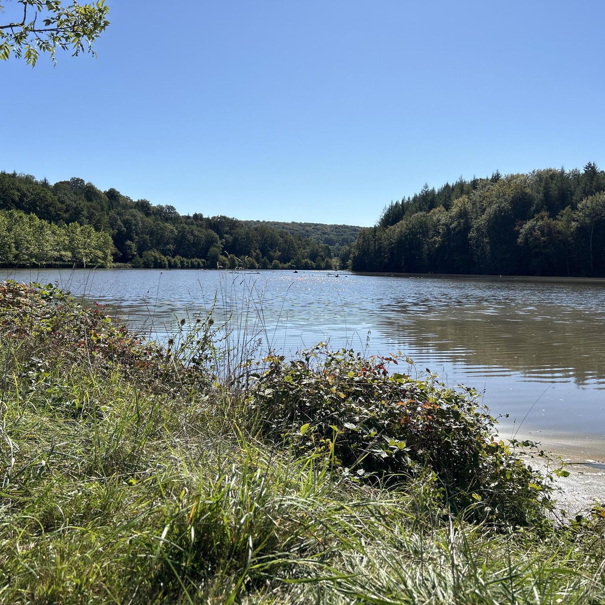
Hiking around Ambiévillers offers diverse natural landscapes, situated in the Haute-Saône department on the border of the Vosges mountains. The region features extensive woodlands, including the Forêt de Darney, covering a significant portion of the commune's land. Rivers like the Coney flow through the area, complemented by numerous springs and streams. The varied topography, with altitudes ranging from 242m to 492m, is shaped by granite, Vosgian sandstone, and variegated sandstone, providing trails with different elevation gains.
Best hiking trails around…
Last updated: July 4, 2026
4.4
(11)
62
hikers
Moderate hike. Good fitness required. Easily-accessible paths. Suitable for all skill levels.
4.3
(9)
41
hikers
7.50km
02:03
120m
120m
Moderate hike. Good fitness required. Easily-accessible paths. Suitable for all skill levels.

Sign up for free
4.7
(7)
26
hikers
Moderate hike. Good fitness required. Easily-accessible paths. Suitable for all skill levels.
3.5
(6)
18
hikers
7.12km
01:53
60m
60m
Easy hike. Great for any fitness level. Easily-accessible paths. Suitable for all skill levels.
7
hikers
Moderate hike. Good fitness required. Easily-accessible paths. Suitable for all skill levels.
Get access to more routes and recommendations from other explorers.
Sign up for free
Already have an account?
Our route recommendations are based on thousands of hikes, rides, and runs completed by other people on komoot.
Start today with a free account
Your next adventure awaits.
Login or Signup


Tips from the Community

extraordinary places to discover
0
0

beautiful view over L'Ourche
0
0

The view from the bridge over the river is interesting, with the village on one side and the rugged, vertical rock face on the other!
1
0
A beautiful old church with impressive stained glass windows.
0
0

Nice narrow canal. Drives through the villages
3
0

Bring cash if you are going to eat something here (no possibility to pay with a debit card)
1
0

Frequently Asked Questions
How many hiking trails are available in Ambiévillers?
Ambiévillers offers a wide selection of hiking opportunities, with over 80 routes available. These trails cater to various preferences, ranging from easy strolls to more challenging treks through the diverse landscapes of the Haute-Saône department.
What types of landscapes can I expect to see while hiking in Ambiévillers?
The region is characterized by its extensive forests, including the vast Forêt de Darney, providing ample shaded walks. You'll also encounter scenic rivers like the Coney, along with numerous springs and streams. The varied topography, shaped by granite and sandstone, ensures diverse terrain and elevation changes, offering a rich natural experience.
Are there any easy, family-friendly hikes in Ambiévillers?
Yes, Ambiévillers has several easy routes suitable for families. A great option is the St. Mansuy – Canal des Vosges loop from Fontenoy-le-Château. This 7.1 km trail is relatively flat, following the historic Canal des Vosges, making it enjoyable for all ages and often completed in under two hours.
Are there any circular walks available in Ambiévillers?
Many of the trails in Ambiévillers are designed as circular routes, allowing you to start and end at the same point. Popular circular options include the Bridge Over the Ourche – Theehuisje loop from Camping Nature La Clairière du Verbamont, which follows the Coney River, and the View of La Forge Neuve – Theehuisje loop from Hennezel, offering beautiful forest views.
What are some notable viewpoints or attractions along the hiking trails?
Hikers can enjoy scenic views, particularly on routes like the View of La Forge Neuve – Theehuisje loop from Hennezel, which offers beautiful vistas of the forested landscape. Additionally, the historic Canal des Vosges is a prominent feature on some trails, such as the St. Mansuy – Canal des Vosges loop. You can also explore nearby attractions like The Royal Factory of Bains-les-Bains or the Canal des Vosges itself.
What is the best time of year to go hiking in Ambiévillers?
Ambiévillers offers pleasant hiking conditions throughout much of the year. The extensive forests provide shade in summer, while the varied topography and rivers are beautiful in spring and autumn. For specific winter conditions, it's advisable to check local weather forecasts, as some trails might be affected by snow or ice, especially at higher elevations.
Are there any trails that pass by a cafe or teahouse?
Yes, some popular routes are named with 'Theehuisje-lus' (Teahouse loop), suggesting proximity to a cafe or teahouse. For example, the Bridge Over the Ourche – Theehuisje loop from Camping Nature La Clairière du Verbamont and the View of La Forge Neuve – Theehuisje loop from Hennezel are good options if you're looking for a refreshment stop along your hike.
What do other hikers say about the trails in Ambiévillers?
The hiking trails in Ambiévillers are highly regarded by the komoot community, with an average rating of 4.4 stars from over 140 reviews. Hikers often praise the tranquility of the preserved environment, the well-maintained paths, and the diverse natural beauty, including the forests and rivers.
Is public transport available to access the hiking trails in Ambiévillers?
Information regarding direct public transport access to specific trailheads in Ambiévillers is not readily available. Most hikers typically reach the starting points by car. We recommend checking local transport options or planning your route with a vehicle for the most convenient access.
Are dogs allowed on the hiking trails in Ambiévillers?
While specific regulations for every trail are not detailed, generally, dogs are welcome on many outdoor trails in the region, especially in natural areas like forests. However, it's always best to keep your dog on a leash, especially in areas with wildlife or near livestock, and to follow local signage regarding pet policies.
What is the typical duration and distance of hikes in Ambiévillers?
Hikes in Ambiévillers vary in length and duration. You can find shorter walks, such as the 7.1 km St. Mansuy – Canal des Vosges loop, which takes about 1 hour 52 minutes. Longer routes, like the 9.3 km Bridge Over the Ourche – Theehuisje loop, can take around 2 hours 33 minutes, offering options for different time commitments and fitness levels.
Most popular attractions around Ambiévillers

Get inspired with the komoot mobile app


Explore more
Browse the best Hikes in other regions.
