The best walks and hikes around Nantouillet
4.4
(137)
874
hikers
64
hikes
Hiking around Nantouillet offers access to varied landscapes within the Île-de-France region, despite the village itself being small. The area is characterized by its proximity to the Oise-Pays de France Regional Natural Park, featuring vast forests like Halatte, Chantilly, Ermenonville, and Carnelle. These woodlands are interspersed with diverse environments including calcareous grasslands, moors, wetlands, and rural scenery with rivers and ponds. The terrain generally consists of gentle elevations, making it suitable for a range of hiking experiences.
Best hiking trails…
Last updated: August 26, 2026
5.0
(1)
2
hikers
24.8km
06:31
200m
210m
Hard hike. Very good fitness required. Easily-accessible paths. Suitable for all skill levels.
3.0
(3)
7
hikers
11.6km
03:02
80m
80m
Moderate hike. Good fitness required. Easily-accessible paths. Suitable for all skill levels.

Sign up for free
8
hikers
3.81km
01:02
50m
50m
Easy hike. Great for any fitness level. Easily-accessible paths. Suitable for all skill levels.
2.5
(2)
7
hikers
8.30km
02:14
100m
100m
Moderate hike. Good fitness required. Easily-accessible paths. Suitable for all skill levels.
4.7
(3)
9
hikers
17.0km
04:25
120m
120m
Moderate hike. Good fitness required. Easily-accessible paths. Suitable for all skill levels.
Get access to more routes and recommendations from other explorers.
Sign up for free
Already have an account?
Our route recommendations are based on thousands of hikes, rides, and runs completed by other people on komoot.
Start today with a free account
Your next adventure awaits.
Login or Signup


Tips from the Community

Nice, yes, calm and peaceful... 4 km in line with the runway of CDG airport, the noise of planes taking off every 2 minutes at an altitude of a few hundred meters is infernal, even during breaks. How the locals manage 24/7 is beyond me...
0
0

Superb in spring!
0
0

Difficult to find, you go through narrow paths.
0
0


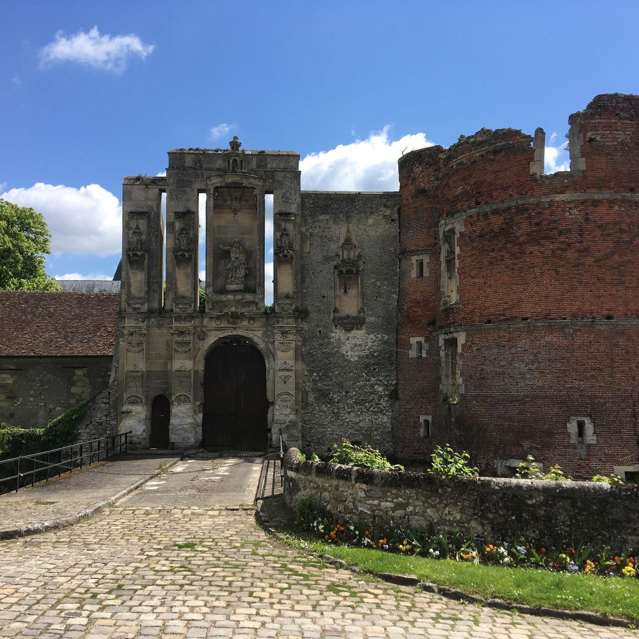
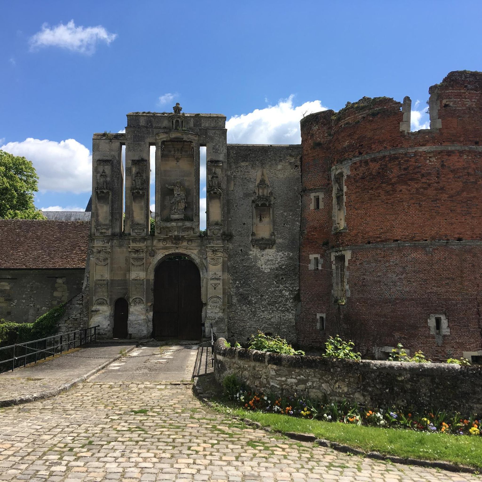
Imposing Renaissance-style castle dating from the 16th century, classified as a historical monument despite its degraded state.
1
0

A Renaissance castle of which there is not much left: https://fr.wikipedia.org/wiki/Ch%C3%A2teau_de_Nantouillet
1
1

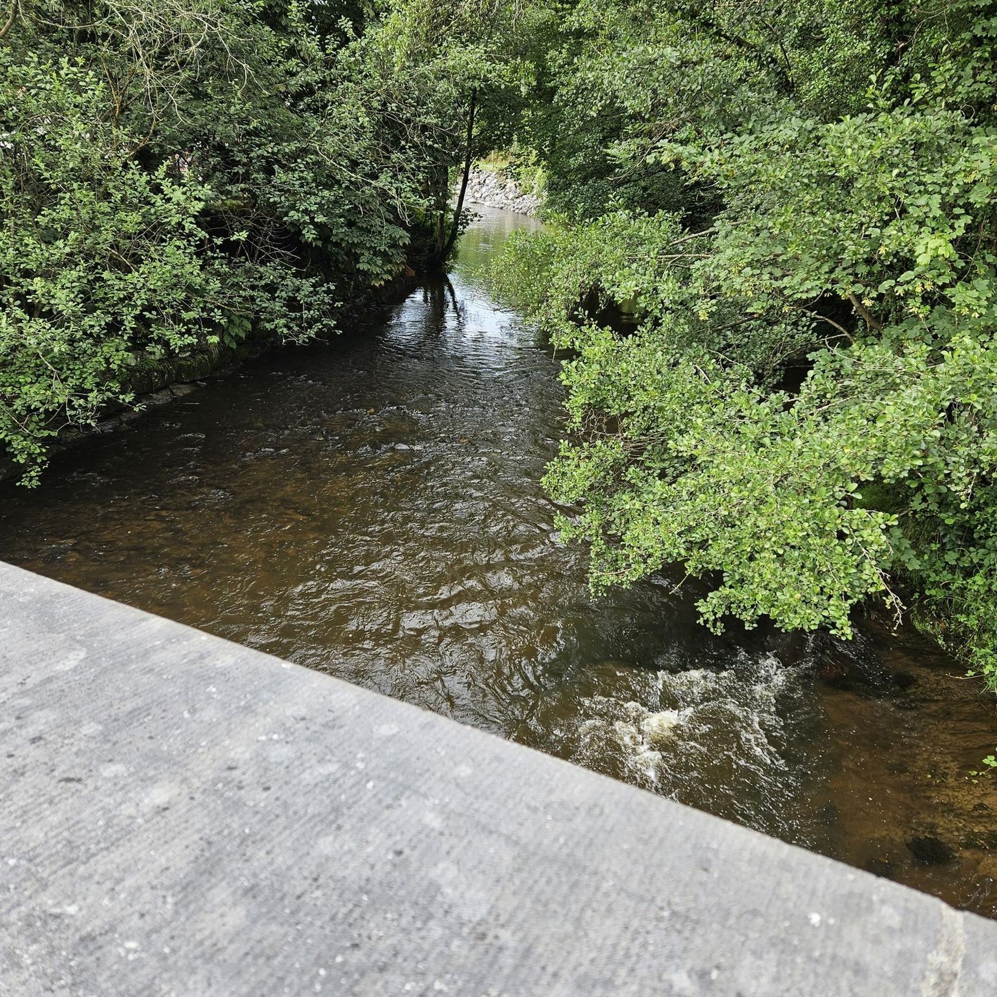
The Etang de la Grue is part of the municipality of Monthyon. It is a site very frequented by fishermen and therefore peaceful. It is an ideal place to refuel and observe the body of water.
1
0
Frequently Asked Questions
How many hiking trails are available around Nantouillet?
There are over 40 hiking routes around Nantouillet, offering a diverse range of experiences. These include 18 easy trails, 21 moderate paths, and 4 more challenging routes, ensuring options for all skill levels. The area benefits from its proximity to the Oise-Pays de France Regional Natural Park, which boasts over 1,000 kilometers of trails.
Are there easy hiking options for beginners or families near Nantouillet?
Yes, Nantouillet offers several easy hiking options suitable for beginners and families. The terrain generally features gentle elevations, especially within the vast forests of the Oise-Pays de France Regional Natural Park. An excellent example is the Forêt régionale de Montgé loop from Montgé-en-Goële, which is a 2.4-mile (3.8 km) trail that can be completed in about an hour, perfect for a leisurely outing.
What kind of landscapes can I expect to see while hiking near Nantouillet?
Hiking around Nantouillet offers a blend of diverse landscapes. You'll primarily encounter vast woodlands, including parts of the Halatte, Chantilly, Ermenonville, and Carnelle forests. Beyond the dense forests, the region features open rural scenery with agricultural fields, calcareous grasslands, moors, and wetlands, often interspersed with charming villages and gentle river valleys.
Are there any circular hiking routes around Nantouillet?
Yes, many of the trails around Nantouillet are designed as circular routes, allowing you to start and end at the same point. For instance, the popular Nantouillet Castle – Church of Juilly loop from Juilly is a 7.2-mile (11.6 km) circular trail that takes about 3 hours, passing by historical sites. Another option is the Nantouillet Castle loop from Gressy, a moderate 10.1-mile (16.3 km) path exploring the rural surroundings.
What interesting landmarks or attractions can I see along the hiking trails?
While hiking near Nantouillet, you can encounter a mix of historical and natural attractions. The village itself is home to the ruined 16th-century Renaissance Château de Nantouillet and the historic Saint-Denis church. Many routes, like the Nantouillet Castle – Church of Juilly loop from Juilly, incorporate these local sights. Further afield, within the Oise-Pays de France Regional Natural Park, you might discover other castles, abbeys, and ancient sites integrated into the hiking network.
What do other hikers enjoy most about the trails around Nantouillet?
The trails around Nantouillet are highly rated by the komoot community, with an average score of 4.5 stars from over 100 reviews. Hikers frequently praise the quiet woodlands, the varied rural landscapes, and the well-maintained paths that offer a peaceful escape into nature. The blend of natural beauty with historical elements, such as the Château de Nantouillet, is also a common highlight.
Is it possible to spot wildlife while hiking in the area?
Yes, the diverse natural environments around Nantouillet, particularly within the extensive forests and wetlands of the Oise-Pays de France Regional Natural Park, provide habitats for various wildlife. Hikers often have the chance to spot roe deer, foxes, badgers, and a variety of bird species, including owls and bats, especially during quieter times of the day.
Are there any specific trails that pass by water features like canals or rivers?
Yes, the region around Nantouillet features several water elements. You can find highlights like the Canal de L'ourcq and the Ourcq cycle path to Claye-Souilly, which offer pleasant walks alongside water. These areas provide a different scenic experience compared to the dense forests, with opportunities for peaceful strolls by the water's edge.
What is the best time of year to go hiking near Nantouillet?
The best time to hike near Nantouillet largely depends on your preference. Spring and autumn offer pleasant temperatures and beautiful scenery, with blooming flowers in spring and vibrant foliage in autumn. Summer provides warm weather for longer days on the trails, especially in the shaded forests. Even winter can be enjoyable for crisp, quiet walks, though some paths might be muddy.
Are there options for longer, more challenging hikes around Nantouillet?
While many trails are easy to moderate, there are options for longer and more challenging hikes. For example, the Loop near Meaux is a difficult 15.4-mile (24.8 km) route with over 200 meters of elevation gain, taking approximately 6.5 hours to complete. This allows experienced hikers to explore more extensive parts of the region's diverse landscapes.
Is there public transport access to hiking areas near Nantouillet?
Nantouillet is a small commune, and while direct public transport to specific trailheads might be limited, its location within the Île-de-France region means it's generally accessible. For detailed information on public transport options to reach the wider Oise-Pays de France Regional Natural Park or specific starting points, it's advisable to check local transport schedules for buses or regional trains connecting to nearby towns.
Are there any specific recommendations for winter hikes in the Nantouillet area?
Winter hikes around Nantouillet can be very peaceful, especially in the extensive forests. The Forêt régionale de Montgé loop from Montgé-en-Goële is a good option for a shorter, accessible winter walk. Be prepared for potentially muddy conditions and dress in layers. The quiet, snow-dusted woodlands offer a unique and serene hiking experience during the colder months.
Most popular routes around Nantouillet
Most popular attractions around Nantouillet

Get inspired with the komoot mobile app


Explore more
Browse the best Hikes in other regions.
