The best road cycling routes around Meyrieu-Les-Étangs
4.3
(192)
3,144
riders
355
rides
Road cycling routes around Meyrieu-Les-Étangs are characterized by a "bumpy" relief of hills, valleys, and plains, with altitudes ranging from 401 to 522 meters. This varied topography provides a range of experiences, from flatter routes across plains and along valleys to more challenging climbs and descents in the hilly sections. The area features numerous ponds, some dating back to the 13th century, alongside forests of chestnut, oak, and hornbeam, and cultivated fields.
Best road cycling routes in Meyrieu-Les-Étangs
- The most popular road cycling route is A travers champs – Montjoux Pond loop from Artas, a 40.8 miles (65.7 km) trail that takes 3 hours 27 minutes to complete. This moderate route traverses varied terrain, including cultivated fields and sections near ponds.
- Another top favourite among local road cyclists is A travers champs loop from Artas, a moderate 26.7 miles (42.9 km) path. This route offers a mix of open landscapes and gentle inclines through the region's characteristic "bumpy" relief.
- Local road cyclists also love the Montjoux Pond – Le Rafour loop from Châtonnay, a 25.6 miles (41.3 km) trail leading through varied landscapes including ponds and fields, often completed in about 1 hour 48 minutes.
- Road cycling around Meyrieu-Les-Étangs is defined by a bumpy relief of hills, valleys, and plains, numerous ponds, and forests of chestnut, oak, and hornbeam. The network offers options for easy, moderate, and difficult ability levels.
- The routes in Meyrieu-Les-Étangs are highly rated by the komoot community with an average score of 4.3 stars from over 160 reviews. More than 2,900 road cyclists have used komoot to explore Meyrieu-Les-Étangs's varied terrain.
Last updated: July 1, 2026
4.0
(1)
35
riders
62.8km
03:16
650m
650m
Moderate road ride. Good fitness required. Mostly well-paved surfaces and easy to ride.
36
riders
41.8km
01:54
340m
350m
Moderate road ride. Good fitness required. Mostly well-paved surfaces and easy to ride.

Sign up for free
3.7
(3)
41
riders
51.8km
02:24
390m
390m
Moderate road ride. Good fitness required. Mostly well-paved surfaces and easy to ride.
4.5
(2)
26
riders
41.4km
01:49
270m
270m
Easy road ride. Great for any fitness level. Mostly well-paved surfaces and easy to ride.
4.0
(2)
14
riders
53.2km
02:27
550m
550m
Moderate road ride. Good fitness required. Mostly well-paved surfaces and easy to ride.
Get access to more routes and recommendations from other explorers.
Sign up for free
Already have an account?
Our route recommendations are based on thousands of hikes, rides, and runs completed by other people on komoot.
Start today with a free account
Your next adventure awaits.
Login or Signup



Tips from the Community

The small sacred monument that the biker encounters here is designed somewhat differently than many other wayside crosses. The most common material is wood or stone, but here, metal has been used. The longitudinal beam is unusually long, so that it rises above the fields, visible from afar. The two ends of the crossbeam and the upper end of the longitudinal beam are adorned with an additional decorative element. But regardless of material and design, all crosses have one thing in common: For the faithful observer, they are a sign of the death of Jesus Christ, but at the same time, they always point beyond that to the resurrection.
0
0


Located in the hamlet of La Roche and dedicated to SAINT CLAIR, the church of Meyrieu les Etangs was built from 1874 to 1879. It replaced the church in the hamlet of Boucharin which was demolished in 1874. In the shape of a Latin cross and Romanesque style, the church of Meyrieu les Etangs has 2 bells which make their voices heard to announce services, ring the Angelus and mark certain exceptional events. Source: Meyrieu-Les-Étangs website
0
0
Located between Meyrieux-les-étangs and Saint-Jean de Bournay in the northwest of the Isère department, the Etang de Montjoux is located at an altitude of 400m and covers an area of 14 hectares. Source: Isère Tourism
1
0

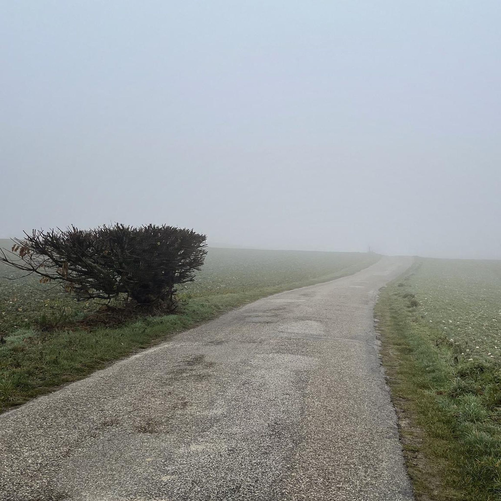
Thick mist, mysterious atmosphere in the absence of a view on this February afternoon.
0
0
Built in the 1870s, but in a Romanesque style.
0
0
Road with good surface, little traffic.
0
0
Frequently Asked Questions
How many road cycling routes are available in Meyrieu-Les-Étangs?
There are over 350 road cycling routes around Meyrieu-Les-Étangs, catering to various skill levels. This includes 41 easy routes, 247 moderate routes, and 63 difficult routes, ensuring options for every cyclist.
What kind of terrain can I expect when road cycling around Meyrieu-Les-Étangs?
The terrain around Meyrieu-Les-Étangs is characterized by a 'bumpy' relief of hills, valleys, and plains, with altitudes ranging from 401 to 522 meters. This varied topography offers a mix of flatter routes across plains and along valleys, as well as more challenging climbs and descents in the hilly sections. You'll also find scenic routes through forests of chestnut, oak, and hornbeam, alongside cultivated fields and numerous ponds.
Are there road cycling routes suitable for beginners or families in Meyrieu-Les-Étangs?
Yes, Meyrieu-Les-Étangs offers 41 easy road cycling routes, many of which traverse flatter sections across plains and along valleys, making them suitable for beginners or families. These routes often provide picturesque rides alongside the tranquil ponds and through charming bocage landscapes.
Can I find challenging road cycling routes in the area?
Absolutely. For those seeking a challenge, there are 63 difficult road cycling routes around Meyrieu-Les-Étangs. These routes typically involve more significant climbs and descents within the region's hilly sections, offering a rewarding experience for advanced cyclists. An example of a moderate route with notable elevation gain is A travers champs – Montjoux Pond loop from Artas, which covers 65.7 km with over 690 meters of elevation gain.
What natural features or landmarks can I see while cycling?
The region is rich in natural beauty. You can expect to cycle alongside many of the approximately thirty ponds, such as Étang de la Rosière, and through forests of chestnut, oak, and hornbeam. The 'vallon du Vordas' offers a particularly beautiful path between forests and ponds. Additionally, you might encounter historical sites like Bonnevaux Castle or Arzay Castle, and enjoy panoramic views from spots like the Orientation table at the summit of Chèzeneuve.
Are there any scenic routes that pass by the famous ponds?
Yes, many routes in Meyrieu-Les-Étangs incorporate the region's defining feature: its numerous ponds. For instance, the Montjoux Pond – Le Rafour loop from Châtonnay leads through varied landscapes including ponds and fields. The Route de Beausoleil – Cabin of the Pond loop from Meyrieu-les-Étangs also offers a beautiful ride near these tranquil waters.
What is the best time of year to go road cycling in Meyrieu-Les-Étangs?
The varied landscape of Meyrieu-Les-Étangs makes it enjoyable for road cycling across multiple seasons. Spring and autumn offer pleasant temperatures and vibrant scenery, with the northern slopes of the hills often covered in lush forests. Summer is also suitable, especially for routes that provide shade from the chestnut and oak trees, or those that pass by the ponds for a refreshing stop.
Are there options for longer road cycling tours from Meyrieu-Les-Étangs?
Yes, Meyrieu-Les-Étangs serves as a gateway to a broader network of cycling routes within the Isère region. For longer excursions, you can connect to routes like the marked 63.4 km route 'Through orchards and heritage sites along the banks of the Rhône' that passes nearby. Additionally, the majestic La Belle Via cycle route, a gentle alternative to the ViaRhôna, traverses the Isère Valley, offering easy routes with stunning views of mountain ranges.
What do other cyclists say about road cycling in Meyrieu-Les-Étangs?
The road cycling routes in Meyrieu-Les-Étangs are highly rated by the komoot community, with an average score of 4.3 stars from over 160 reviews. Cyclists often praise the varied terrain, the picturesque scenery of the ponds and forests, and the availability of routes for different skill levels, making it a rewarding destination for outdoor activities.
Are the road cycling routes generally paved?
Yes, as a road cycling destination, the routes around Meyrieu-Les-Étangs are predominantly on paved surfaces. This includes local roads that wind through the hills, valleys, and alongside the ponds, as well as sections of the broader cycling infrastructure in the Isère region.
Are there any specific attractions or leisure activities near the cycling routes?
Beyond cycling, the Base de Loisirs du Moulin, situated around the Étang du Moulin, is a prominent attraction. This leisure base offers aquatic activities like boats, canoes, kayaks, and aquabikes, along with a supervised sandy beach, children's games, mini-golf, and fishing. It's an ideal spot for relaxation and diverse recreational pursuits after a ride.
Are there circular road cycling routes available?
Yes, many of the road cycling routes in Meyrieu-Les-Étangs are designed as circular loops, allowing you to start and end your ride in the same location. Examples include the A travers champs loop from Artas and the Montjoux Pond – Col du Grand Devez (508 m) loop from Meyrieu-les-Étangs, which offer varied landscapes and scenic views.
Most popular routes around Meyrieu-Les-Étangs
Most popular attractions around Meyrieu-Les-Étangs

Get inspired with the komoot mobile app


Explore more
Browse the best Road cycling routes in other regions.
