The best walks and hikes around Guillon-Les-Bains
4.3
(303)
1,431
hikers
78
hikes
Hiking around Guillon-Les-Bains offers diverse terrain within the Doubs department of eastern France. The region features the tranquil Cusancin Valley, known for its lush vegetation and unique hydrological features like the "Blue Source" and "Green Source." The broader Doubs Valley provides impressive natural landscapes with its meandering river, forests, and rock formations. The area also incorporates parts of the Jura Mountains, contributing rolling hills, cliffs, and varied geological formations.
Best hiking trails around Guillon-Les-Bains
- The most popular hiking route is…
Last updated: July 6, 2026
4.6
(27)
96
hikers
12.6km
03:54
440m
440m
Hike the difficult 7.9-mile Croix de Châtard Loop for panoramic views of the Doubs valley and Baume-les-Dames.
3.0
(16)
32
hikers
7.61km
02:21
270m
270m
Hike the moderate 4.7-mile Val de Cusance Loop to explore the Cusancin valley, discover the Source Bleue, and enjoy panoramic views.

Sign up for free
4.3
(17)
100
hikers
19.4km
05:53
640m
630m
Hard hike. Very good fitness required. Easily-accessible paths. Suitable for all skill levels.
5.0
(13)
46
hikers
8.38km
02:31
260m
260m
Moderate hike. Good fitness required. Easily-accessible paths. Suitable for all skill levels.
4.8
(6)
27
hikers
2.90km
00:50
60m
70m
Easy hike. Great for any fitness level. Easily-accessible paths. Suitable for all skill levels.
Get access to more routes and recommendations from other explorers.
Sign up for free
Already have an account?
Our route recommendations are based on thousands of hikes, rides, and runs completed by other people on komoot.
Start today with a free account
Your next adventure awaits.
Login or Signup

Tips from the Community

Please note, this hike was done in May 2025, and the very last section was inaccessible. We were unable to reach the source of the Cusancin River; fallen trees and overgrown vegetation made the path impossible to find. We had to turn around and return to the starting point by road (barely a hundred meters of asphalt).
1
0


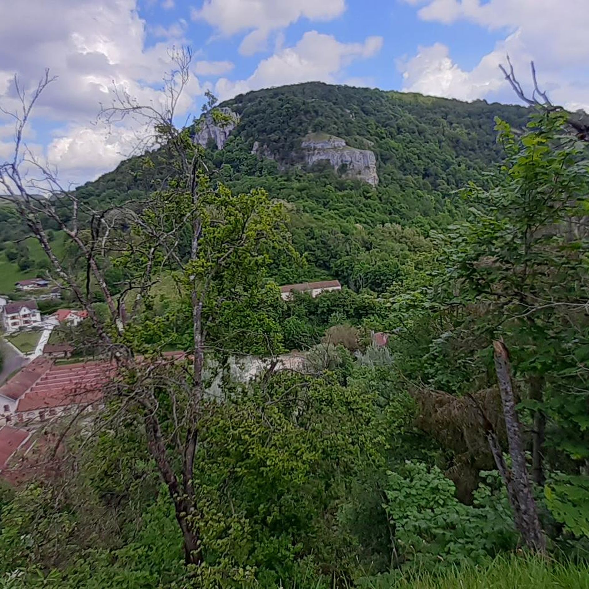
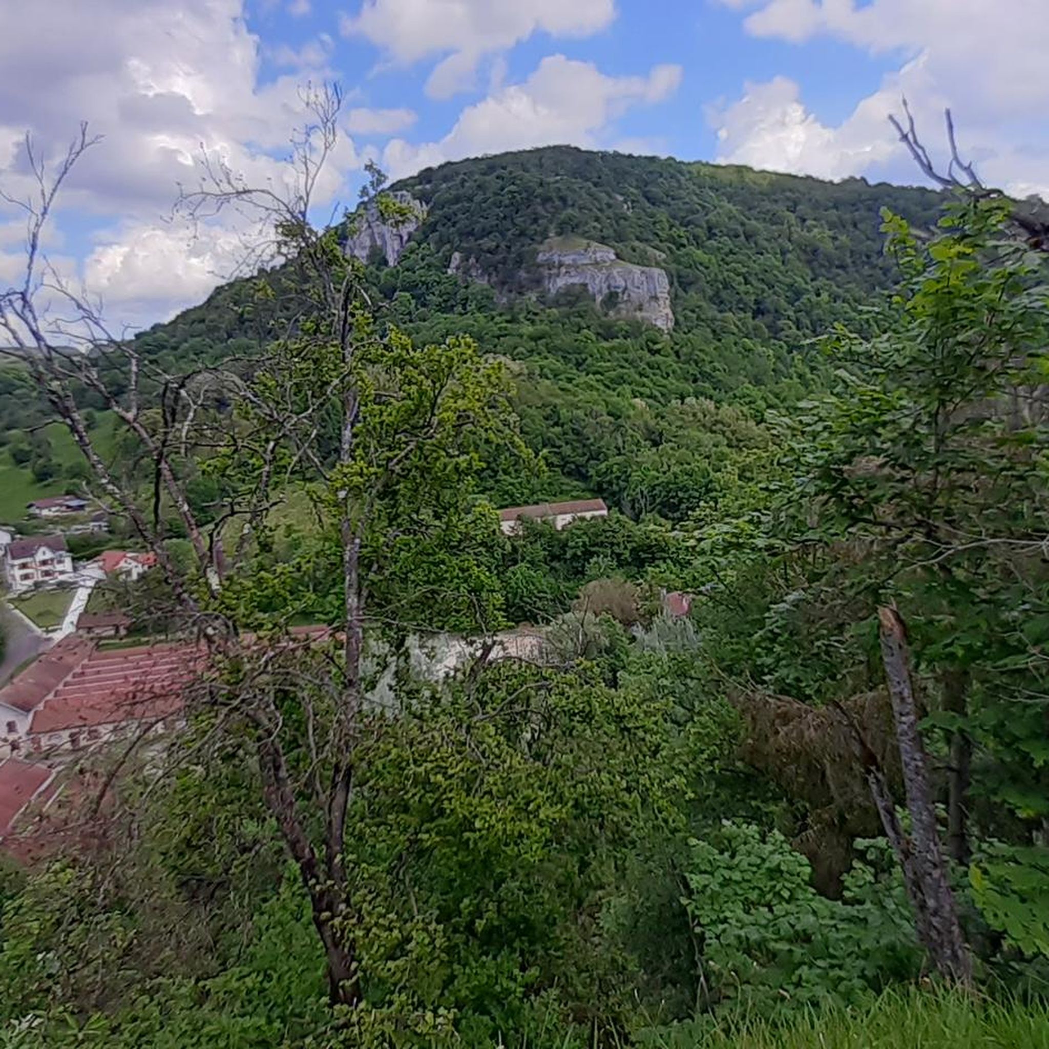
a beautiful valley near Baume-les-Dames
1
0
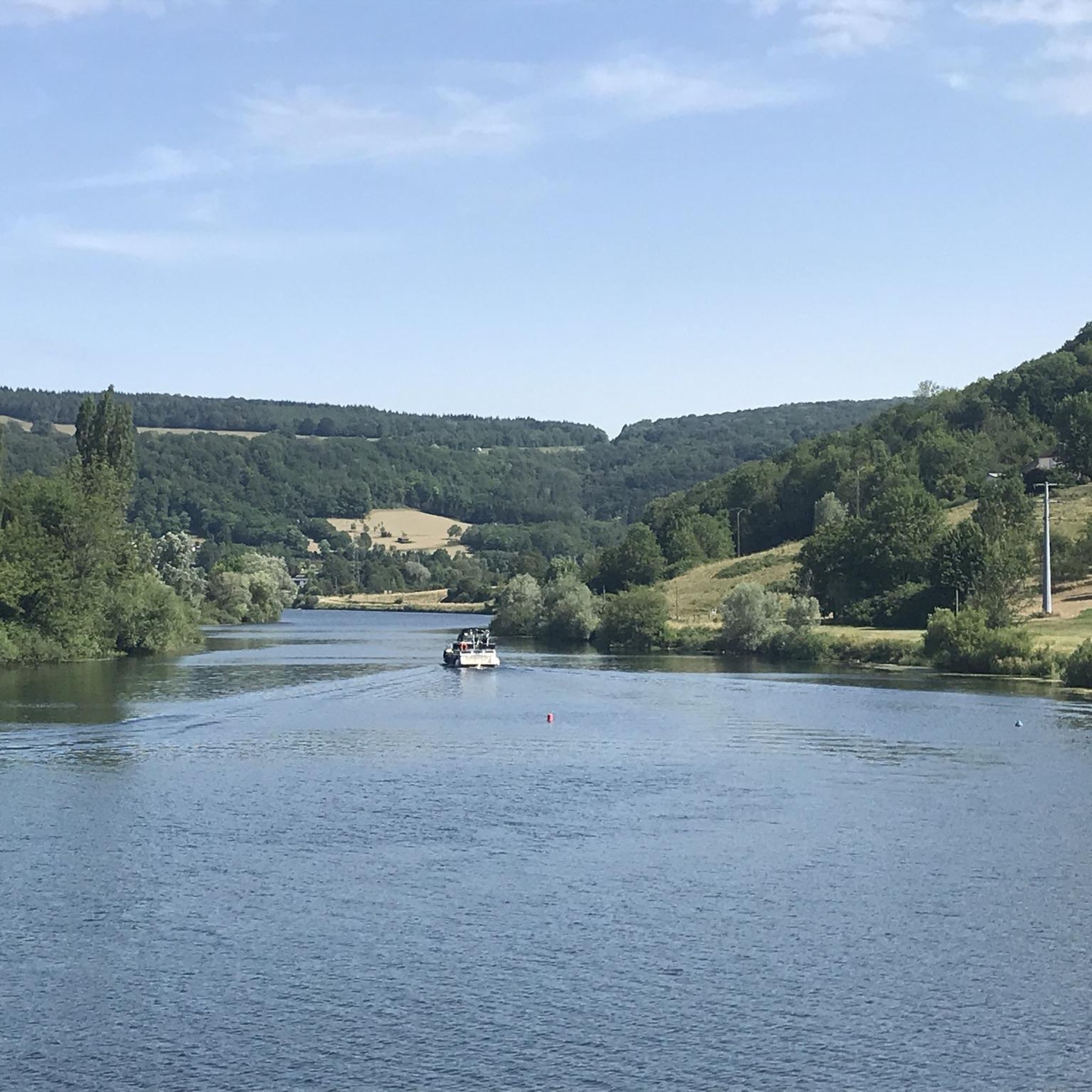
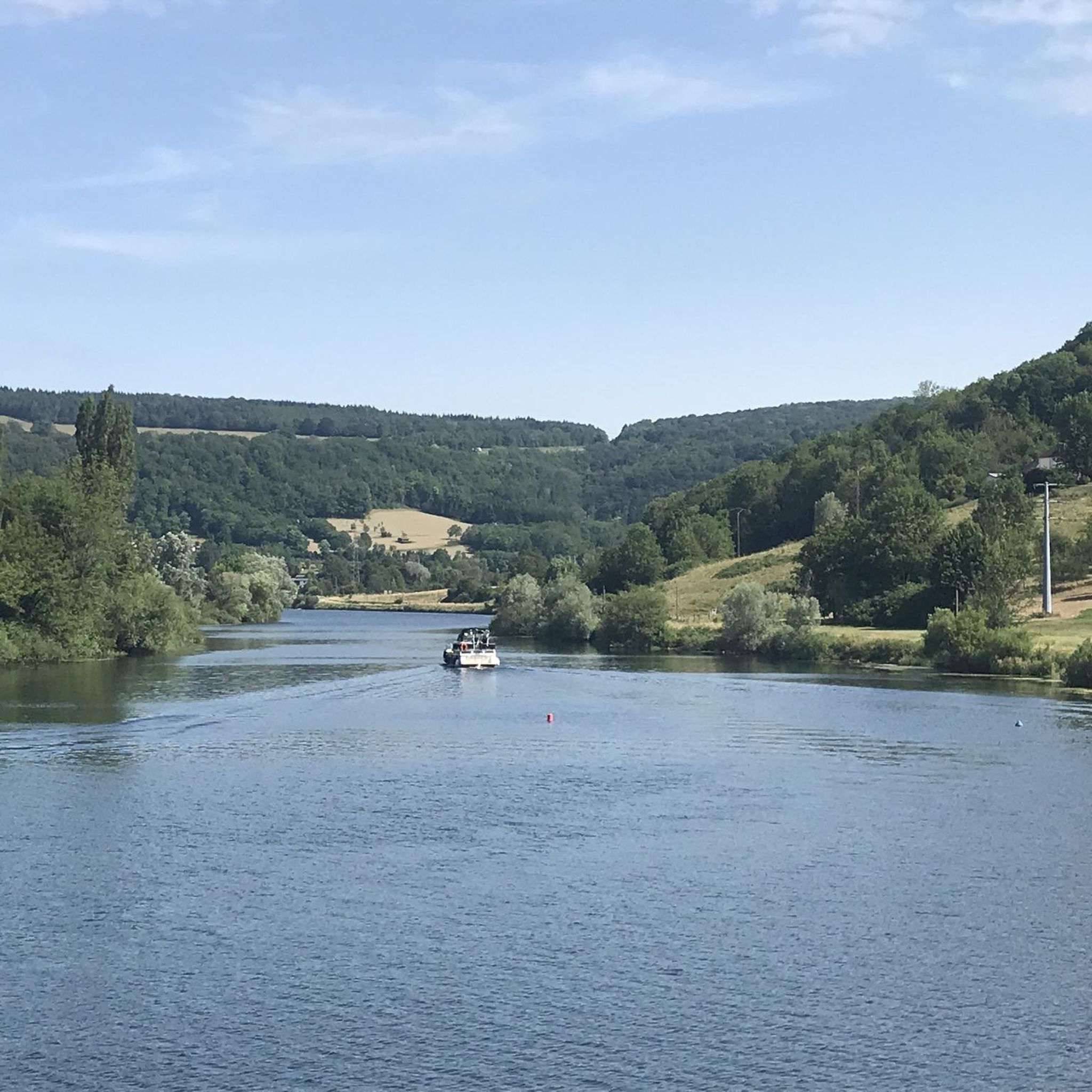
After Baumes-les-Dames, the route towards Germany is initially lined with rocks with large caves on the opposite side.
1
0
an old lock - and opposite the rocks. These are beautiful pictures!
1
0

Built on the foundations of a 12th century feudal castle, the chapel dominates the hamlet of Val-de-Cusance. It was built in 1880 and bears the name of Saint-Ermenfroi, who had built an abbey intended to accommodate the sick and foreigners in the 7th century. The chapel is the ideal place to enjoy a beautiful panorama of the valley, with greenery as far as the eye can see.
1
1
The green spring or the Cuse is located on the left side of the river at approximately the same height as the blue spring. This is the true source of Cusancin. The upper gallery of the cave was walled with dry stones.
0
0
The blue spring is a Vauclusian spring which emerges in an oval basin. Its depth is nine meters. Divers explored the submerged gallery over a length of 220 meters before stumbling upon a narrowing which was not crossed. The gallery is made up of two siphons. The turquoise blue waters give it its name.
1
0
Frequently Asked Questions
How many hiking trails are available around Guillon-Les-Bains?
There are over 75 hiking trails around Guillon-Les-Bains, offering a wide range of options for different abilities and preferences.
What are the different difficulty levels for hiking trails in this region?
The trails around Guillon-Les-Bains cater to various fitness levels. You'll find approximately 38 easy routes, 31 moderate trails, and 8 more challenging hikes, ensuring there's something for everyone.
What natural features and landmarks can I discover on hikes around Guillon-Les-Bains?
The region is rich in natural beauty. You can explore the tranquil Cusancin Valley with its unique hydrological features like the "Blue Source" (La Source bleue) and "Green Source," and even small tuff dams forming mini-waterfalls. The broader Doubs Valley offers impressive landscapes with its meandering river and rock formations. Don't miss viewpoints like Saut de Gamache Viewpoint or Roche de Chatard Viewpoint for stunning panoramas.
Are there any family-friendly hiking options near Guillon-Les-Bains?
Yes, many trails are suitable for families. The hike to Mont de Guillon, starting directly from the village, is generally considered family-friendly, offering beautiful views of the Cusancin Valley. Shorter, easier routes are also available, making it possible for families to enjoy the natural surroundings together.
Can I bring my dog on the hiking trails around Guillon-Les-Bains?
Many trails in the Guillon-Les-Bains area are dog-friendly, allowing you to enjoy the outdoors with your canine companion. However, it's always recommended to keep dogs on a leash, especially in nature reserves or areas with livestock, and to check specific trail regulations before you go.
Are there any circular or loop walks available?
Yes, the region offers several excellent circular walks. A popular choice is the Val de Cusance Loop, a moderate 4.7-mile path that explores the scenic Cusancin Valley. Another option is the Saint-Erminfroid Chapel – The Blue Spring loop from Guillon-les-Bains, which takes you through the countryside and past the Blue Spring.
What is the best time of year to go hiking in Guillon-Les-Bains?
The spring and autumn months are generally ideal for hiking around Guillon-Les-Bains, offering pleasant temperatures and vibrant natural scenery. Summer can also be enjoyable, especially along the river valleys where you might find opportunities for refreshing dips. Winter hiking is possible, but some trails may be more challenging due to snow or ice.
Where can I find parking for hiking trails in Guillon-Les-Bains?
Parking is typically available in or near the village centers and at the start points of many popular trails. For instance, you can usually find parking when starting the hike to Mont de Guillon directly from Guillon-Les-Bains. Specific parking information can often be found on individual route descriptions.
Is public transport available to reach hiking areas around Guillon-Les-Bains?
While Guillon-Les-Bains is a smaller village, public transport options, such as local bus services, may connect it to larger towns like Baume-les-Dames. From these towns, you might find further connections or be able to access trailheads. It's advisable to check local bus schedules in advance for the most up-to-date information.
What do other hikers enjoy most about hiking in Guillon-Les-Bains?
The area is highly rated by the komoot community, with an average score of 4.4 stars from over 200 reviews. Hikers often praise the diverse terrain, from tranquil river valleys to dramatic cliffs, and the unique natural springs. The variety of trails, catering to different ability levels, is also frequently highlighted.
Are there any longer, more challenging hikes for experienced trekkers?
Yes, for experienced trekkers seeking a challenge, routes like the Croix de Châtard Loop offer significant elevation gain over 7.9 miles (12.6 km). Another demanding option is the Saint-Erminfroid Chapel – The Blue Spring loop from Guillon-les-Bains, which covers nearly 12 miles (19.5 km) through varied landscapes.
Can I find places to eat or drink near the hiking trails?
Guillon-Les-Bains itself, historically known for its thermal baths, offers some local amenities. While specific cafes or restaurants directly on trails might be limited, you can usually find options in the village or nearby towns like Baume-les-Dames to refuel after your hike.
Most popular routes around Guillon-Les-Bains
Most popular attractions around Guillon-Les-Bains

Get inspired with the komoot mobile app


Explore more
Browse the best Hikes in other regions.
