The best walks and hikes around Saleich
4.3
(105)
778
hikers
47
hikes
Hiking around Saleich offers diverse terrain, from the gentle foothills to more challenging paths within the Pyrenees. The region is characterized by an extensive karst ensemble, including the Estélas, Arbas, and Milhas massifs, indicative of unique underground formations. Its hydrographic network, featuring small streams like the Hage and Rioutord, adds to the scenic beauty and ecological diversity. This area provides varied landscapes for outdoor activities, particularly hiking.
Best hiking trails around Saleich
- The most popular hiking route is Salies-du-Salat -…
Last updated: July 4, 2026
4.0
(3)
43
hikers
6.71km
01:50
110m
110m
Easy hike. Great for any fitness level. Easily-accessible paths. Suitable for all skill levels.
5.0
(1)
10
hikers
18.5km
07:12
1,220m
1,220m
Hard hike. Very good fitness required. Mostly accessible paths. Sure-footedness required.

Sign up for free
4.5
(2)
18
hikers
3.18km
00:48
10m
10m
Easy hike. Great for any fitness level. Easily-accessible paths. Suitable for all skill levels.
6
hikers
15.3km
04:36
480m
480m
Moderate hike. Good fitness required. Easily-accessible paths. Suitable for all skill levels.
7
hikers
9.47km
02:25
30m
30m
Moderate hike. Good fitness required. Easily-accessible paths. Suitable for all skill levels.
Get access to more routes and recommendations from other explorers.
Sign up for free
Already have an account?
Our route recommendations are based on thousands of hikes, rides, and runs completed by other people on komoot.
Start today with a free account
Your next adventure awaits.
Login or Signup



Tips from the Community

Pleasant lake to walk around or sit down for a barbecue
0
0

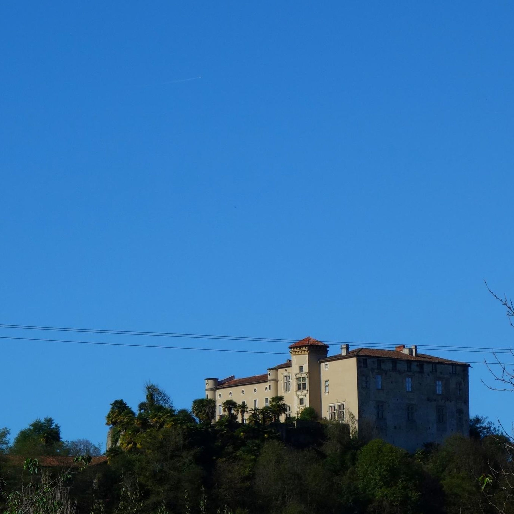
The plateau on which the ruins of the old Notre-Dame-de-la-Pitié church and its castle are located offers lovely views.
0
0

There is not much left of the chapel, but the bells of the chapel ring every hour on the hour. I was very surprised by that.
0
0
beautiful lake next to the village Touille, you can also swim in it.
0
0
Frequently Asked Questions
How many hiking trails are available around Saleich?
There are over 45 hiking routes around Saleich, catering to various skill levels. You'll find everything from easy strolls through the countryside to more challenging mountain excursions in the Pyrenean foothills.
Are there any easy hiking trails suitable for beginners or families?
Yes, Saleich offers several easy trails. For a pleasant introduction to the local scenery, consider the Salies-du-Salat - Montsaunès Loop, an easy 6.7 km route that takes about 1 hour 50 minutes. The region research also mentions the "Saleich loop via Urau and Castelbiague" as an easy 13.96 km hike, showcasing varied landscapes and architectural sites.
What kind of landscapes can I expect to see while hiking in Saleich?
The Saleich region boasts diverse landscapes, from lush forests of beech, ash, chestnut, and boxwood to open fields, plateaus, and plains. You'll also experience the picturesque Pyrenean foothills, with routes offering expansive views over the Saléchois plateau and the Urau plain. The area is also known for its unique karst formations.
Are there any circular walks in the Saleich area?
Yes, many trails around Saleich are circular, allowing you to start and end at the same point. A popular moderate option is the Urau Washhouse – Figonrunden loop from Saleich, which covers about 13.77 km. Another great choice is the Montsaunès church loop from Salies-du-Salat, a moderate 8.5 km route.
What are some notable viewpoints or scenic spots along the trails?
Many trails offer superb views. The Look out point over the valley loop from Chein-Dessus is specifically designed to provide expansive vistas over the valley. Additionally, the "SALEICH - CHAPELLE - PRE CARRE" route is known for excellent viewpoints over the Saléchois plateau and the Urau plain, including a large field with an expansive view of the Salat plain.
Are there any historical or natural attractions to explore near the hiking routes?
Absolutely! You can discover several interesting points. Along some routes, you might find the vestiges of the Saleich castle. The region research also mentions the Chapel of Vallatès and the Murrets Bridge. For natural wonders, the Planque Waterfall is accessible via a shaded hike, and the Grotte de Laspugues is a point of interest on the "SALEICH - CHAPELLE - PRE CARRE" route. You can also visit the Col de Larrieu (704 m) or the Old railroad embankment.
What do other hikers say about the trails in Saleich?
The hiking trails around Saleich are highly regarded by the komoot community, with an average rating of 4.2 stars from over 90 reviews. Hikers often praise the varied terrain, from gentle foothills to more challenging paths, and the picturesque river valleys. Over 600 hikers have used komoot to explore the area's diverse routes.
Are there any challenging hikes for experienced trekkers?
Yes, for those seeking a more strenuous adventure, the Cournudère Summit loop from Arbas is a difficult 18.6 km path with significant elevation gain, leading to higher elevations. The "SALEICH - CHAPELLE - PRE CARRE" route is also described as a "sporty and wild" itinerary with a substantial 550-meter elevation gain over 11.0 km.
Can I find information about the "SALEICH - CHAPELLE - PRE CARRE" route?
Yes, the "SALEICH - CHAPELLE - PRE CARRE" is an 11.0 km walking circuit with a 550-meter elevation gain, taking around 4 hours and 30 minutes. It's known for its sporty and wild scenery and superb viewpoints. You can find more details about this specific route on Hautegaronnetourisme.com.
What is the best time of year to go hiking in Saleich?
The region around Saleich, with its diverse landscapes and proximity to the Pyrenees, is generally pleasant for hiking during spring, summer, and autumn. Summer offers shaded hikes to places like the Planque Waterfall, which can be particularly refreshing. Always check local weather conditions before heading out.
Are there any villages or towns nearby worth visiting after a hike?
Yes, several charming villages are within a reasonable distance. Audressein and Saint-Lizier are notable for their historical and cultural points of interest. Saint-Lizier, in particular, is designated as a "Most Beautiful Village" and is located within the Natural Regional Park of the Ariege Pyrenees, making it a great place to explore.
Most popular attractions around Saleich

Get inspired with the komoot mobile app


Explore more
Browse the best Hikes in other regions.
