The best road cycling routes around Nomeny
4.4
(20)
414
riders
15
rides
Road cycling around Nomeny, located in northeastern France, offers varied terrain suitable for cyclists. The region features a topography with altitudes ranging from 179m to 340m, providing a mix of flat sections and undulating hills. Cyclists can explore routes along the Seille River valley, through forested areas like Foret de la Reine, and around historical landmarks. The area's proximity to larger cities like Nancy and Metz also allows for longer excursions.
Best road cycling routes around Nomeny
- The most popular…
Last updated: July 2, 2026
5.0
(5)
18
riders
64.0km
02:52
660m
660m
Moderate road ride. Good fitness required. Mostly well-paved surfaces and easy to ride.
14
riders
Moderate road ride. Good fitness required. Mostly well-paved surfaces and easy to ride.

Sign up for free
5.0
(2)
8
riders
53.2km
02:25
480m
480m
Moderate road ride. Good fitness required. Mostly well-paved surfaces and easy to ride.
5.0
(1)
6
riders
59.4km
02:39
590m
590m
Moderate road ride. Good fitness required. Some segments of this route may be unpaved and difficult to ride.
6
riders
95.3km
04:08
750m
750m
Moderate road ride. Good fitness required. Mostly well-paved surfaces and easy to ride.
Get access to more routes and recommendations from other explorers.
Sign up for free
Already have an account?
Our route recommendations are based on thousands of hikes, rides, and runs completed by other people on komoot.
Start today with a free account
Your next adventure awaits.
Login or Signup


Tips from the Community

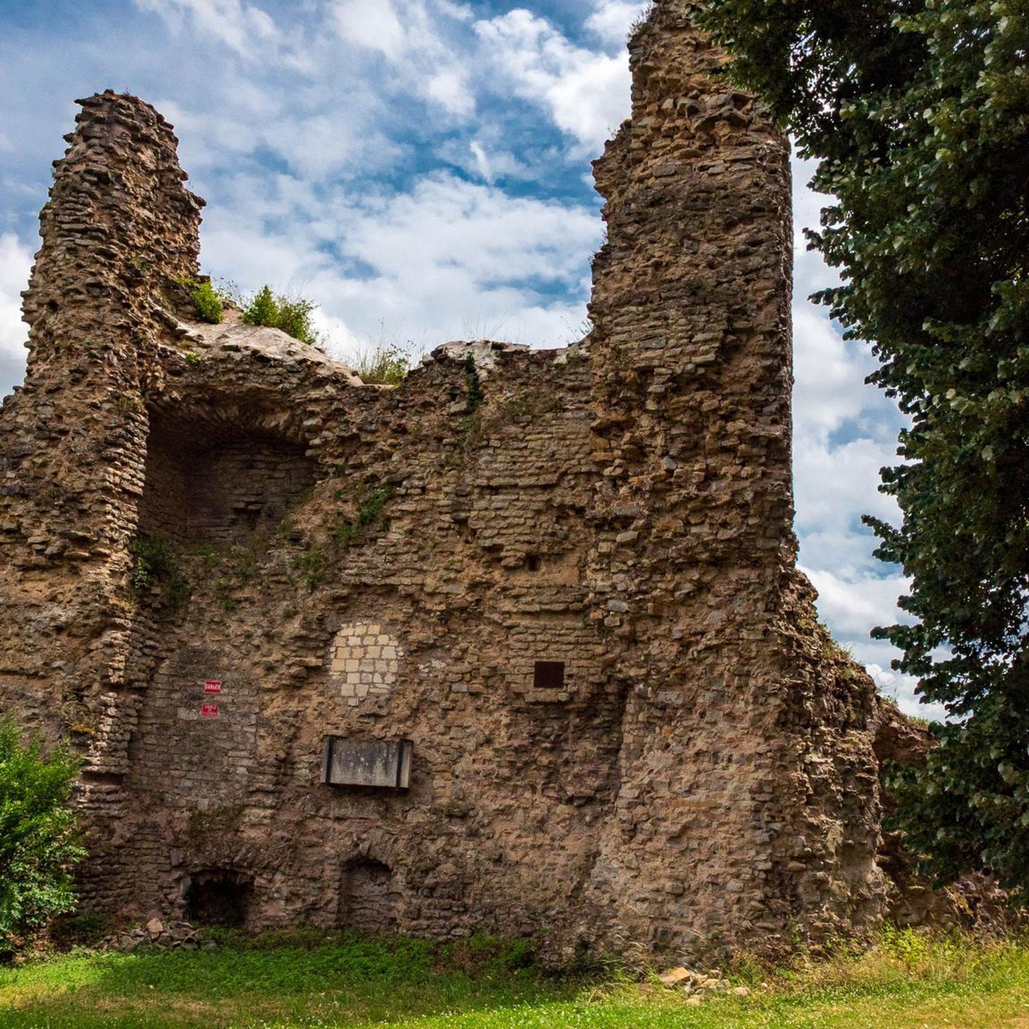
In the heart of Nomeny lie the remains of a medieval castle that was once a strategic stronghold of the bishops of Metz. Built in the 12th century and fortified in the 14th century, the castle had a rich history until it was largely dismantled in the 17th century. Today, a few towers, walls and moats are still visible — silent witnesses to a glorious past.
5
0

You live in Meurthe et Moselle, do you know where the two rivers meet?
2
0

Unfortunately not open to visitors.
2
0

Finally along the Moselle and not on a canal.
1
0

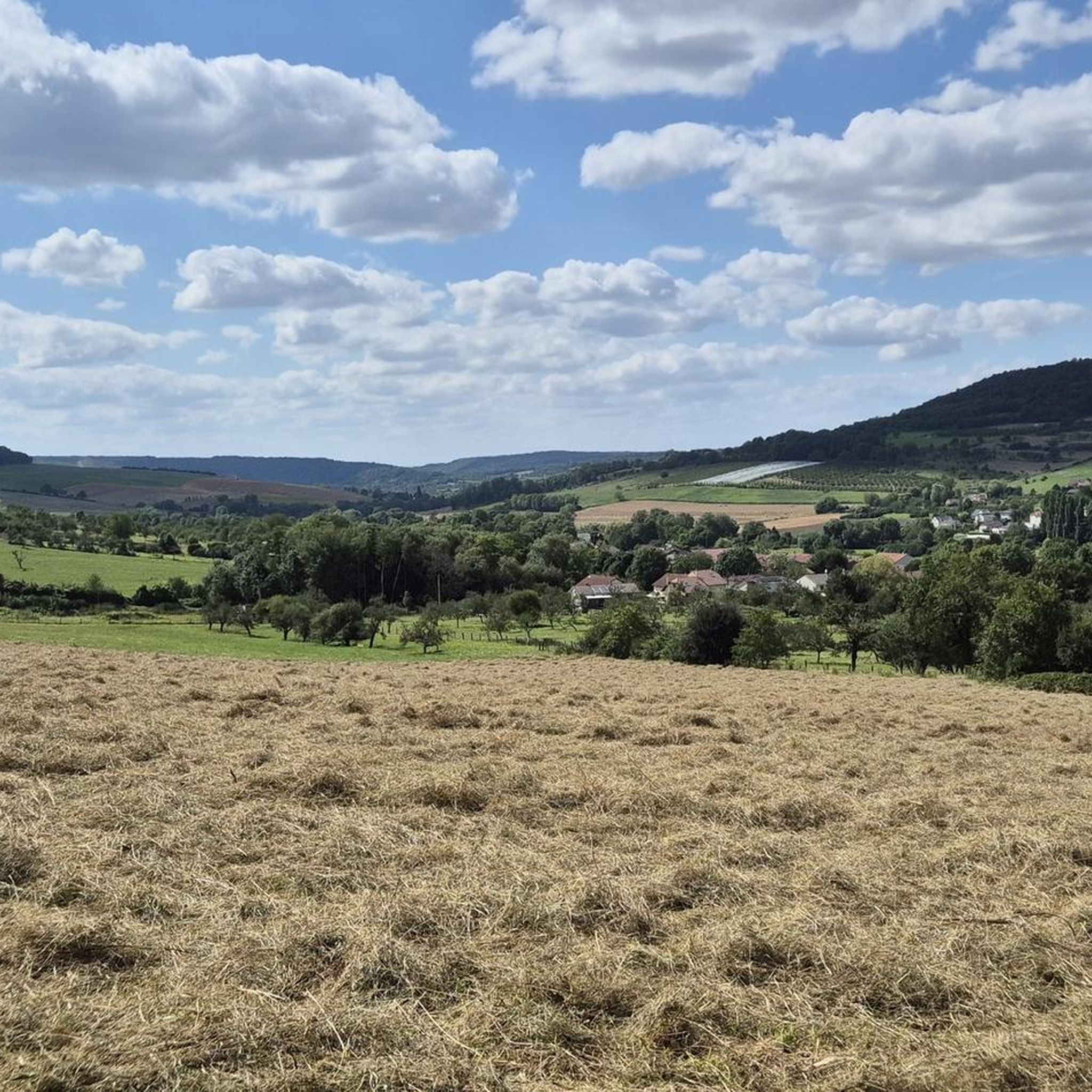
Culminating at an altitude of 400 meters, the Côte de Delme has more than 100 ha of limestone lawns offering an unobstructed view of the Saulnois and the Nied valley. The Côte de Delme is part of a regional nature reserve. There is a picnic area at the northern entrance to the reserve.
0
0

Ruins of an old castle. Beautiful green and overgrown
0
0

Church having paintings dating from 1450 to 1550. Except the heart, made by a painter in 1700.
0
0

The Meurthe and the Moselle meet at the level of the place called the gates of Hell. For centuries, river traffic on the Meurthe has transported wood from the Vosges mountains. By joining the Moselle in a northerly direction, the boats could reach the Rhine. The river then had an economic influence that it has lost today.
5
1
Frequently Asked Questions
How many road cycling routes are available around Nomeny?
There are 16 road cycling routes around Nomeny listed on komoot, offering a variety of experiences for different skill levels.
What kind of terrain can I expect on road cycling routes near Nomeny?
The region around Nomeny features a varied topography, with altitudes ranging from 179m to 340m. You can expect a mix of relatively flat sections, particularly along the Seille River valley, and undulating hills that provide more challenging climbs and descents, such as those around Mont Saint-Jean.
Are there road cycling routes suitable for beginners or families in Nomeny?
Yes, Nomeny offers routes suitable for various abilities. While some local paths might be geared towards mountain biking, there are designated cyclable itineraries in the vicinity, including those in Moivrons, Villers-lès-Moivrons, and Leyr, which are described as largely flat, safe, and accessible. Komoot lists 2 easy road cycling routes in the area.
What are some notable natural features or landscapes I can see while cycling around Nomeny?
Cyclists can enjoy diverse natural beauty. Routes often pass through scenic areas like the Foret de la Reine, located about 35 km away, or offer views of the Parc naturel régional de Lorraine, around 17.6 km from Nomeny. The Seille River valley provides pleasant, often flatter, cycling paths with picturesque views.
Are there any historical landmarks or attractions along the road cycling routes?
Yes, several routes incorporate historical sites. For instance, the Chateau – Ornate Water Fountain loop from Nomeny passes by historical chateaus. Other nearby attractions within cycling distance include Chapel of Light, Sainte-Agathe Chapel, and the Burgruine – chateau loop from Nomeny explores historical ruins and chateaus.
What do other road cyclists enjoy most about the routes in Nomeny?
The road cycling routes in Nomeny are highly rated by the komoot community, with an average score of 4.7 stars from over 10 reviews. Cyclists often praise the varied terrain, which includes both river valleys and forested sections, and the options for different difficulty levels.
Are there any circular road cycling routes available from Nomeny?
Yes, many of the routes around Nomeny are designed as loops. Examples include the Chateau – Delme Hill loop from Nomeny, which leads through rolling hills, and the Chateau – Col de Moivrons (359 m) loop from Nomeny.
What is the best time of year for road cycling in Nomeny?
The Lorraine region, where Nomeny is located, generally offers pleasant cycling conditions from spring through autumn. These seasons provide comfortable temperatures and vibrant landscapes, making them ideal for exploring the varied terrain and natural features.
Can I reach Nomeny and its cycling routes using public transport?
Nomeny is situated between the larger cities of Nancy and Metz. While specific public transport options for carrying bicycles directly to trailheads in Nomeny may vary, these larger cities offer more extensive public transport networks that could serve as starting points for longer cycling excursions into the Nomeny area.
Are there options for longer road cycling tours from Nomeny?
Absolutely. Nomeny's proximity to larger cities like Nancy (22 km) and Metz (25 km) allows for longer cycling excursions. You could plan a ride to explore attractions such as Place Stanislas in Nancy or Metz Cathedral. An example of a longer route is the Voie Verte du Grand Couronné – Moselle Riverside Path loop from Nomeny, which is over 95 km long.
Where can I find places to eat or stay near the cycling routes in Nomeny?
Nomeny itself offers local amenities, including cafes and restaurants. For a wider selection of accommodation and dining options, the nearby cities of Nancy and Metz provide extensive choices, which can be convenient for cyclists planning multi-day trips or seeking more services.
Most popular attractions around Nomeny

Get inspired with the komoot mobile app


Explore more
Browse the best Road cycling routes in other regions.
