The best walks and hikes around Anglards-De-Saint-Flour
4.3
(140)
755
hikers
66
hikes
Hiking around Anglards-De-Saint-Flour offers exploration of a diverse landscape situated at an elevation of 840 meters. The area lies between the valleys of the Ander and Truyère rivers, at the edge of Europe's largest stratovolcano, the Cantal Massif. This region features volcanic plateaus, such as the Aubrac and Planèze, alongside deep gorges carved by rivers like the Truyère and Bes. The terrain provides varied options for outdoor activities, from high plateaus to extensive forests and meadows.
Best hiking trails around Anglards-De-Saint-Flour
- The most popular hiking route is Ruynes-en-Margeride – The Margeride Viewpoint loop from Ruynes-en-Margeride, a 7.7 miles (12.4 km) trail that takes 3 hours 50 minutes to complete, offering views of the surrounding landscape.
- Another top favourite among local hikers is Les Bois du Pirou loop from Le Pirou, an easy 2.0 miles (3.2 km) path. This route winds through local woodlands with minimal elevation gain.
- Local hikers also love the Les Bois du Pirou loop from Rayrolles, a 8.5 miles (13.7 km) trail leading through varied terrain, often completed in about 3 hours 45 minutes.
- Hiking around Anglards-De-Saint-Flour is defined by volcanic landscapes, river gorges, and plateaus. The network of trails offers options for various ability levels, from easy walks to more challenging routes.
- The routes in Anglards-De-Saint-Flour are highly rated by the komoot community with an average score of 4.5 stars from over 100 reviews. More than 690 hikers have used komoot to explore Anglards-De-Saint-Flour's varied terrain.
Last updated: June 29, 2026
4.6
(7)
17
hikers
Moderate hike. Good fitness required. Easily-accessible paths. Suitable for all skill levels.
13
hikers
3.18km
00:51
30m
30m
Easy hike. Great for any fitness level. Easily-accessible paths. Suitable for all skill levels.

Sign up for free
4.5
(2)
5
hikers
13.7km
03:41
170m
170m
Moderate hike. Good fitness required. Easily-accessible paths. Suitable for all skill levels.
3.5
(2)
8
hikers
28.4km
08:04
610m
610m
Hard hike. Very good fitness required. Easily-accessible paths. Suitable for all skill levels.
5.0
(1)
7
hikers
12.5km
03:26
200m
200m
Moderate hike. Good fitness required. Easily-accessible paths. Suitable for all skill levels.
Get access to more routes and recommendations from other explorers.
Sign up for free
Already have an account?
Our route recommendations are based on thousands of hikes, rides, and runs completed by other people on komoot.
Start today with a free account
Your next adventure awaits.
Login or Signup
Tips from the Community

The old cathedral of Saint Flour.
0
0


Panoramic view of Cantal and the lower town.
0
0

Ruynes-en-Margeride is recognizable from afar thanks to its 12th century tower. The latter houses the Margeride eco-museum as well as the garden of Saint-Martin. The beautiful fountain located on Place Gambetta is also to be discovered.
1
0
The name of Saint-Flour comes from Florus, a bishop who came to evangelize the region in the 4th century. The city, located on a volcanic promontory, is doubly protected by ramparts and fortified gates. In the 14th century, the city, due to its importance within the Cantal region, received the prestigious title of religious capital of Haute-Auvergne. The numerous buildings from this period are an integral part of the city and contribute to its beauty.
1
0
Frequently Asked Questions
How many hiking trails are available around Anglards-De-Saint-Flour?
There are over 65 hiking routes in the Anglards-De-Saint-Flour area. These trails offer a diverse range of experiences, from easy strolls to more challenging treks, catering to various fitness levels.
Are there easy hiking trails suitable for beginners or families in Anglards-De-Saint-Flour?
Yes, Anglards-De-Saint-Flour offers a good selection of easy trails. Approximately half of the routes, around 32, are classified as easy. An example is the Les Bois du Pirou loop from Le Pirou, which is a gentle 3.2 km path winding through local woodlands with minimal elevation gain.
What kind of landscapes can I expect to see while hiking in this region?
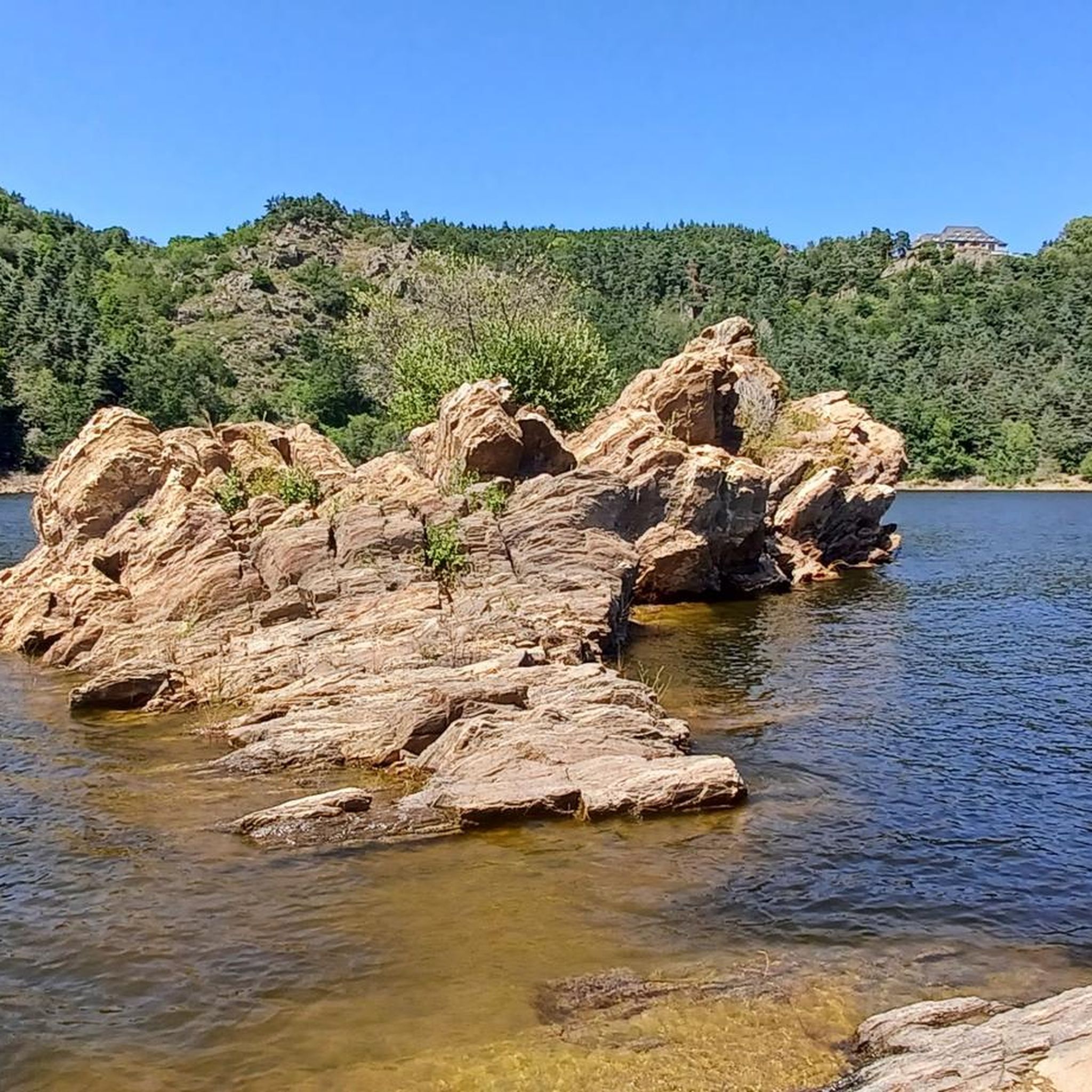
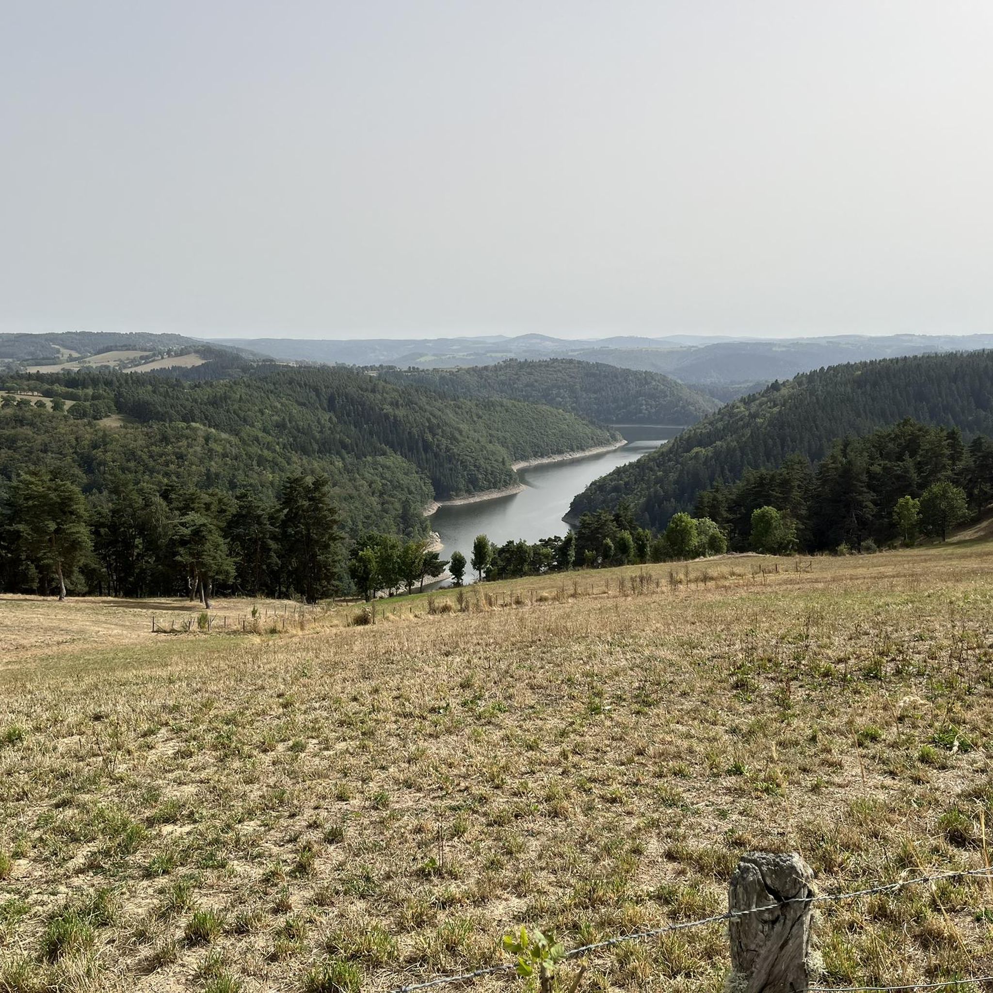
The region around Anglards-De-Saint-Flour is incredibly diverse. You'll hike through volcanic landscapes, dramatic river gorges like the Gorges de la Truyère, and expansive plateaus. The area is situated between the valleys of the Ander and Truyère rivers, at the edge of Europe's largest stratovolcano, offering unique geological features and varied terrain.
Are there any circular hiking routes available?
Yes, many routes in the area are circular, allowing you to start and end at the same point. For instance, the Ruynes-en-Margeride loop from Ruynes-en-Margeride is a popular 4.7 km circular trail that takes you through rural surroundings.
What are some interesting landmarks or attractions I can see near the hiking trails?
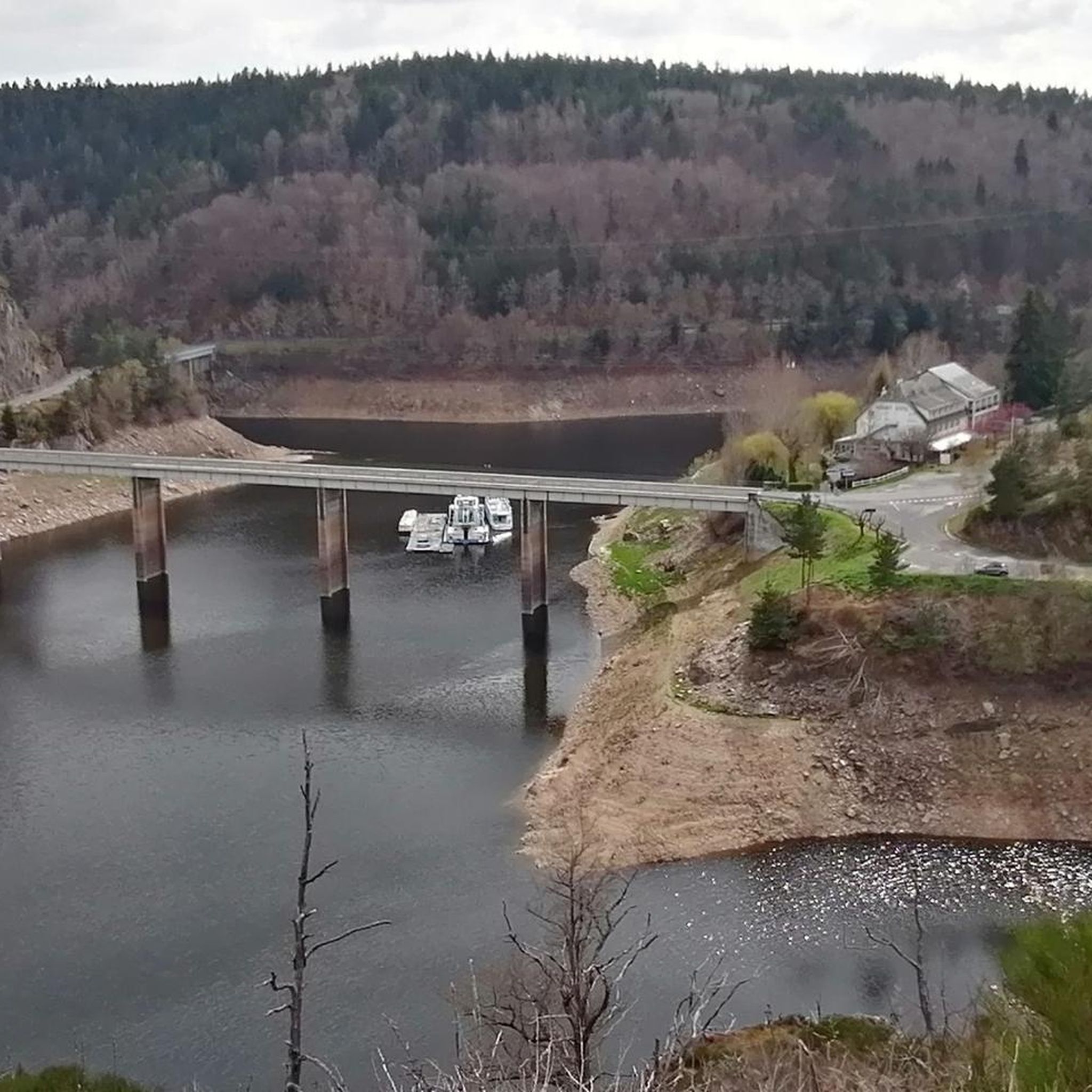
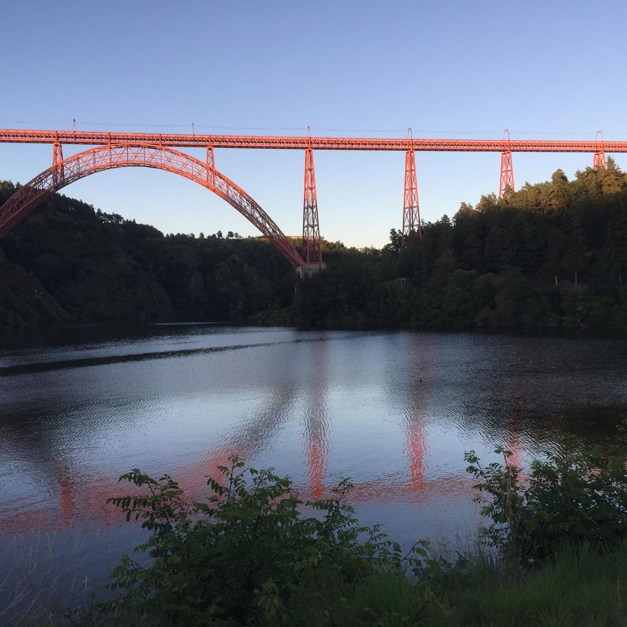
The area boasts several notable attractions. You can explore the historic town of Saint-Flour with its protected ramparts, or admire the impressive Garabit Viaduct from various viewpoints. The stunning Truyère Gorges also offer breathtaking views and are accessible via marked trails.
What do other hikers say about the trails in Anglards-De-Saint-Flour?
The hiking trails in Anglards-De-Saint-Flour are highly regarded by the komoot community, holding an average rating of 4.5 stars from over 100 reviews. Hikers often praise the varied terrain, the stunning natural beauty, and the well-maintained paths that cater to different skill levels.
Are there any longer, more challenging hikes for experienced hikers?
Absolutely. While there are many easy and moderate options, the region also offers more demanding routes. For example, the Ruynes-en-Margeride – The Margeride Viewpoint loop from Ruynes-en-Margeride is a moderate 12.4 km trail with significant elevation gain, offering expansive views of the landscape. There are also 2 routes classified as difficult for those seeking a greater challenge.
Can I find trails that offer good viewpoints?
Yes, the diverse topography of the region, including its volcanic landscapes and river gorges, provides numerous opportunities for scenic viewpoints. Trails often lead to elevated positions offering panoramic vistas, such as those found on the Margeride Viewpoint loop.
What is the typical duration for hikes in Anglards-De-Saint-Flour?
Hike durations vary significantly depending on the trail's length and difficulty. Easy walks like the Les Bois du Pirou loop from Le Pirou can be completed in about an hour, while moderate trails such as the Les Bois du Pirou loop from Rayrolles might take around 3.5 to 4 hours.
Are there any castles or historical sites accessible via hiking trails?
Yes, the region is rich in history. You can find historical sites like Alleuze Castle, which can be integrated into your hiking excursions, offering a glimpse into the region's past amidst natural beauty.
Is Anglards-De-Saint-Flour a good destination for ecotourism?
Yes, Anglards-De-Saint-Flour is well-suited for ecotourism. The area features dedicated trails like the 12 km 'La Fromentale' specifically designed for exploring the village and its natural surroundings, emphasizing the local environment and sustainable outdoor activities.
Most popular routes around Anglards-De-Saint-Flour
Most popular attractions around Anglards-De-Saint-Flour

Get inspired with the komoot mobile app


Explore more
Browse the best Hikes in other regions.
