Top 11 Mountain Passes around La Croix-Sur-Roudoule
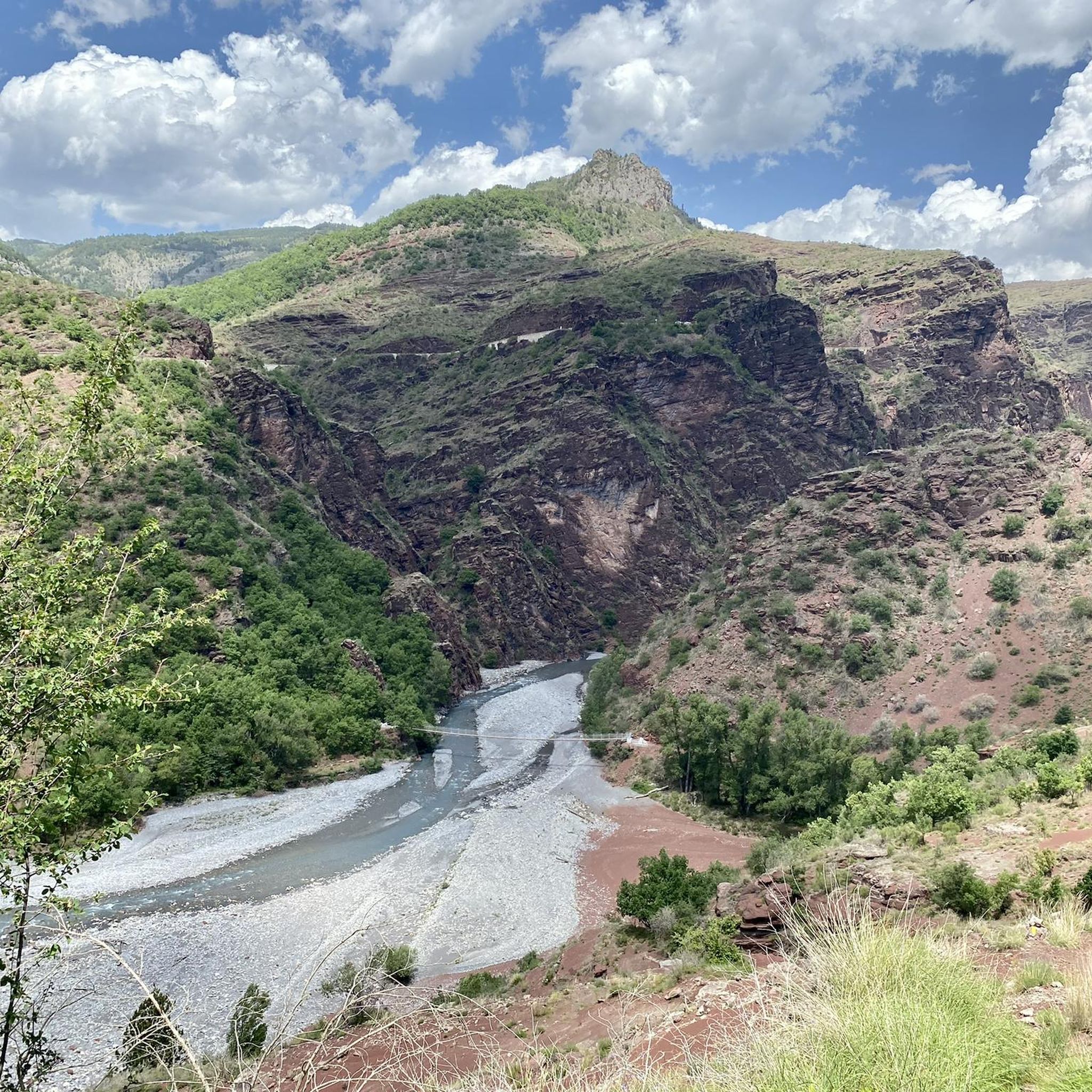
Best mountain passes near La Croix-Sur-Roudoule are found in a region characterized by its mountainous terrain and deep gorges. La Croix-Sur-Roudoule, a village at 853 meters altitude, serves as a gateway to various ascents and historical routes. The area features dramatic cliffs, winding roads, and panoramic views of the Roudoule valley and surrounding peaks. These routes offer a combination of challenging climbs and historical significance.
Best mountain passes around La Croix-Sur-Roudoule
- The most popular mountain passes is Col du Raton…
Last updated: June 26, 2026
Col du Raton
Highlight • Mountain Pass
Translated by Google •
Tip by

Col de Félines (930 m)
Highlight • Mountain Pass
Translated by Google •
Tip by

Sign up now to discover places like this
Get recommendations on the best single tracks, peaks, & plenty of other exciting outdoor places.
Sign up for free
Col de Saint-Raphaël
Highlight • Mountain Pass
Translated by Google •
Tip by
Col de Sainte-Anne
Highlight • Mountain Pass
Translated by Google •
Tip by
Col de Valberg
Highlight • Mountain Pass
Translated by Google •
Tip by
Sign up for free to discover even more mountain passes around La Croix-Sur-Roudoule.
Sign up for free
Already have an account?
Start today with a free account
Your next adventure awaits.
Login or Signup

Tips from the Community

The Col de Sainte-Anne is a pass at an altitude of 425 meters in the French department of Bouches-du-Rhône.
0
0

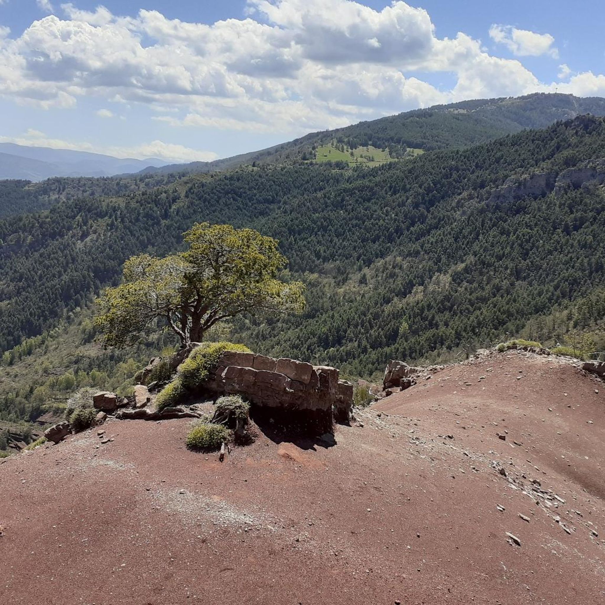
Nestled in the Southern Alps, the Col du Raton offers a wild and unspoiled route, perfect for mountain bike enthusiasts. Culminating at 1,686 meters, it crosses landscapes of steep mountains, pine forests and alpine meadows. The pass reveals breathtaking panoramas of the surrounding valleys, with a clear view of the neighboring peaks. The climb, although sporty, is rewarded by the raw beauty of nature.
0
0

Nice pass of the pre-Alps to do from Entrevaux. The beginning is steep but offers a very beautiful view of the citadel of Entrevaux. the second part is easier and allows you to climb a regular slope in the heart of the Mediterranean landscapes, then a pine forest.
1
0

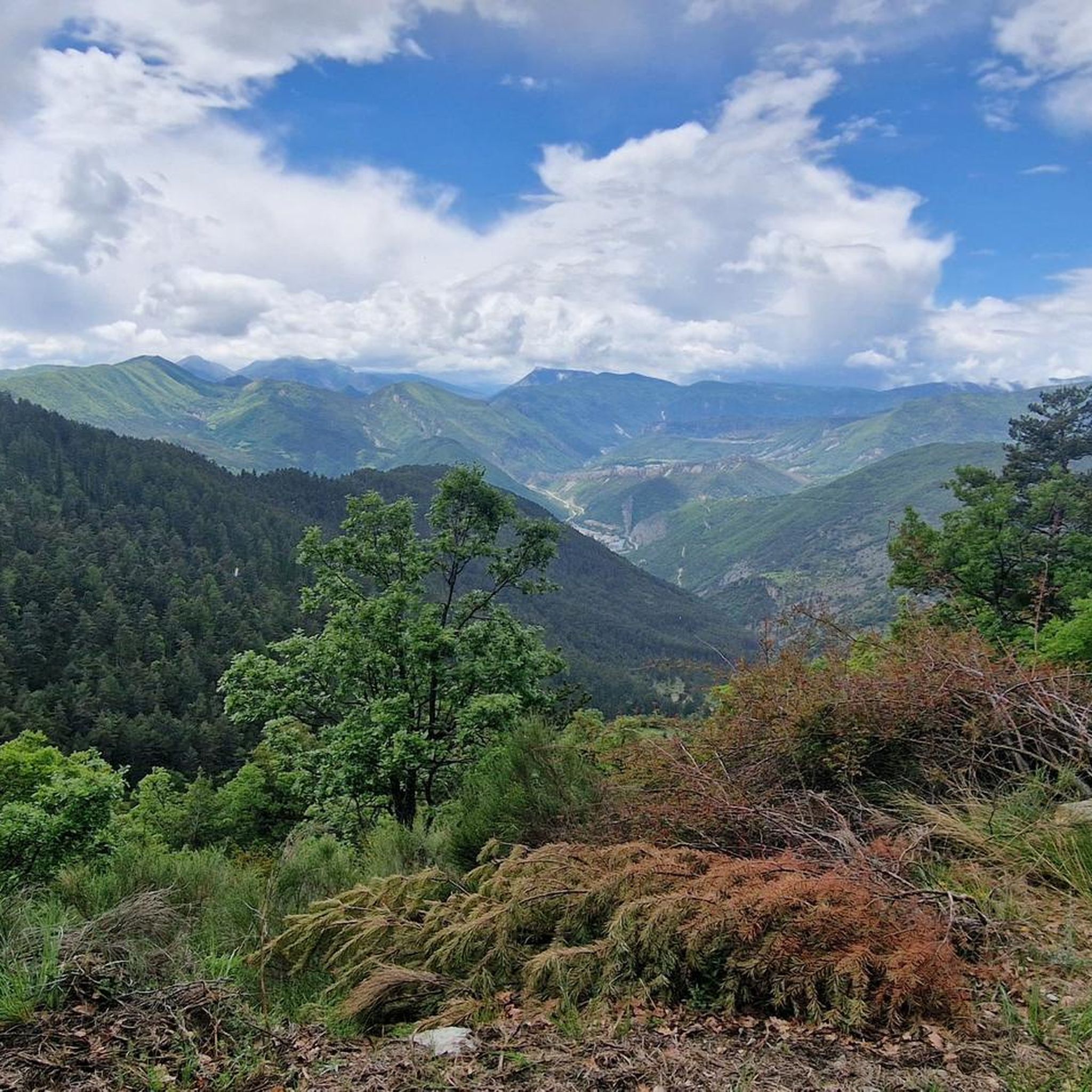
Gateway to the Pre-Alps, from the Var valley. Superb view of the foothills of the Mercantour massif and the Var Valley.
2
0

The Col de Sainte-Anne is 3.9 km long with an elevation gain of 228 m and an average gradient of 5.8%.
2
0
The Col de Valberg from Guillaumes is 12km long, with a vertical drop of 878m and an average gradient of 7.32%.
3
0
The Col de St Raphael from Puget Theniers is 8km long with 465m of elevation gain. The average slope is 4.8%.
2
0
The Col de Félines from Entrevaux is about 7.5 kilometers long with a positive elevation of 445 meters. The average gradient of the climb is 6% with maximum ramps of 12% at the start of the climb (don't worry, it gets easier!).
2
0
Frequently Asked Questions
What are some of the most scenic mountain passes in the La Croix-Sur-Roudoule area?
The region offers several passes with stunning views. The ascent to La Croix-sur-Roudoule itself, starting from Puget-Théniers, provides "belles vues vertigineuses" (beautiful dizzying views) over the Gorges de la Roudoule. From the village, you can enjoy a magnificent panorama of the Dôme de Barrot and the Léouvé cirque. Another option is Col de Saint-Raphaël, which offers superb views of the Mercantour massif foothills and the Var Valley.
Are there mountain passes with historical significance near La Croix-Sur-Roudoule?
Yes, the Col de Roua is notable for being part of an ancient Roman road, with sections of its paving still recognizable and recently restored. It served as a mule track and is integrated into scenic hiking loops in the Roudoule valley, offering a connection to the past.
What kind of natural features can I expect to see when exploring mountain passes in this region?
You'll encounter dramatic cliffs, winding roads, and deep gorges, particularly in the Gorges de la Roudoule. Passes like Col du Raton feature landscapes of steep mountains, pine forests, and alpine meadows, offering breathtaking panoramas of the surrounding valleys and peaks. The "Colorado Niçois" region, accessible via routes around Col de Roua, is known for its striking red rock landscapes.
What outdoor activities can I do near these mountain passes?
The area is excellent for cycling and hiking. For road cycling, you can explore routes like the "Ascros Village and Castle – Col de Saint-Raphaël loop from Puget-Théniers" or the "Climb to Col de Saint-Leger – View of Entrevaux loop from Puget-Théniers." You can find more options in the Road Cycling Routes around La Croix-Sur-Roudoule guide. For gravel biking, consider the "Col du Raton – Raton loop from Valberg" or the "Col de la Couillole – Col de Sainte-Anne loop from Valberg," detailed in the Gravel biking around La Croix-Sur-Roudoule guide.
Are there any easy or moderate mountain passes suitable for beginners or less experienced cyclists?
Yes, the Col de Sainte-Anne is considered an easy-going road with good quality, featuring a 3.9 km climb with an average gradient of 5.8%. Another option is the Col de Saint-Raphaël, described as a small climb with a nice road and almost no car traffic, making it pleasant for a less strenuous ride.
Which mountain passes offer challenging climbs for experienced cyclists?
For a more challenging experience, consider the ascent to La Croix-sur-Roudoule itself, which features a maximum gradient of 8.5% over 580 meters. The Col de Valberg from Guillaumes is a significant climb, 12km long with an 878m vertical drop and an average gradient of 7.32%. The Col de Félines (930 m) also presents a challenge, with initial ramps up to 12% from Entrevaux.
What do visitors particularly enjoy about the mountain passes around La Croix-Sur-Roudoule?
Visitors appreciate the wild and unspoiled nature of routes like Col du Raton, which offers breathtaking panoramas. The quiet roads and superb views, such as those found on the Col de Saint-Raphaël, are also highly valued. The combination of challenging climbs and spectacular scenery makes these passes a rewarding experience for outdoor enthusiasts.
Are there any villages or points of interest along the routes to these mountain passes?
Yes, the ascent to La Croix-sur-Roudoule passes historical bridges, including a medieval bridge and a suspension bridge from 1889. The village of Saint-Léger, accessible via the D16 road towards Col de Saint-Léger, has historical significance for its role during WWII. Additionally, the route to Col de la Mairola offers the chance to experience Auvare, an authentic "eagle's nest" village with narrow streets and vaulted passages.
Can I find hiking trails that incorporate these mountain passes?
Absolutely. The Col de Roua is integrated into scenic hiking loops in the Roudoule valley, allowing you to explore its historical Roman road sections. The area around Auvare, near Col de la Mairola, also serves as a starting point for several hikes, providing access to the rugged beauty of the mountainous landscape.
What is the best time of year to visit the mountain passes around La Croix-Sur-Roudoule?
While specific seasonal details are not provided, mountain passes in this region are generally best enjoyed from late spring through early autumn (May to October) when the weather is milder and roads are clear of snow. This period offers optimal conditions for cycling and hiking, allowing you to fully appreciate the views and outdoor activities.
Are there any specific tips for cycling the mountain passes in this area?
When cycling, be prepared for consistent climbs and varying gradients. For example, the ascent to La Croix-sur-Roudoule has sections up to 8.5%. The Col de Félines (930 m) starts steep but eases up. Many routes, like Col de Saint-Raphaël, offer quiet roads with minimal traffic, enhancing the cycling experience. Always check road conditions, especially after heavy rain or in early spring/late autumn.
Most popular routes around La Croix-Sur-Roudoule
Most popular attractions around La Croix-Sur-Roudoule

Get inspired with the komoot mobile app


Explore more
See even more epic mountain passes by checking out these guides around La Croix-Sur-Roudoule:
