The best running trails in the Absaroka Range
4.0
(1)
139
runners
19
runs
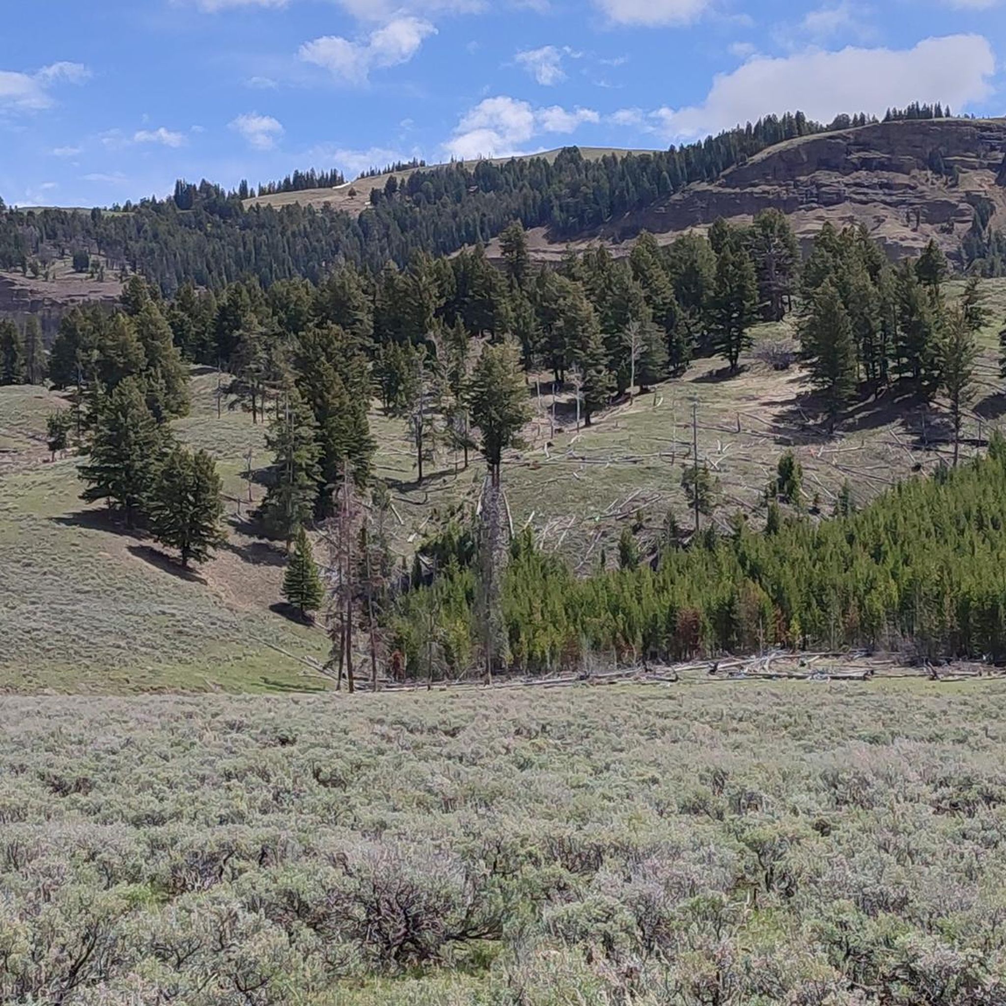
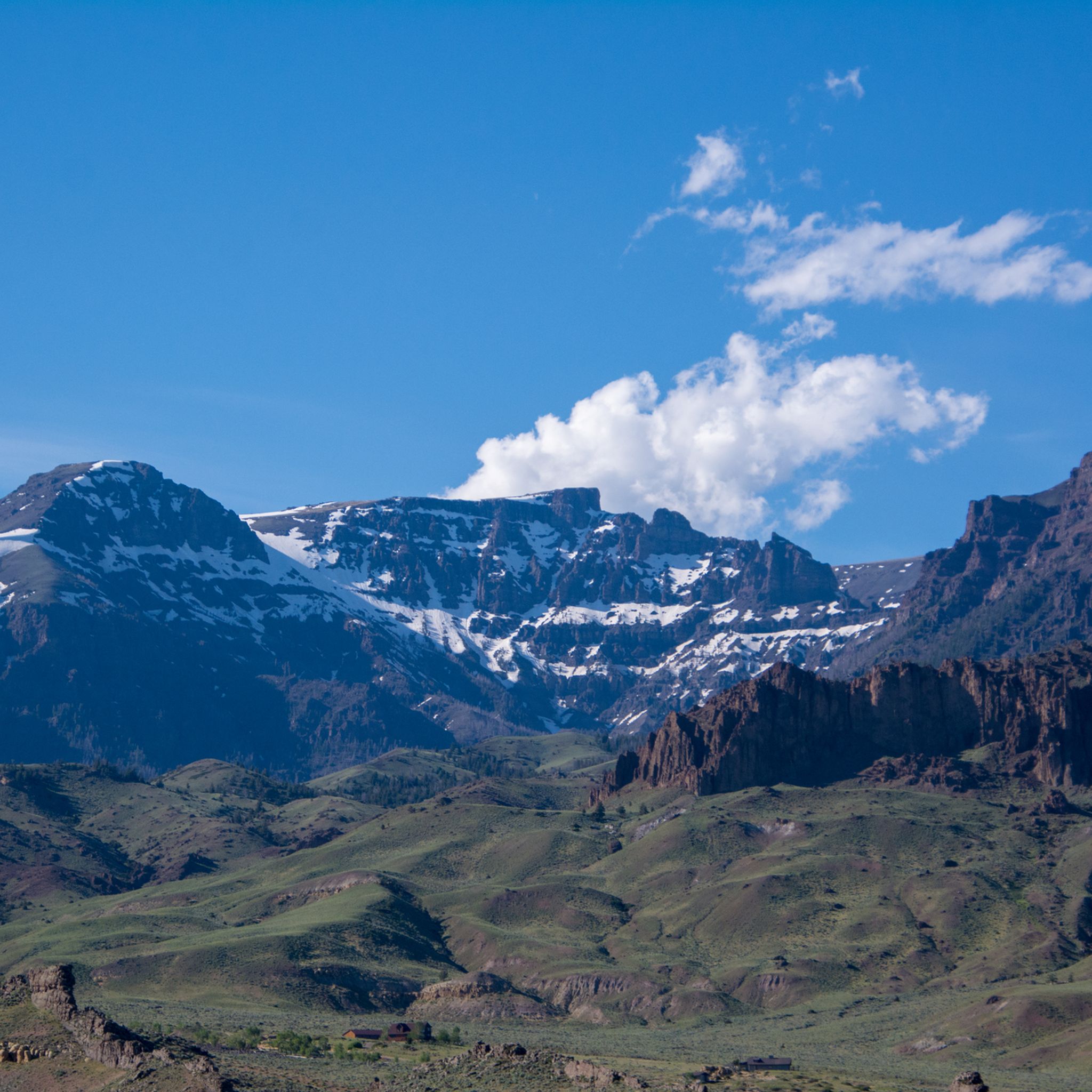
Jogging in the Absaroka Range offers access to a rugged landscape shaped by ancient volcanic activity, featuring distinctive spiny ridgelines and terraced peaks. The region includes vast wilderness areas with dense forests at lower elevations, transitioning to broad mountain meadows and alpine lakes. Numerous high peaks, some exceeding 12,000 feet, provide challenging terrain and significant elevation changes for runners. The range is also characterized by wild rivers and extensive trail networks, making it suitable for trail running.
Best jogging routes…
Last updated: August 21, 2026
19
runners
9.26km
01:11
230m
230m
Moderate run. Good fitness required. Mostly paved surfaces. Suitable for all skill levels.
11
runners
5.70km
00:36
50m
50m
Moderate run. Good fitness required. Mostly paved surfaces. Suitable for all skill levels.

Sign up for free
15
runners
5.46km
00:34
20m
10m
Moderate run. Good fitness required. Mostly paved surfaces. Suitable for all skill levels.
10
runners
Moderate run. Good fitness required. Mostly paved surfaces. Suitable for all skill levels.
15
runners
6.60km
00:48
160m
160m
Moderate run. Good fitness required. Mostly paved surfaces. Suitable for all skill levels.
7
runners
6.10km
00:45
100m
100m
Moderate run. Good fitness required. Mostly paved surfaces. Suitable for all skill levels.
8
runners
Hard run. Very good fitness required. Mostly paved surfaces. Suitable for all skill levels.
9
runners
Moderate run. Good fitness required. Mostly paved surfaces. Suitable for all skill levels.
4.0
(1)
6
runners
12.2km
01:16
50m
50m
Moderate run. Good fitness required. Mostly paved surfaces. Suitable for all skill levels.
4
runners
6.86km
00:50
70m
70m
Moderate run. Good fitness required. Mostly paved surfaces. Suitable for all skill levels.
Get access to more routes and recommendations from other explorers.
Sign up for free
Already have an account?
Our route recommendations are based on thousands of hikes, rides, and runs completed by other people on komoot.
Start today with a free account
Your next adventure awaits.
Login or Signup
Tips from the Community

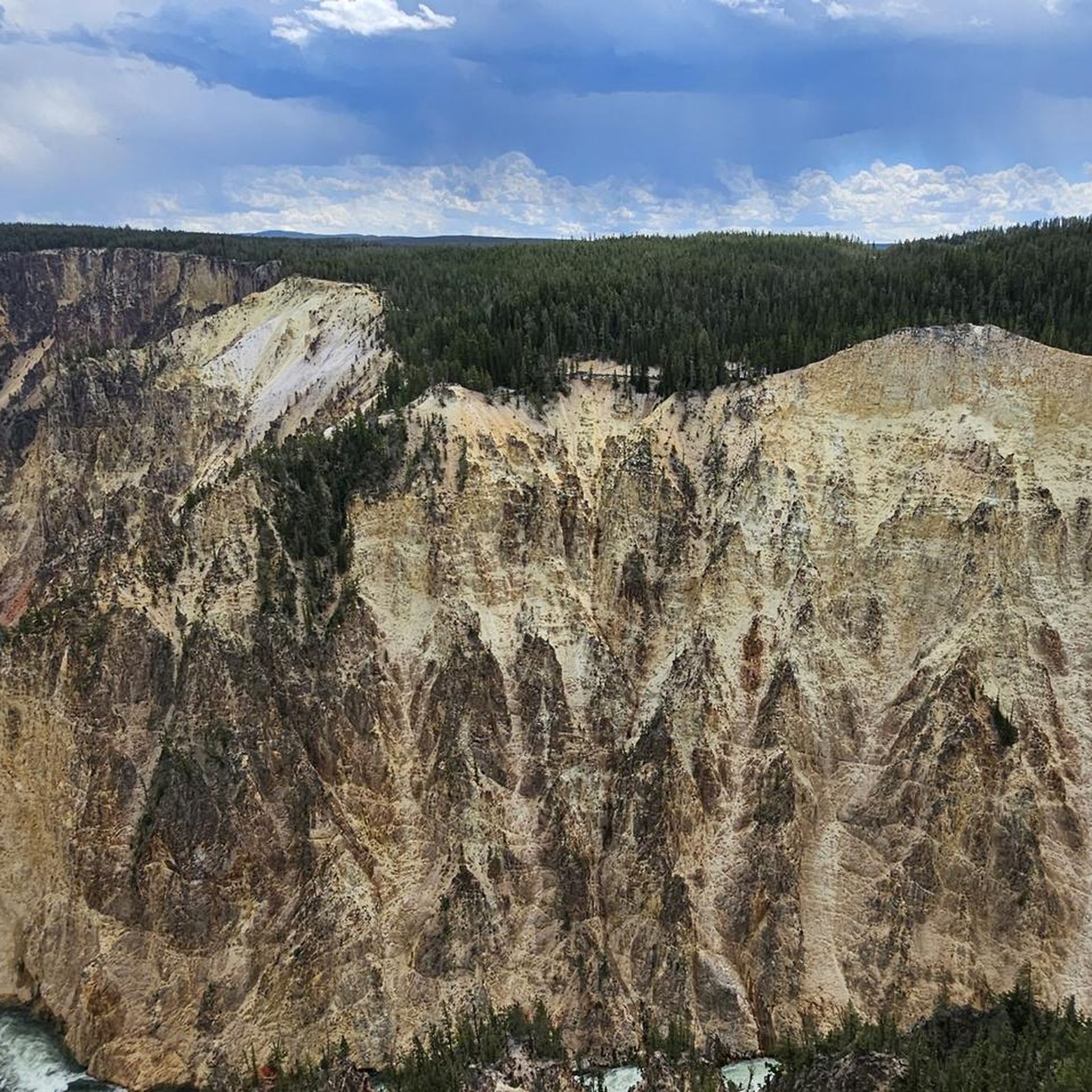
Lower Falls Of The Yellowstone River, Yellowstone National Park, United States 🇺🇸 The Grand Canyon of the Yellowstone stretches for roughly twenty miles and offers some of the most breathtaking vistas in the entire American West. Carved by the power of the Yellowstone River, the canyon walls display a stunning array of colors ranging from deep oranges and reds to brilliant yellows and whites, caused by the chemical weathering of iron compounds in the rhyolite rock. To get the best views of the Lower Falls, visitors should head to Artist Point or Lookout Point, which provide sweeping perspectives of the 308-foot waterfall as it plunges into the canyon below. Timing is essential when planning a visit to this iconic landmark, as the roar of the falls is most thunderous during the late spring and early summer when snowmelt increases the river's volume. It is highly recommended to arrive early in the morning to beat the large crowds and to witness the soft morning light illuminating the canyon walls. For those interested in a closer look, the Brink of the Lower Falls trail offers a steep but rewarding hike that leads directly to the edge of the precipice, allowing you to feel the mist and hear the deafening power of the water. Beyond the main overlooks, travelers should explore the various trails that line both the North and South Rims to find quieter spots for photography and wildlife viewing. The area is home to diverse fauna, including osprey that nest on the towering rock pinnacles and the occasional grizzly bear or elk wandering through the nearby forests. Always carry bear spray and stay on designated paths to protect the fragile geothermal environment. Because Yellowstone is a high-altitude park, it is wise to drink plenty of water and wear layers to accommodate the rapidly changing weather conditions common in the mountains. Faheem Hunarwar
0
0

Wonderful view of the waterfalls.
0
0
Hiking trails lead along the north and south sides of the canyon, offering frequent views of the waterfalls.
0
0
Lower Falls of the Yellowstone, Yellowstone National Park, United States 🇺🇸 The Lower Falls of the Yellowstone River are a majestic sight, plunging dramatically into the Grand Canyon of the Yellowstone. This iconic waterfall, nearly twice the height of Niagara Falls, is a testament to the raw power of nature and the volcanic forces that shaped this unique landscape. Visitors can marvel at its grandeur from various viewpoints, each offering a distinct perspective on the cascading water and the vibrant hues of the canyon walls. The Grand Canyon of the Yellowstone itself is a geological wonder, carved by the mighty Yellowstone River over thousands of years. Its rhyolite rock, altered by hot water and steam, displays a dazzling array of colors, from fiery reds and oranges to soft yellows and browns. Hiking trails wind along the rim and descend into the canyon, providing opportunities for intimate encounters with this breathtaking natural artistry. Exploring this area offers incredible photographic opportunities and a chance to truly connect with the wild heart of Yellowstone. Remember to stay on marked trails for safety and to protect the delicate ecosystem. Early mornings or late afternoons often provide the best light for photography and fewer crowds, allowing for a more serene experience.
1
0

This point looks out from the north rim of the Grand Canyon of Yellowstone. Look upstream, and you'll see the thundering, 308-foot drop of Lower Yellowstone Falls.
0
0
This 110-foot waterfall is only small in comparison to the lower falls, which are almost 330 feet high. Needless to say the upper falls are still magnificent, and the interesting colors in the canyon walls are the result of this region's constant hydrothermal activity.
0
0

A short paved trail enclosed by a retaining wall of waist-high boulders leads you out to the canyon's edge where you are treated to an epic view of the Yellowstone River and dramatic white cliffs. There is a walkway that leads along the canyon rim from here to the lower overlook.
0
0

A real highlight in Yellowstone Park. However, it is quite crowded as the parking lot is only a few meters away. In high season, a view of the Lower Falls becomes a challenge. It is worth taking the hiking trail along the rim to the Upper Falls. Here you can enjoy spectacular views that are not so crowded.
0
0
Frequently Asked Questions
How many running routes are available in the Absaroka Range?
The Absaroka Range offers a selection of 17 dedicated running routes on komoot, catering to various preferences. These include 2 easy routes, 12 moderate routes, and 3 more challenging options for experienced trail runners.
What kind of terrain can I expect on jogging trails in the Absaroka Range?
Jogging in the Absaroka Range means navigating a rugged landscape shaped by ancient volcanic activity. You'll encounter distinctive spiny ridgelines, terraced peaks, and vast wilderness areas. Trails often lead through dense forests at lower elevations, transitioning into broad mountain meadows, and sometimes reaching high-altitude terrain with significant elevation changes. The region is known for its challenging yet rewarding trail running experience.
Are there any routes with impressive waterfalls in the Absaroka Range?
Yes, several running routes offer stunning views of waterfalls. For example, the Lookout Point – Red Rock Point loop from Lower Yellowstone Falls provides views of the Yellowstone River and its dramatic falls. You can also explore the Upper Yellowstone Falls – Upper Falls Viewpoint loop from Upper Yellowstone Falls for perspectives of the Upper Yellowstone Falls. These routes often pass by highlights like Upper Yellowstone Falls and Lower Yellowstone Falls.
What are some notable viewpoints or landmarks along the running paths?
The Absaroka Range is rich with breathtaking viewpoints. Many routes offer panoramic vistas, such as those from View of Lower Falls from Artist Point, Lookout Point, and Inspiration Point View of the Grand Canyon of the Yellowstone. These spots provide magnificent perspectives of the Yellowstone River and its surrounding geological formations.
What is the best time of year for running in the Absaroka Range?
Given the high altitudes and rugged nature of the Absaroka Range, the best time for running is generally during the warmer months, typically from late spring through early fall. During this period, trails are more likely to be clear of snow, and weather conditions are more favorable. Running at higher elevations means thinner air, so proper acclimatization is important, especially for challenging routes.
Are there any loop running trails in the Absaroka Range?
Yes, many of the running routes in the Absaroka Range are designed as loops, offering a varied experience without retracing your steps. Examples include the Running loop from Red Lodge and the New Cody Reservoir loop from Cody, which provide scenic circular paths.
What do other runners say about the trails in the Absaroka Range?
The running routes in the Absaroka Range are highly regarded by the komoot community, with an average rating of 4.5 stars. Runners often praise the region's rugged beauty, the challenge of its high-altitude trails, and the opportunity to experience genuine wilderness. Many appreciate the diverse ecosystems and the dramatic backdrops provided by the volcanic formations.
What kind of wildlife might I encounter while running in the Absaroka Range?
The Absaroka Range is home to abundant wildlife. Runners may have the opportunity to observe animals such as grizzly bears, moose, elk, mule deer, mountain goats, and bighorn sheep. Due to the presence of grizzly bears, it is strongly advised to carry bear spray and know how to use it for safety.
Are there any easy running routes for beginners in the Absaroka Range?
While many routes in the Absaroka Range are moderate to difficult due to the mountainous terrain, there are a couple of easier options available. These routes are generally shorter and have less significant elevation gain, making them more suitable for those new to trail running or looking for a less strenuous jog.
What is the longest running route available in the Absaroka Range?
Among the listed routes, the Brink of the Lower Falls Trail – Lower Falls Overlook loop from Cascade Lake Trailhead is one of the longer options, covering approximately 9.8 miles (15.8 km). This route is classified as difficult and typically takes around 1 hour 50 minutes to complete, offering a substantial challenge and varied terrain near the Yellowstone River.
Are there any specific challenges to consider when running in the Absaroka Range?
Runners in the Absaroka Range should be prepared for several challenges. The high altitudes mean thinner air, requiring a slower pace and proper acclimatization. The terrain can be rugged and demanding, with significant elevation changes. Additionally, the presence of wildlife, particularly grizzly bears, necessitates carrying bear spray and being aware of your surroundings. Always check weather conditions, as they can change rapidly in mountainous regions.
Most popular attractions in the Absaroka Range

Get inspired with the komoot mobile app


Explore more
Browse the best Running Trails & Routes in other regions.
