The best running trails in the San Bernadino Mountains
4.9
(9)
529
runners
62
runs
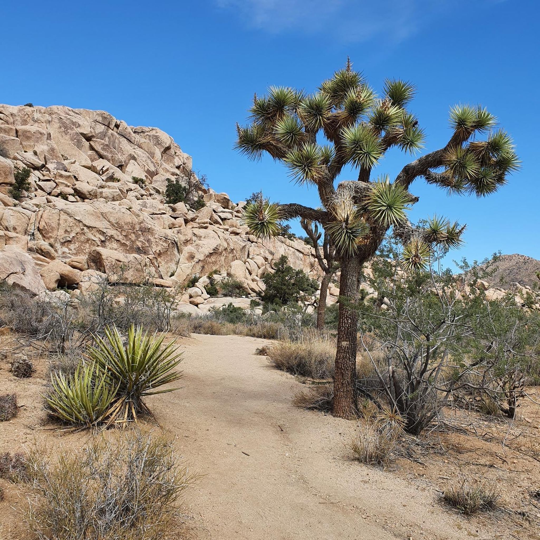
Jogging in the San Bernardino Mountains offers diverse landscapes, from the extensive trail systems of the San Bernardino National Forest to picturesque lakes and varied terrain. The region is characterized by significant elevation changes, with routes winding through pinyon pines, juniper, and fir forests. Joggers can experience deep canyons, expansive meadows, and views of rugged peaks.
Best jogging routes in the San Bernardino Mountains
- The most popular jogging route is Lost Horse Mine Loop Trail, a 6.5 miles (10.4…
Last updated: July 7, 2026
26
runners
10.4km
01:20
200m
200m
Moderate run. Good fitness required. Mostly paved surfaces. Suitable for all skill levels.
12
runners
4.99km
00:38
120m
120m
Moderate run. Good fitness required. Mostly paved surfaces. Suitable for all skill levels.

Sign up for free
9
runners
11.9km
01:32
260m
260m
Moderate run. Good fitness required. Mostly paved surfaces. Suitable for all skill levels.
4
runners
15.6km
02:02
470m
470m
Hard run. Very good fitness required. Mostly paved surfaces. Suitable for all skill levels.
4
runners
4.00km
00:27
20m
20m
Easy run. Great for any fitness level. Mostly paved surfaces. Suitable for all skill levels.
4
runners
7.18km
00:54
120m
120m
Moderate run. Good fitness required. Mostly paved surfaces. Suitable for all skill levels.
2
runners
20.0km
02:33
570m
570m
Hard run. Very good fitness required. Mostly paved surfaces. Suitable for all skill levels.
2
runners
6.19km
00:48
160m
160m
Moderate run. Good fitness required. Mostly paved surfaces. Suitable for all skill levels.
9.44km
01:13
180m
180m
Moderate run. Good fitness required. Mostly paved surfaces. Suitable for all skill levels.
4.75km
00:36
90m
90m
Easy run. Great for any fitness level. Mostly paved surfaces. Suitable for all skill levels.
Get access to more routes and recommendations from other explorers.
Sign up for free
Already have an account?
Our route recommendations are based on thousands of hikes, rides, and runs completed by other people on komoot.
Start today with a free account
Your next adventure awaits.
Login or Signup
Popular around San Bernadino Mountains

Other adventures in the San Bernadino Mountains

Tips from the Community

Keller Peak sits at an elevation of 7,882 feet. At the top there is the Keller Peak Fire Lookout, which is the oldest fire tower still standing in San Bernardino National Forest.
0
0

The preserve encapsulates a serene mountain marsh with sedge, grasses, and endangered bluegrass and checkerbloom. The lake is azure and pillars of quartz monzonite decorate the landscape.
0
0

At 7,882 feet, Keller Peak takes a sustained effort to get to the top. However, it is worth the effort as the views you get from the top are incredible.
0
0
The Exploration Trail is a non-motorized, family friendly trail. The trail was designed by children along with help from the U.S. Forest Service personnel.
0
0
Great view from the PCT onto the valley and Deep Creek. The views stay with you for a while as you stay high above the valley.
0
0

At the confluence of Deep Creek and North Fork Mohave River you can get across the almost dry creek bed most of the year without getting the shoes wet. After the spring snow melt or rain upstream water can be higher so a short wading might be necessary, or a short detour over the side of the dam. A cool trail excursion offers to cross through the tunnel under the dike, often involving a short refreshing section wading through thigh-high water at the northern end. The creek through the tunnel itself is barely a trickle most of the year, that disappears into the desert sand at the other end.
0
0

Leading to Mastodon Peak, the Mastodon Mine Loop Trail is a straightforward, 3-mile trail with peaceful surroundings within Joshua Tree.
0
0

This small mountain in the lower part does not see as many visitors as the center of Joshua Tree National Park. Leave the crowds behind and enjoy a hike to this peak and the scenic ruins of the old Mastodon Mine. In the 1930s, the Hulsey Family found some gold ore, but was not able to get to the main vein, so the mine was abandonded pretty soon.
0
0
Frequently Asked Questions
How many running routes are available in the San Bernardino Mountains?
The San Bernardino Mountains offer a wide selection of routes for runners. According to komoot data, there are over 60 running routes available, catering to various skill levels and preferences.
Are there easy running routes suitable for beginners or families?
Yes, the San Bernardino Mountains feature several easy running routes perfect for beginners or families. For instance, the Castle Rock and Bluff Lake Trail is an easy 2.9-mile path that winds through forests and past tranquil lake views. Another accessible option is the Wall Street Mill Trail, which is just under 2.5 miles long.
Can I find challenging or long-distance running trails in the region?
Absolutely. For those seeking a challenge, the San Bernardino Mountains provide numerous difficult and long-distance running trails. The Keller Peak via Exploration Trail is a difficult 12.4-mile route with significant elevation gain, offering expansive views. Other challenging options include the 10-mile San Jacinto Peak via Round Valley Trail and the 6.7-mile Suicide Rock via Deer Springs Trail, both known for their demanding climbs and panoramic vistas.
Are there any running routes that feature waterfalls?
Yes, you can find running routes that lead to waterfalls in the San Bernardino Mountains. The Pacific Crest Trail to Hesperia Falls is a moderate 5.9-mile route that takes you to a scenic waterfall. While not listed in the guide, other popular waterfall trails in the region include Etiwanda Falls and Bonita Falls, which may offer additional running opportunities.
What kind of natural features or landmarks can I expect to see while running?
The San Bernardino Mountains boast diverse natural features and landmarks. You can expect to see lush forests, deep canyons, expansive meadows, and rugged peaks. Notable attractions include Skull Rock, the Wall Street Stamp Mill, and the Cholla Cactus Garden. The region also features picturesque lakes like Big Bear Lake, Lake Arrowhead, and Silverwood Lake, providing scenic backdrops for your run.
Are the running trails in the San Bernardino Mountains dog-friendly?
Many trails in the San Bernardino National Forest are dog-friendly, but regulations can vary by specific trail or park. It's generally recommended to keep dogs on a leash. Always check the specific rules for the trail you plan to run, as some protected areas or wilderness trails may have restrictions.
What is the best time of year to go running in the San Bernardino Mountains?
The San Bernardino Mountains offer year-round running opportunities, but the best time depends on your preference. Spring (March-May) brings vibrant wildflowers in lower elevations, while early summer (June) sees blooms at higher altitudes. Fall offers stunning foliage. Winter running is possible, especially at lower elevations, but higher trails may be snow-covered, requiring appropriate gear and caution. Always check weather conditions before heading out.
Are there any circular running routes available?
Yes, the San Bernardino Mountains offer several circular running routes. The Lost Horse Mine Loop Trail is a popular 6.5-mile moderate loop. Another option is the Mastodon Mine Loop Trail, a shorter 3.1-mile moderate loop. These routes allow you to experience diverse scenery without retracing your steps.
What do other runners say about their experience in the San Bernardino Mountains?
The running routes in the San Bernardino Mountains are highly rated by the komoot community, with an average score of 4.8 stars from over 7 reviews. More than 600 runners have used komoot to explore the varied terrain. Reviewers often praise the extensive forest trails, rugged mountain terrain, and scenic lake views, highlighting the diversity and beauty of the region.
Do I need any permits to run on trails in the San Bernardino Mountains?
Some areas within the San Bernardino National Forest or specific wilderness areas may require permits, especially for overnight stays or certain activities. While most day-use running trails do not require a permit, it's always best to check with the local ranger station or the official San Bernardino National Forest website for the most current regulations before your run.
Are there less crowded running trails for a more peaceful experience?
While popular trails like Pine Knot and Castle Rock can see more traffic, the vastness of the San Bernardino National Forest offers many opportunities for solitude. Exploring routes slightly off the main tourist hubs or visiting during off-peak hours (early mornings, weekdays) can lead to a more peaceful running experience. Trails like Lost Palms Oasis Trail might offer a quieter run.
Are there any running routes near lakes?
Yes, the San Bernardino Mountains are home to several picturesque lakes that offer scenic running opportunities. Castle Rock and Bluff Lake Trail leads past tranquil lake views. Other notable lakes in the region include Big Bear Lake, Lake Arrowhead, and Silverwood Lake, which often have surrounding trails or paths suitable for running, providing beautiful water vistas.
Most popular routes in the San Bernadino Mountains
Most popular attractions in the San Bernadino Mountains

Get inspired with the komoot mobile app


Explore more
Browse the best Running Trails & Routes in other regions.
