The best running trails around Harbonnières
4.8
(5)
421
runners
65
runs
Jogging routes around Harbonnières offer a pleasant environment for outdoor activity, characterized by a gently rolling plateau with an altitude between 60 and 94 meters. The region features accessible river paths and scenic natural features, making it suitable for various running abilities. The Somme department provides a network of trails, including comfortable macadam surfaces along the Canal de la Somme. These paths wind through tranquil river landscapes and green meadows, providing a natural setting for running.
Best jogging routes around…
Last updated: June 30, 2026
7
runners
5.68km
00:35
10m
10m
Moderate run. Good fitness required. Mostly paved surfaces. Suitable for all skill levels.
4
runners
5.00km
00:31
30m
30m
Easy run. Great for any fitness level. Mostly paved surfaces. Suitable for all skill levels.

Sign up for free
5
runners
7.84km
00:50
10m
10m
Moderate run. Good fitness required. Mostly paved surfaces. Suitable for all skill levels.
3
runners
8.42km
00:57
40m
40m
Moderate run. Good fitness required. Mostly paved surfaces. Suitable for all skill levels.
3
runners
9.75km
01:00
10m
10m
Moderate run. Good fitness required. Mostly paved surfaces. Suitable for all skill levels.
Get access to more routes and recommendations from other explorers.
Sign up for free
Already have an account?
Our route recommendations are based on thousands of hikes, rides, and runs completed by other people on komoot.
Start today with a free account
Your next adventure awaits.
Login or Signup


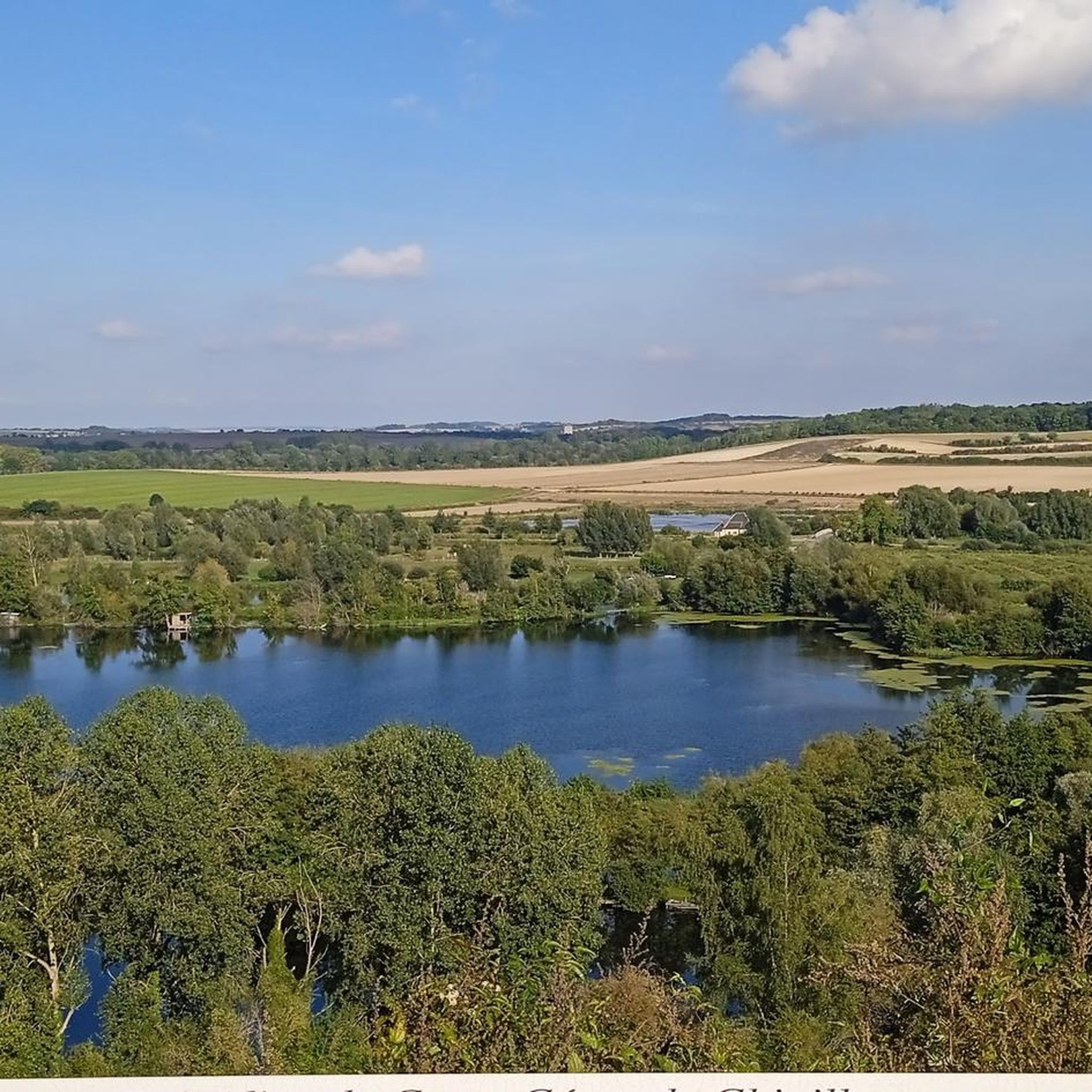


Tips from the Community

Monument to the dead of the First World War built in 1924
0
0
Frequently Asked Questions
How many running routes are available around Harbonnières?
There are over 60 running routes available around Harbonnières, catering to various preferences. The majority, around 59, are considered moderate, with a few easy and difficult options also present.
What is the typical terrain like for running in the Harbonnières area?
The Harbonnières area is characterized by a gently rolling plateau, with altitudes ranging between 60 and 94 meters. This means you'll find relatively flat or gently undulating terrain, ideal for comfortable running. Many routes feature accessible river paths and green meadows.
Are there any easy or beginner-friendly running routes in Harbonnières?
Yes, there are several easy running options. For instance, the Arc de Triomphe de Proyart loop from Proyart is an easy 3.1-mile (5.0 km) trail leading through open landscapes, perfect for beginners or a relaxed run.
Can I find longer distance running trails near Harbonnières?
While many routes are moderate in length, you can find slightly longer options. The Running loop from Framerville-Rainecourt, for example, is a moderate 5.2-mile (8.4 km) route. The region's river paths, like the historic Path from Corbie to Sailly-le-Sec, also offer extended stretches suitable for longer runs.
What kind of natural features or landmarks can I expect to see while running?
The running routes often wind through tranquil river landscapes and green meadows, offering views of local wildlife and diverse flora. Notable features in the broader area include the Path from Corbie to Sailly-le-Sec and the Canal de la Somme Cycle Path, both providing scenic riverside experiences. You might also encounter historical sites like the Château de Suzanne or viewpoints such as Camp César de Chipilly viewpoint.
Are there any circular running routes available?
Yes, many of the running routes around Harbonnières are designed as loops. Examples include the popular Running loop from Rosières-en-Santerre and the Running loop from Vrély, offering convenient circular paths for your run.
Are the running paths in Harbonnières suitable for families?
Yes, the generally flat or gently rolling terrain and accessible river paths make many routes suitable for families. Paths like the Canal de la Somme Cycle Path, with its comfortable macadam surface, are particularly family-friendly for a jog or walk.
What do other runners say about the trails in Harbonnières?
The running routes in Harbonnières are highly rated by the komoot community, with an average score of 4.5 stars from several reviews. Runners often praise the tranquil river landscapes, green meadows, and the variety of options for different ability levels.
Are there any specific paths known for their surface, like paved or macadam?
Yes, the Canal de la Somme Cycle Path is well-known for its comfortable macadam surface, making it an excellent choice for running. Other paths, particularly along the river, also offer smooth and easy-to-navigate surfaces.
What is the best time of year to go running in Harbonnières?
The region's natural beauty, with its river paths and green meadows, makes it pleasant for running throughout much of the year. Spring and autumn offer mild temperatures and vibrant scenery, while summer can be enjoyable, especially along shaded river routes. Winter runs are also possible, though conditions may vary.
Are there options for parking near the running routes?
While specific parking details for every route vary, the region is generally well-equipped for outdoor enthusiasts. Many trailheads, especially those in or near villages like Rosières-en-Santerre or Proyart, typically offer convenient parking facilities to access the routes.
Most popular routes around Harbonnières
Most popular attractions around Harbonnières

Get inspired with the komoot mobile app


Explore more
Browse the best Running Trails & Routes in other regions.
