The best walks and hikes around Apremont-Sur-Allier
4.2
(94)
699
hikers
71
hikes
Hiking around Apremont-Sur-Allier offers trails through a landscape shaped by the confluence of the Loire and Allier rivers. The region features gentle terrain, often following canals and riverbanks, with some routes passing through rural areas and small villages. Elevation changes are generally minimal, making the area accessible for various hiking abilities. The natural environment includes riverine ecosystems and open countryside.
Best hiking trails around Apremont-Sur-Allier
- The most popular hiking route is The Great Escape between Loire, Aubois and Allier, a 8.3 miles (13.4 km) trail that takes 3 hours 22 minutes to complete. This moderate route explores the confluence of three rivers, offering diverse riverside scenery.
- Another top favourite among local hikers is Ducal Palace of Nevers – Pont Canal du Guétin loop from Gimouille, a difficult 15.6 miles (25.1 km) path. This trail features views of the historic aqueduct and canal.
- Local hikers also love the Guetin Canal Aqueduct – View of the Bec d'Allier loop from Gimouille, a 2.8 miles (4.6 km) trail leading through the natural area around the Bec d'Allier, often completed in about 1 hour 9 minutes.
- Hiking around Apremont-Sur-Allier is defined by river paths, canal-side walks, and open countryside. The network offers options for different ability levels, from easy family friendly hikes to more challenging routes.
- The routes in Apremont-Sur-Allier are highly rated by the komoot community with an average score of 4.1 stars from over 80 reviews. More than 600 hikers have used komoot to explore Apremont-Sur-Allier's varied terrain.
Last updated: July 9, 2026
4.5
(2)
12
hikers
13.4km
03:23
20m
20m
Hike 8.3 miles (13.4 km) on The Great Escape, a moderate trail in Bec d'Allier, featuring the Pont Canal du Guétin and river views.
4.4
(12)
53
hikers
9.57km
02:26
30m
30m
Moderate hike. Good fitness required. Easily-accessible paths. Suitable for all skill levels.

Sign up for free
13
hikers
Easy hike. Great for any fitness level. Easily-accessible paths. Suitable for all skill levels.
4.0
(1)
10
hikers
28.3km
07:12
80m
80m
Hard hike. Very good fitness required. Easily-accessible paths. Suitable for all skill levels.
4.2
(5)
5
hikers
7.98km
02:08
80m
90m
Moderate hike. Good fitness required. Easily-accessible paths. Suitable for all skill levels.
Get access to more routes and recommendations from other explorers.
Sign up for free
Already have an account?
Our route recommendations are based on thousands of hikes, rides, and runs completed by other people on komoot.
Start today with a free account
Your next adventure awaits.
Login or Signup

Tips from the Community

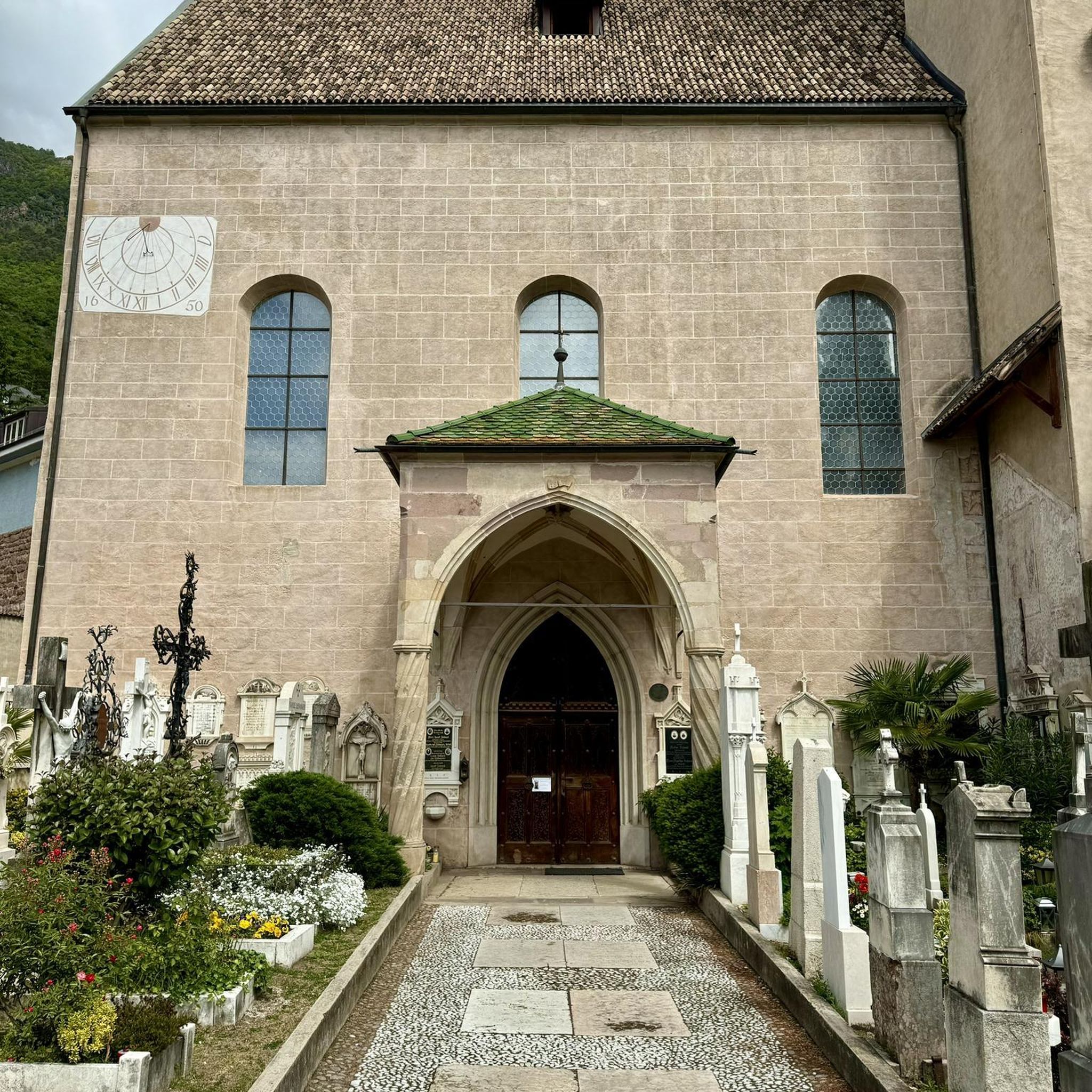
The Chapel of Sainte Marie, built in the first half of the 17th century, is the only remaining vestige of the former Visitation convent.
0
0

The starting point of the Loire cycle path is apparently so beautiful that there are two of them. However, if you look more closely at the location in the komoot system, the two points are a dozen kilometers apart. If you're interested, see also =>> https://www.komoot.com/de-de/highlight/556578
0
0

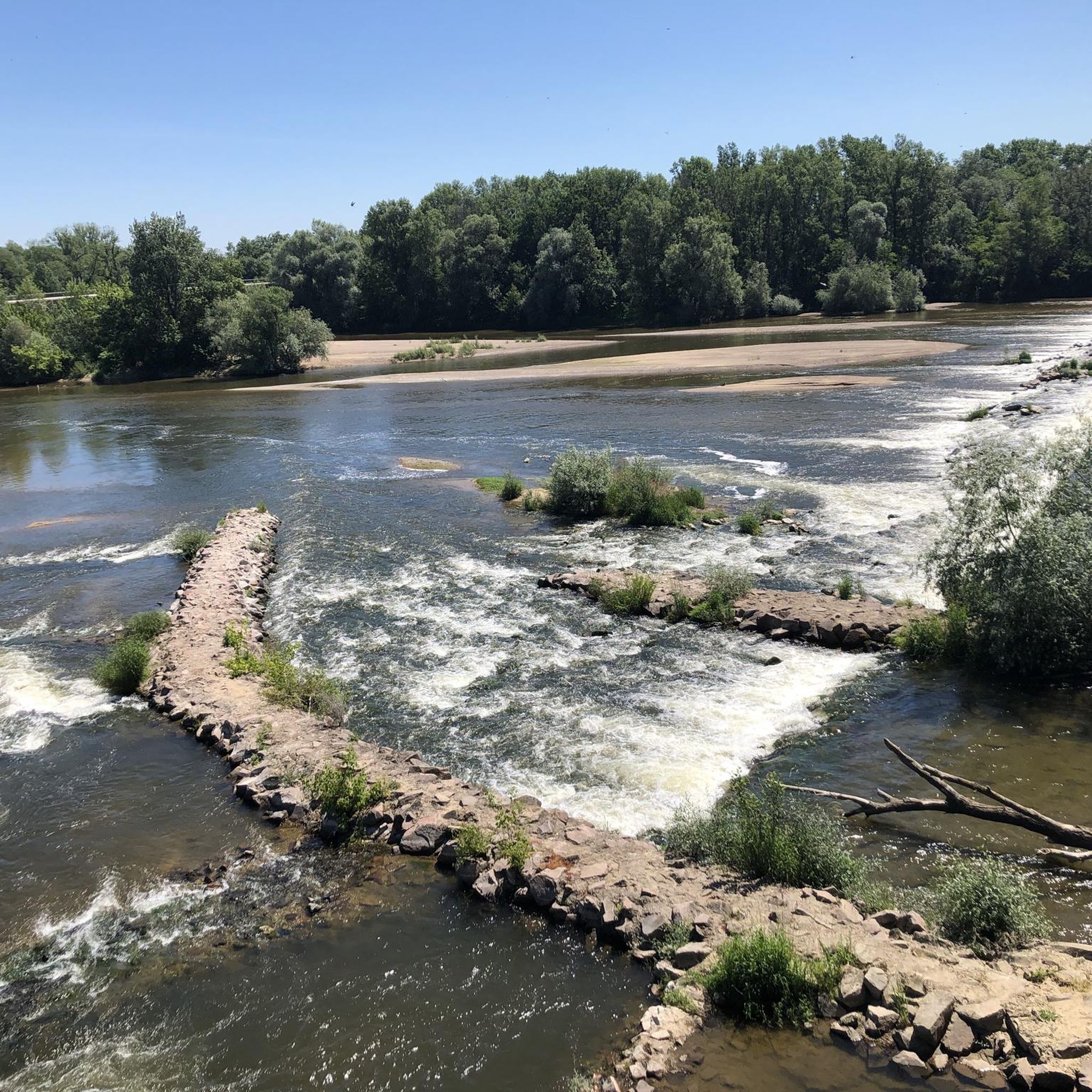
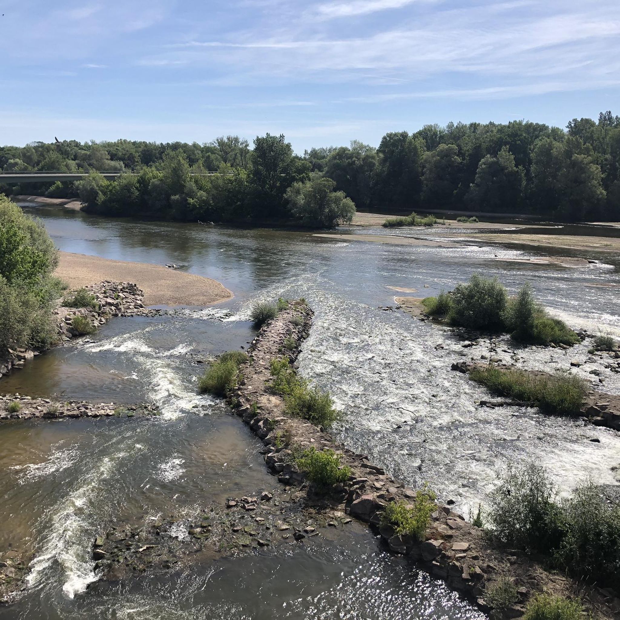
The "Bec d'Allier" is a unique natural paradise covering 300 hectares. It constantly changes with the seasons and due to shifts in water flow. Here, visitors are undisturbed by traffic noise and can find peace and relaxation. Countless animals can be found here, both in the water and in the air. The flowering meadows are also very beautiful in spring and summer.
1
0


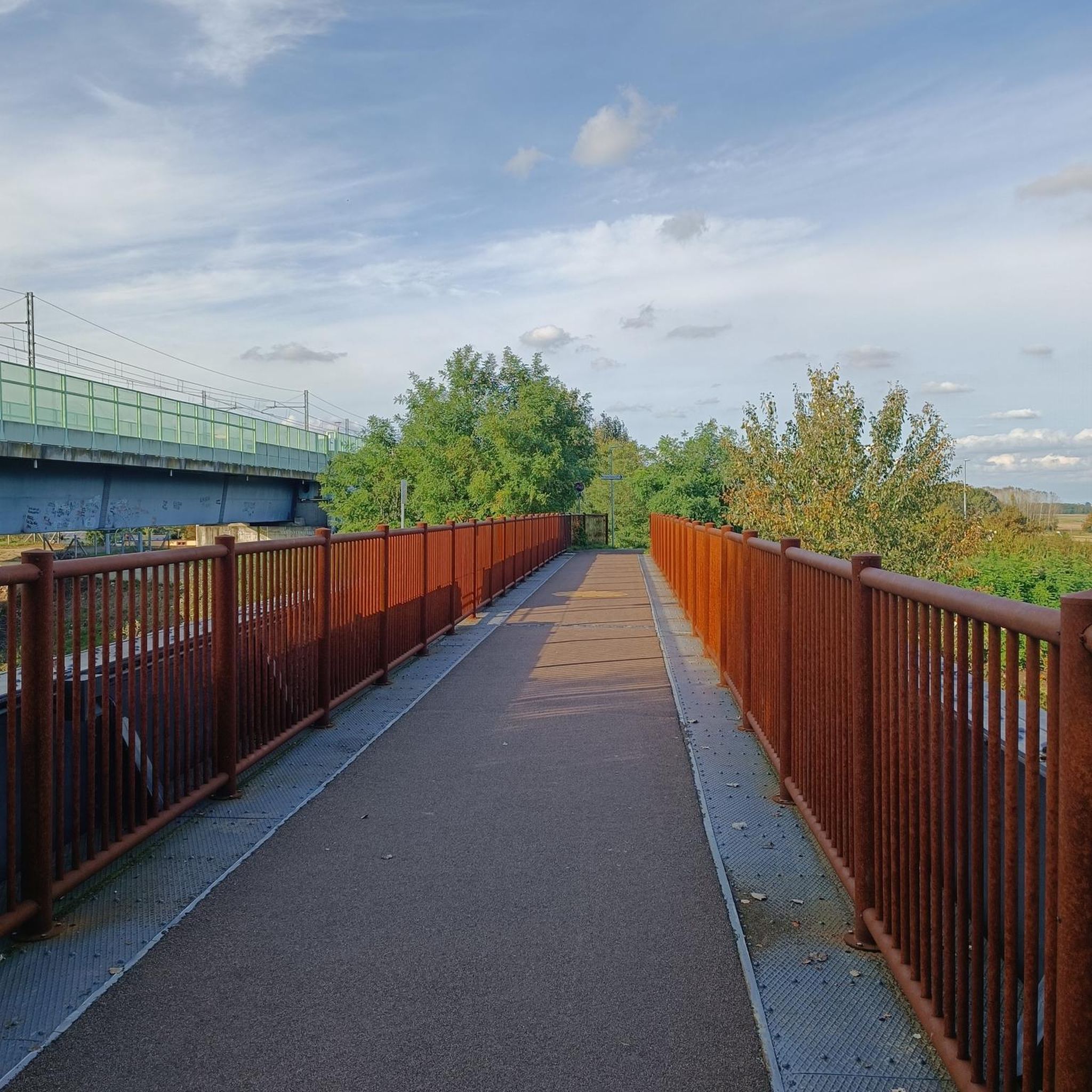
The beautiful bridge leads over the Loire directly to Nevers.
1
0

The façade of this church, which cyclists encounter in the heart of Nevers, rises imposingly. Its construction history – the "Sainte-Marie" Chapel was built in the Baroque style – dates back to the first half of the 17th century. Back then, it didn't stand alone as it does today, but belonged to a convent of Visitandes, whose other buildings have been demolished over the course of history. "You can't enter the interior... but you will undoubtedly be captivated by the façade, which displays an astonishing Baroque style, unique in the Nivernais region and rare in France," states the tourist brochure.
2
0

Magnificent bridge and breathtaking view of Nevers
1
0
Frequently Asked Questions
How many hiking trails are available in Apremont-Sur-Allier?
There are over 60 hiking trails around Apremont-Sur-Allier. These routes offer a variety of experiences, from gentle riverside strolls to longer explorations of the surrounding countryside.
Are there easy hiking trails suitable for beginners or families in Apremont-Sur-Allier?
Yes, Apremont-Sur-Allier is well-suited for beginners and families, with over 30 easy trails. These routes typically feature minimal elevation changes and follow canals or riverbanks, making them accessible for all ages. A good example is the Guetin Canal Aqueduct – View of the Bec d'Allier loop from Gimouille, which is an easy 2.8-mile (4.6 km) trail.
What kind of scenery can I expect on hikes in Apremont-Sur-Allier?
Hikes in Apremont-Sur-Allier are defined by the confluence of the Loire and Allier rivers. You can expect picturesque river paths, tranquil canal-side walks, and open countryside. The landscape often includes views of historic aqueducts and charming rural areas.
Are there any circular walks around Apremont-Sur-Allier?
Yes, many of the trails in Apremont-Sur-Allier are circular, allowing you to start and end at the same point. For instance, the Pont Canal du Guétin – Guétin Aqueduct loop from Gimouille is a popular moderate circular route offering views of the historic aqueduct.
What are some interesting places or landmarks to see while hiking in Apremont-Sur-Allier?
While hiking, you can explore several interesting landmarks. The historic Loire Bridge and the impressive Lorrains Lock are notable. You might also pass through or near Nevers, a significant settlement in the region.
What is the best time of year to go hiking in Apremont-Sur-Allier?
The best time to hike in Apremont-Sur-Allier is generally from spring to autumn (April to October) when the weather is mild and the natural scenery is vibrant. The gentle terrain makes it enjoyable even on warmer days, especially along the shaded riverbanks.
Are dogs allowed on the hiking trails in Apremont-Sur-Allier?
Most trails in the Apremont-Sur-Allier region are dog-friendly, especially those along riverbanks and through open countryside. However, it's always recommended to keep your dog on a leash, particularly when passing through agricultural areas or near wildlife habitats.
Where can I park when hiking in Apremont-Sur-Allier?
Parking is generally available in and around the villages and starting points of the trails, such as Gimouille. Look for designated parking areas or roadside spots where permitted. Specific parking information can often be found on individual route descriptions.
How long do hikes typically take in Apremont-Sur-Allier?
Hike durations vary, but many routes are designed for half-day or full-day excursions. For example, an easy 2.8-mile (4.6 km) loop might take just over an hour, while a moderate 8.3-mile (13.4 km) trail like The Great Escape between Loire, Aubois and Allier could take over three hours.
What do other hikers say about the trails in Apremont-Sur-Allier?
The trails in Apremont-Sur-Allier are highly rated by the komoot community, with an average score of 4.1 stars from over 80 reviews. Hikers often praise the peaceful riverside scenery, the well-maintained paths, and the accessibility of the routes for various fitness levels.
Are there any longer or more challenging hikes for experienced hikers in the area?
While the region is known for its gentle terrain, there are a few longer and more challenging options. For instance, the Ducal Palace of Nevers – Pont Canal du Guétin loop from Gimouille is a difficult 15.6-mile (25 km) hike that offers a more extensive exploration of the area.
Can I combine hiking with other activities, like cycling, in the Apremont-Sur-Allier area?
Absolutely. The region's flat terrain and extensive network of paths along the Loire and Allier rivers make it ideal for combining hiking with cycling. You'll find sections of the famous La Loire à Vélo route nearby, offering excellent opportunities for multi-sport adventures.
Most popular routes around Apremont-Sur-Allier
Most popular attractions around Apremont-Sur-Allier

Get inspired with the komoot mobile app


Explore more
Browse the best Hikes in other regions.
