Châteauneuf-Val-Saint-Donat
Châteauneuf-Val-Saint-Donat
The best walks and hikes around Châteauneuf-Val-Saint-Donat
4.4
(559)
3,856
hikers
166
hikes
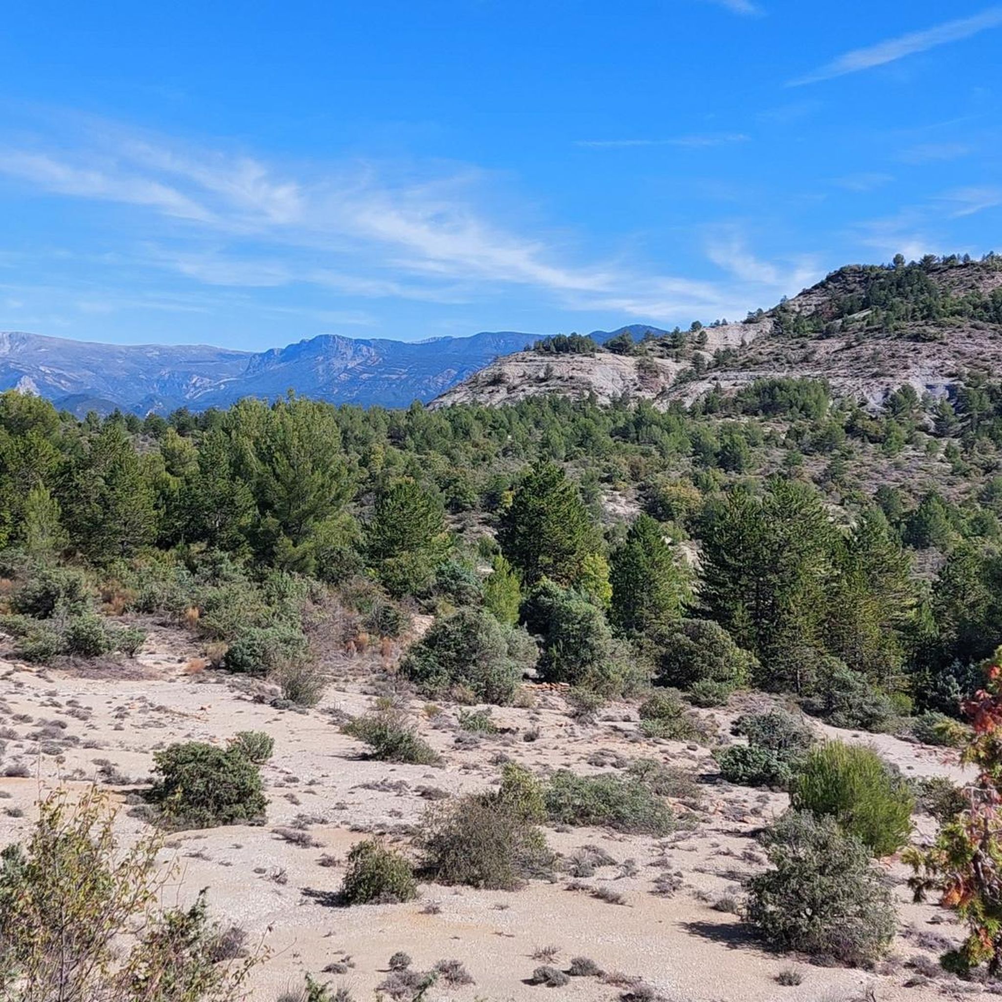
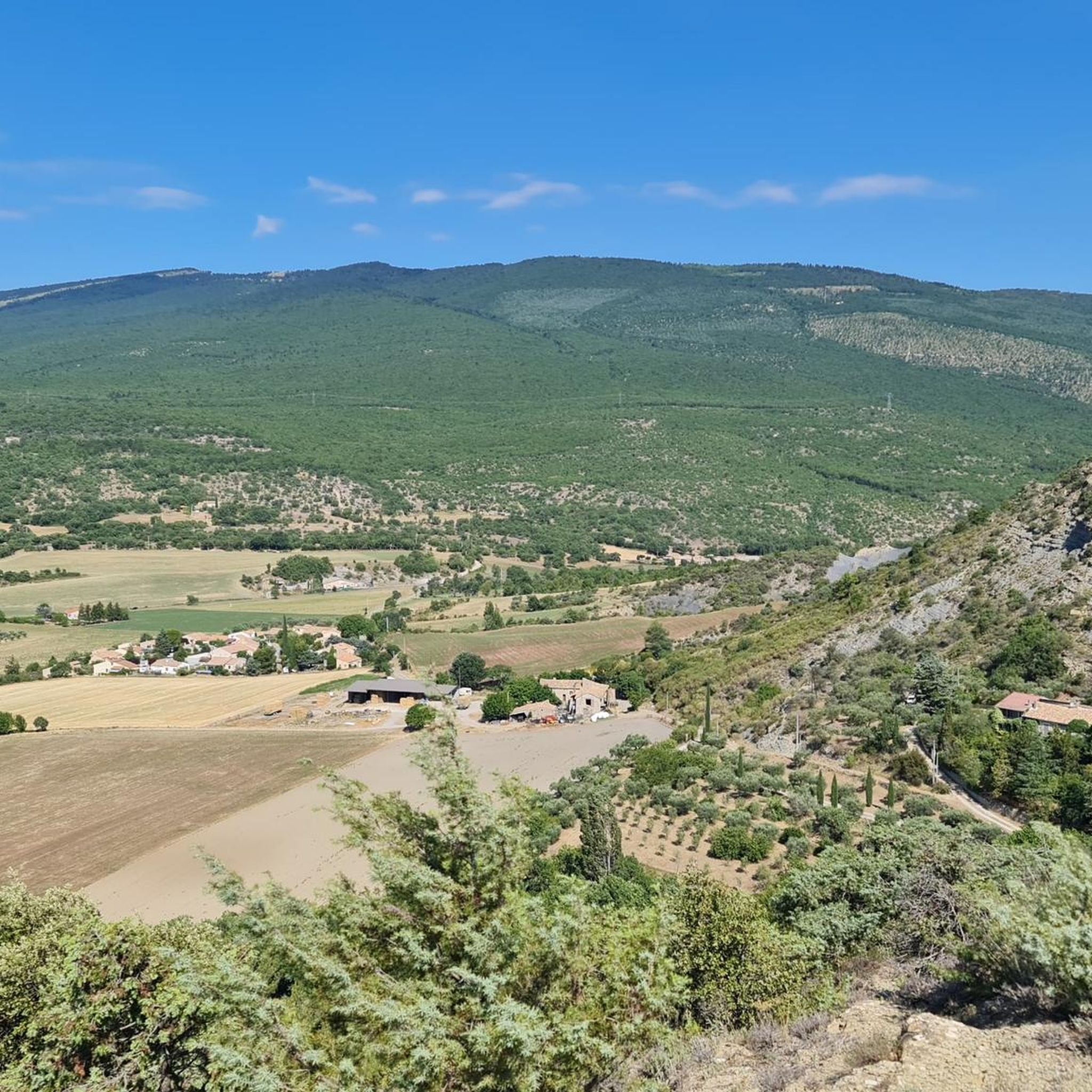
Hiking around Châteauneuf-Val-Saint-Donat offers diverse landscapes at the foot of the Lure mountain, characterized by wooded areas and open green expanses. The region features fields of wheat, olive trees, and lavender, providing a Provencal backdrop. Higher ridges offer views of the Durance valley and the Valensole plateau.
Best hiking trails around Châteauneuf-Val-Saint-Donat
- The most popular hiking route is Footbridge over the Durance – Pénitents des Mées Trail loop from Volonne, a 5.8 miles (9.4 km) trail that takes 2…
Last updated: October 11, 2026
3.9
(14)
165
hikers
Moderate hike. Good fitness required. Easily-accessible paths. Suitable for all skill levels.
4.6
(9)
89
hikers
4.40km
01:08
20m
20m
Easy hike. Great for any fitness level. Easily-accessible paths. Suitable for all skill levels.

5.0
(3)
30
hikers
10.1km
02:56
270m
270m
Moderate hike. Good fitness required. Easily-accessible paths. Suitable for all skill levels.
4.8
(6)
23
hikers
9.00km
02:54
360m
360m
Moderate hike. Good fitness required. Easily-accessible paths. Suitable for all skill levels.
4.7
(3)
21
hikers
8.17km
02:22
210m
210m
Moderate hike. Good fitness required. Easily-accessible paths. Suitable for all skill levels.
Get access to more routes and recommendations from other explorers.
Already have an account?
Our route recommendations are based on thousands of hikes, rides, and runs completed by other people on komoot.
Start today with a free account
Your next adventure awaits.

Tips from the Community

The climb is definitely worth it because of the view of the Durance valley and the mountains in all directions. Magnificent.
1
0
If it rains... or you can't make it down in time... you'll find a roof over your head here.
0
0

Small town, outside a large campsite, above the town a church ruin.
2
0

Pedestrian crossing over the Durance
1
0

Nice passage above the Durance. I recommend chaining it along the Durance by the Hippocampe campsite, it's pretty.
1
0

This beautiful part of the trail strays slightly from the Durance and gives you a glimpse of the geological formation of the Mées penitents in the distance. The trail itself is very pleasant to walk.
1
1
At the edge of the Durance and very close to the campsite, just after passing the charming village of Volonne, you move on a beautiful road.
3
0

Plenty of itineraries, excellent signposting, a wide variety of routes and difficulties, magnificent and varied landscapes, cleaning of the bike on arrival... 5⭐.
0
0
Frequently Asked Questions
How many hiking trails are available around Châteauneuf-Val-Saint-Donat?
There are over 150 hiking routes around Châteauneuf-Val-Saint-Donat, offering diverse landscapes from wooded areas to open green expanses. These trails cater to various skill levels, with 52 easy, 89 moderate, and 18 difficult options.
What types of landscapes can I expect to see while hiking in this region?
The region offers a picturesque setting at the foot of the Lure mountain, featuring a mix of wooded areas and open green expanses. You'll encounter fields of wheat, olive trees, and lavender, creating an idyllic Provencal backdrop. Higher ridges provide panoramic views of the Durance valley, the Valensole plateau, and the distant Gap Basin.
Are there any easy, family-friendly hikes suitable for beginners?
Yes, there are 52 easy routes in the area. A great option for families or beginners is the Footbridge over the Durance – L'Hippocampe Campsite loop from Volonne. This 2.8-mile (4.5 km) path follows the Durance, offering pleasant riverside scenery.
Are there any circular hiking routes around Châteauneuf-Val-Saint-Donat?
Yes, many routes in the area are circular. For example, the Footbridge over the Durance – Pénitents des Mées Trail loop from Volonne is a moderate 5.8-mile (9.4 km) loop with views of the Durance river. Another option is the Volonne Village Center – Church from 1604 loop from Volonne, a 6.2-mile (9.9 km) trail through varied terrain.
What are some notable natural attractions or landmarks near the hiking trails?
While hiking, you can explore various natural features and viewpoints. Consider visiting the Montagne de Lure Pass or enjoying the View of Sisteron and the Rocher de la Baume. The View of the Durance Valley from the Collet de l'Escale also offers stunning vistas.
What do other hikers say about the trails in Châteauneuf-Val-Saint-Donat?
The routes in Châteauneuf-Val-Saint-Donat are highly rated by the komoot community, with an average score of 4.5 stars from over 400 reviews. Hikers often praise the varied terrain, the scenic views of the Durance valley, and the well-maintained paths.
What is the best time of year to go hiking in Châteauneuf-Val-Saint-Donat?
The Provence-Alpes-Côte d'Azur region, including Châteauneuf-Val-Saint-Donat, is generally pleasant for hiking from spring through autumn. Spring offers blooming lavender and wildflowers, while autumn provides comfortable temperatures and beautiful foliage. Summer can be warm, so early morning or late afternoon hikes are recommended.
Are there any trails that offer views from higher elevations?
Yes, from higher ridges in the area, hikers are rewarded with breathtaking panoramic views of the Durance valley, the vast Valensole plateau, and the distant Gap Basin. The Tigne Summit loop from Volonne is a moderate route that gains significant elevation, offering great vistas.
Can I find trails that are suitable for mountain biking or horseback riding?
Beyond hiking, the area around Châteauneuf-Val-Saint-Donat is well-equipped for various outdoor activities. There are numerous trails suitable for mountain biking and horseback riding, catering to different skill levels, alongside the dedicated hiking paths.
Are there any historical points of interest along the trails?
While exploring the area, outdoor enthusiasts can encounter remnants of the past, including sections of the old royal road and the ruins of a 15th-century castle, adding a historical dimension to your hike.
What is the typical duration for a moderate hike in this region?
Moderate hikes in Châteauneuf-Val-Saint-Donat vary in length and duration. For instance, the Footbridge over the Durance – Pénitents des Mées Trail loop from Volonne, which is 5.8 miles (9.4 km), typically takes about 2 hours and 24 minutes to complete.
Most popular routes around Châteauneuf-Val-Saint-Donat
Most popular attractions around Châteauneuf-Val-Saint-Donat

Get inspired with the komoot mobile app


Explore more
Browse the best Hikes in other regions.
