The best running trails around Boppelsen
4.5
(824)
20,210
runners
10
runs
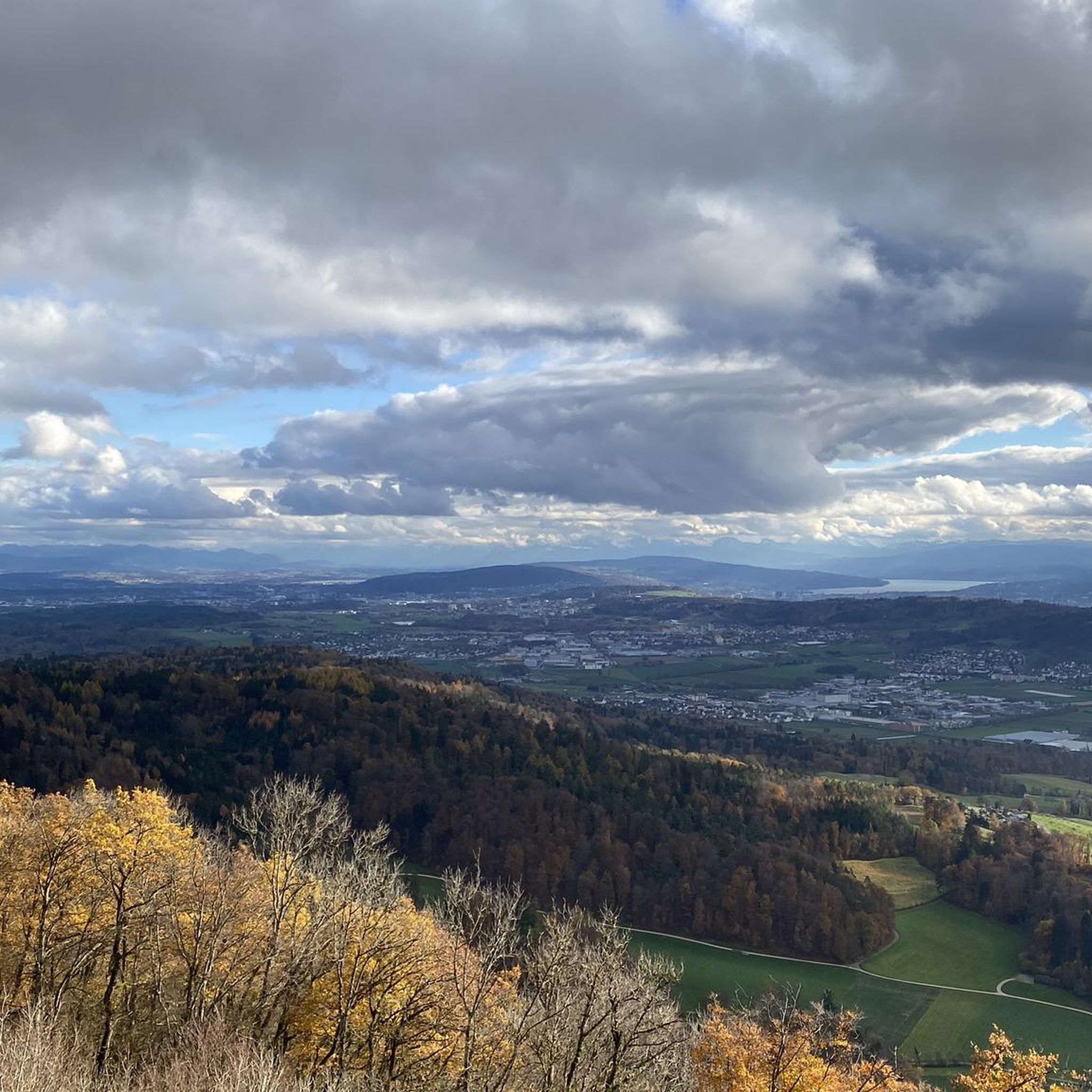
Jogging routes around Boppelsen offer a diverse landscape for runners, characterized by varied terrain and access to natural features. The region includes paths with gentle gradients and more challenging uphill climbs, providing options for different fitness levels. Elevated areas like Lägern Ridge offer expansive views, while other trails feature mostly paved surfaces. This mix of natural scenery and accessible paths makes Boppelsen suitable for a range of running experiences.
Best jogging routes around Boppelsen
- The most popular jogging route is…
Last updated: September 30, 2026
16
runners
9.33km
01:11
310m
310m
Hard run. Very good fitness required. Mostly paved surfaces. Suitable for all skill levels.
10
runners
10.2km
01:06
140m
140m
Moderate run. Good fitness required. Mostly paved surfaces. Suitable for all skill levels.

3.8
(26)
5
runners
4.96km
00:32
70m
70m
Easy run. Great for any fitness level. Mostly paved surfaces. Suitable for all skill levels.
6
runners
6.05km
00:41
150m
150m
Moderate run. Good fitness required. Mostly paved surfaces. Suitable for all skill levels.
6
runners
Moderate run. Good fitness required. Mostly paved surfaces. Suitable for all skill levels.
Get access to more routes and recommendations from other explorers.
Already have an account?
Our route recommendations are based on thousands of hikes, rides, and runs completed by other people on komoot.
Start today with a free account
Your next adventure awaits.
Tips from the Community

This tower is a radar station (secondary radar) for air traffic control and is operated by Skyguide. It processes exclusively echoes actively emitted by flying objects. Unlike the primary radar, which also uses echoes emitted immediately beforehand.
0
0

I definitely have to go there sometime...
1
0

Beautiful village with some old well-kept half-timbered houses🇨🇭👍
1
0

Otelfingen in the Limattal, a well-kept village with many beautiful half-timbered houses.
0
0

A landmark, the new 17.5-meter-diameter sphere is made of white material and is therefore said to be more resistant to heat than its predecessor, which was green.
2
0
The radar station on the Lägern has existed since 1961 and has a range of 150 nautical miles (270 km)
2
0
Frequently Asked Questions
How many running routes are available in Boppelsen?
Boppelsen offers a selection of 10 running routes, catering to various fitness levels. You'll find options ranging from easy strolls to more challenging uphill climbs.
What kind of terrain can I expect on running trails in Boppelsen?
The running trails in Boppelsen feature diverse terrain. While some paths offer mostly paved surfaces, others include varied natural landscapes and significant elevation changes, especially on routes like the View from Lägern Ridge – View from Lägern Hochwacht loop from Boppelsen, which requires good fitness and sure-footedness.
Are there any easy running routes suitable for beginners or families?
Yes, there are easy running options. For instance, the From Boppelsen to Otelfingen loop from Boppelsen is a 3.1-mile (5.0 km) trail with minimal elevation gain, making it a great choice for a gentler experience.
Can I find challenging running trails with significant elevation gain?
Absolutely. For experienced runners seeking a challenge, the View from Lägern Ridge – View from Lägern Hochwacht loop from Boppelsen is a difficult 5.8-mile (9.3 km) route featuring over 1000 feet (300 meters) of elevation gain and expansive views from Lägern Ridge.
Are there scenic viewpoints or natural landmarks along the running paths?
Yes, Boppelsen's natural scenery is a highlight. Many routes offer picturesque backdrops, and you can find elevated areas like Lägern Ridge providing expansive views. Nearby attractions include viewpoints such as Burghorn and the Altberg Observation Tower, which are great for taking in the landscape.
What do other runners say about the trails in Boppelsen?
The running routes in Boppelsen are highly rated by the komoot community, with an average score of 4.5 stars from over 600 reviews. Runners often praise the varied terrain, natural scenery, and the options available for different ability levels.
Are there circular running routes available in Boppelsen?
Many of the routes around Boppelsen are designed as loops, allowing you to start and finish in the same location. Examples include the Otelfingen Village Center loop from Boppelsen and the Scenic Running Trail in Zurich – Wolfsgruebstr Trail Junction loop from Boppelsen.
Is parking available near the running trailheads in Boppelsen?
While specific parking details for each trailhead are not provided, Boppelsen is a small community, and parking is generally available in or near the village center, often close to the start points of popular routes.
What is the best time of year to go running in Boppelsen?
Boppelsen offers a compelling environment for outdoor activities throughout much of the year. Spring and autumn provide pleasant temperatures and vibrant scenery, while summer is also popular. Winter running is possible, but conditions may vary, especially on higher or less maintained trails.
Are there any places to stop for refreshments near the running trails?
Boppelsen and nearby villages like Otelfingen offer local cafes and pubs where you can stop for refreshments. The Otelfingen Village Center loop from Boppelsen, for example, passes directly through a village center where such amenities are typically found.
What is the typical duration for running routes in Boppelsen?
The duration of running routes in Boppelsen varies significantly based on distance and difficulty. Shorter, easier routes like the From Boppelsen to Otelfingen loop from Boppelsen can take around 30-40 minutes, while longer and more challenging trails, such as the View from Lägern Ridge – View from Lägern Hochwacht loop from Boppelsen, may take over an hour.
Are there any specific natural features or wildlife to look out for?
The region is known for its 'Nature and wildlife' and 'Natural scenery.' While specific wildlife sightings aren't guaranteed, you can expect to enjoy diverse flora and fauna typical of Swiss woodlands and ridges. The Lägern Ridge itself is a prominent natural feature offering impressive vistas.
Most popular attractions around Boppelsen

Get inspired with the komoot mobile app


Explore more
Browse the best Running Trails & Routes in other regions.
