The best running trails around Espinchal
4.0
(4)
381
runners
24
runs
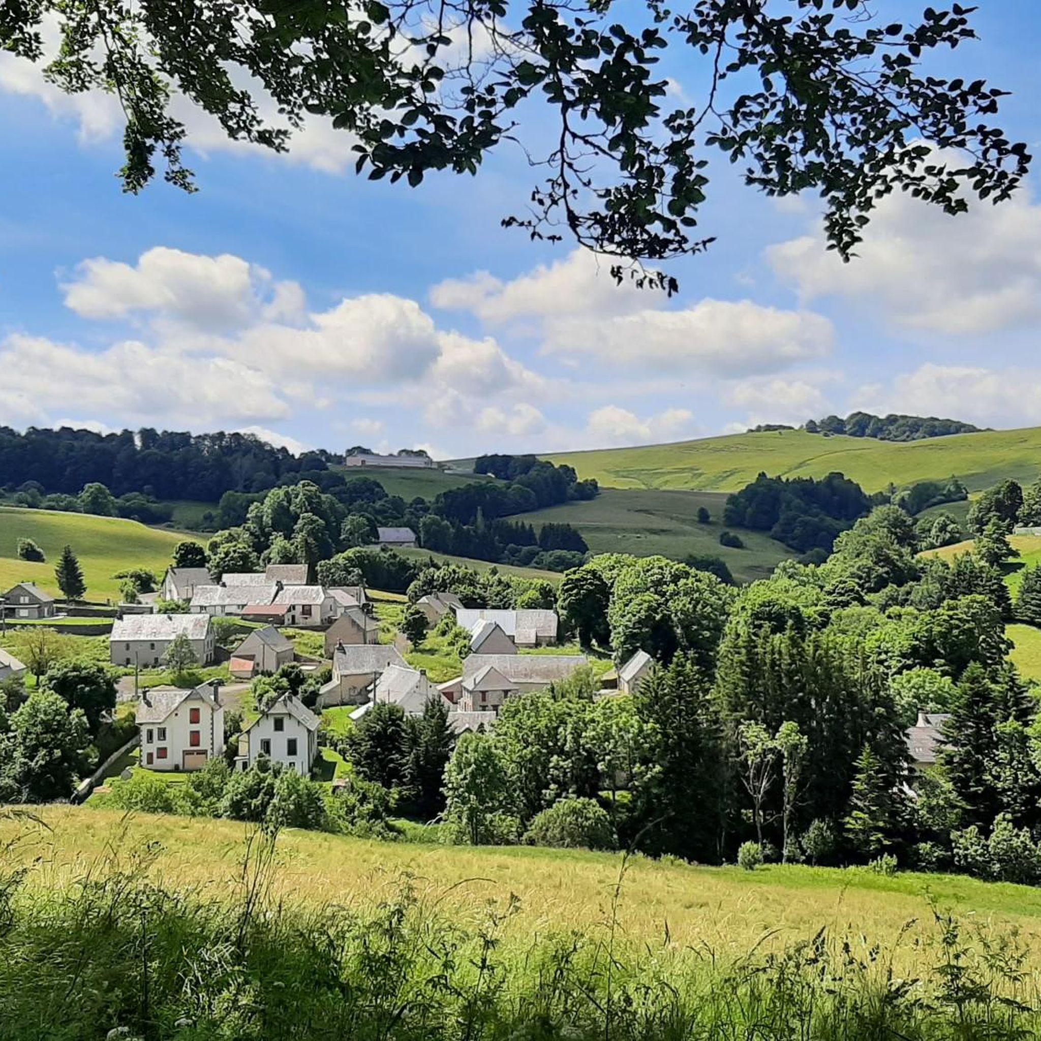
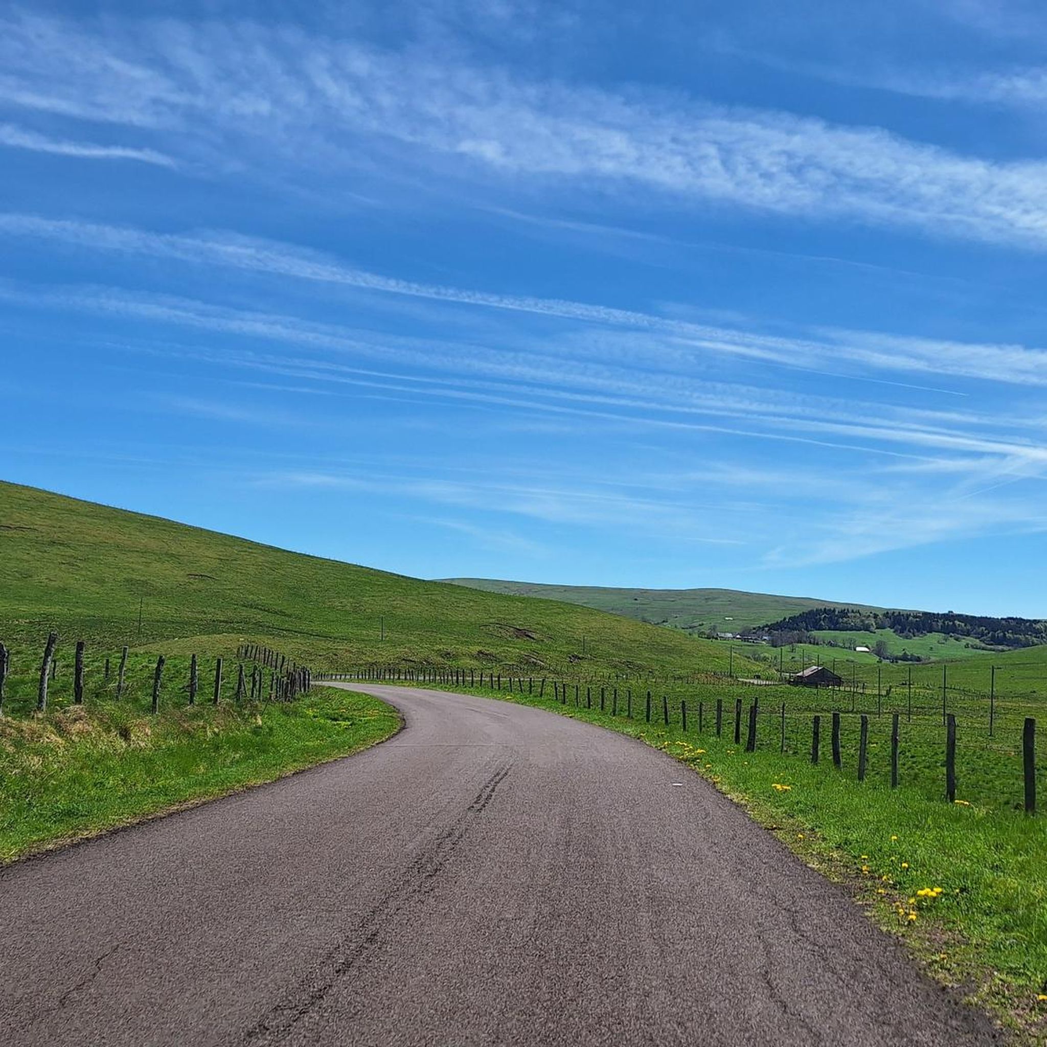
Jogging around Espinchal offers diverse terrain within a remarkable natural landscape, situated at an altitude of 1000 meters between the Cézallier and Sancy massifs. The region is characterized by vast open spaces, including pasture mountains and verdant hills, alongside varied topography from its volcanic origins. Runners can explore forested areas, serene peat bogs, and small streams, providing a blend of challenge and serenity. This area provides access to numerous scenic routes and features, bordering the Cantal region.
Best jogging routes…
Last updated: October 30, 2026
8
runners
15.7km
01:57
380m
380m
Hard run. Very good fitness required. Mostly paved surfaces.
7
runners
Moderate run. Good fitness required. Mostly paved surfaces.

5.0
(1)
5
runners
9.04km
00:59
200m
200m
Moderate run. Good fitness required. Mostly paved surfaces.
6
runners
9.35km
01:06
220m
220m
Moderate run. Good fitness required. Mostly paved surfaces.
3.0
(1)
4
runners
8.56km
01:03
160m
160m
Moderate run. Good fitness required. Mostly paved surfaces.
Get access to more routes and recommendations from other explorers.
Already have an account?
Our route recommendations are based on thousands of hikes, rides, and runs completed by other people on komoot.
Start today with a free account
Your next adventure awaits.
Tips from the Community


Too bad that the only refreshment point reported nearby is closed
0
0

Crater lake at 1225m altitude
0
0

La Godivelle is an extremely isolated village. With its large fountain, its church, and its sublime landscapes, it is a town where it is good to stop.
0
0

The Saint-Austremoine church is a Catholic church erected between the 10th and 11th centuries. A real curiosity, this church is oriented northeast - southwest, unlike the norm which prefers an east-west orientation. Romanesque in style, the church is painted and has many carved capitals. It has been registered as a historical monument since 1969.
0
0

This magnificent waterfall is 18 meters high. As always in Auvergne, we guess the volcanic origin.
2
0
At the foot of this pretty waterfall is an installation allowing you to observe the fall as if you were in the water. You can thus enjoy the reflections of this natural mirror.
2
0
The Godivelle lakes are very close but very different. The upper lake is a very deep crater lake (44 meters) which is not fed by any stream. Conversely, the lower lake is a lake of glacial origin fed by streams and made up of peat bog.
3
0
Frequently Asked Questions
How many running routes are available around Espinchal?
Espinchal offers a selection of over 20 running routes, catering to various preferences and fitness levels. These routes traverse the region's diverse landscape, from vast open spaces to volcanic terrain.
Are there any easy jogging routes for beginners in Espinchal?
While most routes around Espinchal are classified as moderate, many offer gentle elevation changes suitable for those new to trail running. For example, the Around Bonjon - trail loop starting from Saillant - Auvergne Volcanoes Regional Nature Park is a moderate 3.0-mile (4.8 km) trail with gentle inclines, perfect for getting started.
What kind of terrain can I expect on the running trails in Espinchal?
The terrain around Espinchal is incredibly varied, reflecting its location between the Cézallier and Sancy regions. You'll encounter vast open spaces, pasture mountains, and volcanic landscapes. Expect a mix of verdant hills, small streams, and unique peat bogs, offering both challenge and serenity.
Are there any running routes that feature waterfalls or lakes?
Yes, Espinchal's natural beauty includes picturesque waterfalls and serene lakes. The Entraigues Waterfall – Entraygues Waterfalls and Lake loop from Massif Central is a popular 4.5-mile (7.3 km) trail that specifically leads through areas with waterfalls and a lake, providing stunning scenic views during your run. You can also find the beautiful Saillant Waterfall nearby.
Can I find circular running routes in Espinchal?
Absolutely. Many of the running routes in Espinchal are designed as loops, allowing you to start and finish in the same location. Examples include the La traverse – Montgreleix Fountain loop from Montgreleix and the La Godivelle – La Godivelle loop from Espinchal, offering convenient options for your run.
What are some notable landmarks or viewpoints I might see while running?
Espinchal's routes offer access to several scenic landmarks and viewpoints. You might encounter the View of Mont Chamaroux and the Cézallier mountains, or pass through areas near the Col de Montgreleix (1238 m). The region also features beautiful lakes like Lake Pavin and Lac Chauvet, which are great points of interest.
Are there any long-distance trails or routes that pass through Espinchal?
Yes, Espinchal is strategically located and crossed by significant long-distance trails. Notably, the GR30 (Tour des Lacs d'Auvergne) and Le Tour des Vaches Rouges trails pass through the area, connecting the Cantal and Massif du Sancy mountains. These offer extensive options for longer runs or trail running adventures.
What do other runners enjoy most about jogging in Espinchal?
The komoot community highly rates the running experience in Espinchal, with an average score of 5.0 stars. Runners often praise the region's vast open spaces, the tranquility of the pasture mountains, and the diverse volcanic terrain that provides both challenge and breathtaking natural beauty.
What is the best time of year to go running in Espinchal?
Espinchal, situated at an altitude of 1000 meters, offers a pleasant environment for running. While specific seasonal recommendations depend on personal preference, the expansive natural landscapes are generally enjoyable from spring through autumn. The 'Grand Espaces' are particularly inviting during milder weather.
Are there any routes that include the Montgreleix Fountain?
Yes, the Montgreleix Fountain is a notable feature on some local running paths. You can explore the La traverse – Montgreleix Fountain loop from Montgreleix, a moderate 6.7-mile (10.8 km) path that offers varied scenery including this fountain.
What is the typical difficulty level of running routes in Espinchal?
The majority of running routes around Espinchal are classified as moderate, making them accessible to a wide range of runners. There are also a few more challenging trails for those seeking a greater workout, but no easy routes are specifically listed, indicating a generally engaging terrain.
Most popular attractions around Espinchal

Get inspired with the komoot mobile app


Explore more
Browse the best Running Trails & Routes in other regions.
