The best mountain hikes around Val-d'Illiez
4.7
(16)
163
hikers
21
hikes
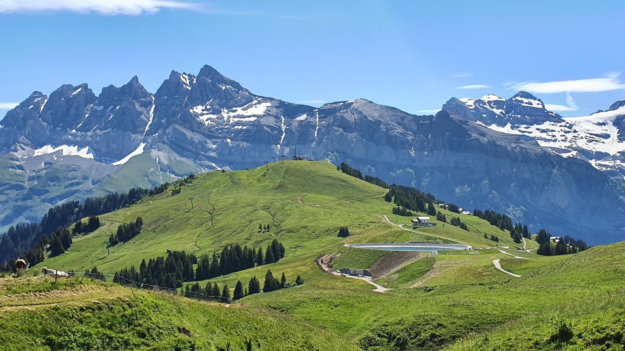
Mountaineering routes around Val-d'Illiez are set within the Swiss Alps, at the base of the Dents du Midi massif. This region features a diverse landscape, including towering peaks, serene alpine lakes, and cascading waterfalls. The terrain ranges from challenging ascents to the Haute Cime to paths through lush forests and varied mountain slopes.
Best mountaineering routes around Val-d'Illiez
- The most popular mountaineering route is La Truche – Pertuis Chetrain loop from Bec du Corbeau, a 5.5 miles (8.9 km)…
Last updated: June 27, 2026
10
hikers
9.43km
03:44
530m
530m
Moderate mountaineering route. Good fitness required. Mostly accessible paths. Sure-footedness required.
8
hikers
16.8km
06:01
900m
900m
Hard mountaineering route. Very good fitness required. Mostly accessible paths. Sure-footedness required.

Sign up for free
7
hikers
11.5km
04:28
730m
730m
Moderate mountaineering route. Good fitness required. Mostly accessible paths. Sure-footedness required.
5
hikers
Hard mountaineering route. Very good fitness required. Easily-accessible paths. Suitable for all skill levels.
5.0
(2)
3
hikers
7.32km
02:49
400m
400m
Moderate mountaineering route. Good fitness required. Mostly accessible paths. Sure-footedness required.
Get access to more routes and recommendations from other explorers.
Sign up for free
Already have an account?
Our route recommendations are based on thousands of hikes, rides, and runs completed by other people on komoot.
Start today with a free account
Your next adventure awaits.
Login or Signup
Popular around Val-d'Illiez
Europe Trail (GR 5) – Hike from Landry to Thonon-les-Bains

Hike from Savoie to Vanoise – Hexatrek in France’s Northern Alps
MTB Trails around Val-d'Illiez
Hiking around Val-d'Illiez
Cycling around Val-d'Illiez
Road Cycling Routes around Val-d'Illiez
Running Trails around Val-d'Illiez

Gravel biking around Val-d'Illiez


Tips from the Community

Quite steep descent, good technique required
1
0

Lake Chésery at the end of May between snow, greenery and black earth
0
0

The climb from Muraz is via a road with almost no cars
0
0

The Croix d'Incrène offers numerous panoramas. Both on the Barme plateau and on the Dents du Midi.
0
0
A path goes up along the torrent. As you gain altitude towards the Barme plateau, the view of the watercourse becomes more and more spectacular.
0
0
Superb little waterfall, easy to access from Champéry.
0
0

Magnificent refuge located between the Dents du Midi and the Dents Blanches. The view of the Illiez valley and the Ruan glacier is breathtaking. The refuge is open between May and September. It has 18 places in dormitories. You must reserve your place. Evening catering is also by reservation.
0
0
Frequently Asked Questions
How many mountaineering routes are available around Val-d'Illiez?
There are over 25 mountaineering routes around Val-d'Illiez, offering a wide range of experiences from moderate climbs to challenging ascents. The region's diverse landscape, set at the foot of the Dents du Midi massif, provides options for various ability levels.
What are some challenging mountaineering routes in Val-d'Illiez?
For experienced mountaineers seeking a challenge, the Val-d'Illiez region offers demanding routes with significant elevation gain. One such route is the Plateau de Barme – Col de Cou Ascent loop from Champéry, a difficult 10.5-mile (16.8 km) path that leads through rugged mountain terrain. The ascent to the Haute Cime of the Dents du Midi massif also presents a significant challenge, often involving scree-laden paths but rewarding with unparalleled panoramic views.
Are there any moderate mountaineering routes suitable for those with some experience?
Yes, Val-d'Illiez has several moderate routes. The La Truche – Pertuis Chetrain loop from Bec du Corbeau is a popular moderate 5.5-mile (8.9 km) trail that takes around 3 hours 18 minutes to complete, offering beautiful views of the alpine landscape. Another great option is the Rocher Coupé – Refuge Chez Christine loop from Champéry, a 5.7-mile (9.2 km) trail through varied mountain scenery.
What natural features and landmarks can I expect to see along the mountaineering routes?
The Val-d'Illiez region is rich in natural beauty. You'll encounter the majestic Dents du Midi massif, picturesque alpine lakes like Lac Vert and Lac de Soi, and numerous waterfalls such as the Cascade de Frassenaye. Many routes also offer stunning viewpoints, including those overlooking the Portes de Culet Pass or the broader Portes du Soleil area. The Col de Coux is another notable mountain pass in the vicinity.
Are there any circular mountaineering routes in Val-d'Illiez?
Yes, many of the mountaineering routes in Val-d'Illiez are designed as loops, allowing you to experience diverse scenery without retracing your steps. Examples include the Portes de Culet loop from Bec du Corbeau, a moderate 7.1-mile (11.5 km) route, and the La Truche – Point de l'Au loop from Bec du Corbeau, a more difficult 9.8-mile (15.7 km) option.
What is the best time of year for mountaineering in Val-d'Illiez?
The best time for mountaineering in Val-d'Illiez is typically during the warmer months, from late spring through early autumn (roughly June to September). During this period, the trails are generally clear of snow, and the weather is more stable, offering ideal conditions to enjoy the alpine landscapes and high-altitude routes. Some routes, especially at higher elevations, may still have snow patches early in the season.
Are there family-friendly mountaineering options in the Val-d'Illiez area?
While many mountaineering routes in Val-d'Illiez are challenging, there are also easier trails suitable for families with some hiking experience. The region offers a network of marked trails that cater to various levels, including less strenuous paths through lush forests and rolling hills. It's advisable to check the difficulty and length of specific routes to ensure they align with your family's capabilities.
Can I bring my dog on the mountaineering trails in Val-d'Illiez?
Generally, dogs are welcome on many hiking and mountaineering trails in the Val-d'Illiez region. However, it's always recommended to keep your dog on a leash, especially in areas with livestock or wildlife, and to check for any specific restrictions on individual routes or in nature reserves. Always carry enough water for your dog and be prepared to clean up after them.
What are the typical distances and durations for mountaineering routes here?
Mountaineering routes in Val-d'Illiez vary significantly in length and duration. You can find shorter routes like the La Truche – Pertuis Chetrain loop, which is about 5.5 miles (8.9 km) and takes around 3 hours 18 minutes. Longer, more challenging routes, such as the Plateau de Barme – Col de Cou Ascent loop, can be up to 10.5 miles (16.8 km) and require over 6 hours to complete. The multi-day Tour des Dents du Midi circuits the entire massif and typically takes three to four days.
What do other mountaineers say about the routes in Val-d'Illiez?
The mountaineering routes in Val-d'Illiez are highly rated by the komoot community, with an average score of 4.7 stars from more than 10 reviews. Mountaineers often praise the spectacular panoramas, the diverse landscape ranging from towering peaks to serene alpine lakes, and the well-maintained network of trails that cater to various experience levels.
Is public transport available to access mountaineering trailheads in Val-d'Illiez?
Val-d'Illiez and the surrounding villages like Champéry are generally well-connected by public transport within the Swiss Alps. It's often possible to reach many trailheads using local bus services or trains, especially in the main valleys. Checking local transport schedules in advance is recommended to plan your access to specific starting points.
Are there any accommodations or places to eat near the mountaineering routes?
Yes, the Val-d'Illiez region, being a popular outdoor destination, offers various accommodations, from hotels and guesthouses in villages like Champéry to mountain huts (refuges) along longer routes. You'll also find cafes and restaurants in the villages where you can refuel after your mountaineering adventures. Some routes, like the Rocher Coupé – Refuge Chez Christine loop, even pass by specific refuges.
Most popular routes around Val-d'Illiez
Most popular attractions around Val-d'Illiez

Get inspired with the komoot mobile app


Explore more
Browse the best Mountain Hikes & Routes in other regions.
